Pustelnia is a village in the administrative district of Gmina Cekcyn, within Tuchola County, Kuyavian-Pomeranian Voivodeship, in north-central Poland.
Nowosady is a village in the administrative district of Gmina Michałowo, within Białystok County, Podlaskie Voivodeship, in north-eastern Poland, close to the border with Belarus.

Grabina is a village in the administrative district of Gmina Łask, within Łask County, Łódź Voivodeship, in central Poland. It lies approximately 4 kilometres (2 mi) south-east of Łask and 33 km (21 mi) south-west of the regional capital Łódź.
Gorzędów-Kolonia is a village in the administrative district of Gmina Gorzkowice, within Piotrków County, Łódź Voivodeship, in central Poland.
Zacisze is a village in the administrative district of Gmina Wartkowice, within Poddębice County, Łódź Voivodeship, in central Poland. It lies approximately 4 kilometres (2 mi) east of Wartkowice, 11 km (7 mi) north-east of Poddębice, and 35 km (22 mi) north-west of the regional capital Łódź.
Mokra Lewa is a village in the administrative district of Gmina Skierniewice, within Skierniewice County, Łódź Voivodeship, in central Poland. It lies approximately 5 kilometres (3 mi) north-west of Skierniewice and 48 km (30 mi) north-east of the regional capital Łódź.
Wyryki-Wola is a village in the administrative district of Gmina Wyryki, within Włodawa County, Lublin Voivodeship, in eastern Poland. It lies approximately 2 kilometres (1 mi) west of Wyryki, 13 km (8 mi) west of Włodawa, and approximately 66 km (41 mi) north-east of the regional capital Lublin.
Dąbrowa is a village in the administrative district of Gmina Pawłów, within Starachowice County, Świętokrzyskie Voivodeship, in south-central Poland. It lies approximately 3 kilometres (2 mi) east of Pawłów, 10 km (6 mi) south-east of Starachowice, and 39 km (24 mi) east of the regional capital Kielce.
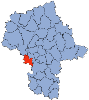
Stare Helenowo is a village in the administrative district of Gmina Przasnysz, within Przasnysz County, Masovian Voivodeship, in east-central Poland.
Kępa Karolińska is a village in the administrative district of Gmina Iłów, within Sochaczew County, Masovian Voivodeship, in east-central Poland.

Glazoué is a town, arrondissement, and commune in the Collines Department of central Benin. It is located on the railway line from Cotonou to Parakou. The commune covers an area of 1350 square kilometres and as of 2002 had a population of 90,475 people.
Łączewna is a village in the administrative district of Gmina Przedecz, within Koło County, Greater Poland Voivodeship, in west-central Poland.
Zajączkowo is a settlement in Gmina Miastko, Bytów County, Pomeranian Voivodeship, in northern Poland.
Zabierzów is a village in the administrative district of Gmina Walce, within Krapkowice County, Opole Voivodeship, in south-western Poland. It lies approximately 3 kilometres (2 mi) north-west of Walce, 10 km (6 mi) south of Krapkowice, and 32 km (20 mi) south of the regional capital Opole.
Bajdyty is a village in the administrative district of Gmina Bartoszyce, within Bartoszyce County, Warmian-Masurian Voivodeship, in northern Poland, close to the border with the Kaliningrad Oblast of Russia. It lies approximately 16 kilometres (10 mi) south-east of Bartoszyce and 52 km (32 mi) north-east of the regional capital Olsztyn.
Ininka is a settlement in the administrative district of Gmina Goleniów, within Goleniów County, West Pomeranian Voivodeship, in north-western Poland. It lies approximately 4 kilometres (2 mi) west of Goleniów and 20 km (12 mi) north-east of the regional capital Szczecin.
Zielonowo is a settlement in the administrative district of Gmina Szczecinek, within Szczecinek County, West Pomeranian Voivodeship, in north-western Poland.

Smilovice is a village and municipality in Mladá Boleslav District in the Central Bohemian Region of the Czech Republic.
Milčice is a village and municipality in Nymburk District in the Central Bohemian Region of the Czech Republic.
Inverness is a census-designated place (CDP) in Arapahoe County, Colorado, United States. The population as of the 2010 Census was 1,532. Inverness is the location of Inverness Business Park, where aerospace company Jeppesen and electronics wholesaler Arrow Electronics, the largest company in Colorado in terms of revenue, are headquartered.