Budapest is an unincorporated community in Ripley County, in the U.S. state of Missouri.
Bardley is an unincorporated community on the Oregon/Ripley county line in the U.S. state of Missouri. It is located approximately two miles north of U.S. Route 160 and thirteen miles east of Alton.
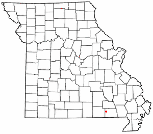
Briar is an unincorporated community in Ripley County, Missouri, United States. It is located on U.S. Route 160, approximately seven miles west of Doniphan.

Oxly is a census-designated place in southeastern Ripley County, Missouri, United States. It is located on Logan Creek along Missouri Route 142, approximately seven miles east of Doniphan.

Gatewood is an unincorporated community in southwest Ripley County, Missouri, United States. It is located approximately fifteen miles southwest of Doniphan on Route 142.
Calm is an unincorporated community in southeastern Oregon County, in the Ozarks of southern Missouri. The community is located at the junction of Missouri routes 142 and UU, one mile east of the Eleven Point River and two miles west of the Oregon - Ripley county line.
Beaverdam is an unincorporated community in Ripley County, in the U.S. state of Missouri.
Bennett is an extinct town in western Ripley County, in the U.S. state of Missouri. The GNIS classifies it as a populated place. The community is located on the North Fork Buffalo Creek in the Mark Twain National Forest.
Burr is an unincorporated community in Ripley County, in the U.S. state of Missouri.
Carie is an unincorporated community in Ripley County, in the U.S. state of Missouri.
Current View is an unincorporated community in Clay County, Arkansas and Ripley County, Missouri, United States. The community straddles the Missouri-Arkansas border on the northeast bank of the Current River. Arkansas Highway 211 connects to the south and Missouri Route E is to the north. Doniphan lies approximately eight miles to the north-northwest and Success, Arkansas is about nine miles south.
Doyle is an unincorporated community in Ripley County, in the U.S. state of Missouri.
Flatwoods is an unincorporated community in Ripley County, in the U.S. state of Missouri.
Gamburg is an unincorporated community in Ripley County, in the U.S. state of Missouri.
Handy is an unincorporated community in the northwest corner of Ripley County, in the U.S. state of Missouri.
Owenmont is an unincorporated community in Ripley County, in the U.S. state of Missouri.
Sinsabaugh is an unincorporated community in southeastern Ripley County, in the U.S. state of Missouri.
Tucker is an extinct town in southwestern Ripley County, in the U.S. state of Missouri. The GNIS classifies it as a populated place. The community lies on Missouri Route Z, south of Gatewood and three miles north of the Missouri-Arkansas border.
Gatewood Township is an inactive township in Ripley County, in the U.S. state of Missouri.
Pine Township is an inactive township in Ripley County, in the U.S. state of Missouri.