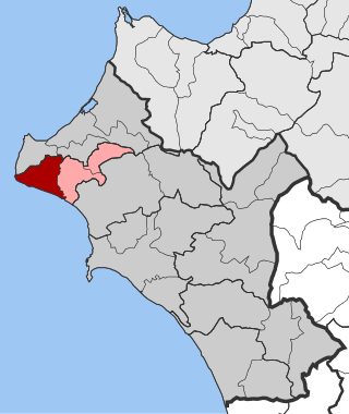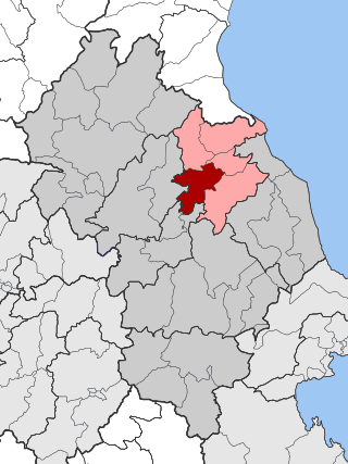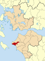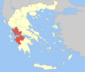
Gastouni is a town and a former municipality in Elis, West Greece, Greece. Since the 2011 local government reform it is part of the municipality Pineios, of which it is the seat and a municipal unit. The municipal unit has an area of 59.325 km2. Gastouni is situated in a flat rural area, 5 km from the Ionian Sea. The river Pineios flows into the sea near Gastouni. The town is 6 km (4 mi) south of Andravida, 4 km (2 mi) east of Vartholomio, 11 km (7 mi) northwest of Amaliada and 26 km (16 mi) northwest of Pyrgos. The Greek National Road 9/E55 and the railway from Patras to Pyrgos pass east of Gastouni. There is a 12th-century Byzantine church in the southwestern quarter Katholiki.

Vartholomio is a town and a former municipality in Elis, West Greece, Greece. Since the 2011 local government reform it is part of the municipality Pineios, of which it is a municipal unit. The municipal unit has an area of 60.696 km2. The municipal unit covers the southern part of the hilly Kyllini peninsula, and the plains to the southeast. The town Vartholomio is in the plains, on the right bank of the river Pineios, which flows into the Ionian Sea south of the town.
Kavasila is a village in the municipal unit of Gastouni, Elis, Greece. Its population is around 1,200. It is situated in a flat rural area, on the right bank of the river Pineios, at about 20 metres (66 ft) elevation. It is 1 kilometre (0.6 mi) northwest of Lefkochori, 2 kilometres (1 mi) east of Kardiakafti, 3 kilometres (2 mi) south of Andravida and 3 kilometres (2 mi) northeast of Gastouni. Kavasila had a train station on the line from Patras to Kalamata via Pyrgos. A branch line to Vartholomio and Kyllini was shut down around 2001. The Greek National Road 9 passes east of the village.
Koroivos is a village in the municipal unit of Gastouni, Elis, Greece. It is situated in a flat rural area, south of the river Pineios. It is 2 km southeast of Lefkochori, 2 km west of Roupaki, 2 km southwest of Agia Mavra and 4 km east of Gastouni. The village was named after Coroebus of Elis, one of the winners of the first Ancient Olympic Games.Today, there is a Cultural Center in the village, while only a kindergarten is open, since the primary school was closed due to lack of children. In the center of the village dominates the temple of Agia Paraskevi, as well as the large square. The small church of the village cemetery, which is preserved to this day, dates from the era of Ottoman rule. The main activity and source of income for the inhabitants of Koroivos is agriculture and animal husbandry.
Agia Mavra is a village in the municipal unit of Tragano, Elis, Greece. It is situated in a flat, rural area, on the left bank of the river Pineios. It is 3km South of Tragano, 4km East of Kavasila, 2km Northwest of Roupaki, 2km Northeast of Koroivos, and 6km Northeast of Gastouni.
Roupaki is a community in the municipal unit of Gastouni, Elis, Greece. It is situated in a flat, rural area, south of the river Pineios. It is 2 km southeast of Agia Mavra, 2 km west of Sosti, 2 km east of Koroivos, 6 km east of Gastouni and 8 km northwest of Amaliada.
Kardiakafti is a village in the northwestern part of the municipal unit of Gastouni in Elis, Greece. It is situated in a flat rural area, on the right bank of the river Pineios. It is 2 km west of Kavasila, 2 km southeast of Dimitra, 3 km northwest of Gastouni and 3 km northeast of Vartholomio.

Pineia is a former municipality in Elis, West Greece, Greece. Since the 2011 local government reform it is part of the municipality Ilida, of which it is a municipal unit. The municipal unit has an area of 148.572 km2. Its seat of administration was in the village Simopoulo. Pineia is named after the river Pineios, which forms its northern border. The area is hilly and sparsely populated. It is about 20 km east of Amaliada, 25 km northeast of Pyrgos and 45 km southwest of Patras.

Tragano is a town and a former municipality in Elis, West Greece, Greece. Since the 2011 local government reform it is part of the municipality Pineios, of which it is a municipal unit. The municipal unit has an area of 41.475 km2. Tragano is situated in a flat, rural area, north of the river Pineios. It is 2 km east of Stafidokampos, 4 km east of Andravida, 3 km north of Agia Mavra, 5 km northwest of Avgeio and 8 km northeast of Gastouni. It is 2 km southeast of the Andravida Air Base.

Palamas is a town and a municipality in the Karditsa regional unit, Greece. Palamas is located south-southwest of Larissa, the capital of Thessaly, northwest of Lamia, north of Sofades, east-northeast of Karditsa and east-southeast of Trikala. Palamas is linked with the road linking Karditsa and Larissa. It also serves roads with the GR-6 and Sofades. The Pineios River is to the north as well as the Trikala regional unit.

Stomio is a village and a community of the Agia municipality. Before the 2011 local government reform it was the seat of the municipality of Evrymenes. The community of Stomio covers an area of 37.985 km2.
Lefkochori is a village in the municipal unit of Gastouni, Elis. It is situated in a flat rural area, on the left bank of the river Pineios, at about 10 m elevation. It is 1 km southeast of Kavasila, 2 km northwest of Koroivos, 3 km west of Agia Mavra and 3 km northeast of Gastouni. The Greek National Road 9 and the railway from Patras to Pyrgos pass west of the village.
Palaiochori is a village in the municipal unit of Gastouni, Elis, Greece. Palaiochori is situated in a flat rural area, 3 km from the Ionian Sea. It is 2 km west of Savalia, 4 km southeast of Gastouni, 3 km northwest of Roviata and 8 km northwest of Amaliada. The mouth of the river Pineios is near Palaiochori.

Evrymenes is a former municipality in the Larissa regional unit, Thessaly, Greece. Since the 2011 local government reform it is part of the municipality Agia, of which it is a municipal unit. The municipal unit has an area of 95.284 km 2. The seat of the municipality was in Stomio. It was named after the ancient city Eurymenae.

Kato Olympos is a municipal unit in the Tempi municipality, within the regional unit of Larissa, in the historical and administrative region of Thessaly, Greece. Kato Olympos has, as of 2021, a population of 3,196 inhabitants. The municipal unit has an area of 128.462 km2 (49.599 sq mi). The seat of the municipal unit is located in Pyrgetos, the largest of its four 'Local Communities' :

Makrychori is a former municipality in the Larissa regional unit, Thessaly, Greece. Since the 2011 local government reform it has been part of the municipality Tempi, of which it is a municipal unit. The municipal unit has an area of 107.767 km2. The municipality was created under the Kapodistrias Law in 1997 out of the former communes of Elateia, Evangelismos, Gyrtoni and Parapotamos.

Farkadona is a municipality in the southeastern Trikala regional unit, part of Thessaly in Greece. It is located about halfway between the cities Larissa to the east, and Trikala to the west, at about 30 km from both. It is situated in the Thessalian Plain, near the river Pineios. Farkadona is on the Greek National Road 6.
Kalyvia Myrtountion is a village in the municipal unit of Vartholomio, Elis, Greece. It is situated in a flat, rural area, on the right bank of the river Pineios, 4 km from the Ionian Sea. It is 1 km southeast of Vartholomio and 3 km west of Gastouni. In the local government reform under the Capodistrian Plan in 1997 it became a part of the municipality of Vartholomio. The patron saint of Kalyvia is Saint John Chrysostom.
Omolio is a village and a community of the Agia municipality. Before the 2011 local government reform it was a part of the municipality of Evrymenes. The community of Omolio covers an area of 22.38 km2. The site of ancient Homolium can be found within the bounds of the community.
Palaiopyrgos is a village and a community of the Agia municipality. Before the 2011 local government reform it was a part of the municipality of Evrymenes. The community of Palaiopyrgos covers an area of 11.678 km2.


