
Jhalawar district is one of the 33 districts of Rajasthan state in western India. The historical city of Jhalawar is the administrative headquarters of the Jhalawar district. The district is bounded on the northwest by Kota district, on the northeast by Baran district, on the east by Guna district of Madhya Pradesh state, on the south by Rajgarh district and Agar Malwa district of Madhya Pradesh state and on the west by Ratlam district and Mandsaur district of Madhya Pradesh state. The district occupies an area of 6219 km². The district is part of Kota division. To know more about Jhalawar City
Kota District is a district of the state of Rajasthan in western India. The city of Kota is the administrative headquarters of the district.
Sirohi District is a district of Rajasthan state in western India. The city of Sirohi is the district headquarters.

Bundi is a district in the state of Rajasthan in western India. The city of Bundi is the district headquarters. It has an area of 5,550 km2 and a population of 1,110,906. It is divided into 5 tehsils which are: Bundi, Hindoli, Nainwa, Keshoraipatan and Indergarh.
Nalkheda is a town (Tehsil) and a nagar Parishad in Agar Malwa district in the Indian state of Madhya Pradesh. Nalkheda is situated on the bank of river Lakhunder.
Adavad, also spelled Adawad or Adwad, is a village in the Chopda Tehsil of Jalgaon District, Maharashtra, India. It is situated at the southern base of the Satpura Hills, about 30 kilometres northwest of the district seat Jalgaon, and 13 kilometres east of the subdistrict seat Chopda. As of the year 2011, it has a total population of 24,357.
Hadubangi, also romanized as Hadobhangi or Haddubangi, is a village in Kashinagara Tehsil, Gajapati District, Odisha, India. It is located near the Odia-Andhra Pradesh border, about 13 kilometres west of the district capital Paralakhemundi, and 11 kilometres southeast of the tehsil capital Kashinagara. As of the year 2011, It has a total population of 1,124.
B. Kothakota is a town and headquarter of B. Kothakota Mandal, Annamayya district, Andhra Pradesh, India. It is located near the state border with Karnataka, approximately 68 kilometres southwest of the district capital Rayachoti. In the year 2011, the town has a total population of 26,191.

Thevalakkara is a village in the Karunagappally Taluk, Kollam District of the state of Kerala, India. It is located near the coast of the Indian Ocean, about 13 kilometres north of the district capital Kollam, and 7 kilometres southeast of the subdistrict capital Karunagappally. It contains a famouse Devi temple along with a church and a mosque. The kadappa at Thevalakara is where ship masts (kadappa) were made for centuries. In 2011, it has a total population of 42,977.
Mohare is a village in Bailhongal Taluk, Belagavi District of Karnataka, India. It is located near the state border with Maharashtra, about 26 kilometres east of the district seat Belgaum, and 16 kilometres northwest of the taluk seat Bailhongal. As of 2011, it has a total population of 2,365.
Gania is a village in Gania Tehsil, Nayagarh District, Odisha, India. As of the year 2011, the village has a total population of 2,213.
Sarti is a village in Dhar Kalan Tehsil, Gurdaspur District, Punjab, India. It is located 68 kilometres northeast of its district capital Gurdaspur, and 8 kilometres north of Dhar Kalan. As of the year 2011, its population is 3,960.
Satar Kataiya, or Sattar Kataiya, is a tehsil of Saharsa District, Bihar, India. Its seat of government is located in the village of Sattar. As of the year 2011, its population is 151,060.
Parham is a village in Jasrana Tehsil, Firozabad District, Uttar Pradesh, India. As of the year 2011, it has a population of 19,642.
Dhamdaha is a block of Purnia District, Bihar, India. Its seat of government is located in the village of Dhamdaha. In 2011, the block has a total population of 288,084.
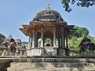
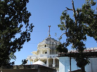
Itawa is a town in Pipalda Tehsil, Kota District, Rajasthan, India. It is located near the state boundary with Madhya Pradesh, about 79 kilometres northeast of the district seat Kota, and 5 kilometres southwest of the tehsil seat Pipalda. As of 2011, the town has a population of 26,741.
Masuri is a Village in Ghaziabad Tehsil, Ghaziabad District, Uttar Pradesh, India. It is situated on the western bank of Upper Ganga Canal, approximately 16 kilometres northeast of the district and tehsil seat Ghaziabad. In the year 2011, the Village has a total population of 22,934.
Nigohi is a town in Tilhar Tehsil, Shahjahanpur District, Uttar Pradesh, India. It is situated on the northern part of Shahjahanpur District, about 25 kilometres north of the district capital Shahjahanpur, and 20 kilometres northeast of the tehsil capital Tilhar. In the year 2011, the town has a population of 18,523.
Fursungi, or Phursungi, is a town in Haveli Taluka, Pune District, Maharashtra, India. It is located on the south of Mula-Mutha River, approximately 13 kilometres east of the district capital Pune, and 9 kilometres southeast of the taluka seat Haveli. Like other settlements in this area, Fursungi is under the administration of Pune Municipal Corporation. At the end of 2011, it is home to 66,062 inhabitants.
Thakraha, or Thakrahan, is a town and the seat of government of Thakrahan Block, Pashchim Champaran, Bihar, India. It is located near the state border with Uttar Pradesh, about 25 kilometres west of the district seat Bettiah. In the year 2011, the town has a total population of 35,734.

