Pipe Shed

Last updated

Pipe Shed
RDR Pipe Shed (cropped).jpg
The Pipe Shed, on the former site of the Methven work camp for the Rangitata Diversion Race
New Zealand relief map.jpg
Green 008000 pog.svg
Pipe Shed
Methven
General information
Architectural styleconcrete pipe
Address59 Main Street (State Highway 77), Methven, New Zealand
CountryNew Zealand
Coordinates 43°38′13.0″S171°38′40.5″E / 43.636944°S 171.644583°E / -43.636944; 171.644583 Coordinates: 43°38′13.0″S171°38′40.5″E / 43.636944°S 171.644583°E / -43.636944; 171.644583
Completed1940
Designated14 April 2005
Reference no.7593

The Pipe Shed in Methven, New Zealand, is a section of pipe cast in 1940 that was converted to a shed for storing explosives. The pipe was one of approximately 800 manufactured for the Rangitata Diversion Race (RDR), and is the only one that remains visible. It serves as a memorial to what was the largest public works project of its time, and is registered as a Category I structure by Heritage New Zealand.

Contents

Rangitata Diversion Race

Site of submerged syphon at the South Branch Ashburton River RDR at South Branch of Ashburton river syphon 1.jpg
Site of submerged syphon at the South Branch Ashburton River

The Rangitata Diversion Race (RDR) was an irrigation project commenced in 1937 and led by the irrigation engineer Thomas Beck. At the time, it was the largest public works scheme undertaken in New Zealand, replacing several small-scale irrigation schemes. Part of the objective was to create employment, coming out of the Great Depression. [1]

The main canal extends 67 km (42 mi) from the Rangitata River to the Rakaia River. There were several major rivers to cross, and the land near the foot of the Surrey Hills, a range between the two branches of the Hinds River, proved unstable. In 1938, the irrigation canal that had already been constructed was damaged over the summer break by a slip caused by heavy rain. [2] [3] The canal was re-routed away from the foot of the hills and piped, using inverted syphons.

The pipes were manufactured during 1940 at The Birches, a homestead south of Mayfield. [1] [4] Eight were started each day. They were built in two sizes, differing in wall thickness, length, and internal diameter. Those for river syphons had an internal diameter of 11 ft (3.4 m), a length of 3.0 m (10 ft), a wall thickness of 230 mm (9 in), and a weight of 18 t (18,000 kg). [1] [5] The 723 larger pipes had an internal diameter and a length of 3.7 m (12 ft), a wall thickness of 250 mm (10 in), and weighed 28 t (28,000 kg) each. [1] [6] As far as is known, these were the second-largest spun reinforced concrete pipes manufactured in the world up to that time, [4] exceeded only by those used in the United States for irrigation from the Colorado River and the water supply system for Boston. [1]

The minister of public works, Bob Semple, was an enthusiastic supporter of the project and drove his car into the first pipe laid at Surrey Hill. [7]

The Pipe Shed is the only pipe section manufactured for the RDR project that remains visible; all the pipes used in the project are submerged. [1] [8]

Methven work camp

Mount Hutt Road Board office; relocation of the Pipe Shed next to the office has been suggested. Mt Hutt Road Board 27.jpg
Mount Hutt Road Board office; relocation of the Pipe Shed next to the office has been suggested.

The Public Works Department established its headquarters for the RDR and a workers' accommodation camp in Methven. In order to store explosives at this site, one of the RDR pipes was installed at the works camp using as a base a pre-cast control gate for the water race. Wooden wedges stop the pipe from rolling. Concrete ends were cast to enclose the open ends, and a wooden door was fitted into one of those; there is a vent in the concrete panel above the door. The pipe is fitted with a wooden floor. It was also used at times to store concrete. [1] [8] The exterior is in good condition apart from a crack in the panel above the vent, but the internal floor has deteriorated, and the door is a replacement. [9]

The Pipe Shed is the only remnant of the work camp. The land is owned by Ashburton District Council and the surrounding area is used for grazing. On three sides, the land is surrounded by roads (Main Street (State Highway 77), South Belt, and the residential cul-de-sac Wayne Place) with the road frontages generally developed. The pipe shed is thus hidden from public view. It is accessible through a gap in bushes and trees from Main Street, or via The Garden Of Harmony, a reserve on South Belt. There has been a proposal to relocate the Pipe Shed to a more visible site next to the Mount Hutt Road Board building, Methven's oldest building. That building is adjacent to the work camp and fronts Main Street. [1] [9]

Heritage registration

The Pipe Shed is a Category I listed historic place, listed on 14 April 2005. [8] Ashburton District Council has the Pipe Shed on its heritage register as item 4 with a Category A listing. [1] The building is unique in several ways: round buildings are unusual, buildings from pre-cast concrete are rare, and it is the only remaining pipe from the RDR that is visible. It is the only reminder of a once busy work camp, and the size of the pipe is a reminder of the technological accomplishment of the RDR. [1]

Related Research Articles

<span class="mw-page-title-main">Plumbing</span> Systems for conveying fluids

Plumbing is any system that conveys fluids for a wide range of applications. Plumbing uses pipes, valves, plumbing fixtures, tanks, and other apparatuses to convey fluids. Heating and cooling (HVAC), waste removal, and potable water delivery are among the most common uses for plumbing, but it is not limited to these applications. The word derives from the Latin for lead, plumbum, as the first effective pipes used in the Roman era were lead pipes.

<span class="mw-page-title-main">Ashburton, New Zealand</span> Town in Canterbury, New Zealand

Ashburton is a large town in the Canterbury Region, on the east coast of the South Island of New Zealand. The town is the seat of the Ashburton District. It is 85 kilometres (53 mi) south west of Christchurch and is sometimes regarded as a satellite town of Christchurch.

<span class="mw-page-title-main">Methven, New Zealand</span> Town in Canterbury, New Zealand

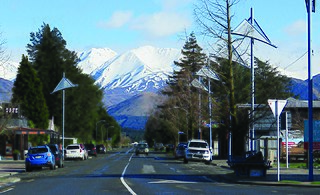
Methven is a small town in the Canterbury region of the South Island of New Zealand. It is located near the western edge of the Canterbury Plains, 35 kilometres north of Ashburton and 95 kilometres west of Christchurch, and at an elevation of 320 m. The town is a service centre for agriculture in the surrounding area, and is a base for skiing at the nearby Mount Hutt skifield. The town slogan is "Amazing Space".

<span class="mw-page-title-main">Canterbury Plains</span>

The Canterbury Plains are an area in New Zealand centred in the Mid Canterbury, to the south of the city of Christchurch in the Canterbury region. Their northern extremes are at the foot of the Hundalee Hills in the Hurunui District, and in the south they merge into the plains of North Otago beyond the Waitaki River. The smaller Amuri Plain forms a northern extension of the plains.

<span class="mw-page-title-main">Rangitata River</span> River in New Zealand

The Rangitata River is one of the braided rivers that helped form the Canterbury Plains in southern New Zealand. It flows southeast for 120 kilometres (75 mi) from the Southern Alps, entering the Pacific Ocean 30 kilometres (19 mi) northeast of Timaru. The river has a catchment area of 1,773 square kilometres (685 sq mi), and a mean annual flow of 95 cubic metres per second (3,400 cu ft/s) at Klondyke.

Ashburton was a New Zealand electorate, first created in 1881 and centred on the South Island town of Ashburton.

The Methven Branch was a branch line railway that was part of New Zealand's national rail network in Canterbury. It opened in 1880 and operated until 1976.

<span class="mw-page-title-main">Pipe (fluid conveyance)</span> Tubular section or hollow cylinder

A pipe is a tubular section or hollow cylinder, usually but not necessarily of circular cross-section, used mainly to convey substances which can flow — liquids and gases (fluids), slurries, powders and masses of small solids. It can also be used for structural applications; hollow pipe is far stiffer per unit weight than solid members.

<span class="mw-page-title-main">Walka Water Works</span> Building in New South Wales, Australia

Walka Water Works is a heritage-listed 19th-century pumping station at 55 Scobies Lane, Oakhampton Heights, City of Maitland, New South Wales, Australia. Originally built in 1887 to supply water to Newcastle and the lower Hunter Valley, it has since been restored and preserved and is part of Maitland City Council's Walka Recreation and Wildlife Reserve. It was added to the New South Wales State Heritage Register on 2 April 1999.

Maraetai Power Station is a hydroelectric power station on the Waikato River, in the North Island of New Zealand. It is the fifth of the eight hydroelectric power stations on the Waikato River, and at 360 MW, is the largest hydroelectric station on the Waikato.

<span class="mw-page-title-main">Ductile iron pipe</span>

Ductile iron pipe is pipe made of ductile cast iron commonly used for potable water transmission and distribution. This type of pipe is a direct development of earlier cast iron pipe, which it has superseded. The ductile iron used to manufacture the pipe is characterized by the spheroidal or nodular nature of the graphite within the iron. Typically, the pipe is manufactured using centrifugal casting in metal or resin lined moulds. Protective internal linings and external coatings are often applied to ductile iron pipes to inhibit corrosion: the standard internal lining is cement mortar and standard external coatings include bonded zinc, asphalt or water-based paint. In highly corrosive environments loose polyethylene sleeving (LPS) to encase the pipe may also be used. Life expectancy of unprotected ductile iron pipes depends on the corrosiveness of soil present and tends to be shorter where soil is highly corrosive. However, a lifespan in excess of 100 years has been estimated for ductile iron pipelines installed using "evolved laying practices", including use of properly installed LPS. Studies of ductile iron pipe's environmental impact have differing findings regarding emissions and energy consumed. Ductile iron pipe manufactured in the United States has been certified as a sustainable product by the Institute for Market Transformation to Sustainability.

<span class="mw-page-title-main">Ashburton District</span> Territorial authority district in Canterbury, New Zealand

Ashburton District is a territorial authority district in the Canterbury Region of the South Island of New Zealand. It encompasses the town of Ashburton, a number of small towns and settlements and the surrounding rural area, roughly coterminous with Mid Canterbury. The district had a population of 36,300 as of June 2022.

<span class="mw-page-title-main">Ashburton River / Hakatere</span> River in Canterbury, New Zealand

The Ashburton River / Hakatere is a river in the Canterbury region of New Zealand, flowing across Mid Canterbury from the Southern Alps to the Pacific Ocean. The official name of the river was amended to become a dual name by the Ngāi Tahu Claims Settlement Act 1998. It has been identified as an Important Bird Area by BirdLife International because it supports breeding colonies of the endangered black-billed gull.

<span class="mw-page-title-main">EA Networks</span> New Zealand electricity distribution company

Electricity Ashburton Limited, trading as EA Networks is a co-operatively-owned electricity distribution company, based in Ashburton, New Zealand.

<span class="mw-page-title-main">Barrhill, New Zealand</span> Village in Canterbury, New Zealand

Barrhill is a lightly populated locality in the Canterbury region of New Zealand's South Island. It is situated on the Canterbury Plains, on the right bank of the Rakaia River, about 17 kilometres (11 mi) inland from Rakaia. It was founded by Cathcart Wason in the mid-1870s and named by him after his old home Barrhill in South Ayrshire, Scotland. Wason set it up as a model village for the workers of his large sheep farm. The population of the village peaked in the mid-1880s before the general recession initiated a downturn for the village. Wason had expected for the Methven Branch railway to run past Barrhill, but the line was built in 1880 on an alignment many miles away, which caused Barrhill population to decrease.

<span class="mw-page-title-main">Rangitata Gorge</span>

The RangitataGorge is a gorge located in the Canterbury High Country in the South Island of New Zealand. The narrow gorge links the headwaters of the Rangitata River with the fertile Canterbury Plains. The Rangitata gorge is commercially rafted by a local company. It is also a popular river for visiting kayakers, fishermen and adventurist locals in jet boats. The gorge is a class IV to V+ depending on the flow of the river and home to the notable rapids including Rooster's Tail, Pencil Sharpener, The Pinch, Pigs Trough and Hells Gate.

The Middle Harbour Syphon is a heritage-listed sewerage syphon located at Monash Crescent, Clontarf, Northern Beaches Council, New South Wales, Australia. It was designed by E. M. de Burgh, an engineer in the NSW Public Works Department and was built from 1922 to 1925 by the Department. The sewerage syphon is also known as the Middle Harbour Syphon NSOOS and The Spit Syphon. The property is owned by Sydney Water, an agency of the Government of New South Wales. The property was added to the New South Wales State Heritage Register on 15 November 2002.

<span class="mw-page-title-main">Cooks River Sewage Aqueduct</span> Historic site in New South Wales, Australia

The Cooks River Sewage Aqueduct is a heritage-listed sewage aqueduct located at Pine Street, Earlwood, New South Wales, Australia. It crosses the Cooks River to Thornley Street, Marrickville. It was designed by Sewerage Construction Branch and NSW Department of Public Works and built during 1895 by J. F. Carson, contractor. The property is owned by Sydney Water, an agency of the Government of New South Wales. It was added to the New South Wales State Heritage Register on 18 November 1999.

<span class="mw-page-title-main">Rangitata Diversion Race</span> Irrigation scheme in Canterbury, New Zealand

The Rangitata Diversion Race or RDR is a combined irrigation and power generation scheme that diverts water from the Rangitata River to irrigate over 100,000 hectares of farmland in Mid-Canterbury, New Zealand. The RDR project was the first major river diversion in New Zealand, and the largest irrigation scheme in the country. It was originally constructed by the Public Works Department between 1937 and 1944. The main canal is 67 km long, 10 m wide and 3 m deep.

Thomas George Gordon Beck was a New Zealand civil engineer who had a leading role in public works engineering projects in New Zealand.

References

  1. 1 2 3 4 5 6 7 8 9 10 "Heritage Item 4 Pipe Shed" (PDF). Ashburton District Council. Archived from the original (PDF) on 31 May 2020. Retrieved 7 May 2022.
  2. "Heavy rain". Ashburton Guardian . Vol. 58, no. 76. 10 January 1938. p. 4. Archived from the original on 7 May 2022. Retrieved 8 May 2022.
  3. "Moving mass". Ashburton Guardian . Vol. 59, no. 236. 19 July 1939. p. 6. Archived from the original on 7 May 2022. Retrieved 8 May 2022.
  4. 1 2 "Rangitata Diversion Race". Engineering New Zealand Te Ao Rangahau. Archived from the original on 19 April 2022. Retrieved 7 May 2022.
  5. "The first pipe". Ashburton Guardian . Vol. 60, no. 288. 12 September 1940. p. 3. Archived from the original on 17 June 2022. Retrieved 8 May 2022.
  6. "Huge pipe-line completed". The Press . Vol. LXXVIII, no. 23586. 13 March 1942. p. 6. Archived from the original on 7 May 2022. Retrieved 8 May 2022.
  7. Heiler, Terry. "Bob Semple in an irrigation pipe (1st of 3)". Te Ara: The Encyclopedia of New Zealand. Archived from the original on 7 May 2022.
  8. 1 2 3 "Pipe Shed". Register of Historic Places. Heritage New Zealand . Retrieved 6 May 2022.
  9. 1 2 Jensen, Mick (12 December 2019). "Pipe relic deserves more". The Ashburton Courier. Archived from the original on 2 March 2022. Retrieved 8 May 2022.