Jaljala is a Village Development Committee in Baglung District in the Dhaulagiri Zone of central Nepal. At the time of the 1991 Nepal census it had a population of 3,637 and had 624 houses in the town.
Bhairabnath is a village in Bajhang District in the Seti Zone of north-western Nepal. At the time of the 1991 Nepal census it had a population of 3,275 and had 613 houses in the village.
Naikap Purano Bhanjyang is a village and former Village Development Committee that is now part of Chandragiri Municipality in Kathmandu District in Province No. 3 of central Nepal. At the time of the 1991 Nepal census it had a population of 3456. The highest terrains in this village locate westerly, in ward No.5. A panoramic beautiful scene of whole Kathmandu Valley from Sanga to Nagarkot and Swayambhunath to Kirtipur Chobar can be viewed very clearly. The height of this hilly region lies in between 1600 m to 1800 m. The whole Himalayan range from Langtang to Mahalangur can also be viewed.
Chyangli is a village development committee in Gorkha District in the Gandaki Zone of northern-central Nepal. At the time of the 1991 Nepal census it had a population of 5,612 and had 1066 houses in the town.
Kachuri Thera is a village development committee in Dhanusa District in the Janakpur Zone of south-eastern Nepal. At the time of the 1991 Nepal census it had a population of 4,560 persons living in 818 individual households.
Lohana Bahbangama is a village development committee in Dhanusa District in the Janakpur Zone of south-eastern Nepal. At the time of the 1991 Nepal census it had a population of 4,772 persons living in 824 individual households. It is near to Janakpur. This village is surrounded by.
Mukhiyapatti Musharniya is a village development committee in Dhanusa District in Province No. 2 of south-eastern Nepal. At the time of the 1991 Nepal census it had a population of 4,621 people living in 436 individual households.
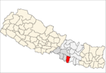
Bhumidanda is a village development committee in Kabhrepalanchok District in Bagmati Pradesh of central Nepal. At the time of the 1991 Nepal census it had a population of 3383 and had 630 houses in it.
Panchakanya is a town and Village Development Committee in Ilam District in the Mechi Zone of eastern Nepal. At the time of the 1991 Nepal census it had a population of 6,666 persons living in 1221 individual households.
Banjariya is a town and Village Development Committee in Bara District in the Narayani Zone of south-eastern Nepal. At the time of the 2011 Nepal census it had a population of 5,999 persons residing in 835 individual households. There were 3,020 males and 2,979 females at the time of census.
Basantapur is a town and Village Development Committee in Bara District in the Narayani Zone of south-eastern Nepal. At the time of the 1991 Nepal census it had a population of 4,435 persons residing in 740 individual households.
Pawan Nagar is a town and Village Development Committee in Dang District in Province No. 5 of south-western Nepal. At the time of the 1991 Nepal census it had a population of 11,428 persons living in 1961 individual households. Farming is the main occupation.
Damarkhu Shivalaya is a town and Village Development Committee in Khotang District in the Sagarmatha Zone of eastern Nepal. At the time of the 1991 Nepal census it had a population of 3,237 persons living in 602 individual households.
Ghatgaun is a village development committee in Surkhet District in the Bheri Zone of mid-western Nepal. At the time of the 1991 Nepal census it had a population of 3352 people living in 659 individual households.
Durgamandau is a village development committee in Doti District in the Seti Zone of western Nepal. At the time of the 1991 Nepal census it had a population of 3285 living in 660 individual households.
Lakshminiya is a village development committee in Mahottari District in the Janakpur Zone of south-eastern Nepal. At the time of the 1991 Nepal census it had a population of 7540 people living in 1444 individual households.
Sitapur Pra. Da. is a town in Mirchaiya Municipality in Siraha District in the Sagarmatha Zone of south-eastern Nepal. The formerly village development committee was merged to form new municipality since 18 May 2014 along with existing Rampur Birta, Malhaniyakhori, Radhopur, Ramnagar Mirchaiya, Fulbariya, Sitapur PraDa and Maheshpur Gamharia Village Development Committees. At the time of the 1991 Nepal census it had a population of 4671 people living in 899 individual households.
Goldhap is a village development committee in Jhapa District in the Mechi Zone of south-eastern Nepal. At the time of the 1991 Nepal census it had a population of 7393 people living in 1252 individual households.
Bagahi is a Village Development Committee in Rautahat District in the Narayani Zone of south-eastern Nepal. At the time of the 1991 Nepal census it had a population of 2217 people residing in 429 individual households.
Raghunathpur is a village development committee in Rautahat District in the Narayani Zone of south-eastern Nepal. At the time of the 1991 Nepal census it had a population of 3484 people living in 673 individual households.