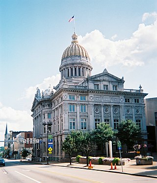
Westmoreland County is a county in the Commonwealth of Pennsylvania, United States, located in the Pittsburgh Metropolitan Statistical Area. As of the 2020 census, the population was 354,663. The county seat is Greensburg and the most populous community is Hempfield Township. It is named after Westmorland, a historic county of England. The county is part of the Southwest Pennsylvania region of the state.
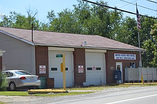
Donegal Township is a township in Westmoreland County, Pennsylvania, United States. The population was 2,192 at the 2020 census, a decrease of 9% compared to 2010.
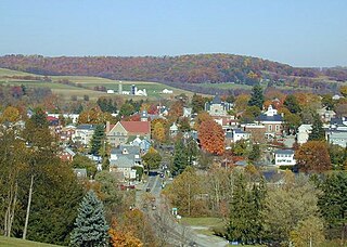
Ligonier is a borough in Westmoreland County, Pennsylvania, United States. The population was 1,513 at the 2020 census. Ligonier was settled in the 1760s. The borough is well known for nearby Idlewild Park, one of the oldest amusement parks in the country; and nearby Seven Springs Mountain Resort. Another tourist attraction is Fort Ligonier Days, a parade and craft market that takes place every fall over the course of three days, and the Ligonier Country Market in the summer months. Ligonier is part of the Pittsburgh Metropolitan Statistical Area.

The Laurel Highlands is a region in southwestern Pennsylvania made up of Fayette County, Somerset County, and Westmoreland County. It has a population of about 600,000 people.

Thomas Mellon was an Irish American businessman, judge, and lawyer who was best known as the founder of Mellon Bank and patriarch of the Mellon family of Pittsburgh.

The Pittsburg and Shawmut Railroad, also known as the Shawmut Line, was a short line railroad company operating passenger and freight service on standard gauge track in central and southwestern Pennsylvania. Since 2004, it has been operated as part of the Buffalo and Pittsburgh Railroad, which is owned by Genesee & Wyoming Inc.

Idlewild and Soak Zone, commonly known as Idlewild Park or simply Idlewild, is an amusement park in the Laurel Highlands near Ligonier, Pennsylvania, United States, about 50 miles (80 km) east of Pittsburgh, along US Route 30. Founded in 1878 as a campground along the Ligonier Valley Railroad by Thomas Mellon, Idlewild is the oldest amusement park in Pennsylvania and the third oldest operating amusement park in the United States behind Lake Compounce and Cedar Point. The park has won several awards, including from industry publication Amusement Today as the best children's park in the world.
The South Pennsylvania Railroad is the name given to two proposed, but never completed, railroads in Pennsylvania during the 19th century. Parts of the right of way for the second South Pennsylvania Railroad were reused for the Pennsylvania Turnpike in 1940.
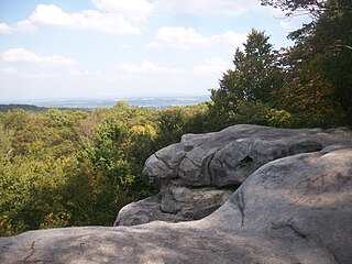
Forbes State Forest is a Pennsylvania state forest in Pennsylvania Bureau of Forestry District #4. The main offices are located in Laughlintown in Westmoreland County, Pennsylvania in the United States. Mount Davis, the highest peak in Pennsylvania, is located in the forest.

Ohiopyle State Park is a Pennsylvania state park on 20,500 acres (8,300 ha) in Dunbar, Henry Clay and Stewart Townships, Fayette County, Pennsylvania in the United States. The focal point of the park is the more than 14 miles (23 km) of the Youghiogheny River gorge that passes through the park. The river provides whitewater boating, recreational fishing, and kayaking. Ohiopyle State Park is bisected by Pennsylvania Route 381 south of the Pennsylvania Turnpike. The park opened to the public in 1965 but was not officially dedicated until 1971.

Keystone State Park is a 1,200-acre (486 ha) Pennsylvania state park in Derry Township, Westmoreland County, Pennsylvania in the United States. Located off U.S. Route 22 near New Alexandria, the park opened in 1945. Its main attraction is the man-made 78-acre (32 ha) Keystone Lake. The park also has extensive picnic areas and several miles of hiking trails.

Kooser State Park is a 250-acre (101 ha) Pennsylvania state park in Jefferson Township, Somerset County, Pennsylvania, in the United States. The park, which borders Forbes State Forest, was built in the 1930s by the Civilian Conservation Corps, who also built the 4-acre (1.6 ha) Kooser Lake by damming Kooser Run. Kooser State Park is on Pennsylvania Route 31 a one-hour drive from Pittsburgh. The park is surrounded by Forbes State Forest.

Laurel Summit State Park is a 6-acre (2.4 ha) Pennsylvania state park in Cook Township, Westmoreland County, Pennsylvania in the United States. It is also a picnic area with a scenic view of Linn Run on the summit of Laurel Mountain. The temperatures at Laurel Summit State Park are generally several degrees cooler than the surrounding towns in the valleys. The elevation of the park is 2,739 feet (835 m) above sea level.

Laurel Mountain State Park is a 493-acre (200 ha) Pennsylvania state park in Ligonier Township, Westmoreland County and Jenner Township, Somerset County, Pennsylvania in the United States.

Laurel Hill State Park is a 3,935-acre (1,592 ha) Pennsylvania state park in Jefferson and Middlecreek Townships, Somerset County, Pennsylvania in the United States. Laurel Hill Lake is a 63-acre (25 ha) man-made lake with a dam that was constructed during the Great Depression by the young men of CCC camps SP-8-PA and SP-15-PA. Laurel Hill State Park is 8 miles (13 km) from Interstate 76 just off Pennsylvania Route 31 near Bakersville and on Pennsylvania Route 653 near Trent.

Linn Run State Park is a Pennsylvania state park on 612 acres (248 ha) in Cook and Ligonier Townships, Westmoreland County, Pennsylvania in the United States. The park borders Forbes State Forest. Two smaller streams, Grove Run and Rock Run, join in Linn Run State Park to form Linn Run which has a waterfall, Adams Falls, which can be seen at the park. This state park is just off Pennsylvania Route 381 near the small town of Rector.

Laurel Ridge State Park is a 13,625-acre (5,514 ha) Pennsylvania state park that with parcels in Cambria, Fayette, Somerset, and Westmoreland counties, Pennsylvania in the United States.
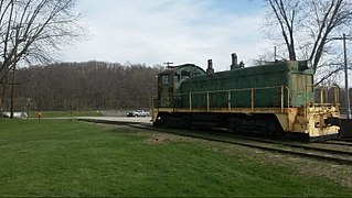
The Turtle Creek Industrial Railroad was a short line freight railroad that operated in western Pennsylvania between the boroughs of Export and Trafford, where it connected to the Pittsburgh Line. The TCKR was a wholly owned subsidiary of the Dura-Bond Corporation, a steel products company headquartered in Export. The company purchased the railroad from Conrail in 1982. For the next 27 years, three to five trains per week made the round trip along just over ten miles (16 km) of track, delivering materials such as steel pipe to the shortline's parent company in Export and lumber to lumber yards in neighboring Murrysville. In the shortline's heyday, trains of typically about four cars in length were hauled by one of the railroad's two 1940s era switch engines, operated by a two-man crew. The railroad was in service until 2009, when flash flooding of Turtle Creek severely damaged the TCKR's tracks which ran adjacent to the stream. After cessation of service, most of the right-of-way was sold to Westmoreland County to become part of the Westmoreland Heritage Trail.
The Ligonier Valley Railroad connected the communities of Latrobe and Ligonier, Pennsylvania, approximately 10 miles (16 km) apart, between 1877 and 1952. For much of its length, the railroad ran parallel to Loyalhanna Creek in a scenic mountain gorge. In addition to the Latrobe-Ligonier line, there was an extension to the coal mining communities of Wilpen and Fort Palmer to the north of Ligonier, as well as several shorter spurs serving coal mines.

The Buffalo and Susquehanna Railroad was a railroad company that formerly operated in western and north central Pennsylvania and western New York. It was created in 1893 by the merger and consolidation of several smaller logging railroads. It operated independently until 1929, when a majority of its capital stock was purchased by the Baltimore and Ohio Railroad. At the same time, the B&O also purchased control of the neighboring Buffalo, Rochester, and Pittsburgh Railway. The Baltimore and Ohio officially took over operations of both roads in 1932.


