
The Pennsylvania Turnpike is a controlled-access toll road that is operated by the Pennsylvania Turnpike Commission (PTC) in the Commonwealth of Pennsylvania in the United States. It runs for 360 miles (580 km) across the state, connecting Pittsburgh in Western Pennsylvania with Philadelphia in eastern Pennsylvania, and passes through four tunnels as it crosses the Appalachian Mountains in central Pennsylvania.

Boswell is a borough in Somerset County, Pennsylvania, United States. It is part of the Johnstown, Pennsylvania Metropolitan Statistical Area. The population was 1,221 at the 2020 census.

Quemahoning Township is a township in Somerset County, Pennsylvania, United States. The population was 1,838 at the 2020 census. It is part of the Johnstown, Pennsylvania, Metropolitan Statistical Area.
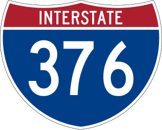
Interstate 376 (I-376) is a major auxiliary route of the Interstate Highway System in the US state of Pennsylvania, located within the Allegheny Plateau. It runs from I-80 near Sharon south and east to a junction with the Pennsylvania Turnpike in Monroeville, after having crossed the Pennsylvania Turnpike at an interchange in Big Beaver. The route serves Pittsburgh and its surrounding areas and is the main access road to Pittsburgh International Airport (PIT). Portions of the route are known as the Beaver Valley Expressway, Southern Expressway, and Airport Parkway. Within Allegheny County, the route runs along the majority of the Penn-Lincoln Parkway, known locally as Parkway West and Parkway East. It is currently the ninth-longest auxiliary Interstate route in the system and second only to I-476 within Pennsylvania.

Sideling Hill, also Side Long Hill, is a long, steep, narrow mountain ridge in the Ridge-and-Valley physiographic province of the Appalachian Mountains, located in Washington County in western Maryland and adjacent West Virginia and Pennsylvania, USA. The highest point on the ridge is Fisher Point, at 2,310 feet (700 m) in Fulton County, Pennsylvania.

Interstate 76 (I-76) is an east–west Interstate Highway in the Eastern United States. The highway runs approximately 435.66 miles (701.13 km) from an interchange with I-71 west of Akron, Ohio, east to I-295 in Bellmawr, New Jersey. This route is not contiguous with I-76 in Colorado and Nebraska.

Sideling Hill Tunnel is one of three original Pennsylvania Turnpike tunnels abandoned after two massive realignment projects. The others are nearby Rays Hill Tunnel, and farther west, the Laurel Hill Tunnel. It was less expensive to realign the Turnpike than to bore a second tube for four lane traffic. Sideling Hill Tunnel is 6,782 feet (2,067 m) long.

Rays Hill Tunnel is one of three original Pennsylvania Turnpike tunnels that were abandoned after two massive realignment projects. The others included the Sideling Hill Tunnel, and farther west, the Laurel Hill Tunnel.

Laurel Hill Tunnel is a 4,541-foot-long (1,384 m) tunnel on the Pennsylvania Turnpike that was bypassed and abandoned in 1964. It is bored through Laurel Ridge, spanning the border of Westmoreland and Somerset counties. Its western portal may be seen from the eastbound side of the Turnpike at milepost 99.3.

Route 92 was a 6.7-mile (10.8 km) proposed branch of the New Jersey Turnpike that would have run from west to east, beginning at U.S. Route 1 just north of Ridge Road in South Brunswick Township, east along Route 32, to Exit 8A in Monroe Township. Route 92 was also assigned in the 1953 renumbering and by the late 1950s it was named the Princeton–Hightstown Bypass, a freeway planned to connect the Somerset Freeway in Montgomery Township, with Route 33 in East Windsor Township. In 1987, the planned Route 92 was truncated to only run east from U.S. Route 1 near Kingston. New plans were announced in 1994, this time running to US 1 near Princeton. After public hearings found opposition was still strong, the planned route was truncated to a much shorter bypass of Hightstown only and numbered Route 133. Construction on the road, the first project awarded under New Jersey's modified Design-build program, began on September 20, 1996 and was opened November 30, 1999.
The South Pennsylvania Railroad is the name given to two proposed, but never completed, Pennsylvania railroads in the nineteenth century. Parts of the right of way for the second South Pennsylvania Railroad were reused for the Pennsylvania Turnpike in 1940.

The Allegheny Mountain Tunnel is a vehicular tunnel carrying the Pennsylvania Turnpike through the Allegheny Mountains. At this point, the Turnpike carries Interstates 70 and 76. When the tunnel was built, it was considered an "engineering marvel."

U.S. Route 30 (US 30) is a U.S. Highway that runs east–west across the southern part of Pennsylvania, passing through Pittsburgh and Philadelphia on its way from the West Virginia state line east to the Benjamin Franklin Bridge over the Delaware River into New Jersey.
The Abandoned Pennsylvania Turnpike is the common name of a 13-mile (21 km) stretch of the Pennsylvania Turnpike that was bypassed in 1968 when a modern stretch opened to ease traffic congestion in the tunnels. In this case, the Sideling Hill Tunnel and Rays Hill Tunnel were bypassed, as was one of the Turnpike's travel plazas. The bypass is located just east of the heavily congested Breezewood interchange for Interstate 70 (I-70) eastbound at what is now I-76 exit 161. The section of the turnpike was at one time part of the South Pennsylvania Railroad.

Interstate 77 (I-77) in the US state of West Virginia is a major north–south Interstate Highway. It extends for 187.21 miles (301.29 km) between Bluefield at the Virginia state line and Williamstown at the Ohio state line.
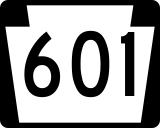
Pennsylvania Route 601 is a 26.6-mile-long (42.8 km) state highway located in Somerset County, Pennsylvania. The southern terminus is at PA 31/PA 281 in Somerset. The northern terminus is at PA 56 in Paint.

U.S. Route 1 (US 1) is a major north–south U.S. Route in the state of Massachusetts, traveling through Essex, Middlesex, Suffolk, Norfolk, and Bristol counties. The portion of US 1 south of Boston is also known as the Boston–Providence Turnpike, Washington Street, or the Norfolk and Bristol Turnpike, and portions north of Boston are known as the Northeast Expressway and the Newburyport Turnpike.
The Pittsburgh, Westmoreland, & Somerset Railroad (PW&S) was a short-lived railroad that connected the Pennsylvania communities of Ligonier and Somerset, running over a mountain known as Laurel Hill or Laurel Mountain.
The Negro Mountain Tunnel is a tunnel located in Negro Mountain in Somerset County, Pennsylvania. It was built by New York Central Railroad as part of the proposed but never completed South Pennsylvania Railroad, which over time became known as "Vanderbilt's Folly". The tunnel is located near milepost 116.7 on the Pennsylvania Turnpike where it is ten miles east of the Quemahoning Tunnel, 16 miles east of the Laurel Hill Tunnel, and seven miles west of the Allegheny Mountain Tunnel currently used by the Turnpike.