Coraopolis is a borough in Allegheny County, Pennsylvania, United States. The population was 5,677 at the 2010 census. In 1940 the population peaked at 11,086. It is a small community located to the west of Pittsburgh, along the Ohio River and to the east of the Pittsburgh International Airport. The borough is noted for its steep topography, numerous brick streets and many large, old homes. The American Bridge Company is headquartered in Coraopolis.

Avalon is a borough in Allegheny County, Pennsylvania, United States, along the Ohio River, 6 miles (10 km) downstream from Pittsburgh. It is a largely residential borough with a few small stores. The population was 4,705 at the 2010 census.

Rochester is a borough in Beaver County, Pennsylvania, United States. Located 25 miles (40 km) northwest of Pittsburgh, it is part of the Pittsburgh metropolitan area. The population was 3,657 at the 2010 census.
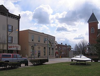
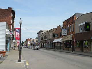
Mars is a borough in Butler County, Pennsylvania, United States. The population was 1,699 at the 2010 census.

The Pittsburgh, Cincinnati, Chicago and St. Louis Railroad, commonly called the Pan Handle Route, was a railroad that was part of the Pennsylvania Railroad system. Its common name came from its main line, which began at Pittsburgh, Pennsylvania, crossed the Northern Panhandle of West Virginia, and continued west to Bradford, Ohio, where it split into a northern line to Chicago and a southern one through Indianapolis, Indiana, to East St. Louis, Illinois.
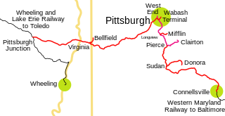
The Pittsburgh and West Virginia Railway was a railroad in the Pittsburgh, Pennsylvania and Wheeling, West Virginia, areas. Originally built as the Wabash Pittsburgh Terminal Railway, a Pittsburgh extension of George J. Gould's Wabash Railroad, the venture entered receivership in 1908 and the line was cut loose. An extension completed in 1931 connected it to the Western Maryland Railway at Connellsville, Pennsylvania, forming part of the Alphabet Route, a coalition of independent lines between the Northeastern United States and the Midwest. It was leased by the Norfolk and Western Railway in 1964 in conjunction with the N&W acquiring several other sections of the former Alphabet Route, but was leased to the new spinoff Wheeling and Lake Erie Railway in 1990, just months before the N&W was merged into the Norfolk Southern Railway.
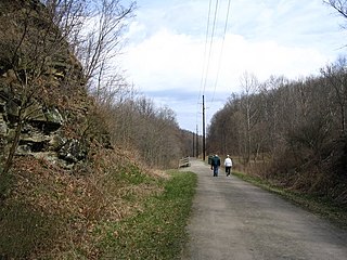
The Montour Trail is a multi-use recreational rail trail near Pittsburgh, Pennsylvania. It was formerly the Montour Railroad.
Note: A fully interactive online map of the Lincoln Highway and all of its re-alignments, markers, monuments and historic points of interest can be viewed at the Lincoln Highway Association Official Map website.
The Fort Wayne Line and Fort Wayne Secondary is a rail line owned and operated by the Norfolk Southern Railway (NS), Chicago, Fort Wayne and Eastern Railroad (CFE), and CSX Transportation in the U.S. states of Pennsylvania, Ohio, and Indiana. The line runs from Pittsburgh, Pennsylvania, west via Fort Wayne, Indiana, to Gary, Indiana, along what was once the Pennsylvania Railroad's Pittsburgh to Chicago main line.
Maynard is an unincorporated community located in western Colerain Township, Belmont County, Ohio, United States, along Wheeling Creek. It has a post office with the ZIP code 43937. Maynard is part of the Wheeling, WV-OH Metropolitan Statistical Area. The community is near Wheeling Township and its sister community of Blainesville. Maynard is a part of the St. Clairsville-Richland City School District.
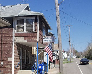
Kensington is an unincorporated community in southwestern Hanover Township, Columbiana County, Ohio, United States. It has a post office with the ZIP code 44427. It lies along U.S. Route 30 at its intersection with Ohio State Routes 9 and 644.
The Weirton–Steubenville, WV-OH Metropolitan Statistical Area, also known as the Upper Ohio Valley, is a metropolitan statistical area consisting of two counties in the Northern Panhandle of West Virginia and one in Ohio, anchored by the cities of Weirton and Steubenville. As of the 2010 census, the MSA had a population of 124,454. In 2017, the population was estimated to have gone down to 118,250. This puts it at 329th largest in the United States.

Mount Washington Transit Tunnel is an important public transportation link in Pittsburgh, Pennsylvania, United States. The approximately 3,500-foot (1,100 m) tunnel connects Station Square to South Hills Junction, and is used only by Pittsburgh Light Rail cars and buses of the Port Authority of Allegheny County. With the cessation of bus service on the Downtown Seattle Transit Tunnel in 2019, the Mount Washington Transit Tunnel is the only tunnel in the United States to operate both bus and rail services.
Eidenau is an unincorporated community in Jackson Township, Butler County, Pennsylvania, United States.
The Coen Tunnel is a railway tunnel in Mingo Junction, Ohio, United States. It is part of the Wheeling and Lake Erie Railway's ex-Pittsburgh and West Virginia Railway line.
Beaver Run is a stream in Coshocton County, in the U.S. state of Ohio.

Calumet is an unincorporated community in Knox Township, Jefferson County, Ohio, United States. It is located just north of Toronto between Ohio State Route 7 and the Ohio River, at 40°28′55″N80°36′24″W. North 4th Street and North River Avenue both run continuously from Toronto to Calumet.
Altamont is an unincorporated community in Steubenville Township, Jefferson County, Ohio, United States. It is located south of Steubenville and just east of Hillsboro along Wilson Avenue, at 40°20′00″N80°37′03″W.
Chandler is an unincorporated community in Wayne Township, Jefferson County, Ohio, United States. It is located south of Bloomingdale at the intersection of Bloomingdale-Smithfield-Chandler Road and County Road 24, at 40°18′28″N80°48′15″W.
Deandale is an unincorporated community in Steubenville Township, Jefferson County, Ohio, United States. It is located about 1 mile (1.6 km) south of Mingo Junction along Ohio State Route 7, at 40°18′33″N80°36′59″W.

