"},"elevation_ft":{"wt":"968"},"coordinates":{"wt":"{{coord|40|23|56|N|81|05|17|W|region:US_type:city|display=inline,title}}"},"postal_code_type":{"wt":"[[ZIP code]]"},"postal_code":{"wt":"43988"},"area_code":{"wt":"[[Area code 740|740]]"},"blank_name":{"wt":"[[Federal Information Processing Standard|FIPS code]]"},"blank_info":{"wt":"39-70814{{cite web|url=https://www.census.gov|publisher=[[United States Census Bureau]]|accessdate=January 31, 2008|title=U.S. Census website}}"},"blank1_name":{"wt":"[[Geographic Names Information System|GNIS]] feature ID"},"blank1_info":{"wt":"2399773{{GNIS|2399773}}"},"website":{"wt":"{{URL|https://www.villageofscio.com/|Village website}}"},"footnotes":{"wt":""}},"i":0}}]}" id="mwBQ">Village in Ohio, United States
Scio, Ohio | |
---|---|
Scio Post Office | |
![]() Location of Scio, Ohio | |
![]() Location of Scio in Harrison County | |
Coordinates: 40°23′56″N81°05′17″W / 40.39889°N 81.08806°W | |
Country | United States |
State | Ohio |
County | Harrison |
Area | |
• Total | 0.56 sq mi (1.44 km2) |
• Land | 0.56 sq mi (1.44 km2) |
• Water | 0.00 sq mi (0.00 km2) |
Elevation | 968 ft (295 m) |
Population (2020) | |
• Total | 673 |
• Density | 1,208.26/sq mi (466.61/km2) |
Time zone | UTC-5 (Eastern (EST)) |
• Summer (DST) | UTC-4 (EDT) |
ZIP code | 43988 |
Area code | 740 |
FIPS code | 39-70814 [3] |
GNIS feature ID | 2399773 [2] |
Website | Village website |
Scio ( /saɪˈoʊ/ SY-oh [4] ) is a village in northern Harrison County, Ohio, United States. The population was 673 at the 2020 census.
Scio was originally called New Market, and under the latter name was platted in 1852. [5]
According to the United States Census Bureau, the village has a total area of 0.56 square miles (1.45 km2), all land. [6]
Census | Pop. | Note | %± |
---|---|---|---|
1880 | 509 | — | |
1890 | 797 | 56.6% | |
1900 | 868 | 8.9% | |
1910 | 877 | 1.0% | |
1920 | 861 | −1.8% | |
1930 | 760 | −11.7% | |
1940 | 1,181 | 55.4% | |
1950 | 1,152 | −2.5% | |
1960 | 1,135 | −1.5% | |
1970 | 1,002 | −11.7% | |
1980 | 1,003 | 0.1% | |
1990 | 856 | −14.7% | |
2000 | 799 | −6.7% | |
2010 | 763 | −4.5% | |
2020 | 673 | −11.8% | |
U.S. Decennial Census [7] |
As of the census [8] of 2010, there were 763 people, 324 households, and 194 families living in the village. The population density was 1,362.5 inhabitants per square mile (526.1/km2). There were 379 housing units at an average density of 676.8 per square mile (261.3/km2). The racial makeup of the village was 98.3% White and 1.7% from two or more races. Hispanic or Latino of any race were 0.1% of the population.
There were 324 households, of which 32.4% had children under the age of 18 living with them, 36.7% were married couples living together, 17.3% had a female householder with no husband present, 5.9% had a male householder with no wife present, and 40.1% were non-families. 37.0% of all households were made up of individuals, and 16% had someone living alone who was 65 years of age or older. The average household size was 2.35 and the average family size was 3.01.
The median age in the village was 38.5 years. 26.1% of residents were under the age of 18; 9.1% were between the ages of 18 and 24; 22.5% were from 25 to 44; 26.8% were from 45 to 64; and 15.3% were 65 years of age or older. The gender makeup of the village was 47.4% male and 52.6% female.
As of the census [3] of 2000, there were 799 people, 358 households, and 220 families living in the village. The population density was 1,446.9 inhabitants per square mile (558.7/km2). There were 400 housing units at an average density of 724.3 per square mile (279.7/km2). The racial makeup of the village was 99.62% White, 0.13% African American and 0.25% Native American. Hispanic or Latino of any race were 0.75% of the population.
There were 358 households, out of which 30.2% had children under the age of 18 living with them, 43.0% were married couples living together, 14.0% had a female householder with no husband present, and 38.3% were non-families. 36.0% of all households were made up of individuals, and 20.1% had someone living alone who was 65 years of age or older. The average household size was 2.23 and the average family size was 2.88.
In the village, the population was spread out, with 24.7% under the age of 18, 7.0% from 18 to 24, 24.3% from 25 to 44, 25.4% from 45 to 64, and 18.6% who were 65 years of age or older. The median age was 41 years. For every 100 females there were 82.8 males. For every 100 females age 18 and over, there were 74.0 males.
The median income for a household in the village was $23,214, and the median income for a family was $30,278. Males had a median income of $26,333 versus $17,625 for females. The per capita income for the village was $17,037. About 13.9% of families and 13.9% of the population were below the poverty line, including 17.8% of those under age 18 and 7.7% of those age 65 or over.
Scio is the midpoint of the multi-use rails-to-trails path, the Conotton Creek Trail. The trail runs along Conotton Creek and is 11.4 miles (18.3 km) long. It is paved and wheelchair accessible, and is also suitable for bicycling, rollerblading, and walking.
Students attend the Harrison Hills City School District. [9]
From 1877 or 1878 to 1911 the Scio College [10] was in the town, until it merged with Mount Union College and the Scio campus closed.
Scio has a public library, a branch of the Puskarich Public Library . [11]
Harrison County is a county located in the U.S. state of Ohio. As of the 2020 census, the population was 14,483, making it the fifth-least populous county in Ohio. Its county seat and largest village is Cadiz. The county is named for General William Henry Harrison, who was later President of the United States.
Carroll County is a county located in the state of Ohio. As of the 2020 census, the population was 26,721. Its county seat is Carrollton, while its largest village is Minerva. It is named for Charles Carroll of Carrollton, the last surviving signer of the Declaration of Independence. Carroll County is part of the Canton-Massillon, OH Metropolitan Statistical Area, which is also included in the Cleveland-Akron-Canton, OH Combined Statistical Area. It is in the Appalachian Ohio region.
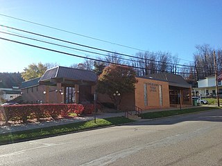
Carrollton is a village in and the county seat of Carroll County, Ohio, United States, located 22 miles (35 km) southeast of Canton. The population was 3,087 at the time of the 2020 census. It is part of the Canton–Massillon metropolitan area.
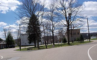
Leesville is a village in southwestern Carroll County, Ohio, United States. The population was 127 at the 2020 census. It is part of the Canton–Massillon metropolitan area.
Sherrodsville is a village in southwestern Carroll County, Ohio, United States. The population was 222 at the 2020 census. It is part of the Canton–Massillon metropolitan area.
Gordon is a village in Darke County, Ohio, United States. The population was 245 at the 2020 census.
Sugar Grove is a village in Fairfield County, Ohio, United States. The population was 429 at the 2020 census.
Vinton is a village in Gallia County, Ohio, United States. The population was 224 at the 2020 census. It is part of the rural Point Pleasant micropolitan area.
Addyston is a village in Miami Township, Hamilton County, Ohio, United States. Located along the Ohio River, it is a western suburb of the neighboring city of Cincinnati. The population was 927 at the 2020 census.
North Bend is a village in Miami Township, Hamilton County, Ohio, United States, along the Ohio River. It is a part of the Greater Cincinnati area. The population was 835 at the 2020 census.
Bowerston is a village in Harrison County, Ohio, United States. The population was 356 at the 2020 census.
Jewett is a village in Harrison County, Ohio, United States. The population was 554 at the 2020 census.
New Athens is a village in Harrison County, Ohio, United States. The population was 222 at the 2020 census.
Tarlton is a village in Fairfield and Pickaway counties in the U.S. state of Ohio. The population was 254 at the 2020 census.
Limaville is a census-designated place (CDP) and former village in Stark County, Ohio, United States. The population was 151 at the 2020 census. It is part of the Canton–Massillon Metropolitan Statistical Area.
Apple Creek is a village in East Union Township, Wayne County, Ohio, United States. The population was 1,188 at the 2020 census.
Harpster is a village in Wyandot County, Ohio, United States. The population was 160 at the 2020 census.
Scio is a city in Linn County, Oregon, United States. The population was 838 at the 2010 census.
Clifton is a village in Clark and Greene counties in the U.S. state of Ohio and is home to the Clifton Mill, one of the largest water-powered grist mills still in existence. The population was 131 at the 2020 census.
Adena is a village in southwestern Jefferson and southeastern Harrison counties in the U.S. state of Ohio. The population was 664 at the 2020 census. It is part of the Weirton–Steubenville metropolitan area.