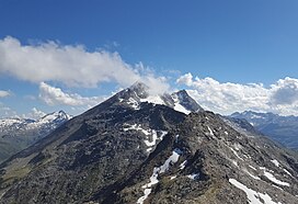
The main chain of the Alps, also called the Alpine divide is the central line of mountains that forms the drainage divide of the range. Main chains of mountain ranges are traditionally designated in this way, and generally include the highest peaks of a range. The Alps are something of an unusual case in that several significant groups of mountains are separated from the main chain by sizable distances. Among these groups are the Dauphine Alps, the Eastern and Western Graians, the entire Bernese Alps, the Tödi, Albula and Silvretta groups, the Jura Mountains, Ortler, and Adamello ranges, and the Dolomites of South Tyrol, as well as the lower Alps of Vorarlberg, Bavaria, and Salzburg.

Piz Bernina is the highest mountain in the Eastern Alps, the highest point of the Bernina Range, and the highest peak in the Rhaetian Alps. It rises 4,048.6 m (13,283 ft) and is located south of Pontresina and near the major Alpine resort of St. Moritz, in the Engadin valley. It is also the most easterly mountain higher than 4,000 m (13,000 ft) in the Alps, the highest point of the Swiss canton of Graubünden, and the fifth-most prominent peak in the Alps. Although the summit lies within Switzerland, the massif is on the border with Italy. The "shoulder" known as La Spedla is the highest point in the Italian Lombardy region.
Piz Cengalo [tʃ´ɛŋɡalɔ] is a mountain in the Bregaglia range of the Alps on the border between the Swiss canton of Graubünden and Italy. The first ascent of the mountain was by D. W. Freshfield and C. Comyns Tucker with guide F. Dévouassoud on 25 July 1866. The name 'Cengalo' derives from Tschingel, meaning girdle.

Lago di Luzzone is a reservoir in Ticino, Switzerland. The reservoir has a volume of 108 million m³ and a surface area of 1.27 km2 (0.49 sq mi). It is located in the upper Blenio valley, in the municipalities of Ghirone and Aquila.

Lai da Sontga Maria is a lake, located north of the Lukmanier Pass in Switzerland. It lies almost entirely in the municipality of Medel, a tiny fraction of the south-west part of the lake belonging to the municipalities of Quinto and Blenio. The reservoir has a surface area is 1.77 km2 (0.68 sq mi). The arch dam Santa Maria was completed in 1968. The main road of the Lukmanier Pass runs along the eastern shore of the lake.

Pizzo Rotondo is a mountain in the Lepontine Alps. At 3,190 metres above sea level, it is the highest mountain lying on the border between the cantons of Ticino and Valais, as well as the highest summit of the Lepontine Alps lying between Nufenen Pass and Lukmanier Pass.
Piz Miez is a mountain of the Oberhalbstein Alps, located on the border between Italy and Switzerland. It lies west of Lago di Lei, on the chain that culminates at Piz Timun.
Piz Cancian is a mountain in the Bernina Range of the Alps, located on the border between Italy and the Switzerland. The summit has an elevation of 3,103 metres (10,180 ft) above sea level.
Piz Combul is a mountain of the Bernina Range (Alps), located on the border between Italy and Switzerland. It lies between the Val Fontana and the Val Poschiavo. With a height of 2,901 metres above sea level, Piz Combul is the highest summit of the range lying south of the Bocchetta da Vartegna.
Piz Paradisin is a mountain of the Livigno Alps, located on the border between Italy and Switzerland. With an elevation of 3,302 metres (10,833 ft) above sea level, it is the third highest mountain of the Livigno Alps. On its west side lies a glacier named Vadreit da Camp.
Piz Lavirun is a mountain in the Livigno Range of the Alps, located on the border between Italy and Switzerland. It lies between the Val Lavirun (Graubünden) and the Valle di Federia (Lombardy).
Piz di Pian is a mountain of the Lepontine Alps on the Swiss-Italian border. With an elevation of 3,158 m (10,361 ft), it is the highest summit on the chain south of Pizzo Tambo.
Pizzo Muncréch is a mountain in the Swiss Lepontine Alps, overlooking Malvaglia in the canton of Ticino. It is located west of Piz di Strega, between the valleys of Combra and Pontirone.
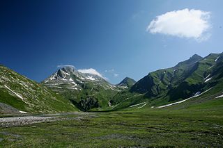
The Greina is a high mountain pass across the western Lepontine Alps, connecting Sumvitg in the canton of Graubünden in Switzerland and Olivone in the canton of Ticino. The pass lies between the Piz Medel on the north and Pizzo Marumo, Piz Terri on the south.
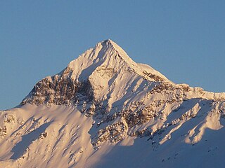
Pizzo Scalino is a mountain of the Bernina Range in Lombardy, Italy. It is known as the Valemalenco Matterhorn due to its pyramidal shape when viewed from the valley below. It lies close to Piz Cancian, where the border with Switzerland runs. The mountain is usually climbed from the Campo Moro Dam. From the summit, the whole of the Bernina Range is visible. It was first climbed in 1830.

Pizzo Paglia is a mountain of the Lepontine Alps, overlooking the Val Cama in the canton of Graubünden. The border with Italy runs 300 metres south of the summit.
The following is a list of Romansh exonyms, that is to say Romansh-language names for towns and cities that do not speak Romansh.

The border between the modern states of Switzerland and Italy extends for 744 kilometres (462 mi), from the French-Swiss-Italian tripoint at Mont Dolent in the west to the Austrian-Swiss-Italian tripoint near Piz Lad in the east. Much of the border runs across the High Alps, rising above 4,600 metres (15,100 ft) as it passes east of Dufourspitze, but it also descends to the lowest point in Switzerland as it passes Lago Maggiore at below 200 metres (660 ft).