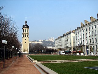
The Presqu’île is the heart of Lyon, France. Extending from the foot of the Croix Rousse hill to the confluence of the Rhône and the Saône rivers, it has a preponderance of cafés, restaurants, luxury shops, department stores, banks, government buildings, and cultural institutions. The 1st and 2nd arrondissements of the city are located here, along with the Hôtel de Ville. The spires of the church of St. Nizier, reconstructed starting in the 14th century, are at the foot of the former Saône river bridge. Though the business centre is located to the east in the 3rd arrondissement, road signs pointing to the centre of the city take drivers to Place Bellecour in the 2nd.

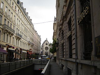
Rue de la République is a street located in the 1st and 2nd arrondissements of Lyon. This is the main shopping street of the city. This zone is served by the metro stations Bellecour, Hôtel de Ville - Louis Pradel and Cordeliers. The street belongs to the zone classified as World Heritage Site by UNESCO.

The Palais de la Bourse or Palais du Commerce is a building located in the quarter Les Cordeliers, in 2nd arrondissement of Lyon. It currently houses the headquarters of the Chamber of Commerce and Industry of Lyon. It is served by the metro station Cordeliers, and by bus lines C3, 18, 23, 25, 28, 58, 71, 91 and 99.

Rue Victor-Hugo is a pedestrian street in the 2nd arrondissement of Lyon, in the Ainay district of the Presqu'île quarter, reputed to be one of the most known shopping area of Lyon. From north to south, it connects the Place Bellecour to the Place Carnot. Beyond the Place Bellecour, the rue de la République is its natural extension, thus creating one of the biggest pedestrian streets in Europe. The street is served by metro stations Perrache, Bellecour and Ampère - Victor Hugo. It belongs to the zone classified as World Heritage Site by UNESCO.

The Place Antonin-Poncet is a square located in the Bellecour quarter, near the Place Bellecour, in the 2nd arrondissement of Lyon, France. It is served by the metro station Bellecour of the lines A and D, and by many buses (10-12-14-15-29-30-35-53-58-88-99). The square belongs to the zone classified as World Heritage Site by UNESCO.

The Rue des Marronniers is a street located in the Bellecour quarter, in the 2nd arrondissement of Lyon. It is a small paved pedestrian street famous for its many bouchons. It is served by the metro station Bellecour and many buses. The street belongs to a zone classified as a World Heritage Site by UNESCO.

The Place Ampère is a pedestrian square located in the Ainay square, in the 2nd arrondissement of Lyon. It is nearly the middle of the rue Victor Hugo and is served by the metro station Ampère - Victor Hugo.

The Place Carnot is a square located in the Perrache quarter, in the 2nd arrondissement of Lyon.

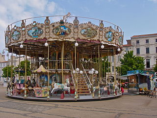
The Place des Jacobins is a square located in the 2nd arrondissement of Lyon. It was created in 1556 and a fountain was added in 1856. The square belongs to the zone classified as World Heritage Site by UNESCO. According to Jean Pelletier, this square is one of the most famous in Lyon, because of its location in the center of the 2nd arrondissement and its heavy traffic, as 12 streets lead here. The square, particularly its architecture and its features, has changed its appearance many times throughout years.

The Place de la Trinité is a square located in the 5th arrondissement of Lyon. The square, fully paved and surrounded by old buildings like the sun house, is more a crossing of small streets than a real square. It is on the hillside of Fourvière and is the low extremity of the hill of Gourguillon. The square is in the center of the zone classified as World Heritage Site by UNESCO.

The Place Sathonay is a square located in the 1st arrondissement of Lyon, France, at the bottom of hill of La Croix-Rousse, in La Martinière quarter. It was named after Nicolas-Marie-Jean-Claude Fay de Sathonay, mayor of Lyon from 1805 to 1812, as a tribute for all the importants works undertaken under his presidency. The square is currently the third largest square in Lyon and belongs to the zone classified as World Heritage Site by UNESCO. According to Lyon geography agrégé Jean Pelletier, it is "one of the most interesting squares of Lyon", because of its harmonious proportions, its boundaries composed of buildings with beautiful 1920s facades, and its plantations, which brings "a charm tinged of poetry" and give it the appearance of a village square.

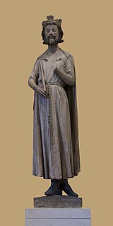
The Cours Charlemagne is a large central street located in the Perrache quarter, in the 2nd arrondissement of Lyon. This street is dedicated to Charlemagne, who came several times to Lyon. In addition, the bishop Leidrade represented the emperor in the city and by his great work of reconstruction. The Cours Charlemagne begins Place des Archives, just at the south of the vaults of the interchange of Perrache. It ends on the Quai Perrache, which overlooks the Pont Pasteur.

The Rue de la Bourse is a street located mainly in the 2nd arrondissement of Lyon, and also in the 1st arrondissement. It starts on the Place des Cordeliers, in the 2nd arrondissement, in front of the Église Saint-Bonaventure, and ends at right angles to the Rue du Bât-d'Argent, beyond which it is extended by the Rue du Garet.
The Rue Édouard-Herriot is one of the most important shopping streets of the Presqu'île in Lyon. It links the two most famous places of the city, the Place Bellecour (south) and the Place des Terreaux (north). Its northern part is located in the 1st arrondissement of Lyon, but the main part of the street is in the 2nd arrondissement. In its southern part, the street passes through the Place des Jacobins. It belongs to the zone classified as World Heritage Site by UNESCO.

The Boulevard des Belges is a wide and posh avenue located in Les Brotteaux quarter, in the 6th arrondissement of Lyon. It begins with the Quai de Grande Bretagne, runs along the southern part of the Parc de la Tête d'Or until the Avenue Verguin and ends on the Place Jules Ferry, in front of the Gare des Brotteaux. The boulevard is lined with plane trees and is served by two velo'v stations and the line B of the metro.

The Place Benoît-Crépu is a stone-paved square, located in Saint-Georges quarter, on the banks of the Saône, in the 5th arrondissement of Lyon. It has fountains with dolphin heads, many benches and trees and a playground. The place belongs to the area classified as World Heritage Site by UNESCO.
The Rue Émile-Zola is a street located in the 2nd arrondissement of Lyon, near Place Bellecour. This is one of the busiest shopping streets of Lyon, which was described as a "bourgeois" street because there are many upscale shops. It begins with the Place des Jacobins and ends at the Place Bellecour after crossing the rue des Archers, and belongs to the zone classified as World Heritage Site by UNESCO. It was named as tribute to the writer of the same name.


