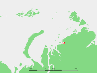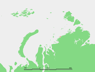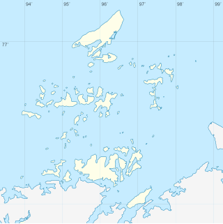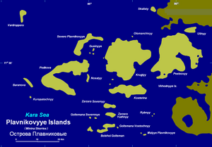
The Plavnikovye Islands (Russian: острова Плавниковые; Ostrova Plavnikovyye) is a group of islands, in the Kara Sea eastern region, off the coast of Siberia. These islands are covered with tundra vegetation and there are many lakes and swamps. They are under snow and ice during most of the year.
The Kara Sea is part of the Arctic Ocean north of Siberia. It is separated from the Barents Sea to the west by the Kara Strait and Novaya Zemlya, and the Laptev Sea to the east by the Severnaya Zemlya archipelago. It is named after the Kara River, which is now relatively insignificant but which played an important role in the Russian conquest of northern Siberia. The Kara River name is derived from Nenets word meaning "hummocked ice".
Siberia is an extensive geographical region spanning much of Eurasia and North Asia. Siberia has historically been a part of modern Russia since the 17th century.
The largest islands of the Plavnikovye Archipelago are Pestsovy Island and Krugly Island. Most of these islands are located and less than 10 km west of the deeply indented shores of the Taymyr Peninsula. But others, like Vardroppera Island, are far offshore. The eastern group of islands, including Kosterina and Pestsovy, are also known as Vkhodnye Islands.
The Taymyr Peninsula is a peninsula in the Far North of Russia, in the Siberian Federal District, that forms the northernmost part of the mainland of Eurasia. Administratively it is part of the Krasnoyarsk Krai Federal subject of Russia.
The Plavnikovye Islands, lie south of the small Kolosovykh peninsula. Geologically they are part of the Minina Skerries, a complex formation that includes the Kolosovykh Islands further north. This island group is located between 73° 15' and 74° 40' N and between 84° and 86° 30' E.
The Minina Skerries are located in the Kara Sea, in the northwestern shores of Siberia. They stretch between the Mikhailov Peninsula and the mouths of the river Pyasina. Their latitude is between 74° and 75° N, and their longitude between 84° and 87° 30' E.
The sea surrounding the Plavnikovye Islands is covered with fast ice in the winter and the climate is severe, with bitter and long winters. The surrounding sea is obstructed by pack ice even in the summer.
This island group belongs to the Krasnoyarsk Krai administrative division of the Russian Federation. It is also part of the Great Arctic State Nature Reserve, the largest nature reserve of Russia.
Krasnoyarsk Krai is a federal subject of Russia, with its administrative center in the city of Krasnoyarsk—the third-largest city in Siberia. Comprising half of the Siberian Federal District, Krasnoyarsk Krai is the largest krai in the Russian Federation, the second largest federal subject and the third largest subnational governing body by area in the world, after Sakha and the Australian state of Western Australia. The krai covers an area of 2,339,700 square kilometers (903,400 sq mi), which is nearly one quarter the size of the entire country of Canada, constituting roughly 13% of the Russian Federation's total area and containing a population of 2,828,187, or just under 2% of its population, per the 2010 Census.
The Great Arctic State Nature Reserve is a nature reserve in Krasnoyarsk Krai, Russia. With an area of 41,692 square kilometers (16,097 sq mi), it is the largest reserve of Russia and Eurasia, as well as one of the largest in the world.
The Plavnikovye Islands should not be confused with Plavnikovy Island (Ostrov Plavnikovy), off the western shores of Severnaya Zemlya, also in the Kara Sea.
Severnaya Zemlya is a 37,000-square-kilometre (14,000-square-mile) archipelago in the Russian high Arctic. It lies off Siberia's Taymyr Peninsula, separated from the mainland by the Vilkitsky Strait. This archipelago separates two marginal seas of the Arctic Ocean, the Kara Sea in the west and the Laptev Sea in the east.
The Nordenskiöld Archipelago or Nordenskjold Archipelago is a large and complex cluster of islands in the eastern region of the Kara Sea. Its eastern limit lies 120 km (75 mi) west of the Taymyr Peninsula.
Shokalsky Island is an island in the Kara Sea, in Russia. It is located on the eastern side of the mouth of the Ob River, off the tip of the narrow northwestern arm of the Gydan Peninsula. It is separated from it by a narrow strait full of islets known as Gydanskiy Proliv.
Maly Taymyr Island is an island in the Laptev Sea, Russian Arctic.
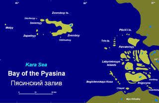
The Zveroboy Islands is a group consisting of a large island and a few scattered small islets. The main island is 17 km in length. It is covered with tundra vegetation and has a lake. This island group is located in the Pyasino Gulf, in the Kara Sea, northeast of Dikson, off the coast of Siberia.
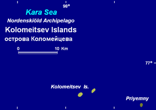
The Kolomeytsev Islands is a group of two small islands, part of the Nordenskjold Archipelago in the Kara Sea coastal region, off the coast of Siberia. These two islands are located at the northwestern end of the archipelago.
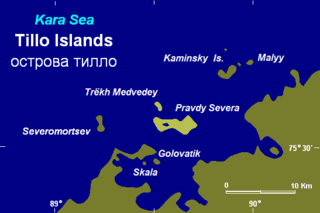
The Tillo Islands is a group of small islands covered with tundra vegetation. They stretch along the Kara Sea coastal region, right off the bleak coast of Siberia's Taymyr Peninsula. Most of the islands of the group are a mere 3 or 4 km from the continental shore.
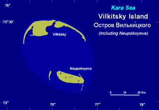
Vilkitsky Island, is an island in the Kara Sea. It is located 40 km northeast of Shokalskogo Island, off the tip of the Gydan Peninsula in North Siberia.
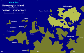
Kolosovykh Island is an island, in the Kara Sea off the coast of Siberia.
Kolchak Island or Kolchaka Island, is an island in the Kara Sea located in a coastal area of skerries NE of the Shturmanov Peninsula. It is near the southern end of the Nordenskiöld Archipelago, but not geographically part of it.
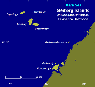
The Heiberg Islands, spelt Geyberg, Gejberg or Geiberg is a group of four small islands covered with tundra vegetation and with scattered stones on their shores. They lie in the Kara Sea, between the bleak coast of Siberia's Taymyr Peninsula and Severnaya Zemlya. These islands are between 35 and 45 km from the continental shore.
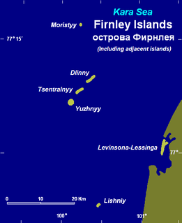
The Firnley Islands is a group of three small islands covered with tundra vegetation and with scattered stones on their shores. They lie in the Kara Sea, close to the bleak coast of Siberia's Taymyr Peninsula, not far east of the Nordenskjold Archipelago. These islands lie about 35 km from the continental shore.
The Mikhailov Peninsula is a small peninsula in the eastern shores of the Kara Sea on the western side of the Taymyr Peninsula. Its latitude is 75° 05' N and its longitude 87° 15' E.
The Labyrintovye Islands is a group of flat islands in the Pyasino Gulf of the Kara Sea. They are located at the mouth of the Pyasina River. Their latitude is 73° 50' N and its longitude 86° 45' E.
Taymyr Island, Russian: Остров Таймыр(Ostrov Taymyr), is a large island in the coast of the Kara Sea. Its length is 33 km (21 mi) and its average width about 10 km (6.2 mi). This island is located west of the Taymyr Gulf in an area of skerries right off the western coast of the Taymyr Peninsula. The narrow strait between Taymyr island and the Siberian coast is called Proliv Taymyrskiy It is about 3 km (1.9 mi) wide on average.
The Taymyr Gulf is a gulf in the Kara Sea that includes the estuary of the Lower Taymyr River.
Nansen Island, is a long and narrow island in the coast of the Kara Sea. Its length is 21 km (13 mi) and its average width about 2.5 km (1.6 mi). This island is located in an area of skerries right off the western coast of the Taymyr Peninsula.
Markgama, or Markham Island is a small, isolated island in the southern region of the Kara Sea off the Sorevnovaniya Bay. This island has only sparse tundra vegetation and it is covered with snow most of the year. The coast of the Taymyr Peninsula is located 15 km to the southeast.
Sorevnovaniya Island is an uninhabited island in the southern region of the Kara Sea. This island is located in the Sorevnovaniya Bay, east of the Mikhailov Peninsula.
Hovgaard Island is an island of the Nordenskiöld Archipelago in the Kara Sea, off the coast of Siberia.
Admiral Sir Albert Hastings Markham was a French- born, British explorer, author, and officer in the Royal Navy. In 1903 he was invested as a Knight Commander of the Order of the Bath. He died in London, England at the age of 76. He is also remembered for designing the flag of New Zealand.
Coordinates: 74°10′N85°15′E / 74.167°N 85.250°E
This Krasnoyarsk Krai location article is a stub. You can help Wikipedia by expanding it. |