Sverdrup Island (Kara Sea)

Last updated
Location of Sverdrup Island in the Kara Sea Kara seaSV.PNG
Location of Sverdrup Island in the Kara Sea
Svordrup.PNG

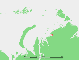
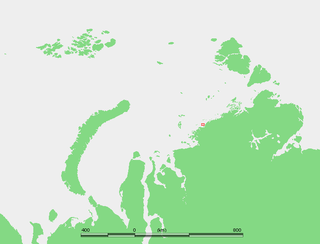
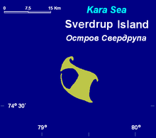
Sverdrup Island or Svordrup Island (Russian: Остров Свердрупа) is an isolated island in the southern region of the Kara Sea. This island is covered with tundra vegetation. It is located 120 km north of Dikson on the Siberian coast. The nearest land mass is the Arkticheskiy Institut Islands, about 90 km to the northeast. The island has a wide bay opening towards the west. Its length is 15 km and its maximum width 10 km.

Kara Sea A marginal sea of the Arctic Ocean north of Siberia between Novaya Zemlya and Severnaya Zemlya

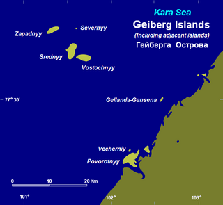
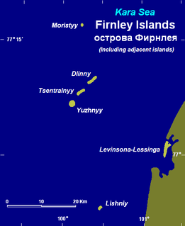
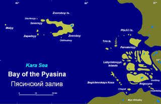
The Kara Sea is part of the Arctic Ocean north of Siberia. It is separated from the Barents Sea to the west by the Kara Strait and Novaya Zemlya, and the Laptev Sea to the east by the Severnaya Zemlya archipelago. It is named after the Kara River, which is now relatively insignificant but which played an important role in the Russian conquest of northern Siberia. The Kara River name is derived from Nenets word meaning "hummocked ice".

Tundra biome where the tree growth is hindered by low temperatures and short growing seasons

In physical geography, tundra is a type of biome where the tree growth is hindered by low temperatures and short growing seasons. The term tundra comes through Russian тундра from the Kildin Sami word тӯндар meaning "uplands", "treeless mountain tract". Tundra vegetation is composed of dwarf shrubs, sedges and grasses, mosses, and lichens. Scattered trees grow in some tundra regions. The ecotone between the tundra and the forest is known as the tree line or timberline.

Dikson (urban-type settlement) Urban-type settlement in Krasnoyarsk Krai, Russia

Dikson is an urban locality in Taymyrsky Dolgano-Nenetsky District of Krasnoyarsk Krai, Russia. It is a port on the Kara Sea, located on a headland at the mouth of the Yenisei Gulf, on Russia's Arctic Ocean coast. As of the 2010 Census, its population was 676.

Contents

The sea surrounding Sverdrup Island is covered with pack ice with some polynias in the long winter and there are many ice floes even in the summer. This Russian island should not be confused with the Sverdrup Islands, an archipelago of the northern Queen Elizabeth Islands, in Nunavut, Canada. Both, however, are named after Norwegian polar explorer, Otto Sverdrup.

Sverdrup Islands archipelago of the northern Queen Elizabeth Islands, in Nunavut, Canada

The Sverdrup Islands is an archipelago of the northern Queen Elizabeth Islands, in Nunavut, Canada. The islands are situated in the Arctic Ocean, west of Ellesmere Island from 77° to 81° North and 85° to 106° West.

Queen Elizabeth Islands island group

The Queen Elizabeth Islands are the northernmost cluster of islands in the Canadian Arctic Archipelago, split between Nunavut and Northwest Territories in Northern Canada. The Queen Elizabeth Islands contain approximately 14% of the global glacier and ice cap area..

Nunavut Territory of Canada

Nunavut is the newest, largest, and most northerly territory of Canada. It was separated officially from the Northwest Territories on April 1, 1999, via the Nunavut Act and the Nunavut Land Claims Agreement Act, though the boundaries had been contemplatively drawn in 1993. The creation of Nunavut resulted in the first major change to Canada's political map since the incorporation of the province of Newfoundland in 1949.

Administration

Sverdrup Island belongs to the Krasnoyarsk Krai administrative division of the Russian Federation. It is also part of the Great Arctic State Nature Reserve – the largest nature reserve of Russia and one of the biggest in the world.

Krasnoyarsk Krai First-level administrative division of Russia

Krasnoyarsk Krai is a federal subject of Russia, with its administrative center in the city of Krasnoyarsk—the third-largest city in Siberia. Comprising half of the Siberian Federal District, Krasnoyarsk Krai is the largest krai in the Russian Federation, the second largest federal subject and the third largest subnational governing body by area in the world, after Sakha and the Australian state of Western Australia. The krai covers an area of 2,339,700 square kilometers (903,400 sq mi), which is nearly one quarter the size of the entire country of Canada, constituting roughly 13% of the Russian Federation's total area and containing a population of 2,828,187, or just under 2% of its population, per the 2010 Census.

Great Arctic State Nature Reserve nature reserve in Russia

The Great Arctic State Nature Reserve is a nature reserve in Krasnoyarsk Krai, Russia. With an area of 41,692 square kilometers (16,097 sq mi), it is the largest reserve of Russia and Eurasia, as well as one of the largest in the world.

Related Research Articles

Shokalsky Island island

Shokalsky Island is an island in the Kara Sea, in Russia. It is located on the eastern side of the mouth of the Ob River, off the tip of the narrow northwestern arm of the Gydan Peninsula. It is separated from it by a narrow strait full of islets known as Gydanskiy Proliv.

Uyedineniya Island island

Uyedineniya Island is an island located in the central part of the Kara Sea, roughly midway between Novaya Zemlya and Severnaya Zemlya. Its latitude is 77° 29' N and its longitude 82° 30' E. It is often labelled as Einsamkeit Island as well as Lonely Island or Solitude Island in English maps.

Arkticheskiy Institut Islands Russian islands in the Arctic Sea

The Arkticheskiy Institut Islands or Arctic Institute Islands is a compact archipelago of narrow islands covered with tundra vegetation. The islands are located in the Kara Sea, about 173 km (107 mi)north of the coast of Siberia, and just 45 km (28 mi) south of the nearest island group, the Izvesti Tsik Islands.

Zveroboy Islands

The Zveroboy Islands is a group consisting of a large island and a few scattered small islets. The main island is 17 km in length. It is covered with tundra vegetation and has a lake. This island group is located in the Pyasino Gulf, in the Kara Sea, northeast of Dikson, off the coast of Siberia.

Voronina Island island group

Voronina Island or Voronina Islands is an isolated two-island group composed of a larger island and a narrow island on its northern side separated by a 3 km wide sound.

Sibiryakov Island island

Sibiryakov Island or Sibiryakow Island, also known as Kuz'kin Island, is an island of 800 square kilometres. Its length is 38 kilometres and its maximum width 27 kilometres. It is covered with tundra vegetation.

Tillo Islands

The Tillo Islands is a group of small islands covered with tundra vegetation. They stretch along the Kara Sea coastal region, right off the bleak coast of Siberia's Taymyr Peninsula. Most of the islands of the group are a mere 3 or 4 km from the continental shore.

Oleny Island island in the Kara Sea

Oleny Island is a single island in the Kara Sea just a few kilometers offshore, north of the coast of one of the arms of the Gydan Peninsula in North Siberia. It is covered with tundra and swamps and it is 53 km in length and its average width is 27 km, having an area of 1197 km². Its latitude is 72° 24' N and the longitude 77° 45' E.

Vilkitsky Island (Kara Sea) island

Vilkitsky Island, is an island in the Kara Sea. It is located 40 km northeast of Shokalskogo Island, off the tip of the Gydan Peninsula in North Siberia.

Mona Islands island group

The Mona Islands or Mohn Islands is a group of a few scattered small islands covered with tundra vegetation. They are located in the Kara Sea, about 30 km north of the western coast of the Taymyr Peninsula in Siberia, Russia.

Russky Island (Kara Sea) island in Russia

Russky Island, also spelt Russkyy and Russkiy, is an island in the Kara Sea. It is located in the Litke Islands subgroup of the Nordenskiöld Archipelago.

Izvestiy TSIK Islands island group

The Izvestiy TSIK Islands or Izvesti Tsik Islands, also known as Izvestia Islands, is an island group in the Kara Sea, Russian Federation.

Plavnikovye Islands

The Plavnikovye Islands is a group of islands, in the Kara Sea eastern region, off the coast of Siberia. These islands are covered with tundra vegetation and there are many lakes and swamps. They are under snow and ice during most of the year.

Kolosovykh Island

Kolosovykh Island is an island, in the Kara Sea off the coast of Siberia.

Kolchak Island island in Russia

Kolchak Island or Kolchaka Island, is an island in the Kara Sea located in a coastal area of skerries NE of the Shturmanov Peninsula. It is near the southern end of the Nordenskiöld Archipelago, but not geographically part of it.

Heiberg Islands island group

The Heiberg Islands, spelt Geyberg, Gejberg or Geiberg is a group of four small islands covered with tundra vegetation and with scattered stones on their shores. They lie in the Kara Sea, between the bleak coast of Siberia's Taymyr Peninsula and Severnaya Zemlya. These islands are between 35 and 45 km from the continental shore.

Firnley Islands

The Firnley Islands is a group of three small islands covered with tundra vegetation and with scattered stones on their shores. They lie in the Kara Sea, close to the bleak coast of Siberia's Taymyr Peninsula, not far east of the Nordenskjold Archipelago. These islands lie about 35 km from the continental shore.

Labyrintovye Islands Russian islands in the Arctic Sea

The Labyrintovye Islands is a group of flat islands in the Pyasino Gulf of the Kara Sea. They are located at the mouth of the Pyasina River. Their latitude is 73° 50' N and its longitude 86° 45' E.

Markgama Island island in Russia

Markgama, or Markham Island is a small, isolated island in the southern region of the Kara Sea off the Sorevnovaniya Bay. This island has only sparse tundra vegetation and it is covered with snow most of the year. The coast of the Taymyr Peninsula is located 15 km to the southeast.

Sorevnovaniya Island island in Russia

Sorevnovaniya Island is an uninhabited island in the southern region of the Kara Sea. This island is located in the Sorevnovaniya Bay, east of the Mikhailov Peninsula.

References

See also

Coordinates: 74°35′N79°27′E / 74.583°N 79.450°E / 74.583; 79.450

Geographic coordinate system Coordinate system

A geographic coordinate system is a coordinate system that enables every location on Earth to be specified by a set of numbers, letters or symbols. The coordinates are often chosen such that one of the numbers represents a vertical position and two or three of the numbers represent a horizontal position; alternatively, a geographic position may be expressed in a combined three-dimensional Cartesian vector. A common choice of coordinates is latitude, longitude and elevation. To specify a location on a plane requires a map projection.