Jackson County is a county located in the northeastern part of the U.S. state of Georgia. As of the 2020 census, the population was 75,907. The county seat is Jefferson. Jackson County comprises the Jefferson, GA Micropolitan Statistical Area, which is included in the Atlanta-Athens-Clarke County-Sandy Springs, GA Combined Statistical Area.

The River Tyne is a river in North East England. Its length is 73 miles (118 km). It is formed by the North Tyne and the South Tyne, which converge at Warden near Hexham in Northumberland at a place dubbed 'The Meeting of the Waters'.

Northumberland County is an upper-tier municipality situated on the north shore of Lake Ontario, east of Toronto in Central Ontario. The Northumberland County headquarters are located in Cobourg.

Wylam is a village and civil parish in the county of Northumberland, England. It is located about 10 miles (16 km) west of Newcastle upon Tyne.
St Cuthbert's Way is a 100-kilometre (62 mi) long-distance trail between the Scottish Borders town of Melrose and Lindisfarne off the coast of Northumberland, England. The walk is named after Cuthbert, a 7th-century saint, a native of the Borders who spent his life in the service of the church. The route links Melrose Abbey, where Cuthbert began his religious life, with his initial burial place on Holy Island. Cuthbert achieved the status of bishop, and was called a saint eleven years after his death, when his coffin was opened and his remains found to be perfectly preserved.
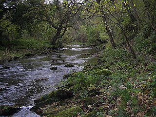
The River Blyth flows eastwards through southern Northumberland into the North Sea at the town of Blyth. It flows through Plessey Woods Country Park. The River Pont is a tributary. The Blyth is 27 miles (44 km) long and the Pont is 17 miles (28 km).

Hadrian's Wall Path is a long-distance footpath in the north of England, which became the 15th National Trail in 2003. It runs for 84 miles (135 km), from Wallsend on the east coast of England to Bowness-on-Solway on the west coast. For most of its length it is close to the remains of Hadrian's Wall, the defensive wall built by the Romans on the northern border of their empire. This is now recognised as part of the "Frontiers of the Roman Empire" World Heritage Site.
The London Borough of Bexley owns and maintains over 100 parks and open spaces within its boundaries, with a total of 638 hectares. They include small gardens, river and woodland areas, and large parks with many sporting and other facilities.
The Pennine Cycleway is a Sustrans-sponsored route in the Pennines range in northern England, an area often called the "backbone of England". The route passes through the counties of Derbyshire, West Yorkshire, Lancashire, North Yorkshire, Cumbria and Northumberland. It is part of the National Cycle Network (NCN). Sustrans founder John Grimshaw calls it 'the best National Cycle Network route of the lot'.
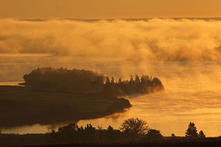
The Sunrise Trail is a scenic roadway in the Canadian province of Nova Scotia. It is located along the province's North Shore on the Northumberland Strait for 333 km (207 mi) from Amherst to the Canso Causeway.

The Mason-Dixon Trail is a 193-mile (311 km) hiking trail that begins at the Appalachian Trail in south-central Pennsylvania, continues through northeastern Maryland and northern Delaware, and re-enters Pennsylvania shortly before ending at Chadds Ford. It is named for the historic Mason–Dixon line, which it crosses twice. About one-third of the route follows roads through rural areas, but the rest is on traditional footpaths. The trail also traverses many tracts of private land, at which passage for hikers has been arranged with owners. This results in occasional relocations. The trail takes hikers through a variety of rural and semi-urban landscapes, with most of the route in Pennsylvania featuring farmlands and forested areas, and most of the route in Maryland and Delaware featuring historic sites and small towns.

The Schuylkill River Trail is a multi-use trail along the banks of the Schuylkill River in southeastern Pennsylvania. Partially complete as of 2018, the trail is ultimately planned to run about 140 miles (230 km) from the river's headwaters in Schuylkill County to Fort Mifflin in Philadelphia.

The Northern Woods and Water Route is a 2,400-kilometre (1,500 mi) route through northern British Columbia, Alberta, Saskatchewan and Manitoba in Western Canada. As early as the 1950s, community groups came together to establish a northern travel route; this was proposed as the Northern Yellowhead Transportation Route. The Northern Woods and Water Route Association was established in 1974, and encouraged promotion of the route with the promise of an increase in tourist travel. The route was designated in 1974 and is well signed throughout its component highways. The route starts at Dawson Creek as the Spirit River Highway and ends at the Perimeter of Winnipeg, Manitoba, after running through the northern regions of the western provinces. From west to east, the Northern Woods and Water Route (NWWR) incorporates portions of British Columbia Highway 49; Alberta Highways 49, 2A, 2, & 55; Saskatchewan Highways 55 & 9; Manitoba Provincial Road 283 and Trunk Highways 10, 5, 68 & 6. The halfway point of the NWWR is approximately at Goodsoil, Saskatchewan.

Shikellamy State Park is a 132-acre (53 ha) Pennsylvania state park located at the confluence of the West Branch Susquehanna River and Susquehanna River in Pennsylvania. The park is divided into two sections. The older part, on a bluff on the western bank of the Susquehanna River, is the 78-acre (32 ha) Shikellamy overlook in Union Township, Union County. The newer part is the 54-acre (22 ha) marina on the southern end of Packer Island in Upper Augusta Township, Northumberland County. Packer's Island lies between the city of Sunbury and the borough of Northumberland at the confluence of the two branches of the river.

Pennsylvania Route 147 is a north–south route that runs for 58.3 miles (93.8 km) along the east shore of the Susquehanna River in central Pennsylvania, United States. The southern terminus is at an interchange with US 22/US 322 in Reed Township. The northern terminus is at an interchange with Interstate 80 (I-80) and I-180 in Turbot Township.
Highway 55 is a paved, undivided provincial highway in the Canadian province of Saskatchewan. It runs from the Alberta border west of Pierceland to Highway 9 near Mountain Cabin. Highway 55 is about 652 kilometres (405 mi) long and forms part of the interprovincial Northern Woods and Water Route.

Pennsylvania Route 405 (PA 405) is a 35.124-mile-long (56.527 km) state highway that runs in the north-central part of the U.S. state of Pennsylvania. The southern terminus is an intersection with PA 61 in Sunbury. The route heads across the Susquehanna River to Northumberland and northward along the West Branch Susquehanna River through Milton, Watsontown and Muncy until entering Hughesville, where it terminates at an intersection with U.S. Route 220 (US 220).

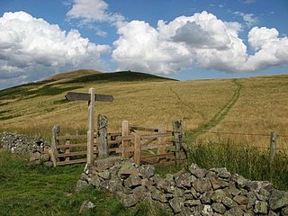
The Cheviot Hills, or sometimes The Cheviots, are a range of uplands straddling the Anglo-Scottish border between Northumberland and the Scottish Borders. The English section is within the Northumberland National Park. The range includes The Cheviot, plus Hedgehope Hill to the east, Windy Gyle to the west, and Cushat Law and Bloodybush Edge to the south.

The Ventura River Parkway Trail is a southern California rail trail along the Ventura River in Ventura County. Roughly paralleling California State Route 33 for 16.5 mi (26.6 km) from Ventura to Ojai, it follows the route of the former Ventura and Ojai Valley Railroad that was abandoned between 1969 and 1995.