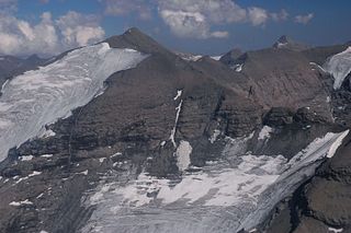
The Grandes Jorasses is a mountain in the Mont Blanc massif, on the boundary between Haute-Savoie in France and Aosta Valley in Italy.

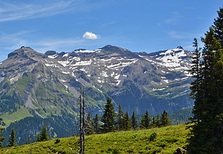
The Wildstrubel is a mountain of the Alps, straddling the border between the Swiss cantons of Bern and Valais. It forms a large glaciated massif, about 15 km wide, extending between the Rawil Pass and the Gemmi Pass. Along with the Muverans, the Diablerets and the Wildhorn, the Wildstrubel is one of the four distinct mountain massifs of the Bernese Alps that lie west of the Gemmi Pass. The massif of the Wildstrubel is at the centre between the valleys of Simmental (BE), Engstligental (BE) and the Rhone (VS), the exact location of the tripoint being the summit of the Schneehorn. It comprises several distinct summits, including the Wetzsteinhorn, the Rohrbachstein, the Weisshorn, the Pointe de la Plaine Morte, Mont Bonvin, the Trubelstock and the Schneehorn. The main crest with the almost equally high summits of the Mittelgipfel and the Grossstrubel forms an amphitheatre oriented eastward which ends at the Steghorn and the Daubenhorn. This area encloses the Wildstrubel Glacier. To the southwest, the Wildstrubel overlooks the high plateau of the Plaine Morte Glacier, which also includes an unnamed lake below the Schneehorn.

The Dent du Géant is a mountain in the Mont Blanc massif in France and Italy.

The Vanoise massif is a mountain range of the Graian Alps, located in the Western Alps. After the Mont Blanc Massif and the Écrins Massif it is the third-highest massif in France, reaching a height of 3,885 m at the summit of Grande Casse. It lies between Tarentaise Valley to the north and the Maurienne Valley in the south. The range is the site of France's first national park, established in 1963, Vanoise National Park. The ski resorts of Tignes and Val-d'Isère and the 2,770-metre-high Col de l'Iseran are located in the eastern part of the range.

Michel Auguste Croz was a French mountain guide and the first ascentionist of many mountains in the western Alps during the golden age of alpinism. He is chiefly remembered for his death on the first ascent of the Matterhorn and for his climbing partnership with Edward Whymper.

The Aiguille de la Tsa is a mountain of the Swiss Pennine Alps, overlooking Arolla in the canton of Valais. It lies on the range culminating at the Dent de Perroc, between the valley of Arolla and the Mont Miné Glacier.
The Pointe d'Orny is a mountain of the Mont Blanc massif, located west of Orsières in the canton of Valais. It lies north-east of the Plateau du Trient.
The Pointe de Vouasson is a mountain of the Swiss Pennine Alps, overlooking Lac des Dix in the canton of Valais. It lies between the valleys of Hérémence (west) and Arolla (east), north of the Aiguilles Rouges d'Arolla.
The Pointe de Bricola is a mountain of the Swiss Pennine Alps, located south of Les Haudères in the canton of Valais. The east side is covered by the Moiry Glacier.
The Pointe des Berons is a mountain of the Mont Blanc Massif, located on the border between Switzerland and France. It lies approximately halfway between the Col de Balme and the Aiguille du Tour. The east (Swiss) side is covered by the Glacier des Berons.
The Rohrbachstein is a mountain of the Bernese Alps, located on the border between the Swiss cantons of Bern and Valais. It lies between the Rawil Pass and the Plaine Morte Glacier.
The Grande Pointe des Planereuses is a mountain of the Mont Blanc massif, located west of Praz de Fort in the canton of Valais, Switzerland. It lies on the range south of the Saleina Glacier.

The Petite Pointe d'Orny is a mountain of the Mont Blanc Massif, overlooking the Trient Glacier in the canton of Valais. It lies north of the Pointe d'Orny.

Pointe Kurz is a mountain of the Mont Blanc Massif, located on the border between France and Switzerland. It lies between the glaciers of Argentière and L'A Neuve, west of La Fouly, the closest locality.
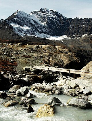
The Chanrion Hut French: is a mountain hut located in the upper Val de Bagnes in the canton of Valais in Switzerland. It lies in an isolated area south of Lac de Mauvoisin at an altitude of 2,462 metres, at the foot of Pointe d'Otemma. The easiest access is from the north.
Pointe de Ronce is a mountain of Savoie, France. It lies in the Mont Cenis range. It has an elevation of 3,612 metres (11,850 ft) above sea level.

The Pointes de Mourti are a mountain of the Swiss Pennine Alps, overlooking the glacier of Moiry in the canton of Valais. They lie north of the Pointe de Bricola, on the range that separates the valley of Hérens from the valley of Moiry.

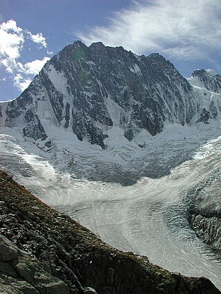
The Pointe de la Plaine Morte is a mountain of the Bernese Alps, located on the border between the Swiss cantons of Bern and Valais. It overlooks the large and flat glacier named Plaine Morte Glacier, from the south-west side.
The Weisshorn is a mountain of the Bernese Alps, located on the border between the Swiss cantons of Bern and Valais. It lies on the main chain of the Bernese Alps, between the Rawil Pass and the Plaine Morte Glacier.

Val de Bagnes, also called the Vallée de Bagnes is a valley located in the Entremont District in the Canton of Valais of Switzerland.

