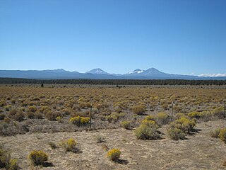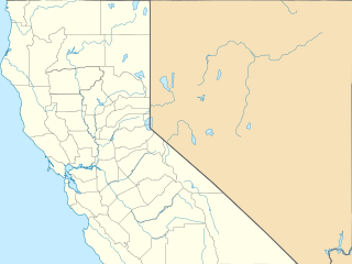
Pinus jeffreyi, also known as Jeffrey pine, Jeffrey's pine, yellow pine and black pine, is a North American pine tree. It is mainly found in California, but also in the westernmost part of Nevada, southwestern Oregon, and northern Baja California. It is named in honor of its botanist documenter John Jeffrey.

Pinus ponderosa, commonly known as the ponderosa pine, bull pine, blackjack pine, western yellow-pine, or filipinus pine is a very large pine tree species of variable habitat native to mountainous regions of western North America. It is the most widely distributed pine species in North America.

The ecology of California can be understood by dividing the state into a number of ecoregions, which contain distinct ecological communities of plants and animals in a contiguous region. The ecoregions of California can be grouped into four major groups: desert ecoregions, Mediterranean ecoregions, forested mountains, and coastal forests.

The Warner Mountains are an 85-mile (137 km)-long mountain range running north–south through northeastern California and extending into southern Oregon in the United States. The range lies within the northwestern corner of the Basin and Range Province, extending from the northeastern corner of Lassen County, California, through eastern Modoc County, California, and northward into Lake County, Oregon.

The Modoc Plateau lies in the northeast corner of California as well as parts of Oregon and Nevada. Nearly 1,000,000 acres (400,000 ha) of the Modoc National Forest are on the plateau between the Medicine Lake Highlands in the west and the Warner Mountains in the east.

Eldorado National Forest is a U.S. National Forest located in the central Sierra Nevada mountain range, in eastern California.

Plumas National Forest is a 1,146,000-acre (4,638 km2) United States National Forest located at the northern terminus of the Sierra Nevada, in northern California. The Forest was named after its primary watershed, the Rio de las Plumas, or Feather River.

The Coast Ranges of California span 400 miles (644 km) from Del Norte or Humboldt County, California, south to Santa Barbara County. The other three coastal California mountain ranges are the Transverse Ranges, Peninsular Ranges and the Klamath Mountains.

Carbonera Creek is a 10.2-mile-long (16.4 km) watercourse in Santa Cruz County, California, that eventually flows to the San Lorenzo River.
Zayante Creek is a 10.3-mile-long (16.6 km) stream within the San Lorenzo River watershed in Santa Cruz County, California, United States. The U.S. government has designated Zayante Creek as impaired with respect to sediment. Lompico Creek, a tributary of Zayante Creek, is listed for impairment by pathogens. In the period 1998 to 2000 a restoration project was conducted for this stream to improve anadromous fish passage, rearing and spawning. There has been a permanent U.S. Geological Survey gauging station on Zayante Creek which has operated since the year 1959; the mean altitude of the Zayante Basin, carved within the western slopes of the Santa Cruz Mountains, is 1,000 feet (300 m). Significant tributaries to Zayante Creek are Lompico Creek and Bean Creek.

The Landels-Hill Big Creek Reserve is a constituent of the University of California Natural Reserve System. It is located off State Route 1 in the Big Sur area on California's central coast, fifty miles south of Monterey and adjacent to the Big Creek State Marine Reserve and Big Creek State Marine Conservation Area.

The Rocky Mountain Floristic Region, also known as the Rocky Mountain Floristic Province, is a floristic region within the Holarctic Kingdom in western North America delineated by Armen Takhtajan and Robert F. Thorne. The region extends from Kodiak Island in Alaska to the San Francisco Bay Area and Sierra Nevada in California. The Vancouverian Province comprises the coastal part of the region for its entire length, including the Pacific Coast Ranges, and the Rocky Mountain Province includes the Rocky Mountains and associated ranges. There are no endemic plant families in the region but many endemic genera and species.

The South Warner Wilderness is a federally designated wilderness area 12 miles (19 km) east of Alturas, California, USA. It encompasses more than 70,000 acres (283 km2) of the Warner Mountains. It is within the Modoc National Forest and managed by the US Forest Service. Elevations range from 5,000 feet (1,500 m) to 9,895 feet at Eagle Peak.

The Eastern Cascades Slopes and Foothills ecoregion is a Level III ecoregion designated by the United States Environmental Protection Agency (EPA) in the U.S. states of Oregon, Washington, and California. In the rain shadow of the Cascade Range, the eastern side of the mountains experiences greater temperature extremes and receives less precipitation than the west side. Open forests of ponderosa pine and some lodgepole pine distinguish this region from the Cascades ecoregion, where hemlock and fir forests are more common, and from the lower, drier ecoregions to the east, where shrubs and grasslands are predominant. The vegetation is adapted to the prevailing dry, continental climate and frequent wildfire. Volcanic cones and buttes are common in much of the region.

The Blue Mountains ecoregion is a Level III ecoregion designated by the United States Environmental Protection Agency (EPA) in the Pacific Northwest, mainly in the state of Oregon, with small areas over the state border in Idaho and southeastern Washington. It is also contiguous with the World Wildlife Fund's Blue Mountain forests ecoregion.

The Lost Forest Research Natural Area is a designated forest created by the Bureau of Land Management to protect an ancient stand of ponderosa pine in the remote high desert county of northern Lake County, in the south central area of the U.S. state of Oregon. Lost Forest is an isolated area of pine trees separated from the nearest contiguous forest land by forty miles of arid desert. There are no springs or surface water in Lost Forest, and much of the southwest portion of the natural area is covered by large shifting sand dunes that are slowly encroaching on the forest.

The California montane chaparral and woodlands is an ecoregion defined by the World Wildlife Fund, spanning 7,900 square miles (20,000 km2) of mountains in the Transverse Ranges, Peninsular Ranges, and Coast Ranges of southern and central California. The ecoregion is part of the larger California chaparral and woodlands ecoregion, and belongs to the Mediterranean forests, woodlands, and scrub biome.
The Ponderosa Fire was a devastating fire during the 2012 California wildfire season. While the fire only burned 27,676 acres (11,200 ha) it destroyed 133 structures making it the most destructive fire of the year. At the height of the fire, on August 24, over 2,300 firefighters were involved with the effort which included 254 fire engines, 46 bulldozers and 54 water tenders.

The Ponderosa Fire was a wildland fire near Forbestown in Butte County, California in the United States. The fire started on August 29, 2017. The cause is still under investigation. The fire was 100% contained on September 23, after it had burned 4,016 acres (16 km2).


