Elliott Corner, California

Last updated
Elliott Corner
Unincorporated community
California Locator Map with US.PNG
Red pog.svg
Elliott Corner
Location in California
Usa edcp location map.svg
Red pog.svg
Elliott Corner
Elliott Corner (the US)
Coordinates: 37°27′46″N119°46′29″W / 37.46278°N 119.77472°W / 37.46278; -119.77472 Coordinates: 37°27′46″N119°46′29″W / 37.46278°N 119.77472°W / 37.46278; -119.77472
Country United States
State California
County Mariposa County
Elevation [1] 2,956 ft (901 m)

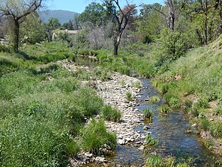
Elliott Corner is an unincorporated community in Mariposa County, California. [1] It is located 10.5 miles (17 km) east of Mariposa, [2] at an elevation of 2956 feet (901 m). [1]

Unincorporated area Region of land not governed by own local government

In law, an unincorporated area is a region of land that is not governed by a local municipal corporation; similarly an unincorporated community is a settlement that is not governed by its own local municipal corporation, but rather is administered as part of larger administrative divisions, such as a township, parish, borough, county, city, canton, state, province or country. Occasionally, municipalities dissolve or disincorporate, which may happen if they become fiscally insolvent, and services become the responsibility of a higher administration. Widespread unincorporated communities and areas are a distinguishing feature of the United States and Canada. In most other countries of the world, there are either no unincorporated areas at all, or these are very rare; typically remote, outlying, sparsely populated or uninhabited areas.

Mariposa County, California County in California

Mariposa County is a county in the U.S. state of California. As of the 2010 U.S. Census, the population was 18,251. The county seat is Mariposa. It is located in the western foothills of the Sierra Nevada mountains, north of Fresno, east of Merced, and southeast of Stockton.

California State of the United States of America

California is a state in the Pacific Region of the United States. With 39.6 million residents, California is the most populous U.S. state and the third-largest by area. The state capital is Sacramento. The Greater Los Angeles Area and the San Francisco Bay Area are the nation's second and fifth most populous urban regions, with 18.7 million and 9.7 million residents respectively. Los Angeles is California's most populous city, and the country's second most populous, after New York City. California also has the nation's most populous county, Los Angeles County, and its largest county by area, San Bernardino County. The City and County of San Francisco is both the country's second-most densely populated major city after New York City and the fifth-most densely populated county, behind only four of the five New York City boroughs.

Related Research Articles

Mariposa, California Census-designated place in California, United States

Mariposa is a census-designated place (CDP) in and the county seat of Mariposa County, California, United States. The population was 2,173 at the 2010 census, up from 1,373 at the 2000 census. Its name is Spanish for "butterfly", after the flocks of monarchs seen overwintering there by early explorers.

Keyesville, California Unincorporated community in California, United States

Keyesville is an unincorporated community in Kern County, California. It is located 2 miles (3.2 km) west of Lake Isabella and the Kern River Valley, at an elevation of 2,848 feet (868 m). Keyesville, founded in 1854 is named for Richard M. Keyes, whose discovery of gold in 1853 started the Kern River Gold Rush.

Yosemite Village, California Unincorporated community in California, United States

Yosemite Village is an unincorporated community in Mariposa County, California. It is located 44 miles (71 km) northeast of Mariposa, at an elevation of 3996 feet.

Agua Fria, California Unincorporated community in California, United States

Agua Fria is an unincorporated community in Mariposa County, California. It is located 5.25 miles (8.4 km) northeast of Catheys Valley, at an elevation of 2001 feet. Agua Fria is the former county seat of Mariposa County located approximately three miles west of Mariposa, California.

Mormon Bar, California Unincorporated community in California, United States

Mormon Bar is an unincorporated community in Mariposa County, California. It is located 2 miles (3.2 km) south-southeast of Mariposa, at an elevation of 1772 feet. Mormon Bar is located near State Route 49.

Barrett, Mariposa County, California Unincorporated community in California, United States

Barrett is an unincorporated community in Mariposa County, California. It is located on the western shore of Lake McClure on the Yosemite Valley Railroad 6.5 miles (10 km) south-southwest of Penon Blanco Peak, at an elevation of 876 feet.

Ben Hur, California Unincorporated community in California, United States

Ben Hur is an unincorporated community in Mariposa County, California. It is located 9 miles (14 km) south of Mariposa, at an elevation of 1752 feet.

Bridgeport, Mariposa County, California Unincorporated community in California, United States

Bridgeport is an unincorporated community in Mariposa County, California. It is located on Agua Fria Creek 5 miles (8 km) east of Catheys Valle, at an elevation of 1499 feet.

Buena Vista, Mariposa County, California Unincorporated community in California, United States

Buena Vista is an unincorporated community in Mariposa County, California. It is located 2.5 miles (4 km) west-northwest of El Portal, at an elevation of 5266 feet.

Darrah, California Unincorporated community in California, United States

Darrah is an unincorporated community in Mariposa County, California. It is located on the southeast slope of Buckingham Mountain, on the east bank of Snow Creek, 8 miles (12.8 km) northeast of Mariposa, and 11.5 miles (19 km) south-southwest of El Portal, at an elevation of 3123 feet.

Dogtown, Mariposa County, California Unincorporated community in California, United States

Dogtown is an unincorporated community in Mariposa County, California. It is located on Maxwell Creek 4 miles (6.4 km) east of Coulterville, at an elevation of 2582 feet.

Hayward, Mariposa County, California Unincorporated community in California, United States

Hayward is an unincorporated community in Mariposa County, California. It is 37 miles east of Modesto on California State Route 132, at an elevation of 643 feet.

Mount Bullion, Mariposa County, California Unincorporated community in California, United States

Mount Bullion is an unincorporated community in Mariposa County, California. It is located 6 miles (9.7 km) southeast of Bear Valley, at an elevation of 2152 feet.

Newtown, Mariposa County, California Former settlement in California, United States

Newtown is a former settlement in Mariposa County, California. It lay at an elevation of 1821 feet.

Bagby, California Unincorporated community in California, United States

Bagby is an unincorporated community in Mariposa County, California. It is located on the north bank of the Merced River 9.5 miles (15 km) northeast of Hornitos, at an elevation of 830 feet. Lake McClure covers the original town site.

Dapishul is a former Pomo settlement in Mendocino County, California. It was located in Redwood Valley; its precise location was near Mariposa creek and the Russian River on the eastern bank above the flood plain.

Ridleys Ferry, later Benton Mills, is a former settlement in Mariposa County, California.

Mariposa Creek river in the United States of America

Mariposa Creek, originally called the Mariposa River, is a creek that has its source in Mariposa County, California. It flows through the town of Mariposa then southwest through the Sierra foothills, into and across the San Joaquin Valley in Merced County, and empties the sloughs of the San Joaquin River south of the city of Merced.

References

  1. 1 2 3 U.S. Geological Survey Geographic Names Information System: Elliott Corner, California
  2. Durham, David L. (1998). California's Geographic Names: A Gazetteer of Historic and Modern Names of the State. Clovis, Calif.: Word Dancer Press. p. 770. ISBN   1-884995-14-4.