Rolling Fork is a city and county seat of Sharkey County, Mississippi, United States. As of the 2020 census, the population of the town was 1,883.

Poplar Bluff is a city in Butler County in southeastern Missouri, United States. It is the county seat of Butler County and is known as "The Gateway to the Ozarks" among other names. The population was 16,225 at the 2020 census. The Poplar Bluff Micropolitan Statistical Area consists of all of Butler County. The city is at the crossroads of U.S. Route 60 and U.S. Route 67.

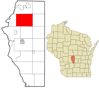
Big Flats is a town in Adams County in the U.S. state of Wisconsin. The population was 1,018 at the 2010 census.

The Anacostia River is a river in the Mid Atlantic region of the United States. It flows from Prince George's County in Maryland into Washington, D.C., where it joins with the Washington Channel and ultimately empties into the Potomac River at Buzzard Point. It is about 8.7 miles (14.0 km) long. The name "Anacostia" derives from the area's early history as Nacotchtank, a settlement of Necostan or Anacostan Native Americans on the banks of the Anacostia River.

Palomar Mountain is a mountain ridge in the Peninsular Ranges in northern San Diego County. It is famous as the location of the Palomar Observatory and Hale Telescope, and known for the Palomar Mountain State Park.

Sweetwater is a town in Beckham and Roger Mills Counties in the U.S. state of Oklahoma. It was incorporated in 1998. The population was 102 at the time of the 2020 census, an increase of 17.2% over the 87 reported in the 2010 census.
Splunge,, is an unincorporated community in Monroe County, Mississippi.
Wren,, is an unincorporated community in Monroe County, Mississippi.
Bridge Creek is a town in Grady County, Oklahoma, United States. As of the 2020 census, the town population was 336, a 0% change from 2010.

Yosemite West is an unincorporated community of resort homes located just outside the southern area of Yosemite National Park, just off Wawona Road, a continuation of State Route 41 from Fresno. It is a census-designated place (CDP), with a population of 47 as of the 2020 census. It is situated one mile (1.6 km) south of the Chinquapin intersection of Wawona Road with Glacier Point Road, at an altitude of 5,100 to 6,300 feet. The elevation reported by the USGS is 5,866 feet (1,788 m). The community is part of Henness Ridge, nearly 3,000 feet (910 m) above the southern banks of the Merced River and State Route 140 from Mariposa. Addresses in this area are shown as "Yosemite National Park, CA 95389".

Uvas Creek is a 29.5-mile-long (47.5 km) mainly southward-flowing stream originating on Loma Prieta peak of the Santa Cruz Mountains, in Santa Clara County, California, United States. The creek descends through Uvas Canyon County Park into Uvas Reservoir near Morgan Hill, and on through Uvas Creek Preserve and Christmas Hill Park in Gilroy. Upon passing U.S. Highway 101 it is known as Carnadero Creek, shortly before the confluence with the Pajaro River at the Santa Clara County - San Benito County boundary.
Vernon is an unincorporated community in Winston County, Mississippi, United States. On April 27, 2011, a tornado hit 5 miles (8 km) southeast of Vernon as part of the 2011 Super Outbreak, damaging between 10 and 20 homes, knocking down numerous trees that blocked roads, and injuring seven people.
Tar Hill is an unincorporated community in Grayson County, Kentucky, United States. On April 26, 2011, two tornadoes hit Tar Hill as part of the 2011 Super Outbreak. The first tornado was rated EF2, was 440 yards (400 m) wide and traversed a path of 3 miles (4.8 km), snapping and uprooting numerous large hardwood trees, destroying a travel trailer, a mobile home, numerous outbuildings and barns, and that fifteen homes had major roof damage. Farm equipment was reportedly thrown 50 yards (46 m). Other reports stated that this tornado destroyed a house, a mobile home, several barns and other buildings. The second tornado was rated as an EF0, was 60 yards (55 m) wide and travelled a path 0.28 miles (450 m), snapping and uprooting trees.
Zama is an unincorporated community in Attala County, Mississippi, United States. A post office operated under the name Ayres from 1891 to 1908 and under the name Zama from 1918 to 1964. On April 27, 2011, a tornado hit the Zama area as part of the 2011 Super Outbreak, causing heavy tree and power line damage. The tornado was rated EF1, with estimated wind speeds of 95 mph. The tornado destroyed a barn in its path of destruction of 50 yards (46 m) wide as it travelled a path of 1 mile (1.6 km).
Endville is an unincorporated community in Pontotoc County, Mississippi, United States.

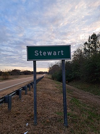
Stewart is a census-designated place and unincorporated community in Montgomery County, Mississippi, United States. As of the 2020 census, it had a population of 99.
Sibleyton is an unincorporated community in Montgomery County, Mississippi, United States. Sibleyton is located on the Columbus and Greenville Railway. A post office operated under the name Sibleyton from 1903 to 1932.A post office operated under the name Poplar Creek from 1848 to 1958.

Zero is an unincorporated community located in central Lauderdale County, Mississippi, United States, located approximately 5.5 miles (8.9 km) southeast of Meridian near U.S. Route 45 and is part of Meridian, Mississippi Micropolitan Statistical Area.
Sherwood Shores is an unincorporated community and census-designated place in Grayson County, Texas, United States. Its population was 1,190 as of the 2010 census. The community is located on the Red River, which forms the state line with Oklahoma.
McCarty Hill is a mountain in the Southern Tier of New York. It is located in Cattaraugus County, mostly in Little Valley and Great Valley, with portions in Ellicottville and Mansfield. In 1940, an 82-foot-6-inch-tall (25.15 m) steel fire lookout tower was built on the mountain. The tower ceased fire lookout operations and then officially closed in early 1989. In 1993, the tower was dismantled and removed and replaced with a free-standing communications tower.


