Porangahau

Last updated

Porangahau
NZ-NI plain map.png
Disc Plain red.svg
Porangahau
Coordinates: 40°18′07″S176°36′45″E / 40.3019°S 176.6126°E / -40.3019; 176.6126
Country New Zealand
Region Hawke's Bay
Territorial authority Central Hawke's Bay District

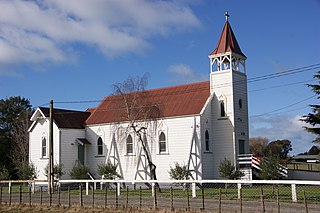
Porangahau, a township close to the Pacific Ocean coast in the south-east of the North Island of New Zealand, has a very small population. It lies in the southernmost part of Hawke's Bay, 45 kilometres south of Waipukurau, and close to the mouth of the Porangahau River. There settlement includes a marae and a school.

Township Designation for types of settlement as administrative territorial entities

Township refers to various kinds of settlements in different countries.

Pacific Ocean Ocean between Asia and Australia in the west, the Americas in the east and Antarctica or the Southern Ocean in the south.

The Pacific Ocean is the largest and deepest of Earth's oceanic divisions. It extends from the Arctic Ocean in the north to the Southern Ocean in the south and is bounded by Asia and Australia in the west and the Americas in the east.

North Island The northern of the two main islands of New Zealand

The North Island, also officially named Te Ika-a-Māui, is one of the two main islands of New Zealand, separated from the larger but much less populous South Island by Cook Strait. The island's area is 113,729 square kilometres (43,911 sq mi), making it the world's 14th-largest island. It has a population of 3,749,200.

Contents

The Māori name Porangahau expresses the idea of a night (po) of pursuit or of retreat (rangahau). [1]

Māori language Polynesian language spoken by New Zealand Māori

Māori, also known as te reo, is an Eastern Polynesian language spoken by the Māori people, the indigenous population of New Zealand. Closely related to Cook Islands Māori, Tuamotuan, and Tahitian, it gained recognition as one of New Zealand's official languages in 1987. The number of speakers of the language has declined sharply since 1945, but a Māori language revitalisation effort slowed the decline, and the language has experienced a revival, particularly since about 2015.

Six kilometres northeast of the township stands an insubstantial hill, with the longest place name in the world: Taumatawhakatangihangakoauauotamateaturipukakapikimaungahoronukupokaiwhenuakitanatahu. [2] [3]

Taumatawhakatangi<wbr>hangakoauauotamatea<wbr>turipukakapikimaunga<wbr>horonukupokaiwhen<wbr>uakitanatahu hill in New Zealand

Taumatawhakatangi­hangakoauauotamatea­turipukakapikimaunga­horonukupokaiwhen­uakitanatahu is a hill near Porangahau, south of Waipukurau in southern Hawke's Bay, New Zealand. The height of the hill is 305 metres (1,001 ft). The hill is notable primarily for its unusually long name, which is of Māori origin; it is often shortened to Taumata for brevity. It has gained a measure of fame as it is the longest place name found in any English-speaking country, and possibly the longest place name in the world; according to World Atlas. The name of the hill has also been listed in the Guinness World Records as the longest place name. Other versions of the name, including longer ones, are also sometimes used.

The area west of the main township, known as Mangaorapa, was used for sheep farming during the 20th century. [4] The area has more recently been used for cattle farming and wine growing. [5] The 2370 hectare Mangaorapa Station was the most expensive farm in Central Hawke's Bay when it was sold in 2005. [6]

Marae

The local Rongomaraeroa Marae and its meeting house, Te Poho o Kahungunu, are affiliated with the Ngāti Kahungunu hapū of Ngāti Hinetewai, Ngāti Kere, Ngāti Manuhiri, Ngāti Pihere and Tamatea Hinepare o Kahungunu. [7] [8]

Ngāti Kahungunu Māori iwi (tribe) in Aotearoa New Zealand

Ngāti Kahungunu is a Māori iwi (tribe) located along the eastern coast of the North Island of New Zealand. The iwi is traditionally centred in the Hawke's Bay and Wairārapa regions.

Education

Porangahau School is a Year 1–8 co-educational state primary school. [9] It is a decile 4 school with a roll of as of March 2019. [10] [11]

In the New Zealand education system, decile is a key measure of socioeconomic status used to target funding and support schools. In academic contexts the full term "socioeconomic decile" or "socioeconomic decile band" may be used.

Mangaorapa School merged with Porangahau School at the end of 2014. [12]

Related Research Articles

Wairoa Place in Hawkes Bay, New Zealand

Wairoa is a town and territorial authority district in New Zealand's North Island. The town is the northernmost in the Hawke's Bay region, and is located on the northern shore of Hawke Bay at the mouth of the Wairoa River and to the west of Mahia Peninsula. It is 118 kilometres northeast of Napier, and 92 kilometres southwest of Gisborne. Percentage-wise, it is often known for being New Zealand's most Maori town, with over 62.29% of the population identifying themselves as Maori. At the same time, it is also the largest town within the district of Wairoa.

Takapau Rural community in New Zealand

Takapau is a small rural community in the Central Hawkes Bay in New Zealand. It is located 20 kilometres west of Waipukurau, off State Highway 2, and has a population of more than 500.

Waipawa Minor urban area in Hawkes Bay, New Zealand

Waipawa is the second-largest town in Central Hawke's Bay in the east of the North Island of New Zealand. It has a population of 2,160. At the 2013 census, it had a population of 1,965, a change of 2.2 percent from the 2006 census.

Tikokino Village in New Zealand

Tikokino is a village in the Central Hawke's Bay District on the east coast of the North Island of New Zealand. It is located 20 kilometres (12 mi) northwest of Waipawa and 55 kilometres (34 mi) southwest of Hastings. The township is located on State Highway 50.

Tolaga Bay Town in Gisborne Region, New Zealand

Tolaga Bay is both a bay and small town on the East Coast of New Zealand's North Island located 45 kilometres northeast of Gisborne and 30 kilometres south of Tokomaru Bay.

Clive, New Zealand Place in New Zealand

Clive is a small town, ten kilometres from the city centres of both Napier and Hastings in the Hawke's Bay region of New Zealand's North Island. It is close to the mouth of the Ngaruroro River.

Pukehou Place in New Zealand

Pukehou is a farming locality in southern Hawke's Bay, in the eastern North Island of New Zealand.

Waimarama Place in New Zealand

Waimarama is a seaside village in Hastings District, Hawke's Bay, New Zealand.

Bridge Pā Place in New Zealand

Bridge Pā is a rural Māori settlement and surrounding area in Hawke's Bay, New Zealand, located approximately 10 kilometres inland from Hastings. The itself comprises approximately 70 households, a school, a meetinghouse of the LDS Church, two marae, a cemetery, a disused quarry, and the 140-year-old historical Homestead of the Puriri Family. The population was 184 in 1996, increasing to 213 in 2001.

Onekawa is a suburb of the city of Napier, in the Hawke's Bay Region of the eastern North Island of New Zealand.

Mohaka Place in New Zealand

Mohaka is a small settlement in the northern Hawke's Bay region of the eastern North Island of New Zealand. It is located on the coast of Hawke Bay, 20 kilometres southwest of Wairoa. The Mohaka River reaches the coast close to Mohaka.

Nuhaka Place in New Zealand

Nuhaka is a small settlement in the northern Hawke's Bay Region of New Zealand's eastern North Island, lying on State Highway 2 between Wairoa and Gisborne.

Frasertown Place in New Zealand

Frasertown is a small settlement in the northern Hawke's Bay Region of New Zealand's eastern North Island.

Ngāti Rakaipaaka is a Māori hapu (subtribe), from the Nuhaka area of northern Hawke's Bay on New Zealand's North Island. It is a subtribe of Ngāti Kahungunu.

Ruakituri Place in New Zealand

Ruakituri is a rural area in the northern Hawke's Bay region of New Zealand's eastern North Island, located north of Wairoa and west of Gisborne. The 2013 New Zealand census recorded 708 people living in the Ruakituri-Morere area.

Putere is a village and rural community located in the Wairoa District of the Hawke's Bay Region, on New Zealand's North Island. It is located based around the small Lake Rotoroa and Lake Rotonuiaha.

Puketapu is a rural community in the Hastings District and Hawke's Bay Region of New Zealand's North Island.

Puketapu is a rural community in the Hastings District and Hawke's Bay Region of New Zealand's North Island.

Pakipaki is a village and rural community in the Hastings District and Hawke's Bay Region of New Zealand's North Island.

Omahu is a village in the Hastings District and Hawke's Bay Region of New Zealand's North Island.

References

  1. Reed, Alexander Wyclif (2002) [1975]. Peter Dowling (ed.). The Reed dictionary of New Zealand place names. Max Cryer (2002 ed.). Auckland: Reed. p. 402. ISBN   0-7900-0761-4. The inhabitants of Heretaunga once had to make a hurried retreat from their enemies at this place.
  2. Reed New Zealand atlas (2004). Auckland: Reed Publishing. Map 50.
  3. "Porangahau - Home to the longest place name in the world"
  4. Pascoe, John. "Land girls on horseback, Mangaorapa, Hawke's Bay". natlib.govt.nz. National Library of New Zealand.
  5. "About Mangaorapa Estate". mangaorapa.co.nz. Mangaorapa Estate.
  6. "HB farm may have sold for $27m". Hawke's Bay Today . New Zealand Herald.
  7. "Te Kāhui Māngai directory". tkm.govt.nz. Te Puni Kōkiri.
  8. "Māori Maps". maorimaps.com. Te Potiki National Trust.
  9. "Ministry of Education School Profile". educationcounts.govt.nz. Ministry of Education.
  10. "Directory of Schools - as at 3 April 2019". New Zealand Ministry of Education. Retrieved 9 May 2018.
  11. "Education Review Office Report". ero.govt.nz. Education Review Office.
  12. "Merger of Porangahau School (2646) and Mangaorapa School (2596)". gazette.govt.nz. Department of Internal Affairs. 18 December 2014.

Coordinates: 40°18′07″S176°36′45″E / 40.3019°S 176.6126°E / -40.3019; 176.6126