
Stenungsund Municipality is a municipality in Västra Götaland County in western Sweden. Its seat is located in the town of Stenungsund. The municipality is situated by the sea inside the islands Orust and Tjörn and traversed by the European route E6 and Bohus Line, in which it has three stops.
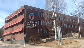
Jokkmokk Municipality is a municipality in Norrbotten County in northern Sweden. Its seat is located in Jokkmokk.

Sutton Bridge is a village and civil parish in the South Holland district of Lincolnshire, England. It is situated on the A17 road, 7 miles (11 km) north from Wisbech and 9 miles (14 km) west from King's Lynn. The village includes a commercial dock on the west bank of the River Nene over which spans a swing bridge, and the parish, two 19th-century lighthouses 3 miles (5 km) to the north from the village on the river Nene.

The Ume River is one of the main rivers in northern Sweden. It is around 460 km (290 mi) long, and flows in a south-eastern direction from its source, the lake Överuman by the Norwegian border within the Scandinavian mountain range. For large parts, the European route E12, also known as Blå Vägen, follows its path.
Hackney Marshes is an area of open space in London's Lower Lea Valley, lying on the western bank of the River Lea. It takes its name from its position on the eastern boundary of Hackney, the principal part of the London Borough of Hackney, and from its origin as an area of true marsh.

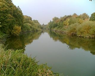
Klarälven is a river flowing through Norway and Sweden. Together with Göta älv, which it is called as the river has passed through the lake Vänern, thus regarded as an entity, Göta älv—Klarälven is the longest river in Scandinavia and in the Nordic countries and its Swedish part the longest river of Sweden. These two rivers also have the largest drainage basin in the same areas, 50,229 km2 (19,394 sq mi) including all the rivers that run into Vänern, of which 42,468 km2 (16,397 sq mi) is located in Sweden and 7,761 km2 (2,997 sq mi) in Norway.

Sveg is a locality and the seat of Härjedalen Municipality in Jämtland County, Sweden with 2,547 inhabitants in 2010.
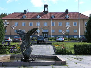
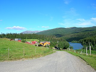
Storuman is a locality and the seat of Storuman Municipality in Västerbotten County, province of Lapland, Sweden with 2,207 inhabitants in 2010. It is situated by the Ume River, at the southeastern end of Lake Storuman.

Lule River is a major river in Sweden, rising in northern Sweden and flowing southeast for 460 km (290 mi) before reaching the Gulf of Bothnia at Luleå. It is the second longest river by watershed area or length in Norrbotten County, but is the largest by average discharge.

Styrsö is a small island and a locality situated in Göteborg Municipality, Västra Götaland County, Sweden. It had 1,304 inhabitants in 2010.

The Pite River is a river in northern Sweden, flowing through the Norrbotten County. It is one of the four major rivers in Norrland that have been left mostly untouched by water power plants, the river has a single dam at Sikfors approximately 15 km upstream from the sea.
Stora Sjöfallet is a national park in Norrbotten County in northern Sweden, in Gällivare Municipality and Jokkmokk Municipality. The national park is 1,278 km2 (493 sq mi) and the third-largest in Sweden. The park is located about 20 km (12 mi) north of the Arctic Circle by the Norwegian border and surrounds the Akkajaure reservoir from the north, east and south.
The Dunderland Valley is a valley in the municipality of Rana in Nordland county, Norway. It reaches from just below the eastern Saltfjellet plateau about 8 miles (13 km) south of the Arctic circle. The mountain Bolna is situated in the uppermost boundary of the valley which then proceeds to the southwest all the way down to the Ranfjorden. Some of the minor side valleys include Plurdalen, Røvassdalen, Bjøllådalen, Grønfjelldalen and Virvassdalen. The valley also includes several villages such as Krokstrand, Bjøllånes, Storvoll, Dunderland, Eiterå, Nevernes, Storforshei, Nevermoen and Røssvoll.

Gammelstaden or Gammelstad is a locality situated in Luleå Municipality, Norrbotten County, Sweden with 4,960 inhabitants in 2010. It is known for the Gammelstad Church Town, a UNESCO World Heritage Site.
Ödåkra is a locality situated in Helsingborg Municipality, Skåne County, Sweden with 4,920 inhabitants in 2010. It is situated just north-east of Helsingborg and could be regarded as a suburb of that city. Ödåkra is known for its old distillery, which existed from 1897 to 1976 and gave the name to the spirit Ödåkra Taffel Aqvavit.

Porjus power station is one of the oldest and largest power plants in Sweden, situated near Porjus. It was built 1910-1915 and has a power of 480 MW. Besides three-phase AC, the plant originally also generated single phase 15 Hz AC for railway traction and hence, two single-phase 80 kV power lines ran along the Iron Ore Line Malmbanan where it was transformed down to 16 kV in substations. However this system was later abandoned in favor of rotary converter stations. The original machines for single phase AC were subsequently scrapped.
Harsprånget is a hydroelectric power station located on the Lule River in northern Sweden, just downstream of Porjus.
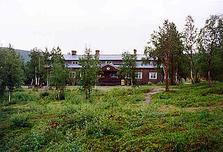
Saltoluokta is a 120 kilometer drive outside Gällivare in northern Sweden, off the beaten track in Jokkmokk Municipality near the municipality's border with Gällivare. Saltoluokta is located less than 1 kilometre from Stora Sjöfallet National Park and the UNESCO World Heritage Site Laponia and it is a popular starting point for Sarek National Park visitors.

Baggböle is a small village on the Ume River in northern Sweden, approximately 8 km (5 mi) upstream of the city of Umeå. The village was a base for sawing local timber in the nineteenth century, with a sawmill powered by the water of the river rapids close to the village. The sawmill at Baggböle was abandoned towards the end of the 19th century, but was in its heyday the largest water-powered sawmill in Sweden. The operations at the sawmill resulted in a new word in Swedish, baggböleri, a term that originally meant illegal felling of timber in forests belonging to the Crown, but is now a pejorative term for 'reckless deforestation'. Today Baggböle is known for Arboretum Norr, an arboretum that has been developed to attract visitors, and develop plants suitable for northern latitudes.

Klabböle Power Plant was a hydroelectric plant located near Umeå in northern Sweden. The plant was commissioned in 1899 and supplied power to the city until 1958, when it was replaced by a newly constructed state-owned power plant in Norrforsen. Klabböle Kraftverk is now a museum located at Ume River's south bank, below the village of Klabböle, about 7 kilometres (4.3 mi) upstream from Umeå.


