Port-Camargue

Last updated
Port-Camargue
District of Le Grau-du-Roi
Port-camargue WH.jpg
Port-Camargue
Coordinates: 43°31′00″N4°08′08″E / 43.51667°N 4.13556°E / 43.51667; 4.13556
Country Flag of France.svg France
Region Occitanie
Department Gard
Arrondissement Nîmes
Canton Aigues-Mortes
Intercommunality Terre de Camargue
Commune Le Grau-du-Roi
Website www.portcamargue.com

Port-Camargue is a district of the town of Le Grau-du-Roi, in the Gard department in the administrative region of Occitanie. Built in the 1960s, it is today one of the biggest marinas in Europe. [1]

Contents

History

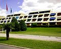
In 1963, the Nîmes Chamber of Commerce and Industry (CCI), with the assistance of Jean Bastide, launched the project to build a new marina on the Languedoc coast, as part of the Mission Racine. The architect selected was Jean Balladur, who also drew up the plans for La Grande-Motte. Its construction began in 1969 with the creation of ponds, quays and piers. Then the first marinas were built. In 1974, the harbor office appeared. In 1980, the second phase of work concerning marinas was launched and in 1985 the initial CCI construction plan. Since then, under market pressure, town planning has continued to evolve with the construction of many additional marinas, apartments and villas. His Régie was chaired by Étienne Mourrut when he was mayor of Le Grau-du-Roi .

Economy

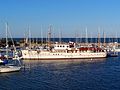
With 4,600 berths, Port-Camargue is one of the top marinas in Europe. More and more permanent residents live there and commercial activity has intensified, with more than a hundred shops. Tourism, along with yachting and boating, is the essence of the economy of Port-Camargue.

Note, moreover, the presence near Port-Camargue of numerous campsites and vast beaches (including that of Espiguette, which extends to Saintes-Maries-de-la-Mer).

Access to the marina is by a channel open to the northwest, in an axis leaving little room for swell. The bottom is sandy and dredged on average at 5 metres. Landing under sail in fairly strong mistral weather can be difficult but without any major risks.

Note the presence for the arrival from the south of wave buoys opposite the Pointe de l'Espiguette. These are sometimes removed for maintenance reasons. They make it possible to indicate the limit of the area of sandbanks bordering along the beaches of the bay. When navigating nearby, the use of the depth sounder is highly recommended. Most of the rocky sand bars extend underwater for more than ten meters. Avoid approaching them too closely.

The harbor master's office is on (almost) permanent standby on channel 9 and can be reached by telephone. Refueling is possible; the station is located after the reception area, following the most northerly channel (to port). Finally, note the presence of an SNSM speedboat, two sailing schools and a UCPA center.

Related Research Articles

<span class="mw-page-title-main">Bouches-du-Rhône</span> Department in Provence-Alpes-Côte dAzur, France

Bouches-du-Rhône is a department in southern France. It borders Vaucluse to the north, Gard to the west and Var to the east. The Mediterranean Sea lies to the south. Its prefecture and largest city is Marseille; other important cities include Aix-en-Provence, Arles, Martigues and Aubagne.

<span class="mw-page-title-main">Aigues-Mortes</span> Commune in Occitanie, France

Aigues-Mortes is a commune in the Gard department in the Occitania region of southern France. The medieval city walls surrounding the city are well preserved. Situated on the junction of the Canal du Rhône à Sète and the Chenal Maritime to Le Grau-du-Roi, the town is a transit center for canal craft and Dutch barges.

<span class="mw-page-title-main">Cherbourg</span> Former municipality in Manche, France

Cherbourg is a former commune and subprefecture located at the northern end of the Cotentin peninsula in the northwestern French department of Manche. It was merged into the commune of Cherbourg-Octeville on 28 February 2000, which was merged into the new commune of Cherbourg-en-Cotentin on 1 January 2016.

<span class="mw-page-title-main">Cap d'Agde</span> Seaside resort in Agde, France

Cap d'Agde is a seaside resort on France's Mediterranean coast. It is located in the commune of Agde, in the Hérault department within the region of Occitanie. Cap d'Agde was planned by architect Jean Le Couteur as part of one of the largest state-run development schemes for holidays in French history. It is also one of the cities in France where an increasing number of retirees reside since 1980.

<span class="mw-page-title-main">Agde</span> Commune in Occitania, France

Agde is a commune in the southern French department of Hérault. It is the Mediterranean port of the Canal du Midi. It is situated on an ancient basalt volcano, hence the name "Black Pearl of the Mediterranée".

<span class="mw-page-title-main">Yellow Line (Montreal Metro)</span> Metro line in Montreal, Quebec, Canada

The Yellow Line, also known as Line 4, is one of the Montreal Metro's four routes operating in Montreal, Quebec, Canada.

<span class="mw-page-title-main">Quebec Route 138</span> Highway in Quebec

Route 138 is a major highway in the Canadian province of Quebec, following the entire north shore of the St. Lawrence River past Montreal to the temporary eastern terminus in Kegashka on the Gulf of St. Lawrence. The western terminus is in Elgin, at the border with New York State south-west of Montreal. Part of this highway is known as the Chemin du Roy, or King's Highway, which is one of the oldest highways in Canada.

<span class="mw-page-title-main">Granville, Manche</span> Commune in Normandy, France

Granville is a commune in the Manche department and region of Normandy, northwestern France. The chef-lieu of the canton of Granville and seat of the Communauté de communes de Granville, Terre et Mer, it is a seaside resort and health resort of Mont Saint-Michel Bay, at the end of the Côte des Havres, a former cod-fishing port and the first shellfish port of France. It is sometimes nicknamed "Monaco of the North" by virtue of its location on a rocky promontory.

<span class="mw-page-title-main">Le Havre tramway</span> Tram system in Le Havre, Normandy, France

Le Havre tramway is a modern two-line tram system in the city of Le Havre in Normandy, France. The modern tramway opened on 12 December 2012.

<span class="mw-page-title-main">Jean-Philippe Lauer</span> French architect and Egyptologist

Jean-Philippe Lauer was a French architect and Egyptologist. He was considered to be the foremost expert on pyramid construction techniques and methods.

<span class="mw-page-title-main">Treaty of Huế (1884)</span> 1884 treaty establishing French colonial rule in Vietnam

The Treaty of Huế or Protectorate Treaty was concluded on 6 June 1884 between France and Đại Nam. It restated the main tenets of the punitive Harmand Treaty of 25 August 1883, but softened some of the harsher provisions of this treaty. The treaty created the protectorates of Annam and Tonkin. It formed the basis of French colonial rule in Vietnam during the next seven decades and was negotiated by Jules Patenôtre, France's minister to China; it is often known as the Patenôtre Treaty. The treaty was signed on the Vietnamese side by Phạm Thận Duật and Tôn Thất Phan, representatives of the emperor Tự Đức’s court. The treaty marked the Nguyễn dynasty's second acceptance of French protectorate in central and northern Vietnam, but it was canceled when the Élysée Accords were signed on 8 March 1949.

<span class="mw-page-title-main">Vauvert</span> Commune in Occitania, France

Vauvert is a commune in the far south of the Gard department in southern France. It was known as Posquières in the Middle Ages. The commune comprises the town of Vauvert and the villages of Gallician and Montcalm. Over a third of the population work in industry, which is largely the food industry, especially wine production. The original settlement was called Posquières and was first mentioned in a document of 810. Since then the town has increased in importance and has had a rich history. At its heyday in the mid-nineteenth century it had a population of 6,000 but this decreased by a third after disease struck the grape crop, the mainstay of the economy of the area. Today, the population has grown again to over 11,000.

<span class="mw-page-title-main">Le Grau-du-Roi</span> Commune in Occitania, France

Le Grau-du-Roi is a commune in the Gard department in southern France. It is the only commune in Gard to have a frontage on the Mediterranean. To the west is the Herault department and La Grande-Motte village, and to the east is the Bouches-du-Rhone department. Using the sea as a vantage point, the commune has four distinct sections: the right beach, the Village, the left beach, Port-Camargue and L'Espiguette. Immediately landwards are the large shallow étangs, saline marshes, which separate it from Aigues Mortes, a neighboring mediaeval walled city that used to be a port. The étangs are home to numerous flamingoes.

<span class="mw-page-title-main">Le Cailar</span> Commune in Occitanie, France

Le Cailar is a commune in the Gard department in southern France. It is located at the confluence of the River Vistre and the River Rhôny. It was an important port during the Iron Age at a time when lagoons connected to the Mediterranean Sea covered the adjoining low-lying land.

<span class="mw-page-title-main">Étienne Mourrut</span> French politician

Étienne Mourrut was a French politician.

<span class="mw-page-title-main">Pays des Impressionnistes</span>

The Pays des Impressionnistes is a certification mark created by the Syndicat intercommunal à vocations multiples des Coteaux de Seine in 2001 to promote the cultural heritage of this touristic area. Nine municipalities in the Yvelines department of France bordering the loop of the Seine River, where, during the nineteenth century, impressionist painters exercised their art, are associated with this creation: Bougival, Carrières-sur-Seine, Chatou, Croissy-sur-Seine, Le Pecq, Le Port-Marly, Louveciennes, Marly-le-Roi and Noisy-le-Roi. There is the Path of the Impressionists, four hiking trails dotted with reproductions of paintings, reflecting the still remarkable character of this landscape of Impressionist sites which has been proposed for inclusion in the World Heritage Site since 2009. Rueil-Malmaison, in the Hauts-de-Seine department, joined them in 2010, when eight of these municipalities have entrusted development task of the Pays des Impressionnistes to the visitor center of Marly-le-Roi, which organises Impressionist cruises along the banks of the Seine, as well as visits of ateliers of contemporary painters.

Éric Deschodt is a French journalist, writer and translator. He wrote police novels written in collaboration under the pseudonym Bernard-Paul Lallier.

<span class="mw-page-title-main">Pointe de l'Espiguette</span> Dune system in France

The Pointe de l'Espiguette is a vast dune system located on the Mediterranean coast of the Gard department in France.

<span class="mw-page-title-main">Port of Boulogne-sur-Mer</span> French port

The Port of Boulogne-sur-Mer is a seaport located on the western coast of the Hauts-de-France region, on the edge of the Pas de Calais, the world's busiest strait for international shipping. It is France's leading fishing port, with a diversified fleet of almost 150 boats. It was also an important link port with England until the end of the 20th century.

Mission Racine was a government initiative for a large-scale infrastructure plan to expand the Tourism offer on the coast of the French region of Languedoc-Roussillon. Team composed exclusively of civil servants, the working group was initiated in 1963 and is named after its president, Pierre Racine. The mission under the Prime Minister Georges Pompidou must manage the road, maritime and air infrastructure by the State. Urban planning is the responsibility of the municipalities concerned between Marseille and Perpignan for popular tourism.

References