Transport in Tanzania includes road, rail, air and maritime networks. The road network is 86,472 kilometres (53,731 mi) long, of which 12,786 kilometres (7,945 mi) is classified as trunk road and 21,105 kilometres (13,114 mi) as regional road. The rail network consists of 3,682 kilometres (2,288 mi) of track. Commuter rail service is in Dar es Salaam only. There are 28 airports, with Julius Nyerere International being the largest and the busiest. Ferries connect Mainland Tanzania with the islands of Zanzibar. Several other ferries are active on the countries' rivers and lakes.
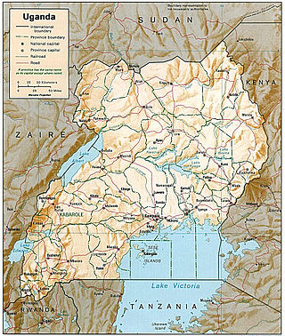
Transport in Uganda refers to the transportation structure in Uganda. The country has an extensive network of paved and unpaved roads.
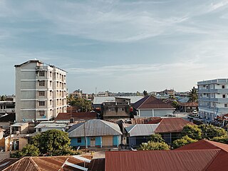
Tanga is a historic city and the capital of Tanga Region. The city the most northerly port city of Tanzania on the west of the Indian Ocean on Tanga Bay. The city has a population of 393,429 in 2022. Tanga city is governed by the Tanga City Council. The city is also home to the Port of Tanga. The name Tanga means "sail" in Swahili. The city is also the capital of Tanga District.
Railway stations in Uganda include:

Tanzania Ports Authority (TPA) is a parastatal public corporation acting under the aegis of the Ministry of Infrastructure Development, that has the responsibility "to manage and operate" the ocean ports and lake ports of the country of Tanzania. The Tanzania Ports Authrorty headquarters are located in Mchafukoge ward of Ilala District in Dar es Salaam Region. It is a member of the Port Management Association of Eastern and Southern Africa.

Kenya–Uganda relations are bilateral relations between Kenya and Uganda. The two African Great Lakes countries are partners in many areas, particularly in the trade, infrastructure, security (military), education, agriculture and energy sectors.
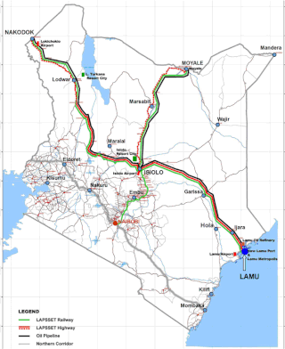
Lamu Port-South Sudan-Ethiopia-Transport (LAPSSET) Corridor project, also known as Lamu corridor is a transport and infrastructure project in Kenya that, when complete, will be the country's second transport corridor. Kenya's other transport corridor is the Mombasa - Uganda transport corridor that passes through Nairobi and much of the Northern Rift. Some basic LAPSSET infrastructure has been built. The construction of LAPSSET's main components is currently ongoing with construction of the first berth at Lamu Port completed in October, 2019 (situation as per October 2019).. Although the project is not formally stalled, its short to medium term success looks increasingly unlikely. Insecurity and political instability in Kenya are mostly to blame for this, as are more commercially viable alternative pipeline options through Tanzania or Ethiopia. The low oil prices since 2015 also affect LAPSSET's commercial prospects.
Northern Corridor is a busy and an important transport route to the East and Central Africa countries of Burundi, Eastern DR Congo, Kenya, Rwanda, South Sudan and Uganda.
The Uganda–Kenya Crude Oil Pipeline (UKCOP) was a proposed pipeline to transport crude oil from Uganda's oil fields in the Northern and Western Regions to the Kenyan port of Lamu on the Indian Ocean. Along the way, the pipeline would have picked up more crude oil from the South Lokichar Basin and other oil fields in northwestern Kenya and delivered it to Lamu for export. South Sudan had also planned to construct a pipeline from its Unity State, linking to the UKCOP as an alternative to its only current oil export route through Port Sudan in its northern neighbor Sudan.
The Kenya–Uganda–Rwanda Petroleum Products Pipeline is a pipeline that carries refined petroleum products from the Kenyan port city of Mombasa to the country's capital of Nairobi and continues to the town of Eldoret in the Eastern Rift Valley. There are plans to extend the pipeline to Uganda's capital, Kampala, continuing on to Rwanda's capital, Kigali.
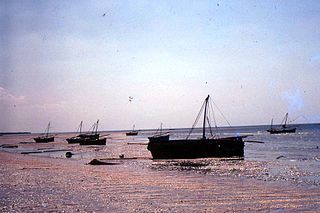
The Bagamoyo Port is set to be constructed in Bagamoyo, Tanzania. It is planned to be one of the largest government infrastructure projects in the country. The Bagamoyo port and its affiliate industrial zone is meant to address congestion at the old port and support Tanzania to become East Africa’s leading shipping and logistics centre.
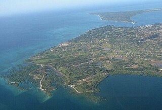
The Mtwara Port was built during the British Colonial times in the city of Mtwara in southern Tanzania. The harbor at the Port of Mtwara was deepened during the colonial times by the British in 1948-1954, and a railway line was built connecting the port, as part of the Tanganyika groundnut scheme. Due to the failure of the scheme the port immediately lost value and the railway line was removed. The port was functional but underutilized for many years due to poor transport infrastructure, However, in the years of 2010-2011 the increased activity in oil and gas natural resources energy exploration caused a surge on operations. The Mtwara port is also an integral part of the Mtwara Development Corridor project and has recently saw major upgrades. The port also has a special economic zone attached to it and In December 2015 Alistair Freeports Limited injected $700,000 to upgrade the Export processing zone around the port area.

The East African Crude Oil Pipeline (EACOP), also known as the Uganda–Tanzania Crude Oil Pipeline (UTCOP), is a 1,443 km crude oil pipeline in planning since 2013, with a foundation stone nominally under construction since 2017 and intended to transport crude oil from Uganda's Tilenga and Kingfisher oil fields to the Port of Tanga, Tanzania on the Indian Ocean.

Tanzania–Uganda relations are bilateral relations between Tanzania and Uganda. Tanzania is a strategic partner of Uganda in many areas, particularly trade, security, education, agriculture and energy. Uganda and Tanzania enjoy warm, cordial and fraternal relations dating back to the 1960s when the two countries gained their independence from the British Empire. Both countries are members of the African Union, Commonwealth of Nations, Non-Aligned Movement and Group of 77. Tanzania and Uganda are both founding members of the East African Community.
Kenya Crude Oil Pipeline, also Lokichar–Lamu Crude Oil Pipeline, is a proposed crude-oil pipeline in Kenya. The pipeline will originate in the oil-rich South Lokichar Basin, near the town of Lokichar, in northwest Kenya to end at Port Lamu, on the Indian Ocean. The route will remain as originally planned in the Uganda–Kenya Crude Oil Pipeline, in August 2015. The route, was proposed by Toyota Tsusho, the consultant selected by the two governments of that now-abandoned project.
Bukasa Inland Port is a planned inland port in Uganda.
The Tanzania–Uganda Natural Gas Pipeline is a proposed natural gas pipeline, carrying liquefied natural gas from Tanzania to Uganda.
Wambabya Central Forest Reserve is located in both Hoima District and Kikuube district in Western Uganda near the north-eastern border of Bugoma Central Forest Reserve. It was demarcated in 1932. It is operated by the National Forest Authority (NFA). It covers an area of 3,429 ha (13.24 sq mi).


