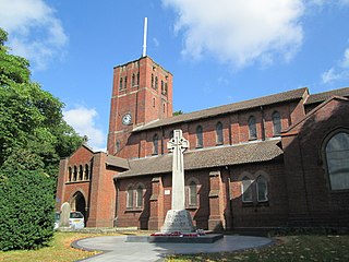
Rowley Regis is a town and former municipal borough in Sandwell in the county of the West Midlands, England. It encompasses the three Sandwell council wards of Blackheath, Cradley Heath and Old Hill, and Rowley. At the 2011 census, the combined population of these wards was 50,257.

The Wildlife Trust for Birmingham and the Black Country is a wildlife trust covering Birmingham and the Black Country in the West Midlands of England. It covers five of the seven districts of the West Midlands county: Birmingham, Dudley, Sandwell, Walsall and Wolverhampton.

The Cotswold Water Park is the United Kingdom's largest marl lake system, straddling the Wiltshire–Gloucestershire border, northwest of Cricklade and south of Cirencester. There are 180 lakes, spread over 42 square miles (110 km2).

Coombe Hill Canal lies in the Vale of Gloucester, south west England, north of Leigh and runs west 2.75 miles (4.43 km) from Coombe Hill Basin to the River Severn near Wainlode Hill. It opened in 1796 and closed 80 years later in 1876, after the only lock was damaged by flooding. The Gloucestershire Wildlife Trust purchased the Coombe Hill Canal nature reserve in 1985 and the area is managed by the trust. Adjacent to the Coombe Hill Canal is a large area of wet meadowland situated midway between Gloucester and Tewkesbury to the west of the A38, which was purchased by the trust in 1999. There is a north and a south meadow. This land and the Canal itself often flood in winter, which attracts hundreds of wildfowl.
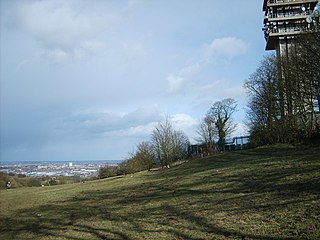
The Rowley Hills are a range of hills in the West Midlands county in England. The range comprises Turner's Hill, Bury Hill, Portway Hill and Darby's Hill. The ridge forms part of the east/west watershed between the River Severn and the River Trent, with rainfall on the western side going to the Bristol Channel via the Severn, and rainfall on the eastern side ending up in the North Sea via the Trent. The hills are situated east of the town of Dudley in Rowley Regis, on the border between the metropolitan boroughs of Dudley and Sandwell.

Periyar National Park and Wildlife Sanctuary (PNP) is a protected area located in the districts of Idukki and Pathanamthitta in Kerala, India. It is notable as an elephant reserve and a tiger reserve. The protected area encompasses 925 km2 (357 sq mi), of which 305 km2 (118 sq mi) of the core zone was declared as the Periyar National Park in 1982. The park is a repository of rare, endemic, and endangered flora and fauna and forms the major watershed of two important rivers of Kerala: the Periyar and the Pamba.
The Kameng Elephant Reserve is an Elephant Reserve located in the Himalayan foothills of Arunachal Pradesh, India, in the districts of West Kameng and East Kameng.
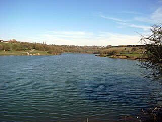
Fens Pools is a 37.6 hectare biological site of Special Scientific Interest in the West Midlands. The site was notified in 1989. under the Wildlife and Countryside Act 1981 and is currently managed by the Country Trust.
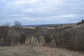
Deacon Hill SSSI is a 35.4-hectare (87-acre) biological Site of Special Scientific Interest in Pegsdon in Bedfordshire. It is in the Chilterns Area of Outstanding Natural Beauty, and it is part of the Pegsdon Hills and Hoo Bit nature reserve, managed by Wildlife Trust for Bedfordshire, Cambridgeshire and Northamptonshire.

Portrack Marsh Nature Reserve is a 50 acres (20 ha) reserve by the northern bank of the River Tees between the Tees Barrage and the Tees Viaduct, near Portrack housing estate in Stockton-on-Tees borough, County Durham. It is the last remaining wetland on the lower Tees. The site is bounded by Marston Road, a disused railway line, the Northumbrian Water's waste water treatment site, the River Tees, the Tees Barrage White Water Course, the grounds of The Talpore pub and a Tees Barrage access road.
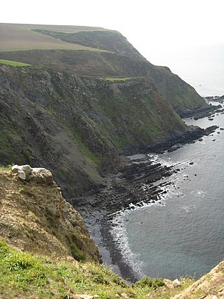
Steeple Point to Marsland Mouth is a coastal Site of Special Scientific Interest (SSSI) in Cornwall, England, UK, noted for its biological characteristics.
Nature Improvement Areas (NIAs) are a network of large scale initiatives in the landscape of England to improve ecological connectivity and improve biodiversity. They were launched in 2012.

Park Hall was a Wildlife Trust nature reserve in Birmingham England, until it was taken possession of by HS2.

Daneway Banks is a 17-hectare (42-acre) biological Site of Special Scientific Interest in Gloucestershire, notified in 1954 and renotified in 1983. It lies half a mile west of Sapperton and is part of a group of wildlife sites in the Frome Valley that includes Siccaridge Wood and Sapperton Canal reserves. The site is in the Cotswold Area of Outstanding Natural Beauty.
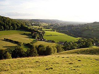
Swift's Hill is a 9.15-hectare (22.6-acre) biological and geological Site of Special Scientific Interest in Gloucestershire, notified in 1966 and renotified in 1984.

Aubrey Buxton Nature Reserve is a 9.7-hectare (24-acre) nature reserve west of Elsenham in Essex. It was donated to the Essex Wildlife Trust by Aubrey Buxton and his wife in 1976.
Deer's Leap Wood is a nature reserve of the Wildlife Trust for Birmingham and the Black Country, in West Midlands, England. There is woodland with a variety of tree species; also a pond and a meadow area.

Rackenford and Knowstone Moors is a nature reserve of the Devon Wildlife Trust, situated about 8 miles (13 km) north-west of Tiverton, in Devon, England. The habitat is culm grassland.
Dunsdon National Nature Reserve is a nature reserve of the Devon Wildlife Trust, near Dunsdon and about 3.5 miles (5.6 km) north-west of Holsworthy, in Devon, England. The habitat is culm grassland.
Hollybed Farm Meadows is nature reserve of the Worcestershire Wildlife Trust, about 1 mile (1.6 km) west of the village of Castlemorton, in Worcestershire, England. The habitat is grassland.

