
French West Africa was a federation of eight French colonial territories in West Africa: Mauritania, Senegal, French Sudan, French Guinea, Ivory Coast, Upper Volta, Dahomey and Niger. The federation existed from 1895 until 1958. Its capital was Saint-Louis in Senegal until 1902, and then Dakar until the federation's collapse in 1960.
Upper Senegal and Niger was a colony in French West Africa, created on 21 October 1904 from colonial Senegambia and Niger by the decree "For the Reorganisation of the general government of French West Africa".

French Sudan was established in the late nineteenth century and occupied roughly the same territory as modern Mali.
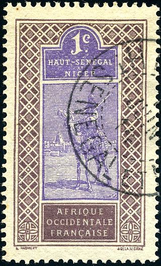
Upper Senegal and Niger was a colony in French West Africa created in 1904 from Senegambia and Niger. Niger became a separate military district in 1911 and a separate colony in 1922, Upper Volta was split off in 1919, and the remainder reorganized as French Sudan in 1920. The capital was Bamako.

This is a survey of the postage stamps and postal history of Chad.
Upper Volta was a colony of French West Africa established in 1919 in the territory occupied by present-day Burkina Faso. It was formed from territories that had been part of the colonies of Upper Senegal and Niger and the Côte d'Ivoire. The colony was dissolved on 5 September 1932, with parts being administered by the Côte d'Ivoire, French Sudan and the Colony of Niger.
The Colony of Niger was a French colonial possession covering much of the territory of the modern West African state of Niger, as well as portions of Mali, Burkina Faso and Chad. It existed in various forms from 1900 to 1960 but was titled the Colonie du Niger only from 1922 to 1960.
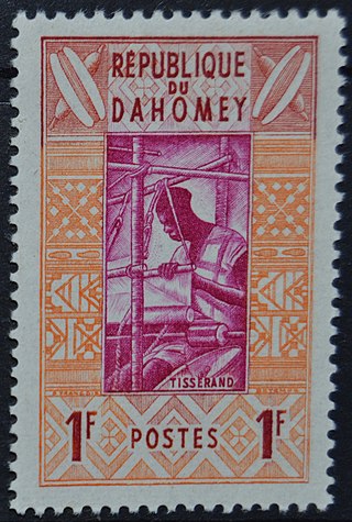
This is a survey of the postage stamps and postal history of Benin, formerly Dahomey.

This is a survey of the postage stamps and postal history of Togo.
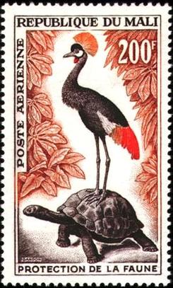
This is a survey of the postage stamps and postal history of Mali.

This is a survey of the postage stamps and postal history of Niger, a former French colony that obtained independence in 1960.

The following is a survey of the postage stamps and postal history of Somalia. From the late 1800s to 1960, northwestern present-day Somalia was administered as British Somaliland, while the northeastern, central and southern part of the country were concurrently administered as Italian Somaliland. In 1960, the two territories were unified as the Somali Republic.
Côte d'Ivoire, or the Ivory Coast, is a country in West Africa established as a French colony in 1893, and becoming independent in 1960.

The Burkina Faso–Niger border is 622 km in length and runs from the tripoint with Mali in the north to the tripoint with Benin in the south.
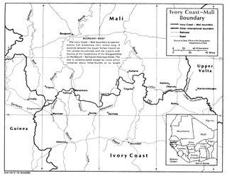
The Ivory Coast–Mali border is 599 km in length and runs from the tripoint with Guinea in the west to the tripoint with Burkina Faso in the east.

The Burkina Faso–Mali border is 1,325 km in length and runs from the tripoint with Ivory Coast in the west to the tripoint with Niger in the east.

The Burkina Faso–Ivory Coast border is 545 km in length and runs from the tripoint with Mali in the west to the tripoint with Ghana in the east.

The Burkina Faso–Togo border is 131 km in length and runs from the tripoint with Ghana in the west to the tripoint with Benin in the east.

The Burkina Faso–Ghana border is 602 km in length and runs from the tripoint with Ivory Coast in the west to the tripoint with Togo in the east.

