The history of the Central African Republic is roughly composed of four distinct periods. The earliest period of settlement began around 10,000 years ago when nomadic people first began to settle, farm and fish in the region. The next period began around 10,000 years prior.

French Equatorial Africa was a federation of French colonial territories in Equatorial Africa which consisted of Gabon, French Congo, Ubangi-Shari, and Chad. It existed from 1910 to 1958 and its administration was based in Brazzaville.
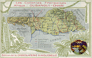
Ubangi-Shari was a French colony in central Africa, a part of French Equatorial Africa. It was named after the Ubangi and Chari rivers along which it was colonised. It was established on 29 December 1903, from the Upper Ubangi and Upper Shari territories of the French Congo; renamed the Central African Republic (CAR) on 1 December 1958; and received independence on 13 August 1960.

The French Congo was a French colony established in the present-day area of the Republic of the Congo, Gabon, and the Central African Republic. It began in 1880 as a protectorate, and its borders with Cabinda, Cameroons, and the Congo Free State were established by treaties over the next decade. French Congo was temporarily divided between Gabon and Middle Congo in 1906, before being reunited as French Equatorial Africa in 1910 in an attempt to copy the relative success of French West Africa.

Ubangi-Shari was a French colony in central Africa which later became the independent country of the Central African Republic on August 13, 1960. It followed the establishment of the Bangui outpost in 1889, and was named in 1894.

Gabon is a country in west central Africa sharing borders with the Gulf of Guinea to the west, Equatorial Guinea to the northwest, and Cameroon to the north, with the Republic of the Congo curving around the east and south. Its size is almost 270,000 km2 with an estimated population of 1,500,000. The capital and largest city is Libreville.

The Central African CFA franc is the currency of six independent states in Central Africa: Cameroon, Central African Republic, Chad, Republic of the Congo, Equatorial Guinea and Gabon. These six countries have a combined population of 55.2 million people, and a combined GDP of over US$100 billion.

This is a survey of the postage stamps and postal history of Chad.

Postage stamps have been used in Cameroon or Cameroun since the nineteenth century.

The Central African Republic has been issuing stamps since 1959. Before this, it was called Ubangi-Shari.

This is a survey of the postage stamps and postal history of Rwanda. The Republic of Rwanda is a landlocked country located in the Great Lakes region of eastern-central Africa, bordered by Uganda, Burundi, the Democratic Republic of the Congo and Tanzania.
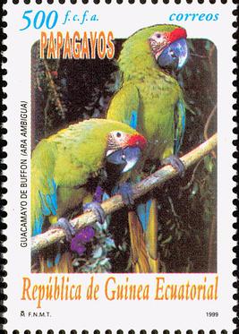
This is a survey of the postage stamps and postal history of Equatorial Guinea, formerly known as Spanish Guinea.

This is a survey of the postage stamps and postal history of Niger, a former French colony that obtained independence in 1960.
This is a survey of the postage stamps and postal history of Madagascar, briefly also known as Malagasy.

The Central African Republic–Chad border is 1,556 km (987 mi) in length and runs from the tripoint with Cameroon in the west, to the tripoint with Sudan in the east.

The Cameroon–Chad border is 1,116 km in length and runs from the tripoint with Nigeria in the north, to the tripoint with the Central African Republic in the south.

The Cameroon–Central African Republic border is 901 km (560 mi) in length and runs from the tripoint with Chad in the north to the tripoint with the Republic of the Congo in the south.

The Central African Republic–Republic of the Congo border is 487 km in length and runs from the tripoint with Cameroon in the west to the tripoint with the Democratic Republic of the Congo in the east.


