
Mahendra Bir Bikram Shah Dev was King of Nepal from 1955 to 1972. Mahendra was born on 11 June 1920 to King Tribhuvan of Nepal. Although Tribhuvan was nominally king since 1911, the royal family had been held captive in Narayanhity Palace since the rise of the prominent Rana dynasty. In 1940 he married Indra Rajya Lakshmi Devi, daughter of General Hari Shamsher Jang Bahadur Rana. Mahendra had three sons, Birendra, Gyanendra, and Dhirendra and three daughters Shanti, Sharada, and Shobha. Crown Princess Indra died in 1950. In 1952, Mahendra married Indra's younger sister, Ratna Rajya Lakshmi Devi. This marriage produced no children as King Mahendra had married on the condition his personal life shall not hinder his national duties and the to be queen agreed to be childless.

Mechi was one of the fourteen zones of Nepal until the restructuring of zones to provinces, comprising four districts; namely Ilam, Jhapa, Panchthar and Taplejung. Its headquarters are at Ilam. It comes under the Eastern Development Region of Nepal. The Indian state of Bihar is to the south, West Bengal and Sikkim in the east and Tibet to the north. The largest town is Damak in the Terai. The majority of the population in Mechi are Limbu, Chettri, Bharmin, or Meche.

Morang District is located in Province No. 1 in eastern Nepal. It is an Outer Terai district. It borders with Bihar, India to the South, Jhapa to the East, Dhankuta and Panchthar to the North, and Sunsari to the west. Morang has one metropolitan city (Biratnagar), eight municipalities and eight rural municipalities. The total area of Morang is 1,855 km2 (716 sq mi). The lowest elevation point is 60 meters and the highest is 2410 meters above sea level. The headquarters of Morang is connected by Koshi National Highway to the east–west Mahendra National Highway at Itahari, Sunsari, and Morang is also connected to the Hill parts of the eastern region of Nepal. Morang is the core industrial sector for the eastern region of Nepal.

Taplejung District is one of 77 districts of Nepal and one of the 14 districts of Province No. 1. It is remotely located in the Himalayas in Eastern Nepal with Tibet to the north across the Himalayas. Taplejung is the third largest district of Nepal.

Ilam is one of four urban municipalities of Ilam District, which lies in the Mahabharata hilly range of Province No. 1, eastern Nepal. Ilam also acts as the headquarters of Ilam District. Being the largest producer region for Nepali tea, its tea farms comprise a major tourist attraction in Province No. 1. Ilam is also famous for its natural scenery and landscapes as well as its diverse agricultural economy which specializes in horticultural crop production.

Damak, a city in eastern Nepal is one of the oldest municipalities in Jhapa District in Province No. 1 of Nepal. It is situated between the Ratuwa River in the east and the Maawa River in the west. It has Sivalik Hills in its north and ends with the intersection of Ratuwa River and Maawa River in the south. Mahendra Highway crosses this municipality nearly bisecting it. It is the largest city in Jhapa District as well as in Province No. 1 with a population of 75,743 in 2011 A.D

Limbuwan is an area of the Himalayan region historically made up of 10 Limbu kingdoms, now part of Nepal, northern Sikkim in India and western Bhutan. Limbuwan means "abode of the Limbus" or "Land of the Limbus". "Yakthung Laaje" in the original Limbu language which means "the country of the Yakthungs".
Mechinagar is a municipality in Jhapa District, Province No. 1, Nepal and is the main entry point from India on Nepal's eastern border. Nepal's custom office is in Kakarvitta, a section of the municipality. The city is almost 475 km south east of the capital city Kathmandu and 115 km east of the state capital of Province One Biratnagar.
Birtamode is a municipality in Jhapa District of Nepal. It is the commercial, educational and transport hub of Jhapa District. Sarnamati Bazar, Dhulabari Bazar, Dhaijan Bazar, Charali Bazar, Shivasatakshi Bazar, Kamatoli Bazar, Chakchaki Bazar and Surunga Bazar are some of the nearest local towns/settlements connected to Birtamod. it is one of the fastest growing city in Nepal. Birtamod is the largest city of Jhapa as well as in Mechi zone.

Budhabare, more specifically Hadiya Budhabare, is a village and former Village Development Committee that is now part of Buddhashanti Rural Municipality in Jhapa district of Province No. 1 in south-eastern Nepal. The latest official data, 2011 Nepal Census, puts the total population of the VDC at 22,936. Owing to this average population size, the VDC has been divided into nine wards.
Bhadrapur is a town and municipality in Jhapa District in the Province No. 1 of southeastern Nepal. It lies on the banks of the Mechi River, and shares borders with Bihar state, India on south and West Bengal state on north. There is a border crossing with customs office for goods. Galgalia village in Kishanganj District borders with Bhadrapur

Dangibari is a village development committee in Jhapa District in the Province No. 1 of south-eastern Nepal. At the time of the 1991 Nepal census it had a population of 7472.
Haldibari is a village development committee (VDC) in Jhapa District in the Province No. 1 of southeastern Nepal. Haldibari, from Haldi, means besar/turmeric. At the time of the 1991 Nepal census it had a population of 6,407 people living in 1,167 individual households.

Belbari, officially known as Belbari municipality, is one of the major suburbs of Morang district, Province No. 1.It lies in the eastern Terai region of Nepal. It was officially upgraded to become a municipality in 2014 AD, which is 2070 BS, which otherwise was a Village Development Committee (VDC) prior to that change. In order to meet the requirements to become a municipality, Belbari VDC merged Kaseni VDC with itself, making it larger in total area. Moreover, in 2017 AD VDC like Dangihat and Bahuni merged with it to become present Belbari Municipality.Now it have 11 wards offices.

Panchayat was a partyless political system incepted by King Mahendra by sidelining the Nepali Congress government of B. P. Koirala on 15th December 1960 AD. He introduced the partyless Panchayat system on 5th January 1961 AD. Under his direct rule King Mahendra introduced the four tiered structure—village, town, district and national Panchayat—on the basis of limited elected executive committee. Mahendra consolidated power by institutionalizing and invoking the three pillars of national identity—Hindu religion, Nepali language and Monarchy—as a foundation of everyday social and religious life. Moreover, the system propagated the idea of Ek Raja, Ek Bhesh, Ek Bhasa, Ek Desh.
Shivasatakshi is a municipality in the southeastern part of Jhapa District in the Mechi Zone of eastern Nepal. The new municipality was formed by merging three existing villages—Shivaganj, Satasidham and Dharampur —on 2 Dec 2014. The office of the municipality is that of the former Satasidham village development committee (VDC).

Province No. 1 is the easternmost of the seven provinces established by the new constitution of Nepal which was adopted on 20 September 2015. The province covers an area of 25,905 km2, about 17.5% of the country's total area. With the industrial city of Biratnagar as its headquarters, the province covers other major eastern towns including Damak, Dharan, Itahari, Inaruwa and Birtamod and includes several mountains including the Everest, Kanchenjunga, and Ama Dablam. Koshi – the largest river of the nation, circumvents the province's western boundary. Adhering to the first-past-the-post voting system issued by the Constituency Delimitation Commission, the province hosts 28 parliamentary seats and 56 provincial seats.
"Melancholy" is an environmentally-themed song sung by 365 Nepali artists. This song was intended to promote an environmental message by breaking the Guinness World Records for "Most Vocal Solos in a Song Recording", which it successfully did. It was written, music composed and directed by environmentalist Nipesh Dhaka. The song was recorded as a single on 19 May 2016. The recording sessions were inaugurated by Prime Minister Khadga Prasad Oli at 8 am and continued until 6 pm. The song was released on 2 September 2017 by President Bidya Devi Bhandari at Army Officer's Club, Kathmandu.
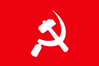
Communism in Nepal traces its roots back to the pro-democracy movement of 1951, and the subsequent overthrow of the autocratic Rana regime and the establishment of democracy in Nepal. The communist movement in Nepal has split into factions multiple times and multiple factions have come together into a single fold at times as well. It has a history of getting banned from open political discourse; as well as multiple instances of embracing guerrilla insurgency, most notably, the Maoist insurgency in the 1990s and early 2000s that led to the Nepalese Civil War, claiming at least 17,000 lives. After the Maoists and other main political parties formed a united coalition, launching a successful peaceful civil resistance against the dictatorial coup d'état by the monarchy, which resulted in the abolition of the monarchy and drafting of a new constitution affirming Nepal as a secular, federal, democratic republic striving towards democratic socialism, the two main communist parties of Nepal contested the first election according to the new constitution as a coalition, eventually leading to the unification of two parties with a strong majority in the federal parliament as well as six out of seven provinces of Nepal.

