The Brahmaputra is a trans-boundary river which flows through Tibet (China), Northeastern India, and Bangladesh. It is known as Brahmaputra or Luit in Assamese, Yarlung Tsangpo in Tibetan, the Siang/Dihang River in Arunachali, and Jamuna River in Bengali. It is the 9th largest river in the world by discharge, and the 15th longest.

The A41 is a trunk road between London and Liverpool, England. Now in parts replaced by motorways, it passes through or near Watford, Kings Langley, Hemel Hempstead, Aylesbury, Bicester, Solihull, Birmingham, West Bromwich, Wolverhampton, Newport, Whitchurch, Chester and Ellesmere Port.

The A6 is one of the main north–south roads in England. It runs from Luton in Bedfordshire to Carlisle in Cumbria, although it formerly started at a junction with the A1 at Barnet. It is the fourth longest numbered road in Britain; only the A1, A38 and A30 are longer.

A controlled-access highway is a type of highway that has been designed for high-speed vehicular traffic, with all traffic flow—ingress and egress—regulated. Common English terms are freeway, motorway, and expressway. Other similar terms include throughway or thruway and parkway. Some of these may be limited-access highways, although this term can also refer to a class of highways with somewhat less isolation from other traffic.

National Highway 16 is a major National Highway in India that runs along east coast of West Bengal, Odisha, Andhra Pradesh, and Tamil Nadu. It was previously known as National Highway 5.
The N7 is a Bangladeshi national highway connecting the Daulatdia Ferry Terminal, on the south bank of the Padma River near the Bangladeshi capital Dhaka, with the Port of Mongla in Bagerhat District. It serves some of the largest cities and towns in southwestern Bangladesh, including Faridpur, Magura, Jhenaidah, Jessore, and Khulna. The highway is known along various stretches as the Dhaka–Khulna Highway, the Jessore-Khulna Highway, and the Khulna-Mongla Highway.

National Highway 7 is a highway connecting Fazilka (Punjab) to Mana (Uttarakhand) in India. It passes through the Indian states of Punjab, Haryana, Himachal Pradesh, and Uttarakhand.
National Highway 47 is a primary National Highway in India. It starts from Bamanbore in Gujarat and terminates at Nagpur in Maharashtra. This national highway is about 1,006 km (625 mi) long. Before renumbering of national highways in 2010, NH-47 was variously numbered as old national highways 8A, 59, 59A & 69.
National Highway 58 is a National Highway in India connecting Fatehpur and Udaipur in the state of Rajasthan. NH58 route is extended from Udaipur to Palanpur in Gujarat.

National Highway 71 is a National Highway in India, that lies completely in the state of Andhra Pradesh. This highway passes through Temple city Tirupati and connects with Coastal Andhra Pradesh. The western terminal starts at the junction of National Highway 42 near Madanapalle and terminates at the junction of National Highway 16 near Naidupeta in the east.

National Highway 75 is one of major National Highway in India. passing through states of Karnataka, Andhra Pradesh, and Tamil Nadu. This national highway was earlier known as National Highway 48 (NH-48) before rationalisation of highway numbers in 2010. The highway connects the port city of Mangaluru (Mangalore) in the west to the city of Vellore in the east. National highway 75 is the main road for travellers from Mangaluru going to Bengaluru and Hassan. NH-75 traverses all three geographical regions of Karnataka state namely Karavali, Malenadu and Bayaluseeme.

National Highway 79 is a National Highway in India entirely within the state of Tamil Nadu. It runs between Ulundurpettai and Salem in the Indian state of Tamil Nadu for a total of 134 km (83 mi). It connects with NH 44 and NH 544 at Salem. NH 79 connects NH 68 and SH 69 at Ulundurpettai and SH 6 at kallakurichi. It was upgraded to a dual carriageway road in two phases on a Build-operate-transfer basis by Reliance Infrastructure and Maytas.
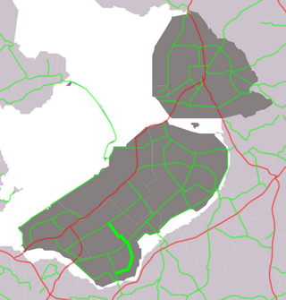
Provincial road N705 (N705) is a road connecting N706 between Almere and Lelystad with N301 near Zeewolde.
National Highway 160, commonly referred to as NH 160 is a national highway in India. It is a spur road of National Highway 60. NH-160 traverses the states of Maharashtra and Karnataka in India.
National Highway 112 is a highway in the Indian state of West Bengal. It runs from Barasat to Petrapole border with Bangladesh. The road also known as Jessore road.

National Highway 19 is a national highway in India. It was previously referred to as Delhi–Kolkata Road and is one of the busiest national highways in India. After renumbering of national highways, Delhi to Agra route is now national highway 44 and Agra to Kolkata route is numbered national highway 19. It constitutes a major portion of the historical Grand Trunk Road. It is also part of AH1 of Asian Highway Network, that traverses from Japan to Turkey.
National Highway 48 is a major National Highway of India that starts at Delhi and terminates at Chennai traversing through seven states of India. It has a total length of 2807 km. NH 48 passes through the states of Delhi, Haryana, Rajasthan, Gujarat, Maharashtra, Karnataka and Tamil Nadu. The stretch between Pune and Bengaluru was known as P.B. Road in olden days.

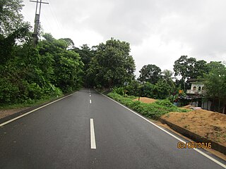
The N706 or Jessore–Benapole highway or historically known as Jessore Road is a National Highway in Bangladesh. It connects Doratana, Jessore to Benapole Border Crossing at the international border with India where it meets with NH 112.