Provincial roads are roads maintained by one or more of the 12 provinces of the Netherlands.
There are main roads, which run in multiple provinces, and province specific provincial roads.
Provincial roads are roads maintained by one or more of the 12 provinces of the Netherlands.
There are main roads, which run in multiple provinces, and province specific provincial roads.
| Number | Length (km) | Length (mi) | Southern or western terminus | Northern or eastern terminus | Formed | Removed | Notes | |
|---|---|---|---|---|---|---|---|---|
| 18 | 11 | — | — | — | — | Exists in two parallel sections to the A2 in Maastricht and Eindhoven | ||
| 10 | 6.2 | Papendrecht | Dordrecht | — | — | Only remaining section of unbuilt A3 | ||
| 5 | 3.1 | Folsgare | Sneek | — | — | Portion of Sneek Ring | ||
| 5 | 3.1 | Groningen | Euvelgunne | — | — | Portion of Groningen Ring | ||
| 9 | 5.6 | A8 at Zaanstad-Noord interchange | A9 at Uitgeest interchange | — | — | Portion of A8; overlaps N246 and N203 due to the missing link of the A8 | ||
| 41 | 25 | A9/N242 in Alkmaar | N250/N99 in Den Helder | — | — | Continuation of A9 | ||
| 21 | 13 | A4 near Leiden | A12 near Bodegraven | — | — | Originally planned as A11 | ||
| 5 | 3.1 | Duindigt | A4 at Leidschendam interchange | — | — | Originally planned as A14; portion of The Hague Ring | ||
| 19 | 12 | Maasvlakte | A15 at Oostvoorne interchange | — | — | |||
| 45 | 28 | A18 in Varsseveld | A35 in Enschede | — | — | Officially a portion of A15, numbered as N15 until the late 1980s | ||
| — | — | — | — | proposed | — | 3 provinces served: North Holland, Flevoland, Overijssel | ||
| 34 | 21 | — | — | — | — | Exists in two sections, connected by the A31 | ||
| 1 | 0.62 | A32 at Wirdum interchange | N31 at Werpsterhoek interchange | — | — | |||
| 72 | 45 | A28 at Assen interchange | Roundabout at N46 in Eemshaven | — | — | Originally planned as A33; section north of A7 originally ran along current N362 and other routes | ||
| 77 | 48 | Roundabout at N36 in Ommen | A28 De Punt | 1951 | current | |||
| 41 | 25 | — | — | — | — | Exists in two sections, connected by the A35 | ||
| 35 | 22 | A35 at Almelo-West interchange, Wierden | Roundabout at N48 in Ommen | — | — | |||
| — | — | Wassenaar | S 101 in The Hague | — | — | Portion of A44 | ||
| 35 | 22 | Euvelgunne interchange, Groningen | N33 in Eemshaven | — | — | |||
| 22 | 14 | N348/N340 in Ommen | N33 in Eemshaven | — | — | |||
| 22 | 14 | A50 at Hattemerbroek interchange | A6 at Emmeloord interchange, Emmeloord | — | — | Originally planned as A38 | ||
| 77 | 48 | Brielle interchange | Middelburg-Oost interchange, Middelburg | — | — | Portion over the Harlingvlietdam was A57 in the 1970s | ||
| 0.5 | 0.31 | A58/N288 in Flushing | Oude-Veerhavenweg in Flushing | — | — | Old route through Zeeuws-Vlaanderen now N676 and N253 | ||
| 45 | 28 | N57 | Hellegatsplein interchange | — | — | Former portion of A18 until the 1980s | ||
| 25 | 16 | N62 | Roundabout at N253/N676 in Schoonedijke | — | — | |||
| 41 | 25 | A58 near Goes | N423 at the Belgian border | 2003 | current | Originally planned as A61; was never a national highway | ||
| 16 | 9.9 | — | — | — | — | Exists in two sections, connected by the A65; planned to be upgraded to a motorway | ||
| 16 | 9.9 | A67 in Veldhoven | N74 at the Belgian border | — | — | Originally planned as the A69, although partially on a different route | ||
| 19 | 12 | De Kooy interchange | Den Oever interchange | — | — | Former portion of A9 | ||
| Number | Length (km) | Length (mi) | Southern or western terminus | Northern or eastern terminus | Formed | Removed | Notes | |
|---|---|---|---|---|---|---|---|---|
| N 194 | 16 | 9.9 | A7 in Scharwoude | N242 in Heerhugowaard | 2018 | current | Formerly N243 and N507 | |
| N 195 | — | — | N201 | N231 | proposed | — | Planned southern ring road of Hoofdorp; status unknown | |
| 2.7 | 1.7 | N201 in De Hoek | Aalsmeer | 2013 | current | Former routing of N201 | ||
| 7.2 | 4.5 | Roundabout N246 in Beverwijk | Heemskerk | — | — | Portion of route originally planned as A8 | ||
| 7 | 4.3 | Woerden | N228 | — | — | Section between De Meern and Utrecht-Centrum interchange of the A2 was signed as N198 until 2010 | ||
| 8.7 | 5.4 | N806 in Bunschoten | Roundabout at N221 in Amersfoort | — | — | |||
| Number | Length (km) | Length (mi) | Southern or western terminus | Northern or eastern terminus | Formed | Removed | Notes | |
|---|---|---|---|---|---|---|---|---|
| 56 | 35 | Zandvoort | Hilversum | — | — | Route through Aalsmeer now N196 | ||
| 56 | 35 | Zandvoort | Hilversum | — | — | Route through Aalsmeer now N196 | ||
| 6.8 | 4.2 | IJmuiden | S 102 in Amsterdam | — | — | Was A6 before 1948 | ||
| 19 | 12 | S 152 in Wormerveer | N513 near Limmen | — | — | Route in Zaanstad now S 152 since mid-2014; route between N246 and A9 is designated as N8 as there is no link to the A8 | ||
| — | — | N210 north of Lopik | Woerden | — | — | |||
| 21 | 13 | N208 in Heemstede | N207 near Nieuw-Vennep | — | — | Connecting roads at the Rottepolderplein interchange are designated A205 | ||
| 42.1 | 26.2 | Zoetermeer | N201 in Aerdenhout | — | — | |||
| 51.7 | 32.1 | N210/N478 in Bergambacht | N208 in Hillegom | — | — | |||
| — | — | Haarlem | IJmuiden | — | — | Final kilometer before the A22 is designated as A208; was A9 and A8 | ||
| 26.3 | 16.3 | Hazerswoude-Rijndijk | A13 | — | — | |||
| 46 | 29 | Terbregseplein, A16 | A2 in Nieuwegein | — | — | |||
| 20.4 | 12.7 | The Hague | Hook of Holland | — | — | |||
| 12.8 | 8.0 | N201 north of Wilnis | N198 east of Woerden | — | — | |||
| 5.9 | 3.7 | A20/N223 near Westerlee | N211/N464 near Poeldijk | — | — | Route originally planned as a variant for A20 | ||
| 21.4 | 13.3 | N3 near Papendrecht | A27 near Breda | — | — | |||
| — | — | — | — | — | — | |||
| — | — | — | — | — | — | |||
| — | — | — | — | — | — | |||
| — | — | — | — | — | — | |||
| — | — | — | — | — | — | |||
| — | — | — | — | — | — | Former portion of A20 | ||
| — | — | — | — | — | — | One section former A1, another section former A28 before 1986 | ||
| — | — | — | — | — | — | Route was unbuilt A54 | ||
| — | — | — | — | — | — | |||
| — | — | — | — | — | — | Was A24 before 1948 | ||
| — | — | — | — | — | — | Was A25 before 1958 | ||
| — | — | — | — | — | — | |||
| — | — | — | — | — | — | |||
| — | — | — | — | — | — | |||
| — | — | — | — | — | — | |||
| — | — | — | — | — | — | |||
| — | — | — | — | — | — | |||
| — | — | — | — | — | — | |||
| — | — | — | — | — | — | |||
| N 234 | — | — | — | — | — | — | ||
| — | — | — | — | — | — | |||
| — | — | — | — | — | — | |||
| N 237 | — | — | — | — | — | — | Former portion of A23 | |
| — | — | — | — | — | — | |||
| — | — | — | — | — | — | |||
| — | — | — | — | — | — | |||
| — | — | — | — | — | — | |||
| — | — | — | — | — | — | |||
| — | — | — | — | — | — | |||
| — | — | — | — | — | — | |||
| N 245 | — | — | — | — | — | — | ||
| — | — | — | — | — | — | |||
| — | — | — | — | — | — | |||
| — | — | — | — | — | — | |||
| N 249 | — | — | — | — | — | — | ||
| N 250 | — | — | — | — | — | — | Was A9 before 1993 | |
| N 251 | — | — | — | — | — | — | ||
| N 252 | — | — | — | — | — | — | ||
| N 253 | — | — | — | — | — | — | Was N58 before 2003 | |
| — | — | — | — | — | — | |||
| N 255 | — | — | — | — | — | — | ||
| N 256 | — | — | — | — | — | — | First 3 km is designated A256 | |
| N 257 | — | — | — | — | — | — | ||
| N 258 | — | — | — | — | — | — | ||
| — | — | A4 at Dinteloord interchange | A4 at Tholen interchange | — | 2014 | Served as a link before the A4 was completed between Rotterdam and Antwerp; replaced by the A4 | ||
| — | — | — | — | — | — | |||
| — | — | — | — | — | — | |||
| — | — | — | — | — | — | |||
| — | — | — | — | — | — | |||
| — | — | — | — | — | — | |||
| — | — | John F. Kennedylaan, Eindhoven | A50 at Oss-Oost interchange, Oss | — | — | Replaced by the A50 | ||
| N 266 | — | — | — | — | — | — | ||
| N 267 | — | — | — | — | — | — | ||
| N 268 | — | — | — | — | — | — | ||
| N 269 | — | — | — | — | — | — | ||
| — | — | — | — | — | — | |||
| — | — | — | — | — | — | No longer a national highway due to the A73 | ||
| — | — | — | — | — | — | |||
| — | — | N78 at the Belgian border | A73 at Maasbree interchange, Blerick | — | — | Section from Blerick to Venray now A73; no longer a national highway due to the A73 | ||
| — | — | N299 in Brunssum | N293 in Posterholt | — | — | Gap in route through Germany, numbered as L 410 | ||
| — | — | — | — | — | — | |||
| N 276 | — | — | — | — | — | — | ||
| — | — | — | — | — | — | |||
| 30 | 19 | N79 at Belgian border | B1 at German border | — | — | Originally planned as A78 | ||
| — | — | — | — | — | — | |||
| — | — | — | — | — | — | Formerly N/A68 | ||
| — | — | — | — | — | — | Former portion of A76 | ||
| — | — | — | — | — | — | Former portion of A63 | ||
| N 283 | — | — | — | — | — | — | ||
| N 284 | — | — | — | — | — | — | ||
| N 285 | — | — | — | — | — | — | ||
| N 286 | — | — | — | — | — | — | ||
| N 287 | — | — | — | — | — | — | ||
| — | — | — | — | — | — | |||
| — | — | — | — | — | — | |||
| N 290 | — | — | — | — | — | — | ||
| N 291 | — | — | — | — | — | — | ||
| N 292 | — | — | — | — | — | — | ||
| — | — | — | — | — | — | |||
| — | — | — | — | — | — | |||
| N 295 | — | — | — | — | — | — | ||
| — | — | — | — | — | — | |||
| — | — | — | — | — | — | |||
| N 298 | — | — | — | — | — | — | ||
| N 299 | — | — | — | — | — | — | ||
| Number | Length (km) | Length (mi) | Southern or western terminus | Northern or eastern terminus | Formed | Removed | Notes | |
|---|---|---|---|---|---|---|---|---|
| — | — | — | — | — | — | |||
| — | — | — | — | — | — | |||
| — | — | — | — | — | — | |||
| — | — | — | — | — | — | |||
| — | — | — | — | — | — | |||
| — | — | — | — | — | — | |||
| — | — | — | — | — | — | |||
| — | — | — | — | — | — | |||
| — | — | — | — | — | — | |||
| — | — | — | — | — | — | |||
| — | — | — | — | — | — | |||
| — | — | — | — | — | — | |||
| — | — | — | — | — | — | |||
| — | — | — | — | — | — | |||
| — | — | — | — | — | — | |||
| — | — | — | — | — | — | |||
| — | — | — | — | — | — | |||
| — | — | — | — | — | — | |||
| — | — | — | — | — | — | |||
| — | — | — | — | — | — | |||
| — | — | — | — | — | — | |||
| — | — | — | — | — | — | |||
| — | — | — | — | — | — | |||
| — | — | — | — | — | — | |||
| — | — | — | — | — | — | |||
| 28 | 17 | A12 | German border near Beek | — | — | Section between Arnhem and Nijmegen is A325 | ||
| — | — | S 103 in Nijmegen | A326 at Parkerplein roundabout near Wijchen | — | — | |||
| — | — | — | — | — | — | |||
| — | — | — | — | — | — | |||
| — | — | — | — | — | — | |||
| 44 | 27 | A6/N337 in Zwolle | A6/N351 in Emmeloord | — | — | |||
| — | — | — | — | — | — | |||
| — | — | — | — | — | — | |||
| — | — | — | — | — | — | |||
| — | — | — | — | — | — | |||
| — | — | — | — | — | — | |||
| — | — | — | — | — | — | |||
| — | — | — | — | — | — | |||
| — | — | — | — | — | — | |||
| — | — | — | — | — | — | |||
| — | — | — | — | — | — | |||
| — | — | — | — | — | — | |||
| — | — | — | — | — | — | |||
| — | — | — | — | — | — | |||
| — | — | — | — | — | — | |||
| — | — | — | — | — | — | |||
| — | — | — | — | — | — | |||
| — | — | — | — | — | — | |||
| — | — | — | — | — | — | |||
| — | — | — | — | — | — | |||
| — | — | — | — | — | — | |||
| — | — | — | — | — | — | |||
| — | — | — | — | — | — | |||
| — | — | — | — | — | — | |||
| — | — | — | — | — | — | |||
| — | — | — | — | — | — | |||
| — | — | — | — | — | — | |||
| — | — | — | — | — | — | |||
| — | — | — | — | — | — | |||
| — | — | — | — | — | — | |||
| — | — | — | — | — | — | |||
| — | — | — | — | — | — | |||
| — | — | — | — | — | — | |||
| — | — | — | — | — | 2012 | Returned to municipalities as a local route | ||
| — | — | — | — | — | — | |||
| — | — | — | — | — | — | |||
| — | — | — | — | — | — | |||
| — | — | — | — | — | — | |||
| — | — | — | — | — | — | |||
| — | — | — | — | — | — | |||
| — | — | — | — | — | — | |||
| — | — | — | — | — | — | |||
| — | — | — | — | — | — | |||
| — | — | — | — | — | — | |||
| — | — | — | — | — | — | |||
| — | — | — | — | — | — | |||
| — | — | — | — | — | — | |||
| — | — | — | — | — | — | |||
| — | — | — | — | — | — | |||
| — | — | — | — | — | — | |||
| — | — | — | — | — | — | |||
| — | — | — | — | — | — | |||
| — | — | — | — | — | — | |||
| — | — | — | — | — | — | |||
| — | — | — | — | — | — | |||
| — | — | — | — | — | — | |||
| — | — | — | — | — | — | |||
| — | — | — | — | — | — | |||
| — | — | — | — | — | — | |||
| — | — | — | — | — | — | |||
| — | — | — | — | — | — | |||
| — | — | — | — | — | — | |||
| — | — | — | — | — | — | |||
| — | — | — | — | — | — | Formerly numbered N637 | ||
| — | — | — | — | — | — | Formerly numbered N621 | ||
| — | — | — | — | — | — | Former portion of N634 | ||
| — | — | — | — | — | — | |||
| — | — | — | — | — | — | |||
| Number | Length (km) | Length (mi) | Southern or western terminus | Northern or eastern terminus | Formed | Removed | Notes | |
|---|---|---|---|---|---|---|---|---|
| — | — | — | — | — | — | |||
| — | — | — | — | — | — | |||
| — | — | — | — | — | — | |||
| — | — | — | — | — | 2006 | Downgraded to local route | ||
| — | — | — | — | — | — | |||
| — | — | — | — | — | — | |||
| — | — | — | — | — | 2004 | Downgraded to local route | ||
| — | — | — | — | — | — | |||
| — | — | — | — | — | — | |||
| — | — | — | — | — | — | |||
| — | — | — | — | — | — | |||
| — | — | — | — | — | — | |||
| — | — | — | — | — | — | |||
| — | — | — | — | — | — | |||
| — | — | — | — | — | — | |||
| — | — | — | — | — | — | |||
| — | — | — | — | — | — | |||
| — | — | — | — | — | 2019 | Downgraded to local route | ||
| — | — | — | — | — | — | |||
| — | — | — | — | — | — | |||
| — | — | — | — | — | — | |||
| — | — | — | — | — | — | |||
| — | — | — | — | — | — | Downgraded to local route | ||
| N 440 | — | — | — | — | — | — | Unsigned | |
| — | — | — | — | — | — | |||
| — | — | — | — | — | — | |||
| — | — | — | — | — | — | |||
| — | — | — | — | — | — | |||
| — | — | — | — | — | — | |||
| — | — | — | — | — | — | |||
| — | — | — | — | — | — | |||
| — | — | — | — | — | 2019 | Downgraded to local route | ||
| — | — | — | — | — | — | |||
| — | — | — | — | — | — | |||
| — | — | — | — | — | — | |||
| — | — | — | — | — | — | |||
| — | — | — | — | — | — | |||
| — | — | — | — | — | — | |||
| — | — | — | — | — | — | |||
| — | — | — | — | — | — | |||
| — | — | — | — | — | — | |||
| — | — | — | — | — | — | |||
| — | — | — | — | — | — | |||
| — | — | — | — | — | — | |||
| — | — | — | — | — | — | |||
| — | — | — | — | — | — | |||
| — | — | — | — | — | — | |||
| — | — | — | — | — | — | |||
| — | — | — | — | — | 2011 | Downgraded to local route | ||
| — | — | — | — | — | — | |||
| — | — | — | — | — | — | |||
| — | — | — | — | — | — | |||
| — | — | — | — | — | — | Downgraded to local route | ||
| — | — | — | — | — | — | |||
| — | — | — | — | — | — | |||
| — | — | — | — | — | — | |||
| — | — | — | — | — | — | |||
| — | — | — | — | — | — | |||
| — | — | — | — | — | — | |||
| — | — | — | — | — | — | |||
| — | — | — | — | — | — | |||
| — | — | — | — | — | — | |||
| — | — | — | — | — | — | |||
| — | — | — | — | — | — | |||
| — | — | — | — | — | — | |||
| — | — | — | — | — | — | |||
| — | — | A2 at Everdingen interchange | A2 at Everdingen interchange | — | — | Now an access ramp to Utrecht from the A2 | ||
| — | — | — | — | — | — | |||
| — | — | — | — | — | — | |||
| — | — | — | — | — | — | |||
| — | — | — | — | — | — | |||
| — | — | — | — | — | — | Downgraded to local route | ||
| — | — | — | — | — | — | |||
| — | — | — | — | — | — | |||
| — | — | — | — | — | — | |||
| — | — | — | — | — | — | |||
| — | — | — | — | — | 1998 | Downgraded to local route | ||
| — | — | — | — | — | — | |||
| — | — | — | — | — | — | |||
| — | — | — | — | — | — | |||
| Number | Length (km) | Length (mi) | Southern or western terminus | Northern or eastern terminus | Formed | Removed | Notes | |
|---|---|---|---|---|---|---|---|---|
| — | — | — | — | — | — | |||
| — | — | — | — | — | — | |||
| — | — | — | — | — | — | |||
| — | — | — | — | — | — | |||
| — | — | — | — | — | — | |||
| — | — | — | — | — | — | |||
| — | — | — | — | — | 2018 | Renumbered to N194 | ||
| — | — | — | — | — | — | |||
| — | — | — | — | — | — | |||
| — | — | — | — | — | — | |||
| — | — | — | — | — | — | |||
| — | — | — | — | — | — | |||
| — | — | — | — | — | — | |||
| — | — | — | — | — | — | |||
| — | — | — | — | — | — | |||
| — | — | — | — | — | — | |||
| — | — | — | — | — | — | |||
| — | — | — | — | — | — | |||
| — | — | — | — | — | — | |||
| — | — | — | — | — | — | |||
| — | — | — | — | — | — | |||
| — | — | — | — | — | — | |||
| — | — | — | — | — | — | |||
| — | — | — | — | — | — | |||
| — | — | — | — | — | — | |||
| — | — | — | — | — | — | |||
| — | — | — | — | — | — | |||
| — | — | — | — | — | — | |||
| — | — | N271 in Nieuw-Bergen | L361 at German border | — | 2008 | Downgraded to local route | ||
| — | — | — | — | — | — | |||
| — | — | — | — | — | — | |||
| — | — | — | — | — | — | |||
| — | — | — | — | — | — | |||
| — | — | — | — | — | — | |||
| — | — | — | — | — | — | |||
| — | — | — | — | — | — | |||
| — | — | — | — | — | — | |||
| — | — | — | — | — | — | |||
| — | — | — | — | — | — | |||
| — | — | — | — | — | — | |||
| — | — | — | — | — | — | |||
| — | — | — | — | — | — | |||
| — | — | — | — | — | — | |||
| — | — | — | — | — | — | |||
| — | — | — | — | — | — | |||
| N 573 | — | — | — | — | — | — | ||
| — | — | — | — | — | — | |||
| — | — | N276 near Doenrade | N274 near Schinveld | — | 2008 | Downgraded to local route | ||
| — | — | Heerlen | N276 near Doenrade | — | 2006 | Downgraded to local route | ||
| — | — | Geleen | Amstenrade | — | 2006 | Downgraded to local route | ||
| — | — | A76 at Spaubeek interchange | Schimmert | — | 2007 | Downgraded to local route | ||
| — | — | Beek | N298 at Hulsberg | — | 2007 | Downgraded to local route | ||
| — | — | Beek | Bunde | — | 2007 | Downgraded to local route | ||
| — | — | — | — | — | — | |||
| — | — | — | — | — | — | |||
| — | — | — | — | — | — | |||
| — | — | — | — | — | — | |||
| — | — | — | — | — | — | |||
| — | — | — | — | — | — | |||
| — | — | — | — | — | — | |||
| — | — | — | — | — | — | |||
| — | — | — | — | — | — | |||
| — | — | — | — | — | — | |||
| — | — | — | — | — | — | |||
| — | — | Brunssum | Eygelshoven | — | 2008 | Downgraded to local route | ||
| — | — | — | — | — | — | |||
| N 599 | — | — | — | — | — | — | ||
| Number | Length (km) | Length (mi) | Southern or western terminus | Northern or eastern terminus | Formed | Removed | Notes | |
|---|---|---|---|---|---|---|---|---|
| N 600 | — | — | — | — | — | — | ||
| N 601 | 5 | 3.1 | A2/A65 at Vught interchange | A59 at Vlijmen | — | — | ||
| — | — | — | — | — | — | |||
| — | — | — | — | — | — | Downgraded to local route due to completion of the A50 | ||
| — | — | — | — | — | — | |||
| — | — | — | — | — | — | |||
| — | — | — | — | — | — | |||
| — | — | — | — | — | — | |||
| — | — | — | — | — | — | |||
| N 609 | — | — | — | — | — | — | ||
| — | — | — | — | 1993 | 2007 | Downgraded to local route | ||
| — | — | — | — | — | — | |||
| — | — | — | — | — | — | |||
| — | — | — | — | — | — | |||
| — | — | — | — | — | — | |||
| — | — | — | — | — | — | |||
| — | — | — | — | — | — | |||
| — | — | — | — | — | — | |||
| — | — | — | — | — | — | |||
| — | — | — | — | — | 2007 | Downgraded to local route | ||
| — | — | — | — | — | — | |||
| — | — | — | — | — | — | |||
| — | — | — | — | — | — | |||
| — | — | — | — | 1993 | 2007 | Downgraded to local route | ||
| — | — | — | — | — | 2010 | Downgraded to local route | ||
| — | — | — | — | — | — | |||
| — | — | — | — | — | 2005 | Downgraded to local route | ||
| N 627 | — | — | — | — | — | — | ||
| — | — | — | — | 1960 | 2001 | Downgraded to local route | ||
| — | — | — | — | — | — | |||
| — | — | — | — | — | 2009 | Downgraded to local route; was A65 from 1932-1982, N261 from 1982-1993 and N283 from 1993-2003 | ||
| — | — | — | — | — | — | |||
| — | — | — | — | — | — | |||
| N 633 | — | — | — | — | — | — | ||
| — | — | — | — | — | 2007 | Valkenswaard to the A2 renumbered to N396 in 2003, remainder downgraded to local route in 2007 | ||
| N 635 | — | — | — | — | — | — | ||
| N 636 | — | — | — | — | — | — | ||
| — | — | — | — | — | — | |||
| — | — | — | — | — | — | |||
| — | — | — | — | — | — | |||
| — | — | — | — | — | — | |||
| — | — | — | — | — | — | |||
| — | — | — | — | — | — | |||
| — | — | — | — | — | — | |||
| — | — | — | — | — | — | |||
| — | — | — | — | — | — | |||
| — | — | — | — | — | — | |||
| — | — | — | — | — | — | |||
| — | — | — | — | — | — | |||
| — | — | — | — | — | 2006 | Downgraded to local route | ||
| — | — | — | — | — | — | |||
| — | — | — | — | — | — | |||
| — | — | — | — | — | — | |||
| — | — | — | — | — | — | |||
| — | — | — | — | — | — | |||
| — | — | — | — | — | — | |||
| — | — | — | — | — | — | |||
| — | — | — | — | — | — | |||
| — | — | — | — | — | — | |||
| — | — | — | — | — | — | |||
| — | — | — | — | — | — | |||
| — | — | — | — | — | — | |||
| — | — | — | — | — | — | |||
| — | — | — | — | — | — | |||
| N 672 | — | — | — | — | — | — | ||
| — | — | — | — | — | — | |||
| — | — | — | — | — | — | |||
| — | — | — | — | — | — | |||
| — | — | — | — | — | — | |||
| N 677 | — | — | — | — | — | — | ||
| N 678 | — | — | — | — | — | — | ||
| N 679 | — | — | — | — | — | — | ||
| N 680 | — | — | — | — | — | — | ||
| N 681 | — | — | — | — | — | — | ||
| — | — | — | — | — | — | |||
| — | — | — | — | — | — | |||
| N 684 | — | — | — | — | — | — | ||
| N 685 | — | — | — | — | — | — | ||
| — | — | — | — | — | — | |||
| N 687 | — | — | — | — | — | — | ||
| N 688 | — | — | — | — | — | — | ||
| — | — | — | — | — | — | |||
| — | — | — | — | — | — | |||
| N 691 | — | — | — | — | — | — | ||
| N 692 | — | — | — | — | — | — | ||
| N 695 | — | — | — | — | — | — | ||
| Number | Length (km) | Length (mi) | Southern or western terminus | Northern or eastern terminus | Formed | Removed | Notes | |
|---|---|---|---|---|---|---|---|---|
| — | — | — | — | — | — | |||
| — | — | — | — | — | — | |||
| — | — | — | — | — | — | |||
| — | — | — | — | — | — | |||
| — | — | — | — | — | — | |||
| — | — | — | — | — | — | |||
| — | — | — | — | — | — | |||
| — | — | — | — | — | — | |||
| — | — | — | — | — | — | |||
| — | — | — | — | — | — | |||
| — | — | — | — | — | — | |||
| — | — | — | — | — | — | |||
| — | — | — | — | — | — | |||
| — | — | — | — | — | — | |||
| — | — | — | — | — | — | |||
| — | — | — | — | — | — | |||
| — | — | — | — | — | — | |||
| — | — | — | — | — | — | |||
| — | — | — | — | — | — | |||
| — | — | — | — | — | 2022 | Former portion of the N307; transferred to municipalities as a local route | ||
| — | — | — | — | — | — | |||
| — | — | — | — | — | — | |||
| — | — | — | — | — | — | |||
| — | — | — | — | — | — | |||
| — | — | — | — | — | — | |||
| — | — | — | — | — | — | |||
| — | — | — | — | — | — | |||
| — | — | — | — | — | — | |||
| — | — | — | — | — | — | |||
| — | — | — | — | — | — | |||
| — | — | — | — | — | — | |||
| — | — | — | — | — | — | |||
| — | — | — | — | — | — | |||
| — | — | — | — | — | — | |||
| — | — | — | — | — | — | |||
| — | — | — | — | — | — | |||
| — | — | — | — | — | — | |||
| — | — | — | — | — | — | |||
| — | — | — | — | — | — | |||
| — | — | — | — | — | — | |||
| — | — | — | — | — | — | |||
| — | — | — | — | — | — | |||
| — | — | — | — | — | — | |||
| — | — | — | — | — | — | |||
| — | — | — | — | — | — | |||
| — | — | — | — | — | — | |||
| — | — | — | — | — | — | |||
| — | — | — | — | — | — | |||
| — | — | — | — | — | — | |||
| — | — | — | — | — | — | |||
| — | — | — | — | — | — | |||
| — | — | — | — | — | — | |||
| — | — | — | — | — | — | |||
| — | — | — | — | — | — | |||
| — | — | — | — | — | — | |||
| — | — | — | — | — | — | |||
| — | — | — | — | — | — | |||
| N 768 | — | — | — | — | — | — | ||
| — | — | — | — | — | — | |||
| — | — | — | — | — | — | |||
| — | — | — | — | — | — | |||
| — | — | — | — | — | — | |||
| — | — | — | — | — | — | |||
| — | — | — | — | — | — | |||
| — | — | — | — | — | — | |||
| — | — | — | — | — | — | |||
| — | — | — | — | — | — | |||
| — | — | — | — | — | — | |||
| — | — | — | — | — | — | |||
| — | — | — | — | — | — | |||
| — | — | — | — | — | — | |||
| — | — | — | — | — | — | |||
| — | — | — | — | — | — | |||
| — | — | — | — | — | — | |||
| — | — | — | — | — | — | |||
| Number | Length (km) | Length (mi) | Southern or western terminus | Northern or eastern terminus | Formed | Removed | Notes | |
|---|---|---|---|---|---|---|---|---|
| — | — | — | — | — | — | |||
| — | — | — | — | — | — | |||
| — | — | — | — | — | — | |||
| — | — | — | — | — | 2011 | Downgraded to local route | ||
| — | — | — | — | — | — | |||
| — | — | — | — | — | 2011 | Downgraded to local route | ||
| 2 | 1.2 | N199 | Nijkerk | — | — | Portion in Nijkerk downgraded to local route | ||
| — | — | — | — | — | — | |||
| — | — | — | — | — | — | |||
| — | — | — | — | — | — | |||
| — | — | — | — | — | — | |||
| — | — | — | — | — | — | |||
| — | — | — | — | — | — | |||
| — | — | — | — | — | — | |||
| — | — | — | — | — | — | |||
| — | — | — | — | — | — | |||
| — | — | — | — | — | — | |||
| — | — | — | — | — | — | |||
| — | — | — | — | — | — | |||
| — | — | — | — | — | — | |||
| — | — | — | — | — | — | |||
| — | — | — | — | — | — | |||
| — | — | — | — | — | — | |||
| — | — | — | — | — | — | |||
| — | — | — | — | — | — | |||
| — | — | — | — | — | — | |||
| — | — | — | — | — | — | |||
| — | — | — | — | — | — | |||
| — | — | — | — | — | — | |||
| — | — | — | — | — | — | |||
| — | — | — | — | — | — | |||
| — | — | — | — | — | — | |||
| — | — | — | — | — | — | |||
| — | — | — | — | — | — | |||
| — | — | — | — | — | — | |||
| — | — | — | — | — | — | |||
| — | — | — | — | — | — | |||
| — | — | — | — | — | — | |||
| — | — | — | — | — | — | |||
| — | — | — | — | — | — | |||
| — | — | — | — | — | — | |||
| — | — | — | — | — | — | |||
| — | — | — | — | — | — | |||
| — | — | — | — | — | — | |||
| — | — | — | — | — | — | |||
| — | — | — | — | — | — | |||
| — | — | — | — | — | — | |||
| — | — | — | — | — | — | |||
| — | — | — | — | — | — | |||
| — | — | — | — | — | — | |||
| — | — | — | — | — | — | |||
| — | — | — | — | — | — | |||
| — | — | — | — | — | — | |||
| — | — | — | — | — | — | |||
| — | — | — | — | — | — | |||
| — | — | — | — | — | — | |||
| Number | Length (km) | Length (mi) | Southern or western terminus | Northern or eastern terminus | Formed | Removed | Notes | |
|---|---|---|---|---|---|---|---|---|
| — | — | — | — | — | — | |||
| — | — | — | — | — | — | |||
| — | — | — | — | — | — | |||
| — | — | — | — | — | — | |||
| — | — | — | — | — | — | |||
| — | — | — | — | — | — | |||
| — | — | — | — | — | — | |||
| — | — | — | — | — | — | |||
| — | — | — | — | — | — | |||
| N 951 | — | — | — | — | — | — | ||
| N 956 | — | — | — | — | — | — | ||
| N 959 | — | — | — | — | — | — | ||
| N 960 | — | — | — | — | — | — | ||
| — | — | — | — | — | — | |||
| — | — | — | — | — | — | |||
| — | — | — | — | — | — | |||
| — | — | — | — | — | — | |||
| N 965 | — | — | — | — | — | — | ||
| — | — | — | — | — | — | |||
| — | — | — | — | — | — | |||
| N 968 | — | — | — | — | — | — | ||
| — | — | — | — | — | — | |||
| N 970 | — | — | — | — | — | — | ||
| N 971 | — | — | — | — | — | — | ||
| — | — | — | — | — | — | |||
| — | — | — | — | — | — | |||
| — | — | — | — | — | — | |||
| — | — | — | — | — | — | |||
| — | — | — | — | — | — | |||
| — | — | — | — | — | — | |||
| — | — | — | — | — | — | |||
| — | — | — | — | — | — | |||
| — | — | — | — | — | — | |||
| — | — | — | — | — | — | |||
| — | — | — | — | — | — | |||
| — | — | — | — | — | — | |||
| — | — | — | — | — | — | |||
| — | — | — | — | — | — | |||
| — | — | — | — | — | — | |||
| — | — | — | — | — | — | |||
| — | — | — | — | — | — | |||
| — | — | — | — | — | — | |||
| — | — | — | — | — | — | |||
| — | — | — | — | — | — | |||
| — | — | — | — | — | — | |||
| — | — | — | — | — | — | |||
| — | — | — | — | — | — | |||
| — | — | — | — | — | — | |||
| — | — | — | — | — | — | |||
| — | — | — | — | — | — | |||
| — | — | — | — | — | — | |||
| — | — | — | — | — | — | |||

There are twelve provinces of the Netherlands representing the administrative layer between the national government and the local governments, with responsibility for matters of subnational or regional importance.
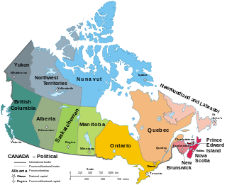
Canada has ten provinces and three territories that are sub-national administrative divisions under the jurisdiction of the Canadian Constitution. In the 1867 Canadian Confederation, three provinces of British North America—New Brunswick, Nova Scotia, and the Province of Canada —united to form a federation, becoming a fully independent country over the next century. Over its history, Canada's international borders have changed several times as it has added territories and provinces, making it the world's second-largest country by area.
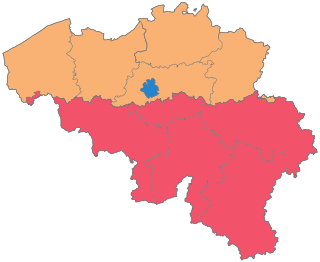
The Kingdom of Belgium is divided into three regions. Two of these regions, Flanders and Wallonia, are each subdivided into five provinces. The third region, Brussels, does not belong to any province and nor is it subdivided into provinces. Instead, it has amalgamated both regional and provincial functions into a single "Capital Region" administration.
Between 1634 and 2009, Finland was administered as several provinces. Finland had always been a unitary state: the provincial authorities were part of the central government's executive branch and apart from Åland, the provinces had little autonomy. There were never any elected provincial parliaments in continental Finland. The system was initially created in 1634. Its makeup was changed drastically on 1 September 1997, when the number of the provinces was reduced from twelve to six. This effectively made them purely administrative units, as linguistic and cultural boundaries no longer followed the borders of the provinces. The provinces were eventually abolished at the end of 2009. Consequently, different ministries may subdivide their areal organization differently. Besides the former provinces, the municipalities of Finland form the fundamental subdivisions of the country. In current use are the regions of Finland, a smaller subdivision where some pre-1997 läänis are split into multiple regions. Åland retains its special autonomous status and its own regional parliament.
The provinces of Thailand are administrative divisions of the government of Thailand. The country is divided into 76 provinces proper, with one additional special administrative area. They are the primary local government units and act as juristic persons. They are divided into amphoe (districts) which are further divided into tambon, the next lower level of local government.

Provinces are the most numerous type of province-level divisions in the People's Republic of China (PRC). There are currently 22 provinces administered by the PRC and one province that is claimed, but not administered, which is Taiwan, currently administered by the Republic of China (ROC).

The provinces of the Colony of New Zealand existed as a form of sub-national government. Initially established in 1846 when New Zealand was a Crown colony without responsible government, two provinces were first created. Each province had its own legislative council and governor. With the passing of the New Zealand Constitution Act 1852 the provinces were recreated around the six planned settlements or "colonies". By 1873 the number of provinces had increased to nine, but they had become less isolated from each other and demands for centralised government arose. In 1875 the New Zealand Parliament decided to abolish the provincial governments, and they came to an end in November 1876. They were superseded by counties, which were later replaced by territorial authorities.

The provinces of Italy are the second-level administrative divisions of the Italian Republic, on an intermediate level between a municipality and a region. Since 2015, provinces have been classified as "institutional bodies of second level".

Fiji is divided administratively into four divisions, which are further subdivided into fourteen provinces. Each province has a provincial council.
Regional routes are the third category of road in the South African route numbering scheme. They are designated with the letter "R" followed by a three-digit number. They serve as feeders connecting smaller towns to the national and provincial routes. Designation as a regional road does not necessarily imply any particular size of road; they range from gravel roads to multi-lane freeways.

National Highways of Pakistan are a network of toll highways in Pakistan, which are owned, maintained and operated by the National Highways Authority under the Ministry of Communications. It maintains 12,131 kilometres (7,538 mi) of roadways organized into various classifications which crisscross the country and provide access to major population centers. National Highways are not to be confused with provincial highways, which are roads maintained by the respective provinces. Pakistan's national highways include the famous Grand Trunk Road, Indus Highway, Karakoram Highway and Makran Coastal Highway. All national highways in Pakistan are pre-fixed with the letter 'N' followed by the unique numerical designation of the specific highway, e.g. "N-5". Each numerical designation is separated by five numerals, i.e. N-5, N-10, N-15, etc. National Highways are distinct from Strategic Highways, which begin with the prefix 'S' and are controlled and operated by the Ministry of Defence.
The subdivisions of Kenya have been in place since 2010, replacing the old system. Under the Constitution of 2010 and other reforms to Provincial Administration the country acquired a new system of Counties. The previous Provinces were scrapped and the 46 Districts, in existence since 1992, were turned into Counties with elected governments.
A province is an administrative division within a country or state. The term derives from the ancient Roman provincia, which was the major territorial and administrative unit of the Roman Empire's territorial possessions outside Italy. The term province has since been adopted by many countries. In some countries with no actual provinces, "the provinces" is a metaphorical term meaning "outside the capital city".

The Northern Province is one of the nine provinces of Sri Lanka. The province has an area of 8,884 km2, making it the 3rd largest province by area, and a population of 1,061,315, making it the least populated province. The city of Jaffna is the capital city of the province.

Northern Provincial Council is the provincial council for the Northern Province in Sri Lanka. In accordance with the Sri Lankan constitution, NPC has legislative power over a variety of matters including agriculture, education, health, housing, local government, planning, road transport and social services. The constitution also gives it powers over police and land but successive central governments have refused to devolve these powers to the provinces. NPC has 38 members elected using the open list proportional representation system.

A strada provinciale, abbreviated SP, is an Italian road that is maintained by provinces or metropolitan cities. In Veneto from 2002, state highways downgraded as provincial roads are maintained by the regional company Veneto Strade. A provincial road is less important than a regional road, but more important than municipal roads. The types of provincial roads are the same ones of state highways.
Like South Africa's eight other provinces, the Northern Cape is governed by a parliamentary system, in which the Premier of the Northern Cape is elected by the Northern Cape Provincial Legislature and in turn selects the Northern Cape Executive Council. As in most other provinces, the African National Congress (ANC) has led the Northern Cape Provincial Government since the end of apartheid. In the most recent provincial election, held in 2019, the ANC won 18 of 30 seats in the provincial legislature and the Democratic Alliance was the official opposition in the legislature. Pursuant to the same election, Zamani Saul was elected Premier of the province.
Provincial governments of Sri Lanka are the devolved governments of the nine Provinces of Sri Lanka. In accordance with the Sri Lankan constitution, provinces have legislative power over a variety of matters including agriculture, education, health, housing, local government, planning, road transport and social services. The constitution also gives them powers over police and land but successive central governments have refused to devolve these powers to the provinces.

Gandaki Province ), is one of the seven federal provinces established by the current constitution of Nepal which was promulgated on 20 September 2015. Pokhara is the province's capital city. It borders the Tibet Autonomous Region in Southwest China to the north, Bagmati Province to the east, Karnali Province to the west, and Lumbini Province and Bihar of India to the south. The total area of the province is 21,504 km2 - constituting 14.57% of Nepal's total area. According to the latest census, the population of the province was 2,479,745. The newly elected Provincial Assembly adopted Gandaki Province as the permanent name by replacing its initial name Province No. 4 on 27 April 2023. Surendra Raj Pandey is the present chief minister of Gandaki Province.
Highway 57 and Provincial Trunk Highway 57 are two short highways in the Canadian provinces of Saskatchewan and Manitoba.