List of motorways in the Netherlands

Last updated

Motorways in the Netherlands
SnelwegenNederland 2008.png
Motorways in the Netherlands highlighted in red
System information
Maintained by Rijkswaterstaat [1]
Highway names
System links

These are the Netherlands' motorways by their national number, listed with the most important towns at or near the roads. The numbers start with 'A' for 'autosnelweg' (motorway in Dutch). Some of these also carry one or more European E-road numbers on (sections of) their trajectory. Although E-roads in the Netherlands are virtually all motorways, the trajectories are frequently not the same.

Contents

Motorways [2]

NumberLength (km)Length (mi)Southern or western terminusNorthern or eastern terminusFormedRemovedNotes
NL-A1.svg A 1 157.73398.011 A10 in Amsterdam A 30 at German border east of De Lutte 01933-01-011933current Amsterdam - Hilversum - Amersfoort - Apeldoorn - Deventer - Hengelo - Germany (Bad Bentheim)
NL-A2.svg A 2 217.098134.898 A10 & S110 in Amsterdam A25 at Belgian border south of Eijsden 01954-01-011954current Amsterdam - Utrecht - 's-Hertogenbosch - Eindhoven - Weert - Geleen - Maastricht - Belgium (Visé)
A 3 A10 in Amsterdam A15 south of Dordrecht01932-01-01193201977-01-011977Planned but never built; now A20 and N3
NL-A4.svg A 4 11974 A10 in Amsterdam A15 in Hoogvliet01938-01-011938current Amsterdam - Schiphol - Hoofddorp - Leiden - The Hague - Delft - Schiedam - Vlaardingen - Hoogvliet
NL-A4.svg A 4 A29/A59 northeast of Heijningen A12 at Belgian border southeast of Ossendrecht 01938-01-011938current Heijningen - Bergen op Zoom - Belgium (Antwerp)
NL-A5.svg A 5 18.83011.700 A10 in Amsterdam A4 east of Hoofddorp 01991-01-011991current Hoofddorp - Amsterdam
NL-A6.svg A 6 102.55763.726 A1 south of Muiderberg A7 southeast of Joure 01959-01-011959currentfrom A1 - Almere - Lelystad - Emmeloord - Joure
NL-A7.svg A 7 240.969149.731 S151 & S155 in Zaandam A 280 at German border south of Nieuweschans 01933-01-011933current Zaanstad - Purmerend - Hoorn - (Afsluitdijk) - Sneek - Heerenveen - Drachten - Groningen - Hoogezand - Winschoten - Nieuweschans - Germany (Bunde)
NL-A8.svg A 8 9.9666.193 A10 in Amsterdam N8/N246 north of Westzaan 01961-01-011961current Amsterdam - Zaanstad
NL-A9.svg A 9 95.67359.448 A1 & S114 in Diemen N9/N242 south of Alkmaar 01957-01-011957currentfrom A1 - Amsterdam Zuidoost - Amstelveen - Badhoevedorp - Haarlem - Beverwijk - Alkmaar
NL-A10.svg A 10 32.06719.926 A8 in Amsterdam A8 in Amsterdam 01961-01-011961current Amsterdam ring
NL-A12.svg A 12 136.81885.015 N44 & S101 in The Hague A 3 at German border east of Babberich 01936-01-011936current Germany (Oberhausen) - Zevenaar - Arnhem - Ede - Utrecht - Gouda - Zoetermeer - The Hague
NL-A13.svg A 13 16.75510.411 A20 & S113 in Rotterdam A4 in The Hague 01933-01-011933current The Hague - Rotterdam
NL-A14.svg A 14 A20 at Rotterdam WilgenplasLandscheidsweg near LeidschendamPlanned, but only the section between the A4 and N44 opened in 2003 as the N14
NL-A15.svg A 15 204.150126.853 N15 south of Rozenburg A325 & N325/S110 west of Het Hoog 01939-01-011939current Europoort - Rotterdam - Dordrecht - Gorinchem - Tiel - Nijmegen
NL-A16.svg A 16 58.09836.100 A20 in Rotterdam A1 in Hazeldonk 01936-01-011936currentExtension to Amsterdam cancelled in 1973; planned to be extended to Rotterdam Airport
NL-A17.svg A 17 26.59316.524 A16/A59 east of Moerdijk A58 in Roosendaal 01962-01-011962current Moerdijk - Roosendaal
NL-A18.svg A 18 2214 A12 northeast of Babberich N18 northwest of Varsseveld 01969-01-011969currentPortion of the A15
A 19 A4, Ypenburg junctionBergen op Zoom01976-01-011976Renumbered to a portion of the A4
NL-A20.svg A 20 38.86224.148 N213 & N220 in Maasdijk A12 east of Gouda 01932-01-011932current Gouda - Rotterdam - Vlaardingen - Maassluis
NL-A22.svg A 22 8.3485.187 A9 east of Velserbroek A9 east of Beverwijk 01941-01-011941current Velsen - Beverwijk
NL-A24.svg A 24 53.1 A15 at Rozenburg A20 at the Krabbeplas02015-01-012015currentUnder construction
NL-A27.svg A 27 108.72867.560 A58 northeast of Rijsbergen A6 east of Almere 01950-01-011950current Breda - Gorinchem - Utrecht - Hilversum - Huizen - Almere
NL-A28.svg A 28 187.471116.489 A27 east of Utrecht N7 in Groningen 01938-01-011938current Utrecht - Amersfoort - Harderwijk - Zwolle - Meppel - Hoogeveen - Assen - Groningen
NL-A29.svg A 29 13.4108.333 A15 & S103 in Barendrecht A4 & A59 northeast of Heijningen 01965-01-011965current Rotterdam - Dinteloord
NL-A30.svg A 30 18.20411.311 A12 east of Ede A1 northwest of Barneveld 01970-01-01c.1970current Barneveld - Ede
NL-A31.svg A 31 64.57740.126 A7 southwest of Harlingen A7 & N381 west of Drachten 01958-01-011958current Harlingen - Leeuwarden
NL-A32.svg A 32 65.93640.971 A28 south of Meppel N31 south of Leeuwarden 01828-01-011828current Meppel - Steenwijk - Heerenveen - Akkrum - Leeuwarden
NL-A35.svg A 35 35.65922.157 N35 & N350 south of Wierden N35 in Enschede 01949-01-011949current Enschede - Hengelo - Almelo - Wierden
NL-A37.svg A 37 42.09226.155 A28 & N48 south of Hoogeveen B402 at German border east of Zwartemeer 01962-01-011962current Hoogeveen - Emmen - Zwartemeer
NL-A38.svg A 38 21.2 A15/A16 in Ridderkerk S105 in Ridderkerk 01979-01-011979currentfrom A15 - A16 - Ridderkerk
NL-A44.svg A 44 27.85017.305 N44 east of Wassenaar A4 & N207 northwest of Leimuiden 01938-01-011938current Wassenaar - Leiden - Nieuw Vennep
NL-A50.svg A 50 159.59199.165 A2 north of Eindhoven A28 & N50 north of Hattemerbroek 01941-01-011941current Eindhoven - Oss - Wijchen - Arnhem - Apeldoorn - Zwolle
NL-A58.svg A 58 136.91685.076 N288 in Vlissingen A2 northeast of Eindhoven 01939-01-011939current Eindhoven - Tilburg - Breda - Roosendaal - Bergen op Zoom - Goes - Middelburg - Vlissingen
NL-A59.svgA 59121.09575.245 A4 & A29 northeast of Heijningen A50 southeast of Oss 01948-01-011948current Willemstad - Moerdijk - Waalwijk - 's-Hertogenbosch - Oss
NL-A65.svg A 65 21.64313.448 A58 & N269 southeast of Tilburg N65 south of Berkel-Enschot 01955-01-011955current Tilburg - Berkel-Enschot
NL-A67.svg A 67 77.88148.393 A21 at Belgian border southwest of Eersel A 40 at German border east of Venlo 01956-01-011956current Belgium (Turnhout) - Eindhoven - Venlo - Germany (Duisburg)
NL-A73.svg A 73 105.71365.687 A2 north of Echt A50 & N322 west of Beuningen 01970-01-011970currentfrom A50 - Nijmegen - Venlo -Roermond - A2 near Maastricht
NL-A74.svg A 74 1.8931.176 A 61 at German border east of Heide A73 east of Tegelen 02010-01-012010current Venlo - Germany (Kaldenkirchen)
NL-A76.svg A 76 27.00816.782 A2 at Belgian border southwest of Stein A 4 at German border east of Bocholtz 01937-01-011937current Belgium (Genk) - Stein - Geleen - Heerlen - Germany (Aachen)
NL-A77.svg A 77 10.1356.298 A73 northeast of Rijkevoort A57 east of Heijen 01975-01-011975current Boxmeer - Germany (Goch)
NL-A79.svg A 79 17.73111.018 A2 northeast of Maastricht A76 southwest of Heerlen 01970-01-011970current Maastricht - Heerlen
A 80 A16 near Zwaanshoek A27 near Hilversum Planned (would replace N201) but never built
NL-A200.svg A 200 11.8667.373 N200/R106 east of Haarlem N200 north of Zwanenburg 01962-01-011962current Zwanenburg-East - Haarlem-East (former A5)
NL-A205.svg A 205 10.62A9 at Rottepolderplein interchange N205 in HaarlemShortest highway in the Netherlands
NL-A208.svgA 2081.5220.946N208 at Velserbroek interchange, HaarlemA22 at IJmuiden interchange
NL-A256.svgA 25631.9 A58 southwest of Goes N256 & N664 west of Goes 01961-01-011961currentfrom A5 - Goes
NL-A261.svgA 261 A58 at Tilburg-Noord interchangeN261 at Loon on Zand interchange02014-01-012014Downgraded to N261
NL-A270.svgA 2703.32.1 N270 northwest of Eindhoven N270 southeast of Nuenen 01974-01-01c.1974current Eindhoven - Helmond
NL-A325.svgA 32585.0 A15 & S110 west of Het Hoog N225 & N325 in Arnhem 02010-01-012010currentFormer portion of A52
NL-A326.svgA 32663.7 A50 west of Wijchen S103 north of Wijchen 01995-01-01c.1995currentFormer S109
NL-A348.svgA 348106.2 A12 & N325 in Arnhem N348 & N317 south of Dieren Former A48
NL-A783.svg A 783 1.50.93 A73, Neerbosch junctionOutskirts of Nijmegen Signed as A73; A783 is an internal designation
  •       Former

Former motorways

The following routes lost their motorway-status:

See also

Related Research Articles

<span class="mw-page-title-main">Transport in the Netherlands</span> Overview of the transport in the Netherlands

The Netherlands is both a very densely populated and a highly developed country in which transport is a key factor of the economy. Correspondingly it has a very dense and modern infrastructure, facilitating transport with road, rail, air and water networks. In its Global Competitiveness Report for 2014-2015, the World Economic Forum ranked the Dutch transport infrastructure fourth in the world.

<span class="mw-page-title-main">M4 motorway</span> Major motorway in England and Wales

The M4, originally the London-South Wales Motorway, is a motorway in the United Kingdom running from west London to southwest Wales. The English section to the Severn Bridge was constructed between 1961 and 1971; the Welsh element was largely complete by 1980, though a non-motorway section around Briton Ferry bridge remained until 1993. On the opening of the Second Severn Crossing in 1996, the M4 was rerouted over it.

<span class="mw-page-title-main">Great Britain road numbering scheme</span>

The Great Britain road numbering scheme is a numbering scheme used to classify and identify all roads in Great Britain. Each road is given a single letter and a subsequent number. Though this scheme was introduced merely to simplify funding allocations, it soon became used on maps and as a method of navigation. There are two sub-schemes in use: one for motorways, and another for non-motorway roads.

<span class="mw-page-title-main">A66 road</span> Trans-Pennine A road in Northern England

The A66 is a major road in Northern England, which in part follows the course of the Roman road from Scotch Corner to Penrith. It runs from east of Middlesbrough in North Yorkshire to Workington in Cumbria.

<span class="mw-page-title-main">Roads in Ireland</span> Overview of roads in Ireland

The island of Ireland, comprising Northern Ireland and the Republic of Ireland, has an extensive network of tens of thousands of kilometres of public roads, usually surfaced. These roads have been developed and modernised over centuries, from trackways suitable only for walkers and horses, to surfaced roads including modern motorways. Driving is on the left-hand side of the road. The major routes were established before Irish independence and consequently take little cognisance of the border other than a change of identification number and street furniture. Northern Ireland has had motorways since 1962, and has a well-developed network of primary, secondary and local routes. The Republic started work on its motorway network in the early 1980s; and historically, the road network there was once somewhat less well developed. However, the Celtic Tiger economic boom and an influx of European Union structural funding, saw national roads and regional roads in the Republic come up to international standard quite quickly. In the mid-1990s, for example, the Republic went from having only a few short sections of motorway to a network of motorways, dual carriageways and other improvements on most major routes as part of a National Development Plan. Road construction in Northern Ireland now tends to proceed at a slower pace than in the Republic, although a number of important bypasses and upgrades to dual carriageway have recently been completed or are about to begin.

<span class="mw-page-title-main">Trunk road</span> Type of major road, usually connecting major settlements

A trunk road, trunk highway, or strategic road is a major road, usually connecting two or more cities, ports, airports and other places, which is the recommended route for long-distance and freight traffic. Many trunk roads have segregated lanes in a dual carriageway, or are of motorway standard.

A routenumber, designation or abbreviation is an identifying numeric designation assigned by a highway authority to a particular stretch of roadway to distinguish it from other routes and, in many cases, also to indicate its classification, general geographical location and/or orientation. The numbers chosen may be used solely for internal administrative purposes; however, in most cases they are also displayed on roadside signage and indicated on maps.

<span class="mw-page-title-main">Concurrency (road)</span> Road bearing more than one route number

A concurrency in a road network is an instance of one physical roadway bearing two or more different route numbers. When two roadways share the same right-of-way, it is sometimes called a common section or commons. Other terminology for a concurrency includes overlap, coincidence, duplex, triplex, multiplex, dual routing or triple routing.
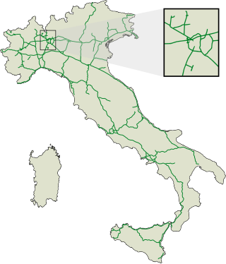
<span class="mw-page-title-main">Controlled-access highway</span> Highway designed for high-speed, regulated traffic flow

A controlled-access highway is a type of highway that has been designed for high-speed vehicular traffic, with all traffic flow—ingress and egress—regulated. Common English terms are freeway, motorway and expressway. Other similar terms include throughway and parkway. Some of these may be limited-access highways, although this term can also refer to a class of highways with somewhat less isolation from other traffic.

<span class="mw-page-title-main">National primary road</span> Major road in Ireland

A national primary road is a road classification in Ireland. National primary roads form the major routes between the major urban centres. There are 2649 km of national primary roads. This category of road has the prefix "N" followed by one or two digits. Motorways are prefixed "M" followed by one or two digits.

<span class="mw-page-title-main">A4 motorway (Netherlands)</span>

The A4 motorway, also called Rijksweg 4, is a motorway in the Netherlands running southwards from Amsterdam to the Belgian border near Zandvliet, north of the city of Antwerp. The 119-kilometre-long (74 mi) A4 is divided into two sections; the first and longer section runs from Amsterdam to the A15 near the city of Rotterdam, while the second section starts near Heijningen, where the A29 and the A4 meet, going to the Belgian border.

<span class="mw-page-title-main">Cheshire West and Chester</span> Borough in England

Cheshire West and Chester is a unitary authority area with borough status in Cheshire, England. It was established on 1 April 2009 as part of the 2009 local government changes, by virtue of an order under the Local Government and Public Involvement in Health Act 2007. It superseded the boroughs of Ellesmere Port and Neston, Vale Royal and the City of Chester; its council assumed the functions and responsibilities of the former Cheshire County Council within its area. The remainder of ceremonial Cheshire is composed of Cheshire East, Halton and Warrington. Cheshire West and Chester has three key urban areas: Chester, Ellesmere Port and Northwich/Winsford.

<span class="mw-page-title-main">European route E751</span> Road in trans-European E-road network

The European route E751, or E751, as defined by the Declaration on the Construction of Main International Traffic Arteries of 1975, and subsequent documents which amended the treaty, is an east–west Class-B branching European road route. Originating in Rijeka, Croatia, where it diverges from European route E61 before passing through the Kanfanar interchange, the route connects Pula, Rovinj, Poreč and Umag in Croatia with Koper in Slovenia. The route provides a high-performance road link in Istria and Slovenian Littoral. Unlike most routes, the E751 centers on the Kanfanar interchange and has three arms, each extending to Rijeka, Pula and Koper. The total length of the route, including all the route arms, is 160 km (99 mi).

<span class="mw-page-title-main">Comparison of European road signs</span>

European traffic signs present relevant differences between countries despite an apparent uniformity and standardisation. Most European countries refer to the 1968 Vienna Convention on Road Signs and Signals. The convention has been adopted by the following countries : Albania, Armenia, Austria, Belarus, Belgium, Bosnia and Herzegovina, Bulgaria, Croatia, Cyprus, the Czech Republic, Denmark, Estonia, Finland, France, Georgia, Germany, Greece, Hungary, Italy, Latvia, Liechtenstein, Lithuania, Luxembourg, Moldova, Montenegro, Netherlands, North Macedonia, Norway, Poland, Portugal, Romania, Russia, San Marino, Serbia, Slovakia, Slovenia, Spain, Sweden, Switzerland, Turkey, Ukraine and the United Kingdom. The convention has not been adopted by Ireland, Iceland or Malta.

<span class="mw-page-title-main">D2 road (Croatia)</span> Road in Croatia

D2 state road is a trunk state road in the northern areas of Croatia that spans from the border crossing with Slovenia at Dubrava Križovljanska in the west via Varaždin, Koprivnica, Virovitica, Našice, Osijek, Vukovar, ending at the Ilok–Bačka Palanka Bridge border crossing with Serbia. The road is 347.9 km (216.2 mi) long.

<span class="mw-page-title-main">Caribbean Netherlands</span> Netherlands Caribbean municipalities

The Caribbean Netherlands is a part of the Netherlands located outside of Europe, in the Caribbean, consisting of three so-called special municipalities. These are the islands of Bonaire, Sint Eustatius and Saba, as they are also known in legislation, or the BES islands for short. The islands are officially classified as public bodies in the Netherlands and as overseas territories of the European Union; as such, European Union law does not automatically apply to them.

<span class="mw-page-title-main">European route E233</span> Road in trans-European E-road network

European route E 233 is a west—east European Class-B road part of the International E-road network, running from Hoogeveen in the Netherlands to Cloppenburg in Germany, passing by the Dutch city of Emmen and the German city of Meppen. The road runs concurrently with four other roads over its course, first with the Dutch A37 from its western terminus to the German border, then with the German B402 up to Haselünne, from there on it follows B213 up to northern Cloppenburg, and on the last 2 kilometres (1.2 mi) of the B213 concurrency it also runs concurrent with B72, which it then follows up to its eastern terminus at the A1, which is also part of E 37. The road has a total length of 132 kilometres (82 mi), of which 41 kilometres (25 mi) in the Netherlands and 91 kilometres (57 mi) in Germany.

<span class="mw-page-title-main">Road transport in the Netherlands</span> Overview of road transport in the Netherlands

With 139,000 km of public roads, the Netherlands has one of the most dense road networks in the world – much denser than Germany and France, but still not as dense as Belgium. In 2013, 5,191 km were national roads, 7,778 km were provincial roads, and 125,230 km were municipality and other roads. Dutch roads include 3,530 km of motorways and expressways, and with a motorway density of 64 kilometres per 1,000 km2, the country also has one of the densest motorway networks in the world. In Dutch a motorway is called "autosnelweg" or simply "snelweg"; other expressways are just called "autoweg". According to a 2004 estimate, some 12,500 km of road remain as yet unpaved.

<span class="mw-page-title-main">Roads in the Netherlands</span>

The Netherlands has a public road network totaling 139,000 km, one of the densest in the world. Its use has increased since the 1950s and now exceeds 200 billion km traveled per year, three quarters of which is by car, making it among the most intensely used road networks. In 2019, the World Economic Forum ranked the quality of Dutch road infrastructure as the best in Europe and second to Singapore out of 141 countries.

References

  1. "Wat voor wegen zijn er in Nederland en wie is de wegbeheerder". De Rijksoverheid. Archived from the original on 15 March 2014. Retrieved 21 December 2014.
  2. "RWS Centrale Informatievoorziening Actuele Wegenlijst, December 2014" (PDF). Archived from the original (PDF) on 2015-09-24. Retrieved 2015-06-30.