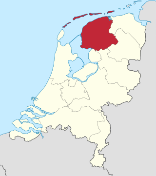
Friesland, historically and traditionally known as Frisia, named after the Frisians, is a province of the Netherlands located in the country's northern part. It is situated west of Groningen, northwest of Drenthe and Overijssel, north of Flevoland, northeast of North Holland, and south of the Wadden Sea. As of January 2023, the province had a population of about 660,000, and a total area of 5,753 km2 (2,221 sq mi).

The Afsluitdijk is a major dam and causeway in the Netherlands. It was constructed between 1927 and 1932 and runs from Den Oever in North Holland province to the village of Zurich in Friesland province, over a length of 32 kilometres (20 mi) and a width of 90 metres (300 ft), at an initial height above Amsterdam Ordnance Datum of between 6.7 metres (22 ft) along the section at Friesland, and 7.4 metres (24 ft) where it crosses the deep channel of the Vlieter. The height at the greater sea depths west of Friesland was required to be a minimum of 7 metres everywhere when originally constructed.

Drachten is a town in the northern Netherlands. It is located in the municipality of Smallingerland, Friesland. It had a population of around 56.098 in 2023 and is the second largest town in the province of Friesland.

A dual carriageway (BrE) or a divided highway (AmE) is a class of highway with carriageways for traffic travelling in opposite directions separated by a central reservation (BrE) or median (AmE). Roads with two or more carriageways which are designed to higher standards with controlled access are generally classed as motorways, freeways, etc., rather than dual carriageways.

The road hierarchy categorizes roads according to their functions and capacities. While sources differ on the exact nomenclature, the basic hierarchy comprises freeways, arterials, collectors, and local roads. Generally, the functional hierarchy can more or less correspond to the hierarchy of roads by their owner or administrator.

A limited-access road, known by various terms worldwide, including limited-access highway, dual-carriageway, expressway, and partial controlled-access highway, is a highway or arterial road for high-speed traffic which has many or most characteristics of a controlled-access highway, including limited or no access to adjacent property, some degree of separation of opposing traffic flow, use of grade separated interchanges to some extent, prohibition of slow modes of transport, such as bicycles, horse-drawn vehicles or ridden horses, or self-propelled agricultural machines; and very few or no intersecting cross-streets or level crossings. The degree of isolation from local traffic allowed varies between countries and regions. The precise definition of these terms varies by jurisdiction.

A controlled-access highway is a type of highway that has been designed for high-speed vehicular traffic, with all traffic flow—ingress and egress—regulated. Common English terms are freeway, motorway, and expressway. Other similar terms include throughway or thruway and parkway. Some of these may be limited-access highways, although this term can also refer to a class of highways with somewhat less isolation from other traffic.
South Road and its southern section as Main South Road outside of Adelaide is a major north–south conduit connecting Adelaide and the Fleurieu Peninsula, in South Australia. It is one of Adelaide's most important arterial and bypass roads. As South Road, it is designated part of route A2 within suburban Adelaide. As Main South Road, it is designated part of routes A13 and B23.
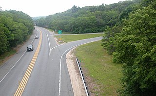
A two-lane expressway or two-lane freeway is an expressway or freeway with only one lane in each direction, and usually no median barrier. It may be built that way because of constraints, or may be intended for expansion once traffic volumes rise. The term super two is often used by roadgeeks for this type of road, but traffic engineers use that term for a high-quality surface road. Most of these roads are not tolled.

The A28 motorway is a motorway in the Netherlands. It is approximately 188 kilometers in length.

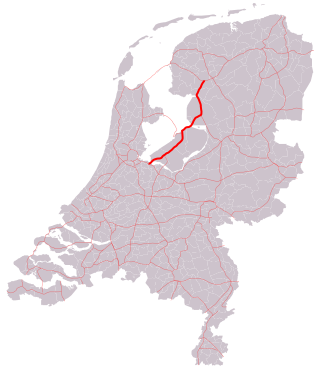
The A7 motorway is a motorway in the Netherlands connecting Zaandam, via the Afsluitdijk, Sneek and Groningen to the German border near Bad Nieuweschans. The entire road is part of the European route E22, with exception of the first kilometer, between the terminus in Zaandam and the interchange Zaandam. The total length is 236 km.
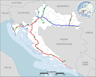
Highways in Croatia are the main transport network in Croatia. The Croatian classification includes several classes of highways:
The A6 motorway is a motorway in the Netherlands. It is just over 100 kilometers in length and it connects the A1 motorway at interchange Muiderberg with the A7 motorway at interchange Joure.

Christiaan "Chris" Arlman was a Dutch politician of the Labour Party (PvdA). During 26 years he was the mayor of four different municipalities, and the chairman of two professional football clubs. He is noted for developing wellness tourism to Nieuweschans, being the first mayor of a united Pekela, for expanding the sea port of Harlingen, and for handling major budget crises at BV Veendam and Cambuur Leeuwarden.

The North–South Motorway is a partially complete motorway traversing the inner western suburbs of Adelaide, from Waterloo Corner in the north to Bedford Park in the south. Progressively constructed in stages since 2010, once complete it will replace the adjacent South Road as Adelaide's main north–south roadway. It will form the central section of the North–South Corridor, being flanked north and south by the Northern Expressway and Southern Expressway, respectively. It is designated part of route M2.

European route E 233 is a west—east European Class-B road part of the International E-road network, running from Hoogeveen in the Netherlands to Cloppenburg in Germany, passing by the Dutch city of Emmen and the German city of Meppen. The road runs concurrently with four other roads over its course, first with the Dutch A37 from its western terminus to the German border, then with the German B402 up to Haselünne, from there on it follows B213 up to northern Cloppenburg, and on the last 2 kilometres (1.2 mi) of the B213 concurrency it also runs concurrent with B72, which it then follows up to its eastern terminus at the A1, which is also part of E 37. The road has a total length of 132 kilometres (82 mi), of which 41 kilometres (25 mi) in the Netherlands and 91 kilometres (57 mi) in Germany.
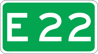
European route E 22 (E 22) is a west–east European route, running from Holyhead in the United Kingdom, through the Netherlands, Germany, Sweden and Latvia, to Ishim in Russia.

Visvliet is a village in the Dutch province of Groningen. It is part of the municipality of Westerkwartier, and is located near the river Lauwers, the border between Friesland and Groningen.
