Puerto Rico Highway 181

Last updated

PR urban primary 181.svg PR secondary 181.svg Ellipse sign 181.svg

Highway 181

Ruta 181
Route information
Maintained by Puerto Rico DTPW
Length68.65 km [1]  (42.66 mi)
Existed1953 [2] –present
Major junctions
South endPR secondary 3.svg PR-3 in Patillas barrio-pueblo
Major intersections
North endPR primary 17.svg PR-17 in Oriente
Location
Country United States
Territory Puerto Rico
Municipalities Patillas, Maunabo, Yabucoa, San Lorenzo, Gurabo, Trujillo Alto, San Juan
Highway system
Ellipse sign 180.svg PR-180 Ellipse sign 182.svg PR-182

Puerto Rico Highway 181 (PR-181), also known as Expreso Trujillo Alto, [3] is a road that connects the towns of San Juan, Puerto Rico (very close to Carolina) in the north/northeast coast of Puerto Rico with Patillas in the southeast, passing through the municipalities of San Juan (very small part) at Jesus de Piñero Avenue (PR-17) as it approaches the Teodoro Moscoso Bridge and the Luis Muñoz Marín International Airport, Trujillo Alto, Gurabo, San Lorenzo, Yabucoa and Patillas in the center of the town district near PR-3. Along with PR-10, PR-149, PR-1 and PR-52, it is one of the longest highways crossing the island from north to south through the central mountainous region. In the north part of Trujillo Alto it is a four-lane highway, turning completely rural on the way to Patillas with the exception of a small tract in Gurabo where it intersects PR-30.

Contents

Route description

Rural road

In Trujillo Alto, near Gurabo, it turns into a rural road with very narrow lanes per direction and hard curves, making it dangerous and requiring low speed limits. In Gurabo, it becomes divided in about 1 kilometer as it intersects Puerto Rico Highway 30, and then quickly turns rural. In San Lorenzo its makes intersection with Puerto Rico Highway 183. For the rest of its length it is still rural. In Yabucoa, PR-182 begins to connect to the main town, while PR-181 continues and as it enters Patillas, it borders lake Carite, before arriving to downtown Patillas, where it meets PR-3. [1]

Major intersections

MunicipalityLocationkm [4] [5] miDestinationsNotes
Patillas Patillas barrio-pueblo 0.00.0PR secondary 3.svg PR-3 (Calle Luis Muñoz Rivera) Arroyo, Maunabo Southern terminus of PR-181
0.30.19Ellipse sign 799.svg PR-799  Cacao Alto
Marín 3.62.2Ellipse sign 7759.svg PR-7759  Marín
PatillasMaunabo
municipal line
MarínMatuyas Alto line10.36.4Ellipse sign 759.svg PR-759  Maunabo
Yabucoa Guayabota 15.19.4Ellipse sign 182.svg PR-182 (Ruta Panorámica) Yabucoa Southern terminus of the Ruta Panorámica concurrency
San Lorenzo Espino 20.612.8Ellipse sign 7740.svg PR-7740 (Ruta Panorámica) Cayey Northern terminus of the Ruta Panorámica concurrency; the Ruta Panorámica continues toward Patillas
21.713.5Ellipse sign 9920.svg PR-9920  Quebrada Arenas
22.013.7Ellipse sign 745.svg PR-745  Espino
Quebrada Honda 23.014.3Ellipse sign 902.svg PR-902  Quebrada Arenas
24.115.0Ellipse sign 913.svg PR-913  Quebrada Honda
24.915.5Ellipse sign 9912.svg PR-9912  Cayaguas
Jagual 28.117.5Ellipse sign 765.svg PR-765  Jagual
HatoQuemados line32.019.9Ellipse sign 788.svg PR-788  Quemados
32.7
10.3 [lower-alpha 1]
20.3
6.4
West plate county (es).svg
PR secondary 183.svg
PR-183 west (Carretera Jesús Santa Aponte) Caguas, Gurabo
Western terminus of PR-183 concurrency
10.6 [lower-alpha 1]
32.8
6.6
20.4
East plate county (es).svg
PR secondary 183.svg
PR-183 east (Carretera Jesús Santa Aponte) Las Piedras
Eastern terminus of PR-183 concurrency
San Lorenzo barrio-pueblo 33.821.0Ellipse sign 980.svg PR-980 (Calle Varona Suárez) Las Piedras One-way street; eastbound access via Calle José de Diego
San Lorenzo barrio-puebloHato line34.721.6Ellipse sign 9931.svg PR-9931  Caguas
Quebrada 37.9–
38.0
23.5–
23.6
Ellipse sign 931.svg PR-931  Navarro
38.523.9Ellipse sign 929.svg PR-929  Juncos
Gurabo Jaguar 40.825.4Ellipse sign 9933.svg PR-9933  Juncos
JaguarMamey line42.826.6PR primary 30.svg PR-30 (Expreso Cruz Ortiz Stella) Caguas, San Juan, Juncos, Humacao PR-30 exits 7 and 8; diamond interchange
Mamey 43.527.0Ellipse sign 189.svg PR-189  Gurabo, Juncos
Celada 45.428.2Ellipse sign 944.svg PR-944  Hato Nuevo
45.528.3Ellipse sign 943.svg PR-943  Gurabo
Quebrada InfiernoMasa line50.631.4Ellipse sign 945.svg PR-945  Masa
54.133.6Ellipse sign 851.svg PR-851 (Carretera Reverendo Erasmo Ocasio Adorno) La Gloria
Trujillo Alto Quebrada NegritoDos Bocas line58.436.3Ellipse sign 852.svg PR-852  Quebrada Grande
Dos BocasLa Gloria line59.537.0Ellipse sign 851.svg PR-851 (Carretera Reverendo Erasmo Ocasio Adorno) La Gloria
Trujillo Alto barrio-puebloLa Gloria line61.438.2Ellipse sign 894.svgTo plate (es).svg
Ellipse sign 175.svg
PR-894 to PR-175  Caguas
Río Grande de Loíza 61.7–
61.9
38.3–
38.5
Puente de Trujillo Alto [6]
CuevasSt. Just line61.938.5Ellipse sign 175.svgEast plate (es).svg
PR urban primary 8860.svg
To plate (es).svg
Ellipse sign 876.svg
PR-175  / PR-8860 east to PR-876 (Carretera Federico Degetau) Caguas, Carolina
63.439.4Ellipse sign 850.svgTo plate (es).svg
Ellipse sign 876.svg
PR-850 to PR-876 (Carretera Federico Degetau) Cuevas
Southbound exit and entrance
63.5–
63.6
39.5–
39.5
West plate (es).svg
PR urban primary 199.svg
Ellipse sign 876.svg PR-199 west (Carretera Coronel Pedro L. Negrón Ramírez) / PR-876 (Carretera Federico Degetau) Cupey, Guaynabo
63.839.6Ellipse sign 848.svg PR-848 (Avenida Juan José "Chejuán" García Ríos) St. Just
Trujillo AltoSan Juan
municipal line
St. JustCuevas
Sabana Llana Sur tripoint
65.340.6Ellipse sign 846.svgEllipse sign 876.svg PR-846  / PR-876 (Carretera Federico Degetau) Cuevas, St. Just
San Juan Sabana Llana Sur 65.640.8Ellipse sign 877.svg PR-877 (Avenida Trujillo Alto) Sabana Llana Sur
Sabana Llana SurOriente line67.1–
67.4
41.7–
41.9
PR urban primary 3.svgEllipse sign 47.svgHospital sign.svg PR-3 (Avenida 65 de Infantería) / PR-47 (Calle De Diego) Río Piedras, Caguas, Carolina Diamond interchange
Oriente 68.6542.66PR primary 17.svgAirport Sign.svg PR-17 (Expreso Jesús T. Piñero) San Juan, Hato Rey, Carolina, Isla Verde Northern terminus of PR-181; PR-17 exits 7B and 8
1.000 mi = 1.609 km; 1.000 km = 0.621 mi
  1. 1 2 Kilometer markers represent the distance along PR-183 rather than PR-181.

See also

Related Research Articles

<span class="mw-page-title-main">Puerto Rico Highway 30</span> Highway in Puerto Rico

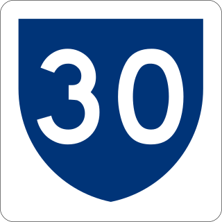
Puerto Rico Highway 30 (PR-30), known as Expreso Cruz Ortiz Stella, is a main freeway in Puerto Rico which connects the city of Caguas to the town of Humacao.

<span class="mw-page-title-main">Puerto Rico Highway 3</span> Highway in Puerto Rico

Puerto Rico Highway 3(PR-3) at nearly 100 miles long, is the second-longest highway on Puerto Rico. It connects the San Juan neighborhood of Río Piedras to downtown Salinas indirectly around the eastern coast of the island. Highway 3 ranges from a three lane urban avenue in San Juan to a one lane rural road past Fajardo. While other roads connect San Juan, it runs the coastline of Puerto Rico east of San Juan, beginning in Río Piedras near Santurce and goes to Fajardo where it goes south paralleling the coastline to Humacao and Maunabo. It goes up to a mountain-scenic route and goes west to Salinas, where it meets PR-1.

<span class="mw-page-title-main">Puerto Rico Highway 53</span> Highway in Puerto Rico

Puerto Rico Highway 53 (PR-53) or unsigned Interstate PR3 is a main tollway that is parallel to Puerto Rico Highway 3, which goes from Fajardo to Salinas. Some segments are still in planning, but when finished it will be about 58 miles (93 km) in length. Two tunnels, about 0.6 mi (1 km) long each, in the towns of Yabucoa and Maunabo were completed in October 2008. It will connect the cities of Fajardo, Ceiba, Naguabo, Humacao, Yabucoa, Maunabo, Patillas, Arroyo, Guayama and Salinas, thus bordering the entire eastern and southeastern coasts of Puerto Rico. Its northern terminus is at PR-3 and PR-194 in Fajardo, and its south terminus is at PR-52 in Salinas.

<span class="mw-page-title-main">Puerto Rico Highway 26</span> Highway in Puerto Rico

Puerto Rico Highway 26 (PR-26), called the Román Baldorioty de Castro Expressway, is the main highway to the Luis Muñoz Marín International Airport and is connected to PR-66. It was converted to a freeway to minimize the traffic in PR-3 and PR-17, to grant better access to the Airport. Several exits exist to provide access to PR-187, PR-37 and PR-22. PR-26 is 15.1 km (9.4 mi) long.

<span class="mw-page-title-main">Puerto Rico Highway 203</span> Highway in Puerto Rico

Puerto Rico Highway 203 (PR-203), also known as the Expreso Chayanne, is a highway which connects Gurabo, Puerto Rico at PR-30 with its parallel route Puerto Rico Highway 183 in San Lorenzo. It is the main route to San Lorenzo and is about 7 kilometers long. It is a dangerous highway, as steep grading is present going down and then going up.

<span class="mw-page-title-main">Puerto Rico Highway 901</span> Highway in Puerto Rico

Puerto Rico Highway 901 (PR-901) is a highway in the southeast coast of Puerto Rico which begins at its junction with PR-182 in Yabucoa and ends at its intersection with PR-760 in Manuabo.

<span class="mw-page-title-main">Puerto Rico Highway 908</span> Highway in Puerto Rico

Puerto Rico Highway 908 (PR-908) is a main highway in the city of Humacao, Puerto Rico. It begins in PR-3 as a two-lane per direction road, which ends being that way approaching University of Puerto Rico at Humacao. It intersects PR-30 just before approaching the institution. After that it becomes a rural one-lane per direction road. It goes back to PR-3, where it ends, near Yabucoa, Puerto Rico.

<span class="mw-page-title-main">Puerto Rico Highway 17</span> Highway in Puerto Rico

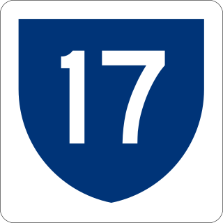
Puerto Rico Highway 17 (PR-17) is a main highway located in Carolina, San Juan and Guaynabo, Puerto Rico. It begins at PR-20 near its terminus with PR-2, and ends in the Luis Muñoz Marín International Airport in Carolina. It is known as Jesus de Piñero Avenue along its entire length.

<span class="mw-page-title-main">Puerto Rico Highway 149</span> Highway in Puerto Rico

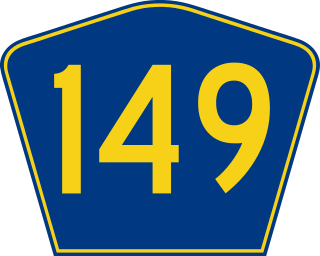
Puerto Rico Highway 149 (PR-149) is a secondary highway in Puerto Rico that connects the towns of Manatí in the north coast of Puerto Rico, from PR-22 to Juana Díaz in the south coast, ending at PR-1.

<span class="mw-page-title-main">Puerto Rico Highway 184</span> Highway in Puerto Rico

Puerto Rico Highway 184 (PR-184) is a main, rural highway that connects Patillas to Cayey, Puerto Rico, with plans to be extended to Cidra. It extends from PR-3 in Cacao Bajo to PR-1 in Beatriz.

<span class="mw-page-title-main">Puerto Rico Highway 189</span> Highway in Puerto Rico

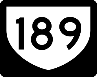
Puerto Rico Highway 189 (PR-189) is a 15 kilometres (9 mi) long main highway which parallels very closely the first half of Puerto Rico Highway 30 from Caguas, Puerto Rico near downtown to Juncos, Puerto Rico passing through all three business centers of Caguas, Gurabo and Juncos. It ends at Puerto Rico Highway 31, and has no direct intersection with Puerto Rico Highway 198 although they are not separated by more than half a kilometer.

<span class="mw-page-title-main">Puerto Rico Highway 183</span> Highway in Puerto Rico

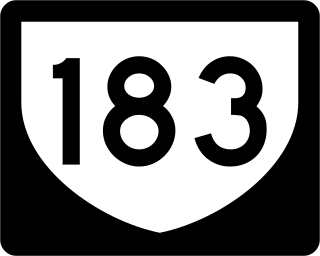
Puerto Rico Highway 183 (PR-183) is a main highway which begins in the downtown/business area of Caguas, near Puerto Rico Highway 1 and ends in Puerto Rico Highway 198 in Las Piedras. Measuring near 25 kilometers, it is real rural parallel road of Puerto Rico Highway 30, though it goes significantly south of the latter and the only municipality it does not go through which PR-30 does in Humacao.

<span class="mw-page-title-main">Puerto Rico Highway 47</span> Highway in Puerto Rico

Puerto Rico Highway 47 (PR-47), also known as Calle De Diego, is an urban road in Río Piedras, Puerto Rico.

<span class="mw-page-title-main">Puerto Rico Highway 122</span> Highway in Puerto Rico

Puerto Rico Highway 122 (PR-122) is mostly an avenue connecting downtown San Germán with Highway 2. After intersecting with Highway 166, the avenue ends and the highway becomes a narrow, rural road until its end.

<span class="mw-page-title-main">Puerto Rico Highway 506</span> Highway in Puerto Rico

Puerto Rico Highway 506 (PR-506) is a two-lane tertiary highway in Ponce, Puerto Rico. The road runs south to north, joining PR-52, where PR-506 starts, to PR-14, where it ends. Its length is 2.0 km. The road is entirely within Barrio Coto Laurel.

<span class="mw-page-title-main">Puerto Rico Highway 182</span> Highway in Puerto Rico

Puerto Rico Highway 182 (PR-182) is a primary road located entirely within the municipality of Yabucoa, Puerto Rico. The road has its northern terminus at its intersection with Puerto Rico Highway 181 in the northwestern end of the town, near San Lorenzo, and its southern terminus in downtown Yabucoa, near PR-9910 and PR-3, where it provides access to many municipal government offices.

<span class="mw-page-title-main">Puerto Rico Highway 163</span> Highway in Puerto Rico

Puerto Rico Highway 163 (PR-163) is a major two-way thoroughfare in Ponce, Puerto Rico. The road has both of its termini as well as all of its length entirely within the Ponce city limits. The road runs east to west from its eastern terminus at PR-2 in Barrio San Antón to its western terminus at PR-500 in Barrio Canas. The road has a length of 4.8 kilometers. Most of the road runs as part of Avenida Las Américas.

<span class="mw-page-title-main">Puerto Rico Highway 176</span> Highway in Puerto Rico

Puerto Rico Highway 176 (PR-176) is a main road in Cupey. It begins at its intersection with PR-175 near Carraízo Lake in Trujillo Alto and ends at PR-1 near downtown Río Piedras.

<span class="mw-page-title-main">Puerto Rico Highway 567</span> Highway in Puerto Rico

Puerto Rico Highway 567 (PR-567) is a north–south rural road located between the municipalities of Orocovis and Morovis, Puerto Rico. It extends from its junction with PR-157 on the Barros–Damián Arriba line in Orocovis, passing through Vaga, Pasto and San Lorenzo barrios until its end at its intersection with PR-145 and PR-6622 in the Torrecillas–Morovis Norte line in Morovis.

References

  1. 1 2 "Tránsito Promedio Diario (AADT)". Transit Data (Datos de Transito) (in Spanish). DTOP PR. pp. 94–95. Archived from the original on 1 April 2019.
  2. "Gurabo, Memoria Núm. 48" (PDF). Puerto Rico Planning Board (in Spanish). 1954. Retrieved 11 August 2020.
  3. "Guía de Carreteras Principales, Expresos y Autopistas". DTOP GOV PR (in Spanish).
  4. Google (27 March 2020). "PR-181 south" (Map). Google Maps . Google. Retrieved 27 March 2020.
  5. Google (27 March 2020). "PR-181 north" (Map). Google Maps . Google. Retrieved 27 March 2020.
  6. Luis F. Pumarada O’Neill (1991). "Los Puentes Históricos de Puerto Rico" (PDF) (in Spanish). pp. 109–110. Retrieved 26 March 2020.