Patillas barrio-pueblo

Last updated
Patillas barrio-pueblo
Pueblo de Patillas
Municipality Seat [1]
Casa Alcaldia, Patillas, Puerto Rico.jpg
Town Hall of Patillas
Patillas barrio-pueblo, Patillas, Puerto Rico locator map.png
Location of Patillas barrio-pueblo within the municipality of Patillas shown in red
Caribbean location map.svg
Red pog.svg
Patillas barrio-pueblo
Location of Puerto Rico
Coordinates: 18°00′33″N66°00′52″W / 18.009072°N 66.014421°W / 18.009072; -66.014421 [2]
Commonwealth Flag of Puerto Rico.svg  Puerto Rico
Municipality Flag of Patillas.svg Patillas
Area
[2]
  Total0.49 sq mi (1.3 km2)
  Land0.49 sq mi (1.3 km2)
  Water0 sq mi (0 km2)
Elevation
[3]
82 ft (25 m)
Population
 (2010)
  Total2,279
  Density4,651/sq mi (1,796/km2)
 Source: 2010 Census
Time zone UTC−4 (AST)

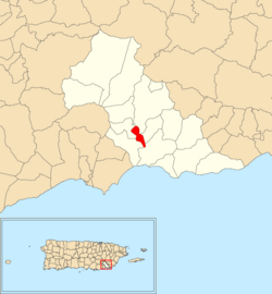
Patillas barrio-pueblo is a barrio and the administrative center (seat) of Patillas, a municipality of Puerto Rico. Its population in 2010 was 2,279. [1] [4] [5] [6]

Contents

As was customary in Spain, in Puerto Rico, the municipality has a barrio called pueblo which contains a central plaza, the municipal buildings (city hall), and a Catholic church. Fiestas patronales (patron saint festivals) are held in the central plaza every year. [7] [8]

The central plaza and its church

The central plaza, or square, is a place for official and unofficial recreational events and a place where people can gather and socialize from dusk to dawn. The Laws of the Indies, Spanish law, which regulated life in Puerto Rico in the early 19th century, stated the plaza's purpose was for "the parties" (celebrations, festivities) (Spanish : a propósito para las fiestas), and that the square should be proportionally large enough for the number of neighbors (Spanish : grandeza proporcionada al número de vecinos). These Spanish regulations also stated that the streets nearby should be comfortable portals for passersby, protecting them from the elements: sun and rain. [7]

Located across the central plaza in Patillas barrio-pueblo is the Parroquia Inmaculado Corazón de María (English: Immaculate Heart of Mary Parish), a Roman Catholic church. The first church was inaugurated in 1811. Its replacement built in 1848 was destroyed by the San Felipe Segundo hurricane in 1928. Designed by Francisco Porrata Dora, the church which stands there now was constructed in the 1930s. In 1995, the church was remodeled with lateral extensions. [9]

History

The barrio was in Spain's gazetteers [10] until Puerto Rico was ceded by Spain in the aftermath of the Spanish–American War under the terms of the Treaty of Paris of 1898 and became an unincorporated territory of the United States. In 1899, the United States Department of War conducted a census of Puerto Rico finding that the population of Pueblo was 1,590. [11]

Historical population
CensusPop.Note
1900 1,590
1910 2,22840.1%
1920 1,693−24.0%
1930 2,03320.1%
1940 2,27211.8%
1950 2,237−1.5%
1960 1,888−15.6%
1980 1,126
1990 948−15.8%
2000 701−26.1%
2010 2,279225.1%
U.S. Decennial Census
1899 (shown as 1900) [12] 1910-1930 [13]
1930-1950 [14] 1980-2000 [15] 2010 [16]

In July 2020, Federal Emergency Management Agency appropriated funds for repairs to Patillas' plaza. [17]

Sectors

Barrios (which are, in contemporary times, roughly comparable to minor civil divisions) [6] in turn are further subdivided into smaller local populated place areas/units called sectores (sectors in English). The types of sectores may vary, from normally sector to urbanización to reparto to barriada to residencial, among others. [18] [19] [20]

The following sectors are in Patillas barrio-pueblo: [21]

Residencial Villa del Caribe, Urbanización Jardines de Patillas, Urbanización Jardines del Mamey, Urbanización Joseira, Urbanización Mariani, Urbanización Melissa, Urbanización Parque del Sol, Urbanización San Benito, Urbanización San Martín, and Urbanización Villas de Patillas.

See also

Related Research Articles

<span class="mw-page-title-main">Guaynabo barrio-pueblo</span> Historical and administrative center (seat) of Guaynabo, Puerto Rico

Guaynabo barrio-pueblo is a barrio and the administrative center (seat) of Guaynabo, a municipality of Puerto Rico. Its population in 2010 was 4,008.

<span class="mw-page-title-main">Dorado barrio-pueblo</span> Historical and administrative center (seat) of Dorado, Puerto Rico

Dorado barrio-pueblo is a barrio and the administrative center (seat) of Dorado, a municipality of Puerto Rico. Its population in 2010 was 780. It is one of the six barrios in the municipality of Dorado, Puerto Rico, along with Espinosa, Higuillar, Maguayo, Mameyal and Río Lajas.

<span class="mw-page-title-main">Añasco barrio-pueblo</span> Historical and administrative center (seat) of Añasco, Puerto Rico

Añasco barrio-pueblo is a barrio-pueblo and the administrative center (seat) of Añasco, a municipality of Puerto Rico. Its population in 2010 was 912.

<span class="mw-page-title-main">Comerío barrio-pueblo</span> Historical and administrative center (seat) of Comerío, Puerto Rico

Comerío barrio-pueblo is a barrio and the administrative center (seat) of Comerío, a municipality of Puerto Rico. Its population in 2010 was 3,657.

<span class="mw-page-title-main">San Sebastián barrio-pueblo</span> Historical and administrative center (seat) of San Sebastián, Puerto Rico

San Sebastián barrio-pueblo is a barrio and the administrative center (seat) of San Sebastián, a municipality of Puerto Rico. Its population in 2010 was 1,424.

<span class="mw-page-title-main">Ceiba barrio-pueblo</span> Historical and administrative center (seat) of Ceiba, Puerto Rico

Ceiba barrio-pueblo is a barrio and the administrative center (seat) of Ceiba, a municipality of Puerto Rico. Its population in 2010 was 3,677. As was customary in Spain, in Puerto Rico, the municipality has a barrio called pueblo which contains a central plaza, the municipal buildings, and a Catholic church. Fiestas patronales are held in the central plaza every year.

<span class="mw-page-title-main">Las Marías barrio-pueblo</span> Historical and administrative center (seat) of Las Marías, Puerto Rico

Las Marías barrio-pueblo is a barrio and the administrative center (seat) of Las Marías, a municipality of Puerto Rico. Its population in 2010 was 262.

<span class="mw-page-title-main">Hormigueros barrio-pueblo</span> Historical and administrative center (seat) of Hormigueros, Puerto Rico

Hormigueros barrio-pueblo is a barrio and the administrative center (seat) of Hormigueros, a municipality of Puerto Rico. Its population in 2010 was 1,204. There is also an Hormigueros barrio in this municipality, with a much larger population.

<span class="mw-page-title-main">Toa Alta barrio-pueblo</span> Historical and administrative center (seat) of Toa Alta, Puerto Rico

Toa Alta barrio-pueblo is a barrio and the administrative center (seat) of Toa Alta, a municipality of Puerto Rico. Its population in 2010 was 397.

<span class="mw-page-title-main">Toa Baja barrio-pueblo</span> Historical and administrative center (seat) of Toa Baja, Puerto Rico

Toa Baja barrio-pueblo is a barrio and the administrative center (seat) of Toa Baja, a municipality of Puerto Rico. Its population in 2010 was 565.

<span class="mw-page-title-main">Villalba barrio-pueblo</span> Historical and administrative center (seat) of Villalba, Puerto Rico

Villalba barrio-pueblo is a barrio and the administrative center (seat) of Villalba, a municipality of Puerto Rico. Its population in 2010 was 729.

<span class="mw-page-title-main">Yabucoa barrio-pueblo</span> Historical and administrative center (seat) of Yabucoa, Puerto Rico

Yabucoa barrio-pueblo is a barrio and the administrative center (seat) of Yabucoa, a municipality of Puerto Rico. Its population in 2010 was 2,593.

<span class="mw-page-title-main">Loíza barrio-pueblo</span> Historical and administrative center (seat) of Loíza, Puerto Rico

Loíza barrio-pueblo is a barrio and the administrative center (seat) of Loíza, a municipality of Puerto Rico. Its population in 2010 was 3,875.

<span class="mw-page-title-main">Lares barrio-pueblo</span> Historical and administrative center (seat) of Lares, Puerto Rico

Lares barrio-pueblo is a barrio and the administrative center (seat) of Lares, a municipality of Puerto Rico. Its population in 2010 was 2,690.

<span class="mw-page-title-main">Canóvanas barrio-pueblo</span> Historical and administrative center (seat) of Canóvanas, Puerto Rico

Canóvanas barrio-pueblo is a barrio and the administrative center (seat) of Canóvanas, a municipality of Puerto Rico. Its population in 2010 was 4,060.

<span class="mw-page-title-main">Quebradillas barrio-pueblo</span> Historical and administrative center (seat) of Quebradillas, Puerto Rico

Quebradillas barrio-pueblo is a barrio and the administrative center (seat) of Quebradillas, a municipality of Puerto Rico. Its population in 2010 was 3,103.

<span class="mw-page-title-main">Morovis barrio-pueblo</span> Historical and administrative center (seat) of Morovis, Puerto Rico

Morovis barrio-pueblo is a barrio and the administrative center (seat) of Morovis, a municipality of Puerto Rico. Morovis barrio-pueblo has about 12 sectors and its population in 2010 was 895.

<span class="mw-page-title-main">Naguabo barrio-pueblo</span> Historical and administrative center (seat) of Naguabo, Puerto Rico

Naguabo barrio-pueblo is a barrio and the administrative center (seat) of Naguabo, a municipality of Puerto Rico. Its population in 2010 was 1,514.

<span class="mw-page-title-main">Río Grande barrio-pueblo</span> Historical and administrative center (seat) of Río Grande, Puerto Rico

Río Grande barrio-pueblo is a barrio and the administrative center (seat) of Río Grande, a municipality of Puerto Rico. Its population in 2010 was 1,772.

<span class="mw-page-title-main">Corozal barrio-pueblo</span> Historical and administrative center (seat) of Corozal, Puerto Rico

Corozal barrio-pueblo is an urban barrio and the administrative center (seat) of Corozal, a municipality of Puerto Rico. Its population in 2010 was 2,631.

References

  1. 1 2 Puerto Rico: 2010 Population and Housing Unit Counts.pdf (PDF). U.S. Dept. of Commerce, Economics and Statistics Administration, U.S. Census Bureau. 2010.
  2. 1 2 "US Gazetteer 2019". US Census. US Government.
  3. U.S. Geological Survey Geographic Names Information System: Patillas barrio-pueblo
  4. Picó, Rafael; Buitrago de Santiago, Zayda; Berrios, Hector H. Nueva geografía de Puerto Rico: física, económica, y social, por Rafael Picó. Con la colaboración de Zayda Buitrago de Santiago y Héctor H. Berrios. San Juan Editorial Universitaria, Universidad de Puerto Rico,1969.
  5. Gwillim Law (20 May 2015). Administrative Subdivisions of Countries: A Comprehensive World Reference, 1900 through 1998. McFarland. p. 300. ISBN   978-1-4766-0447-3 . Retrieved 25 December 2018.
  6. 1 2 "US Census Barrio-Pueblo definition". factfinder.com. US Census. Archived from the original on 13 May 2017. Retrieved 5 January 2019.
  7. 1 2 Santullano, Luis A. (10 March 2019). Mirada al Caribe. Vol. 54. Colegio de Mexico. pp. 75–78. doi:10.2307/j.ctvbcd2vs.12. JSTOR   j.ctvbcd2vs.12.
  8. Pariser, Harry S. (2003). Explore Puerto Rico, Fifth Edition . San Francisco: Manatee Press. pp.  52–55. Retrieved 10 February 2019.
  9. Mari Mut, José A. (2013-08-28). Los Pueblos de Puerto Rico y Las Iglesias de Sus Plazas [The Pueblos of Puerto Rico, and the Churches of its Plazas] (PDF) (in Spanish). pp. 175–177. Archived (PDF) from the original on 2020-12-14. Retrieved 2021-03-20.
  10. "Anuario del comercio, de la industria, de la magistratura y de la administración. 1881". Biblioteca Nacional de España (in Spanish). p. 1614. Retrieved 4 April 2023.
  11. Joseph Prentiss Sanger; Henry Gannett; Walter Francis Willcox (1900). Informe sobre el censo de Puerto Rico, 1899, United States. War Dept. Porto Rico Census Office (in Spanish). Imprenta del gobierno. p.  163.
  12. "Report of the Census of Porto Rico 1899". War Department Office Director Census of Porto Rico. Archived from the original on July 16, 2017. Retrieved September 21, 2017.
  13. "Table 3-Population of Municipalities: 1930 1920 and 1910" (PDF). United States Census Bureau. Archived (PDF) from the original on August 17, 2017. Retrieved September 21, 2017.
  14. "Table 4-Area and Population of Municipalities Urban and Rural: 1930 to 1950" (PDF). United States Census Bureau. Archived (PDF) from the original on August 30, 2015. Retrieved September 21, 2014.
  15. "Table 2 Population and Housing Units: 1960 to 2000" (PDF). United States Census Bureau. Archived (PDF) from the original on July 24, 2017. Retrieved September 21, 2017.
  16. Puerto Rico: 2010 Population and Housing Unit Counts.pdf (PDF). U.S. Dept. of Commerce Economics and Statistics Administration U.S. Census Bureau. 2010. Archived (PDF) from the original on 2017-02-20. Retrieved 2019-08-02.
  17. "FEMA Approves Funds to Repair PR Town Squares". Hudson Valley Press. 2020-07-08. Retrieved 2021-09-23.
  18. "Agencia: Oficina del Coordinador General para el Financiamiento Socioeconómico y la Autogestión (Proposed 2016 Budget)". Puerto Rico Budgets (in Spanish). Retrieved 28 June 2019.
  19. Rivera Quintero, Marcia (2014), El vuelo de la esperanza: Proyecto de las Comunidades Especiales Puerto Rico, 1997-2004 (first ed.), San Juan, Puerto Rico Fundación Sila M. Calderón, ISBN   978-0-9820806-1-0
  20. "Leyes del 2001". Lex Juris Puerto Rico (in Spanish). Retrieved 24 June 2020.
  21. "PRECINTO ELECTORAL Patillas 091" (PDF). Comisión Estatal de Elecciones (in Spanish). Junta de Planificación - Gobierno de Puerto Rico. 22 September 2020. Retrieved 4 January 2021.