Pueblos in Puerto Rico

Last updated

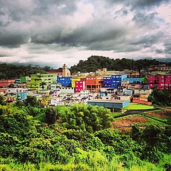
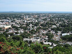
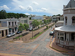
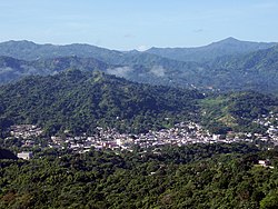
Pueblo is a term primarily used in Puerto Rico to refer to the municipal district ( barrio ) that serves as the administrative, historic and cultural center of a municipality. The concept of pueblo is often used locally as analogous to the concept of downtown in U.S. cities. [1] Pueblos are officially called barrio-pueblo by the United States Census since 1990. [2]

Contents

Overview

City hall building of the former municipality of Rio Piedras. Antigua Casa Alcaldia de Rio Piedras.jpg
City hall building of the former municipality of Río Piedras.

The Spanish word pueblo [3] translates to town in English, since many of these correspond to the original European-founded settlements in their respective contemporary municipalities; however, its usage in Puerto Rican Spanish today corresponds more closely to the concept of downtown in English. [4] [5] In some cases, the concept of pueblo might also refer to municipality, but the term municipality never applies to pueblos. [1] With a few exceptions, the barrio-pueblo is also the historic district of the municipality and usually contains the main town square ( plaza , and in some cases, plaza de armas ) surrounded by the municipal administrative buildings ( alcaldía ) and the main Catholic church in town (either a cathedral or parish church). [2]

The central plaza or square, is a place for official and unofficial recreational events and a place where people can gather and socialize. The Laws of the Indies, the Spanish law which regulated life in Puerto Rico in the early 19th century, stated the plaza's purpose was for celebrations and festivities (Spanish : a propósito para las fiestas), most notably the town patron saint festivals (fiestas patronales), and that the square should be proportionally large enough for the number of neighbors (Spanish : grandeza proporcionada al número de vecinos). These Spanish regulations also stated that the streets nearby should be comfortable portals for passersby, protecting them from the elements: sun and rain. [6]

As of the 2010 census, Mayagüez is the most populated pueblo in Puerto Rico with a population of 26,903, while Las Marías has the lowest population with 262 inhabitants. The largest barrio-pueblo in Puerto Rico is Fajardo with a total area of 3.23 square miles, while Toa Alta is the smallest with an area of 0.03 square miles. [7]

Exceptions

Although all barrio-pueblos correspond to the administrative and downtown area of Puerto Rican municipalities, some barrios and clusters of barrios (such as in Ponce) also function and are categorized as the pueblos of their respective municipalities. The municipality of San Juan is a good example of this: the barrios Pueblo and San Juan Antiguo correspond to the pueblos of the former municipalities of Río Piedras and San Juan (pre-1951). Both of these contained a main town square or plaza de armas with a city hall and a church. When San Juan and Río Piedras merged into a single municipality in 1951, the former pueblo of Río Piedras retained its name. [8] Florida and Ponce are the two other municipalities in Puerto Rico that do not contain a designated barrio-pueblo. The exception of Florida is due to the fact that the municipality has no barrios, [9] while Ponce does not have a single designated barrio-pueblo but six barrios that correspond to the pueblo of Ponce. [10] [11]

The name of the pueblo almost always is the name as the municipality is located in. For example, the barrio-pueblo of the municipality of Caguas is also called Caguas (Pueblo de Caguas). The exception to this occurs with the island municipalities of Culebra and Vieques. Although the barrio-pueblo of Culebra is known as Culebra (Pueblo de Culebra) today, its former name used to be Dewey, [12] while the name of the barrio-pueblo of Vieques today remains Isabel II. [13] Both of these are also the main settlements of the islands they are located in.

History

1905 postcard depicting Colon Square, the main plaza of the pueblo of Mayaguez where the city hall and Catholic cathedral are located. Mayaguez - Plaza Colon.jpg
1905 postcard depicting Colón Square, the main plaza of the pueblo of Mayagüez where the city hall and Catholic cathedral are located.

Although the urban zones that today are designated as barrio-pueblo have existed since the Spanish colonization of Puerto Rico, the concept of barrio was first used in the island during the 19th century. Historians have speculated the creation of barrios as administrative units may have been related to the Puerto Rican representation at the Cortes of Cádiz. [14] All municipalities in the island had a distinct barrio officially called pueblo (this is where the contemporary usage of pueblo in Puerto Rico comes from). Many of these pueblos used to have a certain degree of autonomy and local governance in the form of councils. Today barrios and barrio-pueblos have no political autonomy, and their designation is now for statistical and municipal management purposes. In 1980, they were still referred to as pueblos on the US Census. [15] Beginning with the 1990 census, these pueblos have been officially referred to as barrio-pueblos by the United States Census Bureau. [2]

List of Pueblos

The following list includes all barrio-pueblos and equivalent barrios in Puerto Rico. [16] [17] [18] The municipality of Florida is not included in the list as it has no barrios nor barrio-pueblos. [9] Ponce today has no official barrio-pueblo designations, however six of its barrios (all given cardinal names, i.e., 'first', 'second', 'sixth') correspond to the original core equivalent to the concept of barrio-pueblo today. [10] [11] The municipality of San Juan today, originally consisted of two separate municipalities with a barrio-pueblo each: San Juan Antiguo for the municipality of San Juan, and Pueblo for the former municipality of Río Piedras. [8]

PuebloDesignationMunicipalityPop. (2010)Area (sq. mi)
Adjuntas barrio-pueblo Adjuntas 4,4060.75
Aguada barrio-pueblo Aguada 1,3240.11
Aguadilla barrio-pueblo Aguadilla 3,6270.74
Aguas Buenas barrio-pueblo Aguas Buenas 1,7110.18
Aibonito barrio-pueblo Aibonito 3,5390.8
Añasco barrio-pueblo Añasco 9120.09
Arecibo barrio-pueblo Arecibo 8,4882.62
Arroyo barrio-pueblo Arroyo 1,2060.38
Barceloneta barrio-pueblo Barceloneta 4350.04
Barranquitas barrio-pueblo Barranquitas 2,6950.77
Barrio Cuarto barrio Ponce 1,9990.17
Barrio Primero barrio Ponce 3,1750.26
Barrio Quinto barrio Ponce 5680.11
Barrio Segundo barrio Ponce 7,2130.53
Barrio Sexto barrio Ponce 3,5290.27
Barrio Tercero barrio Ponce 6680.08
Bayamón barrio-pueblo Bayamón 4,7460.64
Cabo Rojo barrio-pueblo Cabo Rojo 1,0780.1
Caguas barrio-pueblo Caguas 22,4062.67
Camuy barrio-pueblo Camuy 3,3540.95
Canóvanas barrio-pueblo Canóvanas 4,0601.25
Carolina barrio-pueblo Carolina 1,2010.08
Cataño barrio-pueblo Cataño 4,2831.05
Cayey barrio-pueblo Cayey 15,2982.45
Ceiba barrio-pueblo Ceiba 3,6770.55
Ciales barrio-pueblo Ciales 1,0090.11
Cidra barrio-pueblo Cidra 1,0640.11
Coamo barrio-pueblo Coamo 6,6850.89
Comerío barrio-pueblo Comerío 3,6570.4
Corozal barrio-pueblo Corozal 2,6310.35
Culebra barrio-pueblo Culebra 4620.22
Dorado barrio-pueblo Dorado 7800.07
Fajardo barrio-pueblo Fajardo 13,7093.23
Guánica barrio-pueblo Guánica 3,5140.98
Guayama barrio-pueblo Guayama 16,8912.47
Guayanilla barrio-pueblo Guayanilla 3,7570.54
Guaynabo barrio-pueblo Guaynabo 4,0080.59
Gurabo barrio-pueblo Gurabo 1,5090.11
Hatillo barrio-pueblo Hatillo 3,1170.84
Hormigueros barrio-pueblo Hormigueros 1,2040.23
Humacao barrio-pueblo Humacao 3,8620.64
Isabel II barrio-pueblo Vieques 1,2070.5
Isabela barrio-pueblo Isabela 7,8261.46
Jayuya barrio-pueblo Jayuya 1,2220.14
Juana Díaz barrio-pueblo Juana Díaz 3,9770.51
Juncos barrio-pueblo Juncos 2,4640.37
Lajas barrio-pueblo Lajas 5640.06
Lares barrio-pueblo Lares 2,6900.58
Las Marías barrio-pueblo Las Marías 2620.06
Las Piedras barrio-pueblo Las Piedras 1,5000.18
Loíza barrio-pueblo Loíza 3,8750.66
Luquillo barrio-pueblo Luquillo 1,0280.25
Manatí barrio-pueblo Manatí 5,7460.77
Maricao barrio-pueblo Maricao 7160.11
Maunabo barrio-pueblo Maunabo 3170.14
Mayagüez barrio-pueblo Mayagüez 26,9032.98
Moca barrio-pueblo Moca 1,7350.32
Morovis barrio-pueblo Morovis 8950.07
Naguabo barrio-pueblo Naguabo 1,5140.25
Naranjito barrio-pueblo Naranjito 1,1570.12
Orocovis barrio-pueblo Orocovis 6820.11
Patillas barrio-pueblo Patillas 2,2790.49
Peñuelas barrio-pueblo Peñuelas 1,4220.25
Pueblo (Río Piedras) barrio San Juan 8,7200.73
Quebradillas barrio-pueblo Quebradillas 3,1030.65
Rincón barrio-pueblo Rincón 9330.12
Río Grande barrio-pueblo Río Grande 1,7720.2
Sabana Grande barrio-pueblo Sabana Grande 1,5540.11
Salinas barrio-pueblo Salinas 2,4530.46
San Germán barrio-pueblo San Germán 2,6600.33
San Juan Antiguo barrio San Juan 7,0852.63
San Lorenzo barrio-pueblo San Lorenzo 2,0450.22
San Sebastián barrio-pueblo San Sebastián 1,4240.12
Santa Isabel barrio-pueblo Santa Isabel 5,1330.87
Toa Alta barrio-pueblo Toa Alta 3970.03
Toa Baja barrio-pueblo Toa Baja 5650.05
Trujillo Alto barrio-pueblo Trujillo Alto 6730.15
Utuado barrio-pueblo Utuado 5,8561.19
Vega Alta barrio-pueblo Vega Alta 1,1690.1
Vega Baja barrio-pueblo Vega Baja 8160.11
Villalba barrio-pueblo Villalba 7290.15
Yabucoa barrio-pueblo Yabucoa 2,5930.52
Yauco barrio-pueblo Yauco 3,0910.32

In pop culture

The song "Me voy pa'l pueblo" by El Trío Los Panchos sings of going to the pueblo. [19]

See also

Related Research Articles

<span class="mw-page-title-main">Caguas, Puerto Rico</span> City and municipality in Puerto Rico

Caguas is a city and municipality of Puerto Rico located in the Central Mountain Range of Puerto Rico, south of San Juan and Trujillo Alto, west of Gurabo and San Lorenzo, and east of Aguas Buenas, Cidra, and Cayey. Caguas was founded in 1775. The municipality had a population of 127,244 at the 2020 census.

<span class="mw-page-title-main">San Lorenzo, Puerto Rico</span> Town and municipality in Puerto Rico

San Lorenzo is a town and municipality of Puerto Rico located in the eastern central region, north of Patillas and Yabucoa; south of Gurabo; east of Caguas and Cayey; and west of Juncos and Las Piedras. San Lorenzo is spread over twelve barrios and San Lorenzo Pueblo. It is part of the San Juan-Caguas-Guaynabo Metropolitan Statistical Area.

<span class="mw-page-title-main">Humacao, Puerto Rico</span> City and municipality in Puerto Rico

Humacao is a city and municipality in Puerto Rico located in the eastern coast of the island, north of Yabucoa; south of Naguabo; east of Las Piedras; and west of Vieques Passage. Humacao is spread over 12 barrios and Humacao Pueblo. It is part of the San Juan-Caguas-Guaynabo Metropolitan Statistical Area.

The municipalities of Puerto Rico are the second-level administrative divisions in the Commonwealth of Puerto Rico. There are 78 such administrative divisions covering all 78 incorporated towns and cities. Each municipality is led by a mayor and divided into barrios, third-level administrative divisions, though the latter are not vested with any political authority. Every municipality is governed as stated by the Autonomous Municipalities Act of 1991, which establishes that every municipality must have an elected strong mayor with a municipal legislature as the form of government. Each legislature must be unicameral, with the number of members related to adequate representation of the total population of the municipality. In contrast to other jurisdictions, both the mayors and the municipal legislators are elected on the same date and for the same term of four years in office.

<span class="mw-page-title-main">Index of Puerto Rico–related articles</span>

The following is an alphabetical list of articles related to the Commonwealth of Puerto Rico.

<span class="mw-page-title-main">Las Piedras, Puerto Rico</span> Town and municipality in Puerto Rico

Las Piedras, is a town and municipality in east Puerto Rico located in the central eastern region of the island, north of Yabucoa; south of Canóvanas and Río Grande; east of Juncos and San Lorenzo; and west of Naguabo and Humacao. Las Piedras is spread over 7 barrios and Las Piedras Pueblo. It is part of the San Juan-Caguas-Guaynabo Metropolitan Statistical Area.

<span class="mw-page-title-main">Naguabo, Puerto Rico</span> Town and municipality in Puerto Rico

Naguabo is a town and municipality in Puerto Rico located in the east coast of the island bordered by the Vieques Passage, north of Humacao; south of Río Grande and Ceiba; and east of Las Piedras. Naguabo is spread over 8 barrios and Naguabo Pueblo. It is part of the San Juan-Caguas-Guaynabo Metropolitan Statistical Area.

<span class="mw-page-title-main">Río Piedras, Puerto Rico</span> District of San Juan, Puerto Rico

Río Piedras is a populous district of San Juan, and former town and municipality of Puerto Rico, which was merged with the municipality of San Juan in 1951. The district today is composed of various barrios such as Pueblo and Universidad. The historic town was founded in 1714 as El Roble, it was given municipality rights in 1823, and since 1903 it has been the home of the University of Puerto Rico's main campus, earning the popular name of Ciudad Universitaria today. The downtown and historic center of Río Piedras is officially known as the Pueblo barrio of the municipality of San Juan.

<span class="mw-page-title-main">Catholic Church in Puerto Rico</span> Part of the worldwide Catholic Church in communion with the Pope in Rome

The Catholic Church in Puerto Rico is part of the worldwide Catholic Church in communion with the pope in Rome. The 78 municipalities in Puerto Rico have a Catholic church which is located in the downtown area, normally across from the central plaza.

<span class="mw-page-title-main">Isabel II barrio-pueblo</span> Historical and administrative center (seat) of Vieques, Puerto Rico

Isabel II barrio-pueblo(referred to as Isabel Segunda in Spanish) is a barrio and the administrative center (seat) in the downtown area in the island-municipality of Vieques, Puerto Rico. Its population in 2010 was 1,354.

<span class="mw-page-title-main">Puerto Rico Firefighters Corps</span> Puerto Rico Fire Department

The Puerto Rico Firefighters Corps (PRFC); is the statewide fire department that provides fire protection, rescue, and protection from other hazards in the U.S. Estado Asociado Libre of Puerto Rico. It was established in 1942 under the Puerto Rico Fire Services. In addition, it offers fire protection services to all the airports under the authority of the Puerto Rico Ports Authority, Rafael Hernández Airport, and Mercedita Airport and they serve as crash rescue divisions. A separate agency, the Puerto Rico Medical Emergency Corps, provides emergency medical services to all Puerto Rico.

<span class="mw-page-title-main">Caimito, San Juan, Puerto Rico</span> Barrio of San Juan, Puerto Rico

Caimito is one of the 18 barrios of the municipality of San Juan, Puerto Rico located in the mountainous part of the municipality. With a land area of 5.41 square miles (14.0 km2), Caimito is the second largest barrio in the municipality of San Juan, Puerto Rico. In 2010 it had 21,825 inhabitants and a population density of 4,034.2 per sq.mi. Located in the southern part of San Juan, Caimito is bordered by barrios Tortugo and Quebrada Arenas to the west, by Monacillo to the north, by Cupey to the east and by the municipality of Caguas to the south.

<span class="mw-page-title-main">Cupey, San Juan, Puerto Rico</span> Barrio of San Juan, Puerto Rico

Cupey is one of the 18 barrios of the municipality of San Juan, Puerto Rico located in the mountainous area of the municipality. It is the largest barrio or district in the San Juan and the third most populous with 36,058 inhabitants according to the 2010 US Census. The territorial land area of Cupey is 7.49 square miles (19.40 km2). It is bound by the municipality of Caguas to the South, by the municipality of Trujillo Alto to the East, by the barrios of Caimito and Monacillo to the West, and by the barrios of El Cinco and Sabana Llana Sur to the North. Between 1990 and 2000 Cupey had a 17.98% increase in population, more than any other barrio in San Juan.

<span class="mw-page-title-main">Pueblo, San Juan, Puerto Rico</span> Barrio of Puerto Rico

Río Piedras Pueblo, is one of 18 barrios in the municipality of San Juan, Puerto Rico. Rio Piedras Pueblo is what used to be the urban center-barrio of the former municipality of Río Piedras until 1951, when the municipality of Rio Piedras was merged with the municipality of San Juan.

<span class="mw-page-title-main">Portugués (Ponce)</span> Barrio of Ponce, Puerto Rico

Portugués Rural or, more commonly, simply Portugués, is one of the 31 barrios in the municipality of Ponce, Puerto Rico. Along with Magueyes, Tibes, Montes Llanos, Maragüez, Machuelo Arriba, Sabanetas, and Cerrillos, Portugués is one of the municipality's eight rural interior barrios. It was founded in 1831.

The barrios of Puerto Rico are the primary legal divisions of the seventy-eight municipalities of Puerto Rico. Puerto Rico's 78 municipios are divided into geographical sections called barrios and, as of 2010, there were 902 of them. In the US Census a barrio sometimes includes a division called a comunidad or subbarrio. In Puerto Rico, barrios are composed of sectors. The types of sectors, (sectores) may vary, from normally sector to urbanización to reparto to barriada to residencial, among others.

<span class="mw-page-title-main">Culebra barrio-pueblo</span> Historical and administrative center (seat) of Culebra, Puerto Rico

Culebra barrio-pueblo or Culebra Pueblo is a barrio and the administrative center (seat) of Culebra, an island-municipality of Puerto Rico. Its population in 2010 was 462.

<span class="mw-page-title-main">Caguas barrio-pueblo</span> Historical and administrative center (seat) of Caguas, Puerto Rico

Caguas Pueblo is a barrio and downtown area that serves the administrative center (seat) of the city and municipality of Caguas, a municipality of Puerto Rico. It is bordered by the Cagüitas River to the north and located two miles southwest of the Grande de Loiza River. Its population in 2010 was 22,406.

References

  1. 1 2 Sperling, Jonathan (1990). "Census Geography in Puerto Rico. A Technical Addendum for the 1990 Census". Caribbean Studies. 23 (3/4): 111–130. ISSN   0008-6533. JSTOR   25613008.
  2. 1 2 3 José A. Mari Mut (2013-08-28). Los pueblos de Puerto Rico y las iglesias de sus plazas.
  3. Pano, José Luis (July 15, 2020). "El proyecto 'Pueblos Vivos Aragón' lanza la campaña "Es el momento de volver al pueblo'". heraldo.es (in Spanish). Retrieved February 1, 2022.
  4. History, 2000 Census of population and housing , p. 400, at Google Books, U.S. Dept. of Commerce, Economics and Statistics Administration, U.S. Census Bureau, 2009
  5. Cartographic Boundary Files. Archived 2013-05-10 at the Wayback Machine U. S. Census Bureau. Retrieved 1 December 2011.
  6. Santullano, Luis A. (10 March 2019). "La Plaza y la Calle". Mirada al Caribe. Vol. 54. Colegio de Mexico. pp. 75–78. doi:10.2307/j.ctvbcd2vs.12. JSTOR   j.ctvbcd2vs.12.
  7. United States Department of Commerce, United States Census Bureau (September 18, 2012). "2010 Census of Puerto Rico Assessment Report" (PDF). census.gov.
  8. 1 2 Picó, Rafael; Buitrago de Santiago, Zayda; Berrios, Hector H. Nueva geografía de Puerto Rico: física, económica, y social, por Rafael Picó. Con la colaboración de Zayda Buitrago de Santiago y Héctor H. Berrios. San Juan Editorial Universitaria, Universidad de Puerto Rico,1969.
  9. 1 2 Gwillim Law (20 May 2015). Administrative Subdivisions of Countries: A Comprehensive World Reference, 1900 through 1998. McFarland. p. 300. ISBN   978-1-4766-0447-3 . Retrieved 25 December 2018.
  10. 1 2 Ponce: Notas para su historia. Archived 18 June 2018 at the Wayback Machine Mariano Vidal Armstrong. Oficina Estatal de Conservacion Historica. San Juan, Puerto Rico. 1989. page 6. Accessed 19 February 2018.
  11. 1 2 Hacia un Estudio Integral de la Toponimia del Municipio de Ponce, Puerto Rico. Sunny A. Cabrera Salcedo. Ph.D. dissertation. May 1999. University of Massachusetts Amherst. Graduate School. Department of Spanish and Portuguese. Page 33.
  12. "Culebra" (in Spanish). Retrieved 2022-02-01.
  13. "Welcome to Isabel II | Vieques" . Retrieved 2022-02-01.
  14. Los alcaldes de los barrios. Archived 2014-04-13 at the Wayback Machine Rafael Torrech San Inocencio. "Barrios del Sur." El Sur a la Vista. Ponce, Puerto Rico. 16 January 2011. Retrieved 1 December 2011.
  15. "1980 Census of Population. General Population Characteristics. Puerto Rico". Internet Archive. January 14, 2022. Retrieved February 3, 2022.
  16. Bureau, US Census. "Puerto Rico". Census.gov. Retrieved 2022-02-01.
  17. El rastro de los primeros colonizadores en nuestros barrios. Archived 2018-12-26 at the Wayback Machine Rafael Torrech San Inocencio. El Sur a la Vista. Ponce, Puerto Rico. 14 November 2010. Retrieved 7 December 2011.
  18. "Población por Barrios". Programa Graduado de Demografía. Retrieved 2022-02-01.
  19. Merlos, Jessica (October 15, 2021). "Música nacional Trío Cuscatlán presenta su disco "Remembranzas del 50"". Diario El Mundo (in Spanish). Retrieved February 1, 2022.