Arroyo barrio-pueblo

Last updated
Arroyo barrio-pueblo
Pueblo de Arroyo
Municipality Seat [1]
Alcaldia de Arroyo, Arroyo-barrio pueblo, Puerto Rico.jpg
Town hall in Arroyo
Arroyo barrio-pueblo, Arroyo, Puerto Rico locator map.png
Location of Arroyo barrio-pueblo within the municipality of Arroyo shown in red
Caribbean location map.svg
Red pog.svg
Arroyo barrio-pueblo
Location of Puerto Rico
Coordinates: 17°57′47″N66°03′46″W / 17.962984°N 66.062727°W / 17.962984; -66.062727 [2]
Commonwealth Flag of Puerto Rico.svg  Puerto Rico
Municipality Flag official of Arroyo.svg Arroyo
Area
[2]
  Total0.38 sq mi (1.0 km2)
  Land0.21 sq mi (0.5 km2)
  Water0.17 sq mi (0.4 km2)
Elevation
[3]
10 ft (3 m)
Population
 (2010)
  Total1,206
  Density3,281/sq mi (1,267/km2)
 Source: 2010 Census
Time zone UTC−4 (AST)

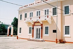
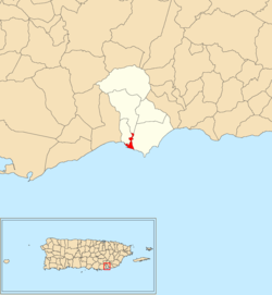
Arroyo barrio-pueblo is a barrio and the administrative center (seat) of Arroyo, a municipality of Puerto Rico. Its population in 2010 was 1,206. [4] [5] [1]

Contents

As was customary in Spain, in Puerto Rico, the municipality has a barrio called pueblo which contains a central plaza, the municipal buildings (city hall), and a Catholic church. Fiestas patronales (patron saint festivals) are held in the central plaza every year. [6] [7]

The central plaza and its church

The central plaza, or square, is a place for official and unofficial recreational events and a place where people can gather and socialize from dusk to dawn. The Laws of the Indies, Spanish law, which regulated life in Puerto Rico in the early 19th century, stated the plaza's purpose was for "the parties" (celebrations, festivities) (Spanish : a propósito para las fiestas), and that the square should be proportionally large enough for the number of neighbors (Spanish : grandeza proporcionada al número de vecinos). These Spanish regulations also stated that the streets nearby should be comfortable portals for passersby, protecting them from the elements: sun and rain. [6]

Located across the central plaza in Arroyo barrio-pueblo is the Parroquia Nuestra Señora del Carmen (Our Lady of Mount Carmel Parish). Construction of the church started in 1855 and its tower, designed by Juan Francisco Bertoli, was added in 1888. This church shares a resemblance to the parish churches in Guayama barrio-pueblo and Humacao barrio-pueblo. The church has been renovated and enlarged since its inauguration. [8]

History

Arroyo barrio-pueblo was in Spain's gazetteers [9] until Puerto Rico was ceded by Spain in the aftermath of the Spanish–American War under the terms of the Treaty of Paris of 1898 and became an unincorporated territory of the United States. In 1899, the United States Department of War conducted a census of Puerto Rico finding that the population of Arroyo Pueblo was 2,137. [10]

Historical population
CensusPop.Note
1900 2,137
1910 3,22050.7%
1920 3,025−6.1%
1930 3,3089.4%
1940 4,29029.7%
1950 4,98016.1%
1960 3,741−24.9%
1970 0−100.0%
1980 2,243
1990 1,837−18.1%
2000 1,503−18.2%
2010 1,206−19.8%
U.S. Decennial Census
1899 (shown as 1900) [11] 1910-1930 [12]
1930-1950 [13] 1980-2000 [14] 2010 [15]

In July 2020, Federal Emergency Management Agency appropriated funds for repairs to Arroyo's plaza. [16]

Places in Arroyo barrio-pueblo:

See also

Related Research Articles

<span class="mw-page-title-main">Bayamón barrio-pueblo</span> Historical and administrative center (seat) of Bayamón, Puerto Rico

Bayamón barrio-pueblo is a barrio and the administrative center (seat) of Bayamón, a municipality of Puerto Rico. Its population in 2010 was 4,746.

<span class="mw-page-title-main">Barceloneta barrio-pueblo</span> Historical and administrative center (seat) of Barceloneta, Puerto Rico

Barceloneta barrio-pueblo is a barrio and the administrative center (seat) of Barceloneta, a municipality of Puerto Rico. Its population in 2010 was 435.

<span class="mw-page-title-main">Yauco barrio-pueblo</span> Historical and administrative center (seat) of Yauco, Puerto Rico

Yauco barrio-pueblo is a barrio and the administrative center (seat) of Yauco, a municipality of Puerto Rico. Its population in 2010 was 3,091.

<span class="mw-page-title-main">Peñuelas barrio-pueblo</span> Historical and administrative center (seat) of Peñuelas, Puerto Rico

Peñuelas barrio-pueblo is a barrio and the administrative center (seat) of Peñuelas, a municipality of Puerto Rico. Its population in 2010 was 1,422.

<span class="mw-page-title-main">Hatillo barrio-pueblo</span> Historical and administrative center (seat) of Hatillo, Puerto Rico

Hatillo barrio-pueblo is a barrio and the administrative center (seat) of Hatillo, a municipality of Puerto Rico. Its population in 2010 was 3,117.

<span class="mw-page-title-main">Camuy barrio-pueblo</span> Historical and administrative center (seat) of Camuy, Puerto Rico

Camuy barrio-pueblo is a barrio and the administrative center (seat) of Camuy, a municipality of Puerto Rico. Its population in 2010 was 3,354.

<span class="mw-page-title-main">Guayanilla barrio-pueblo</span> Historical and administrative center (seat) of Guayanilla, Puerto Rico

Guayanilla barrio-pueblo is an urban barrio and the administrative center (seat) of Guayanilla, a municipality of Puerto Rico. Its population in 2010 was 3,757.

<span class="mw-page-title-main">Maricao barrio-pueblo</span> Historical and administrative center (seat) of Maricao, Puerto Rico

Maricao barrio-pueblo is a barrio and the administrative center (seat) of Maricao, a municipality of Puerto Rico. Its population in 2010 was 716.

<span class="mw-page-title-main">Moca barrio-pueblo</span> Historical and administrative center (seat) of Moca, Puerto Rico

Moca barrio-pueblo is a barrio and the administrative center (seat) of Moca, a municipality of Puerto Rico. Its population in 2010 was 1,735.

<span class="mw-page-title-main">Salinas barrio-pueblo</span> Historical and administrative center (seat) of Salinas, Puerto Rico

Salinas barrio-pueblo is a barrio and the administrative center (seat) of Salinas, a municipality of Puerto Rico. Its population in 2010 was 2,453.

<span class="mw-page-title-main">Santa Isabel barrio-pueblo</span> Historical and administrative center (seat) of Santa Isabel, Puerto Rico

Santa Isabel barrio-pueblo is a barrio and the administrative center (seat) of Santa Isabel, a municipality of Puerto Rico. Its population in 2010 was 5,133.

<span class="mw-page-title-main">Juncos barrio-pueblo</span> Historical and administrative center (seat) of Juncos, Puerto Rico

Juncos barrio-pueblo is a barrio and the administrative center (seat) of Juncos, a municipality of Puerto Rico. Its population in 2010 was 2,464.

<span class="mw-page-title-main">Cayey barrio-pueblo</span> Historical and administrative center (seat) of Cayey, Puerto Rico

Cayey barrio-pueblo is a barrio and the administrative center (seat) of Cayey, a municipality of Puerto Rico. Its population in 2010 was 15,298.

<span class="mw-page-title-main">Guayama barrio-pueblo</span> Historical and administrative center (seat) of Guayama, Puerto Rico

Guayama barrio-pueblo is a barrio and the administrative center (seat) of Guayama, a municipality of Puerto Rico. Its population in 2010 was 16,891.

<span class="mw-page-title-main">Juana Díaz barrio-pueblo</span> Historical and administrative center (seat) of Juana Díaz, Puerto Rico

Juana Díaz barrio-pueblo is a barrio and the administrative center (seat) of Juana Díaz, a municipality of Puerto Rico. Its population in 2010 was 3,977.

<span class="mw-page-title-main">Lajas barrio-pueblo</span> Historical and administrative center (seat) of Lajas, Puerto Rico

Lajas barrio-pueblo is a barrio and the administrative center (seat) of Lajas, a municipality of Puerto Rico. Its population in 2010 was 564.

<span class="mw-page-title-main">Las Piedras barrio-pueblo</span> Historical and administrative center (seat) of Las Piedras, Puerto Rico

Las Piedras barrio-pueblo is a barrio and the administrative center (seat) of Las Piedras, a municipality of Puerto Rico. Its population in 2010 was 1,500.

<span class="mw-page-title-main">Manatí barrio-pueblo</span> Historical and administrative center (seat) of Manatí, Puerto Rico

Manatí barrio-pueblo is a barrio and the administrative center (seat) of Manatí, a municipality of Puerto Rico. Its population in 2010 was 5,746. Manatí barrio-pueblo is where the central plaza, the municipal buildings, and a Catholic church are located.

<span class="mw-page-title-main">Trujillo Alto barrio-pueblo</span> Historical and administrative center (seat) of Trujillo Alto, Puerto Rico

Trujillo Alto barrio-pueblo is a barrio and the administrative center (seat) of Trujillo Alto, a municipality of Puerto Rico. Its population in 2010 was 673.

<span class="mw-page-title-main">Luquillo barrio-pueblo</span> Historical and administrative center (seat) of Luquillo, Puerto Rico

Luquillo barrio-pueblo is a barrio and the administrative center (seat) of Luquillo, a municipality of Puerto Rico. Its population in 2010 was 1,028.

References

  1. 1 2 Puerto Rico: 2010 Population and Housing Unit Counts.pdf (PDF). U.S. Dept. of Commerce, Economics and Statistics Administration, U.S. Census Bureau. 2010.
  2. 1 2 "US Gazetteer 2019". US Census. US Government.
  3. U.S. Geological Survey Geographic Names Information System: Arroyo barrio-pueblo
  4. Picó, Rafael; Buitrago de Santiago, Zayda; Berrios, Hector H. Nueva geografía de Puerto Rico: física, económica, y social, por Rafael Picó. Con la colaboración de Zayda Buitrago de Santiago y Héctor H. Berrios. San Juan Editorial Universitaria, Universidad de Puerto Rico,1969.
  5. Gwillim Law (20 May 2015). Administrative Subdivisions of Countries: A Comprehensive World Reference, 1900 through 1998. McFarland. p. 300. ISBN   978-1-4766-0447-3 . Retrieved 25 December 2018.
  6. 1 2 Santullano, Luis A. (10 March 2019). Mirada al Caribe. Vol. 54. Colegio de Mexico. pp. 75–79. doi:10.2307/j.ctvbcd2vs.12. JSTOR   j.ctvbcd2vs.12.
  7. Pariser, Harry S. (2003). Explore Puerto Rico, Fifth Edition . San Francisco: Manatee Press. pp.  52–55. Retrieved 10 February 2019.
  8. Mari Mut, José A. (2013-08-28). Los Pueblos de Puerto Rico y Las Iglesias de Sus Plazas [The Pueblos of Puerto Rico, and the Churches of its Plazas] (PDF) (in Spanish). pp. 31–33. Archived (PDF) from the original on 2020-12-14. Retrieved 2021-05-16.
  9. "Anuario del comercio, de la industria, de la magistratura y de la administración. 1881". Biblioteca Nacional de España (in Spanish). p. 1614. Retrieved 4 April 2023.
  10. Joseph Prentiss Sanger; Henry Gannett; Walter Francis Willcox (1900). Informe sobre el censo de Puerto Rico, 1899, United States. War Dept. Porto Rico Census Office (in Spanish). Imprenta del gobierno. p.  162.
  11. "Report of the Census of Porto Rico 1899". War Department Office Director Census of Porto Rico. Archived from the original on July 16, 2017. Retrieved September 21, 2017.
  12. "Table 3-Population of Municipalities: 1930 1920 and 1910" (PDF). United States Census Bureau. Archived (PDF) from the original on August 17, 2017. Retrieved September 21, 2017.
  13. "Table 4-Area and Population of Municipalities Urban and Rural: 1930 to 1950" (PDF). United States Census Bureau. Archived (PDF) from the original on August 30, 2015. Retrieved September 21, 2014.
  14. "Table 2 Population and Housing Units: 1960 to 2000" (PDF). United States Census Bureau. Archived (PDF) from the original on July 24, 2017. Retrieved September 21, 2017.
  15. Puerto Rico: 2010 Population and Housing Unit Counts.pdf (PDF). U.S. Dept. of Commerce Economics and Statistics Administration U.S. Census Bureau. 2010. Archived (PDF) from the original on 2017-02-20. Retrieved 2019-08-02.
  16. "FEMA Approves Funds to Repair PR Town Squares". Hudson Valley Press. 2020-07-08. Retrieved 2021-09-23.