Guaynabo barrio-pueblo is a barrio and the administrative center (seat) of Guaynabo, a municipality of Puerto Rico. Its population in 2010 was 4,008.[1][4][5][6]
As was customary in Spain, in Puerto Rico, the municipality has a barrio called pueblo which contains a central plaza, the municipal buildings (city hall), and a Catholic church. Fiestas patronales (patron saint festivals) are held in the central plaza every year.[7][8]
U.S. Decennial Census 1899 (shown as 1900)[9] 1910-1930[10] 1930-1950[11] 1980-2000[12] 2010[13]
The central plaza and its church
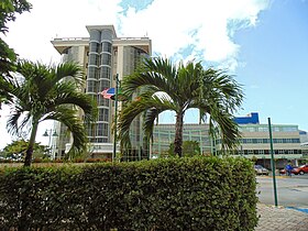
Central plaza of Guaynabo
The central plaza, or square, is a place for official and unofficial recreational events and a place where people can gather and socialize from dusk to dawn. The Laws of the Indies, Spanish law, which regulated life in Puerto Rico in the early 19th century, stated the plaza's purpose was for "the parties" (celebrations, festivities) (Spanish: a propósito para las fiestas), and that the square should be proportionally large enough for the number of neighbors (Spanish: grandeza proporcionada al número de vecinos). These Spanish regulations also stated that the streets nearby should be comfortable portals for passersby, protecting them from the elements: sun and rain.[7]
Located across the central plaza in Guaynabo barrio-pueblo is the Parroquia San Pedro Mártir, a Roman Catholic church.[14]
Barrios (which are, in contemporary times, roughly comparable to minor civil divisions)[6] in turn are further subdivided into smaller local populated place areas/units called sectores (sectors in English). The types of sectores may vary, from normally sector to urbanización to reparto to barriada to residencial, among others.[18][19][20]
The following sectors are in Guaynabo barrio-pueblo:[21][22]
Barriada Fuentes, Barrio Frailes Llano, Condominios Altos Reales, Condominios Balcones de Guaynabo, Condominios Balcones de San Pedro, Condominios Chalets del Parque, Condominios Monte Mayor, Condominios Murano Luxury Apartments, Condominios Palmar del Río, Condominios Parque Real, Condominios Plaza del Palmar, Condominios Portal de Sofía, Condominios Villas de Guaynabo, Hogar Golden Retirement, Reparto Piñeiro, Residencial Jardines de Guaynabo, Residencial Villas de Mabó, Sector Cubita, Sector Guzmán, Sector Honduras, Sector Marrero, Urbanización Colimar, Urbanización Colinas Metropolitanas, Urbanización Estancias Reales, Urbanización Mansiones de Guaynabo, Urbanización Mansiones Reales, Urbanización Palma Real, Urbanización Quintas Reales, Urbanización Reparto Esperanza, and Urbanización Villas Reales.
Gallery
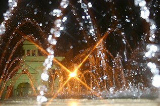
The fountain at the Central Plaza of Guaynabo at night
↑ Rivera Quintero, Marcia (2014), El vuelo de la esperanza: Proyecto de las Comunidades Especiales Puerto Rico, 1997-2004 (firsted.), San Juan, Puerto Rico Fundación Sila M. Calderón, ISBN978-0-9820806-1-0
↑ "Leyes del 2001". Lex Juris Puerto Rico (in Spanish). Archived from the original on 14 September 2018. Retrieved 24 June 2020.
↑ "PRECINTO ELECTORAL GUAYNABO 006"(PDF). Comisión Estatal de Elecciones (in Spanish). PR Government. 21 May 2019. Archived(PDF) from the original on 15 June 2020. Retrieved 20 July 2020.
↑ "PRECINTO ELECTORAL GUAYNABO 007"(PDF). Comisión Estatal de Elecciones (in Spanish). PR Government. 14 January 2019. Archived(PDF) from the original on 15 June 2020. Retrieved 20 July 2020.
This page is based on this Wikipedia article Text is available under the CC BY-SA 4.0 license; additional terms may apply. Images, videos and audio are available under their respective licenses.