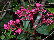
List of endemic flora of Puerto Rico

Last updated

Map of the ecosystems of Puerto Rico Puerto Rico ecosystems map-en.jpg
Map of the ecosystems of Puerto Rico

This is a list of the endemic flora of Puerto Rico . This list is sorted in alphabetical order by binomial names. Common names are in parentheses.

Contents

Apocynaceae

Aquifoliaceae

Araliaceae

Asclepiadaceae

Asteraceae

Begoniaceae

Bignoniaceae

Boraginaceae

Bromeliaceae

Buxaceae

Cactaceae

Harrisia portoricensis on Mona Island Higo Chumbo fruit (5840524148).jpg
Harrisia portoricensis on Mona Island

Campanulaceae

Canellaceae

Celastraceae

Clusiaceae

Cyatheaceae

Cyperaceae

Ebenaceae

Ericaceae

Euphorbiaceae

Fabaceae

Flacourtiaceae

Gesneriaceae

Icacinaceae

Lauraceae

Loranthaceae

Magnoliaceae

Malpighiaceae

Malvaceae

Marcgraviaceae

Melastomataceae

Meliaceae

Moraceae

Myrtaceae

Nyctaginaceae

Orchidaceae

Passifloraceae

Passiflora tulae Passiflora tulae1.jpg
Passiflora tulae

Phyllanthaceae

Piperaceae

Poaceae

Polygalaceae

Polygonaceae

Polypodiales

Rhamnaceae

Rubiaceae

Salicaceae

Sapindaceae

Sapotaceae

Schizaeaceae

Schoepfiaceae

Selaginellaceae

Simaroubaceae

Simarouba tulae Simarouba tulae.jpg
Simarouba tulae

Solanaceae

Styracaceae

Ternstroemiaceae

Thymelaeaceae

Urticaceae

Verbenaceae

Zamiaceae

See also

Notes

  1. 1 2 "There has much disagreement with respect to the number of Zamia species recognized in Puerto Rico and the West Indies. In a detailed study of leaf morphology, based on herbarium species, Eckenwalder (1980) found a continuous gradation in foliar characteristics throughout the West Indies, concluding that Zamia was represented in the West Indies by two subspecies of Z. pumila. Accordingly, all native populations in Puerto Rico are Z. pumila ssp. pumila. A contrasting view is presented by Stephenson (1987) where four species are recognized in Puerto Rico based on foliar and strobili characters desrived from herbarium specimens and live plants. For the most part..., the present authors follow Stephenson's opinion, realising that further work is needed (DNA sequencing) in order to confirm or reject his assessment." Acevedo-Rodriguez, P. and M.T. Strong. 2005. Zamiaceae. In Acevedo-Rodriguez, P. and M.T. Strong (eds.) Monocotyledons and Gymnosperms of Puerto Rico and the Virgin Islands. Contributions from the United States National Herbarium volume 52.

Related Research Articles

<span class="mw-page-title-main">El Yunque National Forest</span> Rainforest near Río Grande, Puerto Rico

El Yunque National Forest, formerly known as the Caribbean National Forest, is a forest located in northeastern Puerto Rico. While there are both temperate and tropical rainforests in other states and territories, it is the only tropical rainforest in the United States National Forest System and the United States Forest Service. El Yunque National Forest is located on the slopes of the Sierra de Luquillo mountains, encompassing more than 28,000 acres of land, making it the largest block of public land in Puerto Rico.

<i>Zamia</i> Genus of cycads in the family Zamiaceae

Zamia is a genus of cycad of the family Zamiaceae, native to North America from the United States throughout the West Indies, Central America, and South America as far south as Bolivia. The genus is considered to be the most ecologically and morphologically diverse of the cycads, and is estimated to have originated about 68.3 million years ago.

<span class="mw-page-title-main">Puerto Rican amazon</span> Parrot endemic to the archipelago of Puerto Rico

The Puerto Rican amazon, also known as the Puerto Rican parrot or Iguaca (Taíno), is the only extant parrot endemic to the archipelago of Puerto Rico, and belongs to the Neotropical genus Amazona. Measuring 28–30 cm (11.0–11.8 in), the bird is a predominantly green parrot with a red forehead and white rings around the eyes. Its closest relatives are believed to be the Cuban amazon and the Hispaniolan amazon.

<span class="mw-page-title-main">Cordillera Central (Puerto Rico)</span> Main mountain range in Puerto Rico

The Cordillera Central is the only mountain range in the main island of Puerto Rico, consisting of three subranges: the central Cordillera Central, the southeastern Sierra de Cayey, and the northeastern Sierra de Luquillo. Bordered by the extensive Northern Karst Belt in the northwest and discontinuos, narrow costal plains in the north and south, the numerous ridges and foothills of the three subranges combined extend throughout the island. Concentrated in the central region of the island from west to east, the eponymous main subrange of Cordillera Central originates in the municipality of Mayagüez and merges with the Sierra de Cayey subrange on the town boundary between the municipalities of Barranquitas and Aibonito. At 1,338 meters on the town line between Ponce and Jayuya, Cerro de Punta is the summit of the Cordillera Central and the highest point in Puerto Rico.

Stenostomum portoricense, synonym Antirhea portoricensis, is a species of plant in the family Rubiaceae. It is endemic to Puerto Rico.

<span class="mw-page-title-main">El Toro Wilderness</span> National Wilderness Preservation System in Puerto Rico

El Toro Wilderness is a 10,254-acre (41.5 km2) federally designated National Wilderness Preservation System unit located within El Yunque National Forest on the Sierra de Luquillo in eastern Puerto Rico. El Toro, named after the highest peak in the forest at 3,524 feet (1,074 m), is the only tropical wilderness in the United States National Forest System. It was created in 2005 by the Caribbean National Forest Act of 2005.

<span class="mw-page-title-main">Northeast Ecological Corridor</span> Protected Nature Reserve in Puerto Rico

The Northeast Ecological Corridor Nature Reserve (NECNR) refers to an area designated as a protected Nature Reserve located on the northeast coast of Puerto Rico, between the municipalities of Luquillo and Fajardo. Specifically, the lands that comprise the NEC are located between Luquillo's town square to the west and Seven Seas Beach to the east, being delineated by PR Route # 3 to its south and the Atlantic Ocean to its north. It was decreed as a protected area by former Puerto Rico Governor Aníbal S. Acevedo-Vilá in April 2008, a decision reversed by Governor Luis G. Fortuño-Burset in October 2009, although he later passed a law in June 2012 re-designated as nature reserve two-thirds of its lands, after intense lobbying and public pressure. Later, in 2013, Governor Alejandro García-Padilla signed a law declaring all lands within the NEC a nature reserve. The area comprises 2,969.64 acres, which include such diverse habitats as forest, wetlands, beaches, coral communities, and a sporadically bioluminescent lagoon. The Corridor is also home to 866 species of flora and fauna, of which 54 are considered critical elements, meaning rare, threatened, endangered and endemic species classified by the Puerto Rico Department of Natural and Environmental Resources (DNER), some even designated as critically endangered by the International Union for Conservation of Nature and Natural Resources (IUCN). These include, among others, federally endangered species such as the plain pigeon, the snowy plover, the Puerto Rican boa, the hawksbill sea turtle and the West Indian manatee. The beaches along the NEC, which are 8.74 kilometers long are important nesting grounds for the leatherback sea turtle, which starts its nesting season around April each year.

The flora of the Dominican Republic is diverse.

A. portoricensis may refer to:

<span class="mw-page-title-main">Reserva Natural Punta Cucharas</span> Nature reserve in Ponce, Puerto Rico

Reserva Natural Punta Cucharas is a nature reserve in Barrio Canas, Ponce, Puerto Rico. It consists of both a land area component as well as an offshore marine area. The land component has an area of 698 cuerdas while the marine component has an expanse of 3,516 cuerdas, for a total area of 4,214 cuerdas. The Reserve consists of mangrove ecosystems, coastal sand dunes, a saline lagoon known as Laguna Las Salinas, open water, and a century-old local community. The lagoon occupies and area of 347,898 m2 Ecological protection is managed and enforced by the Puerto Rico Department of Natural and Environmental Resources. Eight activities are allowed at the Reserve: scuba diving, boating, fishing, hiking, sun bathing, photography, bird watching and canoeing. Activities prohibited are: Camping, crabbing/trapping, horseback riding, water crafting, and hunting. Pets, ATVs, and fireplaces are also prohibited.

<span class="mw-page-title-main">Carite State Forest</span> Forest in southeastern Puerto Rico

Carite State Forest is a state forest and nature reserve located in the Sierra de Cayey mountain range in southeastern Puerto Rico. The forest extends over approximately 2,600 hectares and is located in the municipalities of Caguas, Cayey, Guayama, Patillas and San Lorenzo. The forest is located along the Ruta Panorámica, which offers access to the forest.

<span class="mw-page-title-main">La Robleda Natural Protected Area</span> 254-acre protected area in Cayey, Puerto Rico

La Robleda Natural Protected Area is a 254-acre protected natural area and conservation easement in Cayey, Puerto Rico. La Robleda, meaning 'the oak grove', gets its name from the high concentration of pink manjack trees, locally known as roble blanco, in the area. The pink manjack trees in this nature reserve bloom for a few weeks every year, creating a natural scenic spectacle of pink and white colors in the Sierra de Cayey.

<span class="mw-page-title-main">Punta Guaniquilla</span> Protected area in Puerto Rico

Punta Guaniquilla is a headland or small peninsula located immediately to the south of Buyé Beach and north of Boquerón Bay in the municipality of Cabo Rojo, Puerto Rico. The entirety of the headland is protected as the Punta Guaniquilla Nature Reserva by the Conservation Trust of Puerto Rico and the Puerto Rico Department of Natural and Environmental Resources since 1977, making it one of the oldest nature reserves officially protected by Puerto Rico Law #150.

References

  1. Known only from the summit of Cerro Mariquita in the Sierra Bermeja. .
  2. Known only from the summit of Cerro Mariquita in the Sierra Bermeja. .
  3. Francis, John K. and Lowe, Carol A. 2000. Bioecología de Arboles Nativos y Exóticos de Puerto Rico y los Indias Occidentales. USDA Forest Service International Institute of Tropical Forestry General Technical Report IITF-15
  4. Calliandra locoensis
  5. Puerto Rico's national flower.
  6. The records for this species are questionable
  7. This species was formerly classified as Clidemia portoricensis and Clidemia pusilliflora .
  8. A federally listed endangered species.
  9. 1 2 3 4 5 Ackerman, James D. (30 June 1995). "An orchid flors of Puerto Rico and the Virgin Islands". Memoirs of the New York Botanical Garden. 73.
  10. A federally listed endangered species.
  11. Formerly Encylcis krugii and Epidendrum krugii
  12. Lioger & Martorell, 2000, Flora of Puerfto Rico and adjacent islands: a systematic synopsis, 2nd ed., Edit. Univ. Puerto Rico, San Juan, Puerto Rico
  13. Luer, C. A. 2002. Selbyana 23: 22. Formerly known as Lepanthes veleziana var. retusicolumna
  14. Known only from two sites in southwestern Puerto Rico
  15. Known from only two locations in southwestern Puerto Rico
  16. Known only from a single site at the Guánica Commonwealth Forest.
  17. Román Guzmán, Javier A. 2006. A study of Randia portoricensis (Urb.) Britton & Standley [Rubiaceae]: A rare species. MS Thesis, University of Puerto Rico, Mayagüez

Further reading