Gurabo barrio-pueblo

Last updated
Gurabo barrio-pueblo
Pueblo de Gurabo
Municipality seat [1]
2021pueblodegurabo1.jpg
Museo del Deporte in Gurabo barrio-pueblo
Gurabo barrio-pueblo, Gurabo, Puerto Rico locator map.png
Location of Gurabo barrio-pueblo within the municipality of Gurabo shown in red
Caribbean location map.svg
Red pog.svg
Gurabo barrio-pueblo
Location of Puerto Rico
Coordinates: 18°15′20″N65°58′22″W / 18.255578°N 65.972889°W / 18.255578; -65.972889 [2]
Commonwealth Flag of Puerto Rico.svg  Puerto Rico
Municipality Flag of Gurabo.svg Gurabo
Area
[2]
  Total0.11 sq mi (0.3 km2)
  Land0.11 sq mi (0.3 km2)
  Water0 sq mi (0 km2)
Elevation
[3]
177 ft (54 m)
Population
 (2010)
  Total1,509
  Density13,718.2/sq mi (5,296.6/km2)
 Source: 2010 Census
Time zone UTC−4 (AST)
ZIP Code
00778

Gurabo barrio-pueblo is a barrio and the administrative center (seat) of Gurabo, a municipality of Puerto Rico. Its population in 2010 was 1,509. [1] [4] [5] [6]

Contents

As was customary in Spain, in Puerto Rico, the municipality has a barrio called pueblo which contains a central plaza, the municipal buildings (city hall), and a Catholic church. Fiestas patronales (patron saint festivals) are held in the central plaza every year. [7] [8]

The central plaza and its church

The central plaza, or square, is a place for official and unofficial recreational events and a place where people can gather and socialize from dusk to dawn. The Laws of the Indies, Spanish law, which regulated life in Puerto Rico in the early 19th century, stated the plaza's purpose was for "the parties" (celebrations, festivities) (Spanish : a propósito para las fiestas), and that the square should be proportionally large enough for the number of neighbors (Spanish : grandeza proporcionada al número de vecinos). These Spanish regulations also stated that the streets nearby should be comfortable portals for passersby, protecting them from the elements: sun and rain. [7]

Located across from the central plaza is the Church of San José (Parroquia San José), a Roman Catholic church which was inaugurated in 1822. Over time, the church has been damaged by hurricanes and repaired and remodeled. The latest restoration on the church was completed in 1989. [9]

History

Gurabo barrio-pueblo was in Spain's gazetteers [10] until Puerto Rico was ceded by Spain in the aftermath of the Spanish–American War under the terms of the Treaty of Paris of 1898 and became an unincorporated territory of the United States. In 1899, the United States Department of War conducted a census of Puerto Rico finding that the population of Gurabo Pueblo was 1,309. [11]

Demographics

Historical population
CensusPop.Note
1900 1,309
1910 2,23070.4%
1920 2,55014.3%
1930 3,46836.0%
1940 3,5692.9%
1950 4,41923.8%
1960 3,957−10.5%
1970 0−100.0%
1980 1,982
1990 1,922−3.0%
2000 1,9602.0%
2010 1,509−23.0%
U.S. Decennial Census
1899 (shown as 1900) [12] 1910-1930 [13]
1930-1950 [14] 1980-2000 [15] 2010 [16]

Sectors

Barrios (which are, in contemporary times, roughly comparable to minor civil divisions) [6] in turn are further subdivided into smaller local populated place areas/units called sectores (sectors in English). The types of sectores may vary, from normally sector to urbanización to reparto to barriada to residencial, among others. [17] [18] [19] [20] [21]

The following sectors are in Gurabo barrio-pueblo: [22] Barriada Nueva, Casco del Pueblo, El Cerro, Rabo del Buey, and Vietnam. El Cerro is famous for its steep roads and step streets, and it gives Gurabo the nickname Pueblo de las Escaleras ("town of the stairs"). [23]

See also

Related Research Articles

<span class="mw-page-title-main">Gurabo, Puerto Rico</span> Town and municipality in Puerto Rico

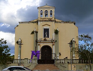
Gurabo is a town and municipality in eastern Puerto Rico. It is located in the central eastern region, north of San Lorenzo; south of Trujillo Alto; east of Caguas; and west of Carolina and Juncos. Gurabo is spread over 9 barrios and Gurabo Pueblo. It is part of the San Juan-Caguas-Guaynabo Metropolitan Statistical Area.

<span class="mw-page-title-main">Dorado barrio-pueblo</span> Historical and administrative center (seat) of Dorado, Puerto Rico

Dorado barrio-pueblo is a barrio and the administrative center (seat) of Dorado, a municipality of Puerto Rico. Its population in 2010 was 780. It is one of the six barrios in the municipality of Dorado, Puerto Rico, along with Espinosa, Higuillar, Maguayo, Mameyal and Río Lajas.

<span class="mw-page-title-main">Naranjito barrio-pueblo</span> Historical and administrative center (seat) of Naranjito, Puerto Rico

Naranjito barrio-pueblo is a barrio and the administrative center (seat) of Naranjito, a municipality of Puerto Rico. Its population in 2010 was 1,157.

<span class="mw-page-title-main">Aibonito barrio-pueblo</span> Historical and administrative center (seat) of Aibonito, Puerto Rico

Aibonito barrio-pueblo is a barrio and the administrative center (seat) of Aibonito, a municipality of Puerto Rico. Its population in 2010 was 3,539.

<span class="mw-page-title-main">Añasco barrio-pueblo</span> Historical and administrative center (seat) of Añasco, Puerto Rico

Añasco barrio-pueblo is a barrio-pueblo and the administrative center (seat) of Añasco, a municipality of Puerto Rico. Its population in 2010 was 912.

<span class="mw-page-title-main">Comerío barrio-pueblo</span> Historical and administrative center (seat) of Comerío, Puerto Rico

Comerío barrio-pueblo is a barrio and the administrative center (seat) of Comerío, a municipality of Puerto Rico. Its population in 2010 was 3,657.

<span class="mw-page-title-main">Ciales barrio-pueblo</span> Historical and administrative center (seat) of Ciales, Puerto Rico

Ciales barrio-pueblo is a barrio and the administrative center (seat) of Ciales, a municipality of Puerto Rico. Its population in 2010 was 1,009.

<span class="mw-page-title-main">Las Marías barrio-pueblo</span> Historical and administrative center (seat) of Las Marías, Puerto Rico

Las Marías barrio-pueblo is a barrio and the administrative center (seat) of Las Marías, a municipality of Puerto Rico. Its population in 2010 was 262.

<span class="mw-page-title-main">Toa Alta barrio-pueblo</span> Historical and administrative center (seat) of Toa Alta, Puerto Rico

Toa Alta barrio-pueblo is a barrio and the administrative center (seat) of Toa Alta, a municipality of Puerto Rico. Its population in 2010 was 397.

<span class="mw-page-title-main">Villalba barrio-pueblo</span> Historical and administrative center (seat) of Villalba, Puerto Rico

Villalba barrio-pueblo is a barrio and the administrative center (seat) of Villalba, a municipality of Puerto Rico. Its population in 2010 was 729.

<span class="mw-page-title-main">Rincón barrio-pueblo</span> Historical and administrative center (seat) of Rincón, Puerto Rico

Rincón barrio-pueblo is a barrio-pueblo, the administrative center (seat) of Rincón, a municipality of Puerto Rico. Its population in 2010 was 933.

<span class="mw-page-title-main">Aguadilla barrio-pueblo</span> Historical and administrative center (seat) of Aguadilla, Puerto Rico

Aguadilla barrio-pueblo is an urban barrio and the administrative center (seat) of Aguadilla, a municipality of Puerto Rico. Its population in 2010 was 3,627.

<span class="mw-page-title-main">Lares barrio-pueblo</span> Historical and administrative center (seat) of Lares, Puerto Rico

Lares barrio-pueblo is a barrio and the administrative center (seat) of Lares, a municipality of Puerto Rico. Its population in 2010 was 2,690.

<span class="mw-page-title-main">Orocovis barrio-pueblo</span> Historical and administrative center (seat) of Orocovis, Puerto Rico

Barrio Pueblo is a barrio and the administrative center (seat) of Orocovis, a municipality of Puerto Rico. Its population in 2010 was 682.

<span class="mw-page-title-main">Culebra barrio-pueblo</span> Historical and administrative center (seat) of Culebra, Puerto Rico

Culebra barrio-pueblo or Culebra Pueblo is a barrio and the administrative center (seat) of Culebra, an island-municipality of Puerto Rico. Its population in 2010 was 462.

<span class="mw-page-title-main">Quebradillas barrio-pueblo</span> Historical and administrative center (seat) of Quebradillas, Puerto Rico

Quebradillas barrio-pueblo is a barrio and the administrative center (seat) of Quebradillas, a municipality of Puerto Rico. Its population in 2010 was 3,103.

<span class="mw-page-title-main">Morovis barrio-pueblo</span> Historical and administrative center (seat) of Morovis, Puerto Rico

Morovis barrio-pueblo is a barrio and the administrative center (seat) of Morovis, a municipality of Puerto Rico. Morovis barrio-pueblo has about 12 sectors and its population in 2010 was 895.

<span class="mw-page-title-main">Río Grande barrio-pueblo</span> Historical and administrative center (seat) of Río Grande, Puerto Rico

Río Grande barrio-pueblo is a barrio and the administrative center (seat) of Río Grande, a municipality of Puerto Rico. Its population in 2010 was 1,772.

<span class="mw-page-title-main">Corozal barrio-pueblo</span> Historical and administrative center (seat) of Corozal, Puerto Rico

Corozal barrio-pueblo is an urban barrio and the administrative center (seat) of Corozal, a municipality of Puerto Rico. Its population in 2010 was 2,631.

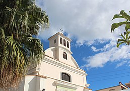
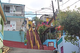
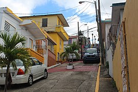
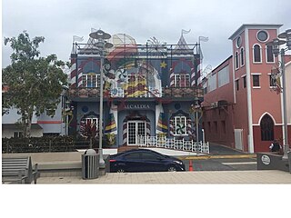
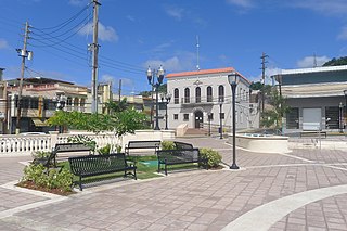
Pueblo is a term primarily used in Puerto Rico to refer to the municipal district (barrio) that serves as the administrative, historic and cultural center of a municipality. The concept of pueblo is often used locally as analogous to the concept of downtown in U.S. cities. Pueblos are officially called barrio-pueblo by the United States Census since 1990.

References

  1. 1 2 Puerto Rico: 2010 Population and Housing Unit Counts.pdf (PDF). U.S. Dept. of Commerce, Economics and Statistics Administration, U.S. Census Bureau. 2010.
  2. 1 2 "US Gazetteer 2019". US Census. US Government.
  3. U.S. Geological Survey Geographic Names Information System: Gurabo barrio-pueblo
  4. Picó, Rafael; Buitrago de Santiago, Zayda; Berrios, Hector H. Nueva geografía de Puerto Rico: física, económica, y social, por Rafael Picó. Con la colaboración de Zayda Buitrago de Santiago y Héctor H. Berrios. San Juan Editorial Universitaria, Universidad de Puerto Rico,1969.
  5. Gwillim Law (20 May 2015). Administrative Subdivisions of Countries: A Comprehensive World Reference, 1900 through 1998. McFarland. p. 300. ISBN   978-1-4766-0447-3 . Retrieved 25 December 2018.
  6. 1 2 "US Census Barrio-Pueblo definition". factfinder.com. US Census. Archived from the original on 13 May 2017. Retrieved 5 January 2019.
  7. 1 2 Santullano, Luis A. (10 March 2019). Mirada al Caribe. Vol. 54. Colegio de Mexico. pp. 75–78. doi:10.2307/j.ctvbcd2vs.12. JSTOR   j.ctvbcd2vs.12.
  8. Pariser, Harry S. (2003). Explore Puerto Rico, Fifth Edition . San Francisco: Manatee Press. pp.  52–55. Retrieved 10 February 2019.
  9. Mari Mut, José A. (2013-08-28). Los Pueblos de Puerto Rico y Las Iglesias de Sus Plazas [The Pueblos of Puerto Rico, and the Churches of its Plazas] (PDF) (in Spanish). pp. 106–108. Retrieved 2021-05-04.
  10. "Anuario del comercio, de la industria, de la magistratura y de la administración. 1881". Biblioteca Nacional de España (in Spanish). p. 1614. Retrieved 4 April 2023.
  11. Joseph Prentiss Sanger; Henry Gannett; Walter Francis Willcox (1900). Informe sobre el censo de Puerto Rico, 1899, United States. War Dept. Porto Rico Census Office (in Spanish). Imprenta del gobierno. p.  163.
  12. "Report of the Census of Porto Rico 1899". War Department Office Director Census of Porto Rico. Archived from the original on July 16, 2017. Retrieved September 21, 2017.
  13. "Table 3-Population of Municipalities: 1930 1920 and 1910" (PDF). United States Census Bureau. Archived (PDF) from the original on August 17, 2017. Retrieved September 21, 2017.
  14. "Table 4-Area and Population of Municipalities Urban and Rural: 1930 to 1950" (PDF). United States Census Bureau. Archived (PDF) from the original on August 30, 2015. Retrieved September 21, 2014.
  15. "Table 2 Population and Housing Units: 1960 to 2000" (PDF). United States Census Bureau. Archived (PDF) from the original on July 24, 2017. Retrieved September 21, 2017.
  16. Puerto Rico: 2010 Population and Housing Unit Counts.pdf (PDF). U.S. Dept. of Commerce Economics and Statistics Administration U.S. Census Bureau. 2010. Archived (PDF) from the original on 2017-02-20. Retrieved 2019-08-02.
  17. Mari Mut, José A. (28 August 2013). "Los pueblos de Puerto Rico y las iglesias de sus plazas" (in Spanish). Retrieved 19 June 2020 via archive.org.
  18. "Agencia: Oficina del Coordinador General para el Financiamiento Socioeconómico y la Autogestión (Proposed 2016 Budget)". Puerto Rico Budgets (in Spanish). Retrieved 28 June 2019.
  19. Rivera Quintero, Marcia (2014), El vuelo de la esperanza : Proyecto de las Comunidades Especiales Puerto Rico, 1997-2004 (Primera edición ed.), San Juan, Puerto Rico Fundación Sila M. Calderón, ISBN   978-0-9820806-1-0
  20. "Leyes del 2001". Lex Juris Puerto Rico (in Spanish). Retrieved 24 June 2019.
  21. "Comunidades Especiales de Puerto Rico" (in Spanish). 8 August 2011. Retrieved 24 June 2019.
  22. "PRECINTO ELECTORAL GURABO 084" (PDF). Comisión Estatal de Elecciones (in Spanish). PR Government. 21 September 2019. Retrieved 22 June 2020.
  23. "Gurabo". Discover Puerto Rico. Retrieved 2022-01-13.