Culebra barrio-pueblo

Last updated
Culebra barrio-pueblo
Pueblo de Culebra
Dewey [1]
Municipality Seat [2]
Culebra, Puerto Rico City Hall.JPG
Town Hall in Culebra barrio-pueblo
Map of Culebra highlighting Dewey (Pueblo).png
Location of Culebra barrio-pueblo within the municipality of Culebra highlighted
USA Puerto Rico location map.svg
Red pog.svg
Culebra barrio-pueblo
Location of Culebra in Puerto Rico
Coordinates: 18°18′21″N65°18′08″W / 18.305921°N 65.302173°W / 18.305921; -65.302173 [3]
Commonwealth Flag of Puerto Rico.svg  Puerto Rico
Municipality Flag of Culebra (Puerto Rico).svg Culebra
Area
[3]
  Total0.22 sq mi (0.6 km2)
  Land0.13 sq mi (0.3 km2)
  Water0.09 sq mi (0.2 km2)
Elevation
[4]
10 ft (3 m)
Population
 (2010)
  Total462
  Density3,553.8/sq mi (1,372.1/km2)
 Source: 2010 Census
Time zone UTC−4 (AST)
ZIP Code
00775

Culebra barrio-pueblo or Culebra Pueblo (English: Culebra Town, historically: Dewey) is a barrio and the administrative center (seat) of Culebra, an island-municipality of Puerto Rico. Its population in 2010 was 462. [2] [5] [6] [7]

Contents

As was customary in Spain, in Puerto Rico, the municipality has a barrio called pueblo which contains a central plaza, the municipal buildings (city hall), and a Catholic church. Fiestas patronales (patron saint festivals) are held in the central plaza every year. [8] [9]

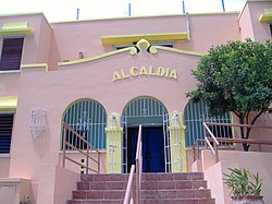
The central plaza and its church

The central plaza, or square, is a place for official and unofficial recreational events and a place where people can gather and socialize from dusk to dawn. The Laws of the Indies, Spanish law, which regulated life in Puerto Rico in the early 19th century, stated the plaza's purpose was for "the parties" (celebrations, festivities) (Spanish : a propósito para las fiestas), and that the square should be proportionally large enough for the number of neighbors (Spanish : grandeza proporcionada al número de vecinos). These Spanish regulations also stated that the streets nearby should be comfortable portals for passersby, protecting them from the elements: sun and rain. [8]

At one time, this barrio was referred to as Dewey. [1] [10]

Located across from the central plaza is the Parroquia Nuestra Señora del Carmen (English: Our Lady of Mount Carmel Parish), a Roman Catholic church. The church is made of concrete and faces east. [11]

History

Culebra barrio-pueblo was in Spain's gazetteers [12] until Puerto Rico was ceded by Spain in the aftermath of the Spanish–American War under the terms of the Treaty of Paris of 1898 and became an unincorporated territory of the United States. In 1899, the United States Department of War conducted a census of Puerto Rico finding that the population of Culebra barrio-pueblo was 206. [13]

Historical population
CensusPop.Note
1900 206
1910 38486.4%
1920 265−31.0%
1930 37742.3%
1940 47225.2%
1950 69346.8%
1960 498−28.1%
1980 849
1990 707−16.7%
2000 652−7.8%
2010 462−29.1%
U.S. Decennial Census
1899 (shown as 1900, is an estimate) [14] 1910-1930 [15]
1930-1950 [16] 1980-2000 [17] 2010 [18]

Sectors

Barrios (which are, in contemporary times, roughly comparable to minor civil divisions) [7] in turn are further subdivided into smaller local populated place areas/units called sectores (sectors in English). The types of sectores may vary, from normally sector to urbanización to reparto to barriada to comunidad to residencial, among others. [19] [20] [21]

The following sectors are in Culebra barrio-pueblo: [22]

Comunidad Clark, Sector Fulladosa, Sector Melones, Sector Sardinas I, and Sector Sardinas II.

See also

Related Research Articles

<span class="mw-page-title-main">Isabel II barrio-pueblo</span> Historical and administrative center (seat) of Vieques, Puerto Rico

Isabel II barrio-pueblo(referred to as Isabel Segunda in Spanish) is a barrio and the administrative center (seat) in the downtown area in the island-municipality of Vieques, Puerto Rico. Its population in 2010 was 1,354.

<span class="mw-page-title-main">Guaynabo barrio-pueblo</span> Historical and administrative center (seat) of Guaynabo, Puerto Rico

Guaynabo barrio-pueblo is a barrio and the administrative center (seat) of Guaynabo, a municipality of Puerto Rico. Its population in 2010 was 4,008.

<span class="mw-page-title-main">Cataño barrio-pueblo</span> Historical and administrative center (seat) of Cataño, Puerto Rico

Cataño barrio-pueblo is an urban barrio and the administrative center (seat) of Cataño, a municipality of Puerto Rico. Its population in 2010 was 4,283. It is an urban barrio located in the northeastern section of the municipality.

<span class="mw-page-title-main">Bayamón barrio-pueblo</span> Historical and administrative center (seat) of Bayamón, Puerto Rico

Bayamón barrio-pueblo is a barrio and the administrative center (seat) of Bayamón, a municipality of Puerto Rico. Its population in 2010 was 4,746.

<span class="mw-page-title-main">Playa Sardinas I</span> Barrio of Culebra, Puerto Rico

Playa Sardinas I is a barrio in the municipality of Culebra, Puerto Rico. Its population in 2010 was 186.

<span class="mw-page-title-main">Playa Sardinas II</span> Barrio of Culebra, Puerto Rico

Playa Sardinas II is a barrio in the municipality of Culebra, Puerto Rico. Its population in 2010 was 64.

<span class="mw-page-title-main">Aibonito barrio-pueblo</span> Historical and administrative center (seat) of Aibonito, Puerto Rico

Aibonito barrio-pueblo is a barrio and the administrative center (seat) of Aibonito, a municipality of Puerto Rico. Its population in 2010 was 3,539.

<span class="mw-page-title-main">Añasco barrio-pueblo</span> Historical and administrative center (seat) of Añasco, Puerto Rico

Añasco barrio-pueblo is a barrio-pueblo and the administrative center (seat) of Añasco, a municipality of Puerto Rico. Its population in 2010 was 912.

<span class="mw-page-title-main">Comerío barrio-pueblo</span> Historical and administrative center (seat) of Comerío, Puerto Rico

Comerío barrio-pueblo is a barrio and the administrative center (seat) of Comerío, a municipality of Puerto Rico. Its population in 2010 was 3,657.

<span class="mw-page-title-main">San Sebastián barrio-pueblo</span> Historical and administrative center (seat) of San Sebastián, Puerto Rico

San Sebastián barrio-pueblo is a barrio and the administrative center (seat) of San Sebastián, a municipality of Puerto Rico. Its population in 2010 was 1,424.

<span class="mw-page-title-main">Las Marías barrio-pueblo</span> Historical and administrative center (seat) of Las Marías, Puerto Rico

Las Marías barrio-pueblo is a barrio and the administrative center (seat) of Las Marías, a municipality of Puerto Rico. Its population in 2010 was 262.

<span class="mw-page-title-main">Gurabo barrio-pueblo</span> Historical and administrative center (seat) of Gurabo, Puerto Rico

Gurabo barrio-pueblo is a barrio and the administrative center (seat) of Gurabo, a municipality of Puerto Rico. Its population in 2010 was 1,509.

<span class="mw-page-title-main">Hormigueros barrio-pueblo</span> Historical and administrative center (seat) of Hormigueros, Puerto Rico

Hormigueros barrio-pueblo is a barrio and the administrative center (seat) of Hormigueros, a municipality of Puerto Rico. Its population in 2010 was 1,204. There is also an Hormigueros barrio in this municipality, with a much larger population.

<span class="mw-page-title-main">Toa Baja barrio-pueblo</span> Historical and administrative center (seat) of Toa Baja, Puerto Rico

Toa Baja barrio-pueblo is a barrio and the administrative center (seat) of Toa Baja, a municipality of Puerto Rico. Its population in 2010 was 565.

<span class="mw-page-title-main">Villalba barrio-pueblo</span> Historical and administrative center (seat) of Villalba, Puerto Rico

Villalba barrio-pueblo is a barrio and the administrative center (seat) of Villalba, a municipality of Puerto Rico. Its population in 2010 was 729.

<span class="mw-page-title-main">Rincón barrio-pueblo</span> Historical and administrative center (seat) of Rincón, Puerto Rico

Rincón barrio-pueblo is a barrio-pueblo, the administrative center (seat) of Rincón, a municipality of Puerto Rico. Its population in 2010 was 933.

<span class="mw-page-title-main">Santa Isabel barrio-pueblo</span> Historical and administrative center (seat) of Santa Isabel, Puerto Rico

Santa Isabel barrio-pueblo is a barrio and the administrative center (seat) of Santa Isabel, a municipality of Puerto Rico. Its population in 2010 was 5,133.

<span class="mw-page-title-main">Loíza barrio-pueblo</span> Historical and administrative center (seat) of Loíza, Puerto Rico

Loíza barrio-pueblo is a barrio and the administrative center (seat) of Loíza, a municipality of Puerto Rico. Its population in 2010 was 3,875.

<span class="mw-page-title-main">Corozal barrio-pueblo</span> Historical and administrative center (seat) of Corozal, Puerto Rico

Corozal barrio-pueblo is an urban barrio and the administrative center (seat) of Corozal, a municipality of Puerto Rico. Its population in 2010 was 2,631.

Pueblo is a term primarily used in Puerto Rico to refer to the municipal district (barrio) that serves as the administrative, historic and cultural center of a municipality. The concept of pueblo is often used locally as analogous to the concept of downtown in U.S. cities. Pueblos are officially called barrio-pueblo by the United States Census since 1990.

References

  1. 1 2 "Culebra, a Quiet Corner of the Caribbean". The New York Times. 6 November 2014. Retrieved 9 September 2020.
  2. 1 2 Puerto Rico: 2010 Population and Housing Unit Counts.pdf (PDF). U.S. Dept. of Commerce, Economics and Statistics Administration, U.S. Census Bureau. 2010.
  3. 1 2 "US Gazetteer 2019". US Census. US Government.
  4. U.S. Geological Survey Geographic Names Information System: Culebra barrio-pueblo
  5. Picó, Rafael; Buitrago de Santiago, Zayda; Berrios, Hector H. Nueva geografía de Puerto Rico: física, económica, y social, por Rafael Picó. Con la colaboración de Zayda Buitrago de Santiago y Héctor H. Berrios. San Juan Editorial Universitaria, Universidad de Puerto Rico,1969.
  6. Gwillim Law (20 May 2015). Administrative Subdivisions of Countries: A Comprehensive World Reference, 1900 through 1998. McFarland. p. 300. ISBN   978-1-4766-0447-3 . Retrieved 25 December 2018.
  7. 1 2 "US Census Barrio-Pueblo definition". factfinder.com. US Census. Archived from the original on 13 May 2017. Retrieved 5 January 2019.
  8. 1 2 Santullano, Luis A. (10 March 2019). Mirada al Caribe. Vol. 54. Colegio de Mexico. pp. 75–78. doi:10.2307/j.ctvbcd2vs.12. JSTOR   j.ctvbcd2vs.12.
  9. Pariser, Harry S. (2003). Explore Puerto Rico, Fifth Edition . San Francisco: Manatee Press. pp.  52–55. Retrieved 10 February 2019.
  10. U.S. Geological Survey Geographic Names Information System: Dewey City Hall
  11. Mari Mut, José A. (2013-08-28). Los Pueblos de Puerto Rico y Las Iglesias de Sus Plazas [The Pueblos of Puerto Rico, and the Churches of its Plazas] (PDF) (in Spanish). pp. 82–84. Archived (PDF) from the original on 2020-12-14. Retrieved 2020-12-14.
  12. "Anuario del comercio, de la industria, de la magistratura y de la administración. 1881". Biblioteca Nacional de España (in Spanish). p. 1614. Retrieved 4 April 2023.
  13. Mapa de Municipios y Barrios (PDF). Santurce, Puerto Rico: Junta de Planificación. 1955. p. 19. Retrieved 9 April 2021.
  14. "Report of the Census of Porto Rico 1899". War Department Office Director Census of Porto Rico. Archived from the original on July 16, 2017. Retrieved September 21, 2017.
  15. "Table 3-Population of Municipalities: 1930 1920 and 1910" (PDF). United States Census Bureau. Archived (PDF) from the original on August 17, 2017. Retrieved September 21, 2017.
  16. "Table 4-Area and Population of Municipalities Urban and Rural: 1930 to 1950" (PDF). United States Census Bureau. Archived (PDF) from the original on August 30, 2015. Retrieved September 21, 2014.
  17. "Table 2 Population and Housing Units: 1960 to 2000" (PDF). United States Census Bureau. Archived (PDF) from the original on July 24, 2017. Retrieved September 21, 2017.
  18. Puerto Rico: 2010 Population and Housing Unit Counts.pdf (PDF). U.S. Dept. of Commerce Economics and Statistics Administration U.S. Census Bureau. 2010. Archived (PDF) from the original on 2017-02-20. Retrieved 2019-08-02.
  19. "Agencia: Oficina del Coordinador General para el Financiamiento Socioeconómico y la Autogestión (Proposed 2016 Budget)". Puerto Rico Budgets (in Spanish). Retrieved 28 June 2019.
  20. Rivera Quintero, Marcia (2014), El vuelo de la esperanza: Proyecto de las Comunidades Especiales Puerto Rico, 1997-2004 (first ed.), San Juan, Puerto Rico Fundación Sila M. Calderón, ISBN   978-0-9820806-1-0
  21. "Leyes del 2001". Lex Juris Puerto Rico (in Spanish). Retrieved 24 June 2020.
  22. "PRECINTO ELECTORAL CULEBRA 097" (PDF). Comisión Estatal de Elecciones (in Spanish). PR Government. 7 November 2018. Retrieved 24 June 2020.