Ciales barrio-pueblo

Last updated
Ciales barrio-pueblo
Pueblo de Ciales
Municipality Seat [1]
Ciales, Puerto Rico police.jpg
Ciales Police Car
Ciales barrio-pueblo, Ciales, Puerto Rico locator map.png
Location of Ciales barrio-pueblo within the municipality of Ciales shown in red
Caribbean location map.svg
Red pog.svg
Ciales barrio-pueblo
Location of Puerto Rico
Coordinates: 18°20′10″N66°28′08″W / 18.336173°N 66.468875°W / 18.336173; -66.468875 [2]
Commonwealth Flag of Puerto Rico.svg  Puerto Rico
Municipality Flag of Ciales.svg Ciales
Area
[2]
  Total0.11 sq mi (0.3 km2)
  Land0.11 sq mi (0.3 km2)
  Water0 sq mi (0 km2)
Elevation
[3]
302 ft (92 m)
Population
 (2010)
  Total1,009
  Density9,172.7/sq mi (3,541.6/km2)
 Source: 2010 Census
Time zone UTC−4 (AST)

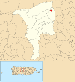
Ciales barrio-pueblo is a barrio and the administrative center (seat) of Ciales, a municipality of Puerto Rico. Its population in 2010 was 1,009. [1] [4] [5]

Contents

As was customary in Spain, in Puerto Rico, the municipality has a barrio called pueblo which contains a central plaza, the municipal buildings (city hall), and a Catholic church. Fiestas patronales (patron saint festivals) are held in the central plaza every year. [6] [7]

The central plaza and its church

The central plaza, or square, is a place for official and unofficial recreational events and a place where people can gather and socialize from dusk to dawn. The Laws of the Indies, Spanish law, which regulated life in Puerto Rico in the early 19th century, stated the plaza's purpose was for "the parties" (celebrations, festivities) (Spanish : a propósito para las fiestas), and that the square should be proportionally large enough for the number of neighbors (Spanish : grandeza proporcionada al número de vecinos). These Spanish regulations also stated that the streets nearby should be comfortable portals for passersby, protecting them from the elements: sun and rain. [6]

Located across the central plaza on Calle Betances in Camuy barrio-pueblo is the Parroquia Nuestra Señora del Rosario, a Roman Catholic church. By 1820 there was a wooden church at the site. A church made of masonry walls was built in 1895 and demolished in 1959. The current church was inaugurated in 1963. [8]

San Juan Nepomuceno is the patron saint of Ciales. Ciales celebrates its patron saint festival in October. The Fiestas Patronales de Nuestra Señora del Rosario y San Jose is a religious and cultural celebration that generally features parades, games, artisans, amusement rides, regional food, and live entertainment. [9]

History

Ciales barrio-pueblo was in Spain's gazetteers [10] until Puerto Rico was ceded by Spain in the aftermath of the Spanish–American War under the terms of the Treaty of Paris of 1898 and became an unincorporated territory of the United States. In 1899, the United States Department of War conducted a census of Puerto Rico finding that the population of Ciales barrio-pueblo was 1,356. [11]

Historical population
CensusPop.Note
1900 1,356
1910 1,68324.1%
1920 2,23833.0%
1930 1,780−20.5%
1940 1,9197.8%
1950 3,48281.4%
1960 3,275−5.9%
1980 1,428
1990 1,360−4.8%
2000 1,211−11.0%
2010 1,009−16.7%
U.S. Decennial Census
1899 (shown as 1900) [12] 1910-1930 [13]
1930-1950 [14] 1980-2000 [15] 2010 [16]

Sectors

Barrios (which are, in contemporary times, roughly comparable to minor civil divisions) [17] in turn are further subdivided into smaller local populated place areas/units called sectores (sectors in English). The types of sectores may vary, from normally sector to urbanización to reparto to barriada to residencial, among others. [18] [19] [20]

The following sectors are in Ciales barrio-pueblo: [21]

Barriada La Aldea, Barriada La Cuerda, Barriada Otero, Barriada Santo Domingo, Barriada Verdum, Calle Morovis, Calle Nueva, Comunidad Cuba, Comunidad Los Milagros, Residencial Colinas de Jaguas, and Sector Las Guabas.

Places and views of Ciales barrio-pueblo:

See also

Related Research Articles

<span class="mw-page-title-main">Isabel II barrio-pueblo</span> Historical and administrative center (seat) of Vieques, Puerto Rico

Isabel II barrio-pueblo(referred to as Isabel Segunda in Spanish) is a barrio and the administrative center (seat) in the downtown area in the island-municipality of Vieques, Puerto Rico. Its population in 2010 was 1,354.

<span class="mw-page-title-main">Cataño barrio-pueblo</span> Historical and administrative center (seat) of Cataño, Puerto Rico

Cataño barrio-pueblo is an urban barrio and the administrative center (seat) of Cataño, a municipality of Puerto Rico. Its population in 2010 was 4,283. It is an urban barrio located in the northeastern section of the municipality.

<span class="mw-page-title-main">Naranjito barrio-pueblo</span> Historical and administrative center (seat) of Naranjito, Puerto Rico

Naranjito barrio-pueblo is a barrio and the administrative center (seat) of Naranjito, a municipality of Puerto Rico. Its population in 2010 was 1,157.

<span class="mw-page-title-main">Aguada barrio-pueblo</span> Historical and administrative center (seat) of Aguada, Puerto Rico

Aguada barrio-pueblo is a small barrio and the administrative center (seat) of Aguada, a municipality of Puerto Rico. Its population in 2010 was 1,324. Aguada barrio-pueblo has two subdivisions: California and Rosario.

<span class="mw-page-title-main">Añasco barrio-pueblo</span> Historical and administrative center (seat) of Añasco, Puerto Rico

Añasco barrio-pueblo is a barrio-pueblo and the administrative center (seat) of Añasco, a municipality of Puerto Rico. Its population in 2010 was 912.

<span class="mw-page-title-main">Comerío barrio-pueblo</span> Historical and administrative center (seat) of Comerío, Puerto Rico

Comerío barrio-pueblo is a barrio and the administrative center (seat) of Comerío, a municipality of Puerto Rico. Its population in 2010 was 3,657.

<span class="mw-page-title-main">San Sebastián barrio-pueblo</span> Historical and administrative center (seat) of San Sebastián, Puerto Rico

San Sebastián barrio-pueblo is a barrio and the administrative center (seat) of San Sebastián, a municipality of Puerto Rico. Its population in 2010 was 1,424.

<span class="mw-page-title-main">Las Marías barrio-pueblo</span> Historical and administrative center (seat) of Las Marías, Puerto Rico

Las Marías barrio-pueblo is a barrio and the administrative center (seat) of Las Marías, a municipality of Puerto Rico. Its population in 2010 was 262.

<span class="mw-page-title-main">Gurabo barrio-pueblo</span> Historical and administrative center (seat) of Gurabo, Puerto Rico

Gurabo barrio-pueblo is a barrio and the administrative center (seat) of Gurabo, a municipality of Puerto Rico. Its population in 2010 was 1,509.

<span class="mw-page-title-main">Toa Alta barrio-pueblo</span> Historical and administrative center (seat) of Toa Alta, Puerto Rico

Toa Alta barrio-pueblo is a barrio and the administrative center (seat) of Toa Alta, a municipality of Puerto Rico. Its population in 2010 was 397.

<span class="mw-page-title-main">Villalba barrio-pueblo</span> Historical and administrative center (seat) of Villalba, Puerto Rico

Villalba barrio-pueblo is a barrio and the administrative center (seat) of Villalba, a municipality of Puerto Rico. Its population in 2010 was 729.

<span class="mw-page-title-main">Rincón barrio-pueblo</span> Historical and administrative center (seat) of Rincón, Puerto Rico

Rincón barrio-pueblo is a barrio-pueblo, the administrative center (seat) of Rincón, a municipality of Puerto Rico. Its population in 2010 was 933.

<span class="mw-page-title-main">San Lorenzo barrio-pueblo</span> Historical and administrative center (seat) of San Lorenzo, Puerto Rico

San Lorenzo barrio-pueblo is a barrio and the administrative center (seat) of San Lorenzo, a municipality of Puerto Rico. Its population in 2010 was 2,045.

<span class="mw-page-title-main">Aguadilla barrio-pueblo</span> Historical and administrative center (seat) of Aguadilla, Puerto Rico

Aguadilla barrio-pueblo is an urban barrio and the administrative center (seat) of Aguadilla, a municipality of Puerto Rico. Its population in 2010 was 3,627.

<span class="mw-page-title-main">Lares barrio-pueblo</span> Historical and administrative center (seat) of Lares, Puerto Rico

Lares barrio-pueblo is a barrio and the administrative center (seat) of Lares, a municipality of Puerto Rico. Its population in 2010 was 2,690.

<span class="mw-page-title-main">Orocovis barrio-pueblo</span> Historical and administrative center (seat) of Orocovis, Puerto Rico

Barrio Pueblo is a barrio and the administrative center (seat) of Orocovis, a municipality of Puerto Rico. Its population in 2010 was 682.

<span class="mw-page-title-main">Morovis barrio-pueblo</span> Historical and administrative center (seat) of Morovis, Puerto Rico

Morovis barrio-pueblo is a barrio and the administrative center (seat) of Morovis, a municipality of Puerto Rico. Morovis barrio-pueblo has about 12 sectors and its population in 2010 was 895.

<span class="mw-page-title-main">Naguabo barrio-pueblo</span> Historical and administrative center (seat) of Naguabo, Puerto Rico

Naguabo barrio-pueblo is a barrio and the administrative center (seat) of Naguabo, a municipality of Puerto Rico. Its population in 2010 was 1,514.

<span class="mw-page-title-main">Cidra barrio-pueblo</span> Historical and administrative center (seat) of Cidra, Puerto Rico

Cidra barrio-pueblo is a barrio and the administrative center (seat) of Cidra, a municipality of Puerto Rico. Its population in 2010 was 1,064.

<span class="mw-page-title-main">Corozal barrio-pueblo</span> Historical and administrative center (seat) of Corozal, Puerto Rico

Corozal barrio-pueblo is an urban barrio and the administrative center (seat) of Corozal, a municipality of Puerto Rico. Its population in 2010 was 2,631.

References

  1. 1 2 Puerto Rico: 2010 Population and Housing Unit Counts.pdf (PDF). U.S. Dept. of Commerce, Economics and Statistics Administration, U.S. Census Bureau. 2010.
  2. 1 2 "US Gazetteer 2019". US Census. US Government.
  3. U.S. Geological Survey Geographic Names Information System: Ciales barrio-pueblo
  4. Picó, Rafael; Buitrago de Santiago, Zayda; Berrios, Hector H. Nueva geografía de Puerto Rico: física, económica, y social, por Rafael Picó. Con la colaboración de Zayda Buitrago de Santiago y Héctor H. Berrios. San Juan Editorial Universitaria, Universidad de Puerto Rico,1969.
  5. Gwillim Law (20 May 2015). Administrative Subdivisions of Countries: A Comprehensive World Reference, 1900 through 1998. McFarland. p. 300. ISBN   978-1-4766-0447-3 . Retrieved 25 December 2018.
  6. 1 2 Santullano, Luis A. (10 March 2019). Mirada al Caribe. Vol. 54. Colegio de Mexico. pp. 75–78. doi:10.2307/j.ctvbcd2vs.12. JSTOR   j.ctvbcd2vs.12.
  7. Pariser, Harry S. (2003). Explore Puerto Rico, Fifth Edition. San Francisco: Manatee Press. pp. 52–55. Retrieved 10 February 2019.
  8. Mari Mut, José A. (2013-08-28). Los Pueblos de Puerto Rico y Las Iglesias de Sus Plazas [The Pueblos of Puerto Rico, and the Churches of its Plazas] (PDF) (in Spanish). pp. 67–69. Archived (PDF) from the original on 2020-12-14. Retrieved 2021-08-23.
  9. "Ciales Municipality". enciclopediapr.org. Fundación Puertorriqueña de las Humanidades (FPH). Archived from the original on 2019-03-27. Retrieved 2019-03-20.
  10. "Anuario del comercio, de la industria, de la magistratura y de la administración. 1881". Biblioteca Nacional de España (in Spanish). p. 1614. Retrieved 4 April 2023.
  11. Joseph Prentiss Sanger; Henry Gannett; Walter Francis Willcox (1900). Informe sobre el censo de Puerto Rico, 1899, United States. War Dept. Porto Rico Census Office (in Spanish). Imprenta del gobierno. p.  162.
  12. "Report of the Census of Porto Rico 1899". War Department Office Director Census of Porto Rico. Archived from the original on July 16, 2017. Retrieved September 21, 2017.
  13. "Table 3-Population of Municipalities: 1930 1920 and 1910" (PDF). United States Census Bureau. Archived (PDF) from the original on August 17, 2017. Retrieved September 21, 2017.
  14. "Table 4-Area and Population of Municipalities Urban and Rural: 1930 to 1950" (PDF). United States Census Bureau. Archived (PDF) from the original on August 30, 2015. Retrieved September 21, 2014.
  15. "Table 2 Population and Housing Units: 1960 to 2000" (PDF). United States Census Bureau. Archived (PDF) from the original on July 24, 2017. Retrieved September 21, 2017.
  16. Puerto Rico: 2010 Population and Housing Unit Counts.pdf (PDF). U.S. Dept. of Commerce Economics and Statistics Administration U.S. Census Bureau. 2010. Archived (PDF) from the original on 2017-02-20. Retrieved 2019-08-02.
  17. "US Census Barrio-Pueblo definition". factfinder.com. US Census. Archived from the original on 13 May 2017. Retrieved 5 January 2019.
  18. "Agencia: Oficina del Coordinador General para el Financiamiento Socioeconómico y la Autogestión (Proposed 2016 Budget)". Puerto Rico Budgets (in Spanish). Retrieved 28 June 2019.
  19. Rivera Quintero, Marcia (2014), El vuelo de la esperanza: Proyecto de las Comunidades Especiales Puerto Rico, 1997-2004 (first ed.), San Juan, Puerto Rico Fundación Sila M. Calderón, ISBN   978-0-9820806-1-0
  20. "Leyes del 2001". Lex Juris Puerto Rico (in Spanish). Retrieved 24 June 2020.
  21. "DESGLOSE DE SECTORES Y CENTROS DE VOTACIÓN CIALES 023" (PDF). Comisión Estatal de Elecciones Puerto Rico (in Spanish). 19 October 2018. Archived from the original (PDF) on 15 June 2020. Retrieved 15 June 2020.