Marchlewszczyzna was a Polish National District in the Ukrainian Soviet Socialist Republic created as an experiment and as part of the Soviet korenizatsia campaign in Zhytomyr Okruha to the west of Zhytomyr on 21 July 1925 by resolution of the Little Presidium of the All-Ukrainian Central Executive Committee. Its capital, the town of Dovbysh, was renamed later in 1926 as Marchlewsk. The district was one of 32 other national districts that were created in the Ukrainian SSR during that period (1924-1939). Creation of the district was based on standards adopted by the fourth session of the All-Ukrainian Central Executive Committee and recommendations of the Central Commission in affairs of National Minorities at that executive committee. It was created to implement an idea in creation of Polish national districts on territories of Ukrainian and Belarusian SSRs.

The administrative divisions of Ukraine are under the jurisdiction of the Ukrainian Constitution. Ukraine is a unitary state with three levels of administrative divisions: 27 regions, 136 raions (districts) and 1469 hromadas.

An oblast in Ukraine, sometimes translated as region or province, is the main type of first-level administrative division of the country. Ukraine's territory is divided into 24 oblasts, as well as one autonomous republic and two cities with special status. Ukraine is a unitary state, thus the oblasts do not have much legal scope of competence other than that which is established in the Ukrainian Constitution and devolved by law. Articles 140–146 of Chapter XI of the constitution deal directly with local authorities and their competence.

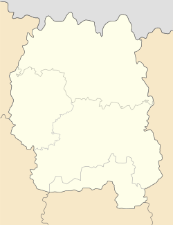
Zhytomyr Oblast, also referred to as Zhytomyrshchyna, is an oblast (province) in northwestern Ukraine. The administrative center of the oblast is the city of Zhytomyr. Its population is approximately 1,179,032.

Ovruch is a city in Korosten Raion, Zhytomyr Oblast, northern Ukraine. Until 2020, it was the administrative center of the former Ovruch Raion, until it was merged into Korosten Raion. It has a population of approximately 15,250, and is home to the Ovruch air base.

Konotop is a city in Sumy Oblast, northeastern Ukraine. Konotop serves as the administrative center of Konotop Raion within the oblast. Konotop is located about 129 kilometres (80 mi) from Sumy, the administrative center of the oblast. It is host to Konotop Air Base. The population is 83,543.

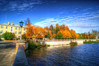
Radomyshl is a historic city in Zhytomyr Raion, Zhytomyr Oblast, northern Ukraine. Before 2020, it was the administrative center of the former Radomyshl Raion. It is located on the left bank of the Teteriv River, a right tributary of the Dnieper. Its population is approximately 13,685. It is located within the historic region of Right-bank Ukraine.
Lyudinovo is a town and the administrative center of Lyudinovsky District in Kaluga Oblast, Russia, located on the shores of Lake Lompad formed by a dam on the Nepolot River, 188 kilometers (117 mi) southwest of Kaluga, the administrative center of the oblast. As of the 2021 Census, its population was 35,874.
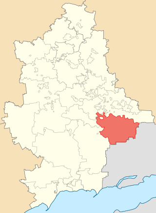
Amvrosiivka Raion was a raion (district) within the eastern part of Donetsk Oblast in eastern Ukraine. The raion was abolished on 18 July 2020 as part of the administrative reform of Ukraine, which reduced the number of raions of Donetsk Oblast to eight. However, since 2014 the raion was not under control of Ukrainian government and has been part of the Donetsk People's Republic which continues using it as an administrative unit. The administrative center of the raion is the town of Amvrosiivka. The last estimate of the raion population, reported by the Ukrainian government, was 43,759. In 2022, the Donetsk People's Republic including the Amvrosiivka Raion was annexed by Russia.

Andrushivka is a city in Berdychiv Raion, Zhytomyr Oblast, Ukraine. Prior to the 2020 administrative reform, it was the administrative center of the former Andrushivka Raion. The population in 2023 is 8669 people.

Oleshky, previously known as Tsiurupynsk from 1928 to 2016, is a city in Kherson Raion, Kherson Oblast, southern Ukraine, located on the left bank of the Dnieper River with the town of Solontsi to the south. It is the oldest city of the oblast and one of the oldest in southern Ukraine. It is known for its proximity to the Oleshky Sands, a large desert region. Oleshky is the site of artist Polina Rayko's home, a national cultural monument of Ukraine. It also hosts the administration of Oleshky urban hromada, one of the hromadas of Ukraine. It had a population of 24,124.
Dovbysh is a rural settlement in Zviahel Raion, Zhytomyr Oblast, Ukraine. The settlement was previously known as Markhlevsk after the Polish-born Soviet politician and civil activist Julian Marchlewski. Population: 4,071

Narodychi is a rural settlement in Korosten Raion, Zhytomyr Oblast, northern Ukraine. It was the administrative center of the former Narodychi Raion, and after the reform in 2020, the city became part of the Korosten Raion. It lies on the northern side of the Uzh River, 134 kilometres northwest of Kyiv. Population: 2,907
Portselianove, formerly known as Pershotravensk is a rural settlement in Zviahel Raion, Zhytomyr Oblast, Ukraine. Its population is 3,261.

Khoroshiv, until 2015 Volodarsk-Volynskyi is a rural settlement in Zhytomyr Raion, Zhytomyr Oblast, Ukraine. Population: 7,335

Pulyny Raion was a raion (district) of Zhytomyr Oblast, northern Ukraine. Its administrative centre was located at Pulyny. The raion covered an area of 853 square kilometres (329 sq mi). The raion was abolished on 18 July 2020 as part of the administrative reform of Ukraine, which reduced the number of raions of Zhytomyr Oblast to four. The area of Pulyny Raion was merged into Zhytomyr Raion. The last estimate of the raion population was 22,193

Zviahel Raion is a raion (district) of Zhytomyr Oblast, northern Ukraine. Until 2022, it was known as Novohrad-Volynskyi Raion. Its administrative centre is located at Zviahel, Ukraine. The raion covers an area of 5,242.6 square kilometres (2,024.2 sq mi). Population: 164,972.

Nova Ushytsia is a rural settlement in Kamianets-Podilskyi Raion, Khmelnytskyi Oblast, western Ukraine. It hosts the administration of Nova Ushytsia settlement hromada, one of the hromadas of Ukraine. The settlement's population was 4,557 as of the 2001 Ukrainian Census. Current population: 3,880.
Zhytomyr Oblast is subdivided into districts (raions) which are subdivided into municipalities (hromadas).

Novovorontsovka is a rural settlement in Beryslav Raion, Kherson Oblast, southern Ukraine. It hosts the administration of Novovorontsovka settlement hromada, one of the hromadas of Ukraine. Novovorontsovka is located on the right bank of the Kakhovka Reservoir, an artificial reservoir on the Dnieper. It has a population of 5,951.