This article has an unclear citation style.(March 2019) |
Punds Water is a freshwater loch near Mangaster in Northmavine, Shetland. It also gives its name to a nearby Neolithic heel-shaped cairn.
This article has an unclear citation style.(March 2019) |
Punds Water is a freshwater loch near Mangaster in Northmavine, Shetland. It also gives its name to a nearby Neolithic heel-shaped cairn.
The cairn (at 60°25′25″N1°24′45″W / 60.42375°N 1.41240°W ) is composed of large boulders and stands about 1.5 metres (5 ft) high above the surrounding peat. The facade faces east by southeast and measures more than 15 metres (50 ft) across. From front to back the cairn measures 9.8 metres (32 ft). Within the facade is the entrance to a passage leading to a trefoil-shaped burial chamber. [1]

A broch is an Iron Age drystone hollow-walled structure found in Scotland. Brochs belong to the classification "complex Atlantic roundhouse" devised by Scottish archaeologists in the 1980s.

A chambered cairn is a burial monument, usually constructed during the Neolithic, consisting of a sizeable chamber around and over which a cairn of stones was constructed. Some chambered cairns are also passage-graves. They are found throughout Britain and Ireland, with the largest number in Scotland.

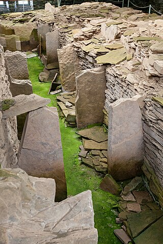
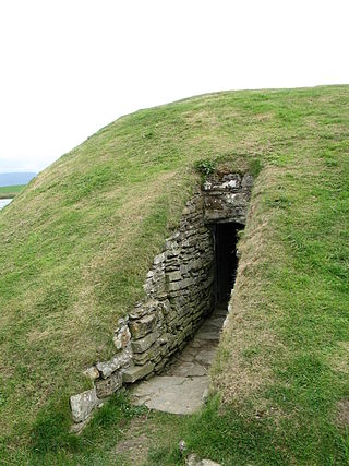
Maeshowe is a Neolithic chambered cairn and passage grave situated on Mainland Orkney, Scotland. It was probably built around 2800 BC. In the archaeology of Scotland, it gives its name to the Maeshowe type of chambered cairn, which is limited to Orkney.

Vementry is an uninhabited Scottish island in Shetland on the north side of the West Mainland, lying south of Muckle Roe.

Broch of Mousa is a preserved Iron Age broch or round tower. It is on the island of Mousa in Shetland, Scotland. It is the tallest broch still standing and amongst the best-preserved prehistoric buildings in Europe. It is thought to have been constructed c. 100 BC, and is one of more than 500 brochs built in Scotland. The site is managed by Historic Environment Scotland as a scheduled monument.

The Dwarfie Stane is a megalithic chambered tomb carved out of a titanic block of Devonian Old Red Sandstone located in a steep-sided glaciated valley between the settlements of Quoys and Rackwick on Hoy, an island in Orkney, Scotland. The stone is a glacial erratic located in desolate peatland. The site is managed by Historic Environment Scotland.

This timeline of prehistoric Scotland is a chronologically ordered list of important archaeological sites in Scotland and of major events affecting Scotland's human inhabitants and culture during the prehistoric period. The period of prehistory prior to occupation by the genus Homo is part of the geology of Scotland. Prehistory in Scotland ends with the arrival of the Romans in southern Scotland in the 1st century AD and the beginning of written records. The archaeological sites and events listed are the earliest examples or among the most notable of their type.

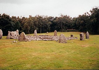
Easter Aquhorthies stone circle, located near Inverurie in north-east Scotland, is one of the best-preserved examples of a recumbent stone circle and one of the few that still have their full complement of stones and the only one that has all its stones still standing without having been re-erected. It stands on a gentle hill slope about 1 mile (1.6 km) west of Inverurie and consists of a ring of nine stones, eight of which are grey granite and one red jasper. Two more grey granite stones flank a recumbent of red granite flecked with crystals and lines of quartz. The circle is particularly notable for its builders' use of polychromy in the stones, with the reddish ones situated on the SSW side and the grey ones opposite. The discovery of a possible cist covered by a capstone at the centre of the circle indicates that there may once have been a cairn there, but only a conspicuous bump now remains.

Prehistoric Orkney refers only to the prehistory of the Orkney archipelago of Scotland that begins with human occupation. Although some records referring to Orkney survive that were written during the Roman invasions of Scotland, “prehistory” in northern Scotland is defined as lasting until the start of Scotland's Early Historic Period.

Midhowe Chambered Cairn is a large Neolithic chambered cairn located on the south shore of the island of Rousay, Orkney, Scotland. The name "Midhowe" comes from the Iron Age broch known as Midhowe Broch, that lies just west of the tomb. The broch got its name from the fact that it is the middle of three such structures that lie grouped within 500 metres (1,600 ft) of each other and Howe from the Old Norse word haugr meaning mound or barrow. Together, the broch and chambered cairn form part of a large complex of ancient structures on the shore of Eynhallow Sound separating Rousay from Mainland, Orkney.

Unstan is a Neolithic chambered cairn located about 2 mi (3 km) north-east of Stromness on Mainland, Orkney, Scotland. The tomb was built on a promontory that extends into the Loch of Stenness near the settlement of Howe. Unstan is notable as an atypical hybrid of the two main types of chambered cairn found in Orkney, and as the location of the first discovery of a type of pottery that now bears the name of the tomb. The site is in the care of Historic Environment Scotland as a scheduled monument.

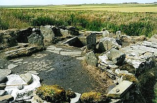
Liddle Burnt Mound is a Bronze Age site on the island of South Ronaldsay, Orkney. The site consists of the remains of a building and a mound that surrounds it on three sides. The purpose of the site is controversial, but most investigators believe burnt mounds hosted a "domestic function", perhaps related to cooking.

Funzie Girt is an ancient dividing wall that was erected from north to south across the island of Fetlar in Shetland, Scotland. Some sources describe it as having been built in the Neolithic, but the date of construction is not certainly known. The line of the wall, which ran for over 4 kilometres (2.5 mi), once divided the island in two almost equal sections. Also known as the Finnigirt Dyke, it has vanished in places at the southern end, although the ruins are clearly visible along much of the uninhabited north of the island, where it is a conspicuous feature of the landscape. The dyke's original purpose is not known, nor is its relationship to other archaeological sites of a similar age nearby. There are various folk tales about its construction, and it is the subject of various pieces of Shetland folk music.
The Pettigarths Field Cairns is a Neolithic site in the parish of Nesting, northeastern Whalsay, in the Shetland islands of Scotland. It is located approximately 140 metres (460 ft) to the northwest of Benie Hoose. The site contains upright stones as well as masonry. The south cairn is roughly 6 metres (20 ft) square, with an eastern entrance passage and circular chamber about 2 metres across. 4 metres (13 ft) to the north is a round cairn, 4.5 metres (15 ft) in diameter, with a rectangular cist. The two cairns are located on a rise, about 140 metres (460 ft) northwest of Benie Hoose.

Prehistoric art in Scotland is visual art created or found within the modern borders of Scotland, before the departure of the Romans from southern and central Britain in the early fifth century CE, which is usually seen as the beginning of the early historic or Medieval era. There is no clear definition of prehistoric art among scholars and objects that may involve creativity often lack a context that would allow them to be understood.

Tulach an t-Sionnaich, is a cairn at the northern end of Loch Calder in Caithness, Scotland that has been expanded over time. It was partially excavated in 1961 and 1963. Before the excavations there was just a 60-metre (200 ft) long and 12-metre (40 ft) wide cairn with no recognizable structures. The cairn is oriented from northwest to southeast; the southeastern end being higher and somewhat wider. Subsequently a ditch was cut some 15 metres (50 ft) from this end of the cairn.

The heel-shaped cairn, with its usually cruciform chamber, is a type of megalithic monument that is found in Scotland, especially in Caithness and Sutherland and in the Shetland Islands. In Orkney, the Isbister Cairn is the only site that is similar in shape.

Audrey Shore Henshall was a British archaeologist known for her work on Scottish chambered cairns, prehistoric pottery and early textiles.

Dr Anna Ritchie OBE, BA, PhD, FSA, Hon FSA Scot is a British archaeologist and historian.

Loanhead of Daviot stone circle is a recumbent stone circle in Aberdeenshire in lowland northeast Scotland. The circle consists of the recumbent stone with its flankers and a complete set of eight orthostats about 21 metres (69 ft) in diameter surrounding a low kerbed ring cairn which has an open court. However, the present appearance has in part been produced by substantial restoration after archaeological excavation in 1934, and in 1989 by the removal of the stones covering the central court.
60°27′50″N1°24′32″W / 60.464°N 1.409°W