Punta Alta de Comalesbienes

Last updated
Punta Alta de Comalesbienes
P1030055 - Pic i Punta Alta de Comalesbienes.JPG
Highest point
Elevation 3,014.1 m (9,889 ft)
Coordinates 42°35′8.51″N0°52′49.11″E / 42.5856972°N 0.8803083°E / 42.5856972; 0.8803083 Coordinates: 42°35′8.51″N0°52′49.11″E / 42.5856972°N 0.8803083°E / 42.5856972; 0.8803083
Geography
Catalonia location map.svg
Red triangle with thick white border.svg
Punta Alta de Comalesbienes
Catalonia, Spain
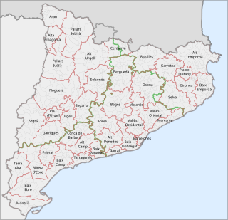
Location Vilaller & Vall de Boí (Alta Ribagorça) Catalonia
Parent range Pyrenees
Climbing
First ascent Summer 1880 by Schrader and H. Passet [1]
Easiest route From Estany de Cavallers

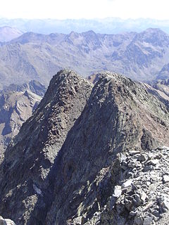
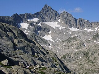
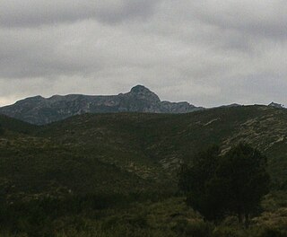
Punta Alta de Comalesbienes, also known as Punta Alta, is a mountain of Catalonia, Spain. Punta Alta has an elevation of 3.014 metres above sea level. [2]

Catalonia Autonomous area of northeastern Spain

Catalonia is an autonomous community in Spain on the northeastern corner of the Iberian Peninsula, designated as a nationality by its Statute of Autonomy. Catalonia consists of four provinces: Barcelona, Girona, Lleida, and Tarragona. The capital and largest city is Barcelona, the second-most populated municipality in Spain and the core of the sixth most populous urban area in the European Union. It comprises most of the territory of the former Principality of Catalonia. It is bordered by France (Occitanie) and Andorra to the north, the Mediterranean Sea to the east, and the Spanish autonomous communities of Aragon to the west and Valencia to the south. The official languages are Catalan, Spanish, and the Aranese dialect of Occitan.

Spain Kingdom in Southwest Europe

Spain, officially the Kingdom of Spain, is a country mostly located in Europe. Its continental European territory is situated on the Iberian Peninsula. Its territory also includes two archipelagoes: the Canary Islands off the coast of Africa, and the Balearic Islands in the Mediterranean Sea. The African enclaves of Ceuta, Melilla, and Peñón de Vélez de la Gomera make Spain the only European country to have a physical border with an African country (Morocco). Several small islands in the Alboran Sea are also part of Spanish territory. The country's mainland is bordered to the south and east by the Mediterranean Sea except for a small land boundary with Gibraltar; to the north and northeast by France, Andorra, and the Bay of Biscay; and to the west and northwest by Portugal and the Atlantic Ocean.

Contents

It is located close to the 2993 m high Pic de Comalesbienes, on the eastern side of the Estany de Cavallers glacial lake, near the Besiberri Massif, in the Vall de Boí, Pyrenees.

Glacial lake lake formed by a melted glacier

A glacial lake is a body of water with origins from glacier activity. They are formed when a glacier erodes the land, and then melts, filling the depression created by the glacier.

Besiberri Massif mountain in Spain

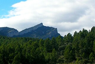
Besiberri Massif is a mountain massif of the central area of the Pyrenees, Lleida, Catalonia, Spain. It is located at the western limit of the Aigüestortes i Estany de Sant Maurici National Park.

Vall de Boí Municipality in Catalonia, Spain

The Vall de Boí is a narrow, steep-sided valley and a small municipality in the province of Lleida, in the autonomous community of Catalonia, northern Spain. It lies in the northeastern corner of the comarca of Alta Ribagorça, on the edges of the Pyrenees. It is the largest municipality of the region, with its main town being Barruera.

See also

Related Research Articles

Comarques of Catalonia Wikimedia list article

This is a list of the 42 comarques into which Catalonia is divided. A comarca is a group of municipalities, roughly equivalent to a "county" in the U.S.A. or the U.K. However, in the context of Catalonia, the term "county" can be a bit misleading, because in medieval Catalonia, aside from the kings of Aragon, the most important rulers were counts, notably the Counts of Barcelona and of Urgell. Comarques have no particular relation to the "counties" that were ruled by counts.

Pica dEstats mountain

Pica d'Estats is a 3,143-metre-high (10,312 ft) mountain in the Montcalm Massif, Pyrenees. on the Spanish–French border, and is the highest mountain in Catalonia.

Outline of Catalonia Overview of and topical guide to Catalonia

The following outline is provided as an overview of and topical guide to Catalonia:

Punta Gabarró mountain in France

Punta Gabarró or Punta de Gabarró is a mountain of the Montcalm Massif. Located in the Pyrenees, at the border between France and Spain, it has an elevation of 3,105 metres (10,187 ft) above sea level.

Comaloforno mountain in Spain

Comaloforno is a mountain of the Pyrenees, Lleida, Catalonia, Spain. With an elevation of 3,029 metres (9,938 ft) above sea level, it is the highest summit of the Besiberri Massif.

Besiberri Nord mountain in Spain

Besiberri Nord is a mountain of the Massís del Besiberri, Catalonia, Spain. Located in the Pyrenees, it has an altitude of 3009 metres above sea level.

Pic de la Pala Alta de Sarradé mountain in la Vall de Boí, Alta Ribagorça, Catalonia, Spain

Pic de la Pala Alta de Sarradé is a mountain of the Pyrenees, Catalonia, Spain. Located in the Aigüestortes i Estany de Sant Maurici National Park, it has an elevation of 2,983 metres above sea level).

Punta Senyalada mountain in Spain

Punta Senyalada, also known as Pic de la Torreta and Pic dels Soldats, is a mountain of Catalonia, Spain. Located in the Besiberri Massif, Pyrenees, it has an elevation of 2,952 metres above sea level.

Punta de la Torroja is a mountain of Catalonia, Spain. It has an elevation of 1,204 metres above sea level.

Punta de l'Aigua is a mountain of Catalonia, Spain. It has an elevation of 1,091 metres above sea level.

Punta de la Barrina is a mountain of Catalonia, Spain. It has an elevation of 1,013 metres above sea level.

Punta del Curull mountain in Spain

Punta del Curull is a mountain of Catalonia, Spain. It has an elevation of 1,021 metres above sea level. It is the highest point of Serra de la Llena.

Serra de Pàndols mountain in Spain

Serra de Pàndols is a limestone mountain chain located at the southern end of the Catalan Pre-Coastal Range, in Catalonia, Spain.

Serra de Cavalls mountain in Spain

Serra de Cavalls is a mountain chain located at the southern end of the Catalan Pre-Coastal Range, Catalonia, Spain. The ridge's highest point is Punta Redona. This mountain range lies within the Benissanet, Gandesa and El Pinell de Brai municipal term. On the northern side are two ridges of parallel foothills called Serra del Pebre and Serra de Santa Madrona. Its northern prolongation is known as Serra de la Vall de la Torre.

Serra de Paüls mountain in Spain

Serra de Paüls is a mountain range in the northern side of the Ports de Tortosa-Beseit, Catalonia, Spain. The highest summit, Punta de l'Aigua has an elevation of 1,091.6 metres above sea level.

Montmeneu mountain in Spain

Montmeneu or Punta de Montmaneu is a mountain in Catalonia, Spain. It is located within the La Granja d'Escarp and Seròs municipal limits, Segrià.

Serra de la Llena mountain in Spain

Serra de la Llena, also known as Serra la Llena, is a mountain chain straddling the municipal terms of Vilanova de Prades, La Pobla de Cérvoles (Garrigues) and Ulldemolins (Priorat), in Catalonia, Spain. These mountains have characteristic large and rounded rocky outcrops.

Prades Mountains mountain in Spain

Prades Mountains, also known as Muntanyes de Prades, is a large calcareous mountain massif straddling the comarcas of Alt Camp, Baix Camp, Conca de Barberà, Garrigues and Priorat, in Catalonia, Spain. They are a Site of Community Importance.

Buinaca mountain in Spain

Buinaca or Punta de la Buinaca, also spelt Boinaca, is one of the highest mountains of the Cardó Massif, Catalan Pre-Coastal Range, Catalonia, Spain. This mountain has an elevation of 764 metres above sea level.

References

  1. Els tresors d'Aigüestortes i Sant Maurici. Pep Coll, Mercè Aniz i Víctor Luengo. Pagès Editors. lleida 2002.
  2. Mapa Topogràfic de Catalunya - Institut Cartogràfic de Catalunya