Punta Tempesta

Last updated
Punta Tempesta
Punta Tempesta.png
Highest point
Elevation 2,679 m (8,789 ft) [1]
Prominence 309 m (1,014 ft) [2] [1]
Listing Alpine mountains 2500-2999 m
Coordinates 44°25′18.62″N07°08′20.83″E / 44.4218389°N 7.1391194°E / 44.4218389; 7.1391194
Geography
Alps location map.png
Red triangle with thick white border.svg
Punta Tempesta
Alps
Location Piedmont, Italy
Parent range Cottian Alps
Climbing
Easiest route footpath

Punta Tempesta is a 2,679 m a.s.l. mountain of the Cottian Alps, located in Italy.

Contents

Etymology

The name Tempesta in Italian means Storm. [3]

Geography

Summit cross, on its right Monte Tibert Punta Tempesta croce di vetta a destra monte Tibert.png
Summit cross, on its right Monte Tibert

The mountain is located on a ridge which divides two sub-valleys of the Maira watershed, Vallone di Marmora (west) and Vallone di Intersile; its summit stands not faraway from the water divide between Valle Maira and Valle Grana. Punta tempesta is separated from the neighbouring Monte Tibert by the Intersile Pass (2.520 m), while heading SE Sibolet Pass (2.546 m) divides it from Punta Sibolet (2581 m). Towards North the ridge between Marmora and Intersile sub-valleys goes on with a mountain named Punta La Piovosa (in English Rainy Summit, 2.602 m).

Punta Tempesta administratively belongs to the Marmora municipality ( comune ). [4]

SOIUSA classification

According to SOIUSA (International Standardized Mountain Subdivision of the Alps) the mountain can be classified in the following way: [5]

Access to the summit

Punta Tempesta is accessible via waymarked footpaths from different locations. Among them can be cited Esischie Pass, [6] Santuario di San Magno (in Valle Grana, 1.761 m) [7] and Tolosano, a frazione (village) of Marmora. [8] In the Italian scale tweir hiking difficulty is rated E (Escursionisti, namely suitable for normal hikers). Sometimes the hikers also reach monte Tibert or other nearby mountains. During winter Punta Tempesta is also a popular destination for alpine skiers or hikers with snowshoes. [9]

Related Research Articles

<span class="mw-page-title-main">Pointe de Paumont</span> Mountain in Italy

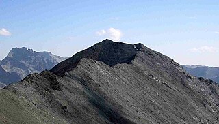
Pointe de Paumont or Cima del Vallone is a mountain of Savoie, France and of the Province of Turin, Italy. It lies in the Cottian Alps range. It has an elevation of 3,171 metres above sea level.

<span class="mw-page-title-main">Punta Bagnà</span> Mountain in Italy

Punta Bagnà or Cime du Grand Vallon is a mountain of Savoie, France and of the Province of Turin, Italy. It lies in the Cottian Alps range. It has an elevation of 3,129 metres above sea level.

<span class="mw-page-title-main">Punta Sommeiller</span> Mountain in Italy

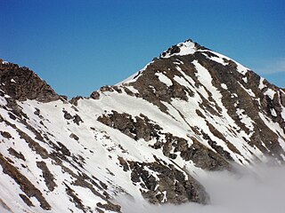
Punta Sommeiller or Pointe Sommeiller is a mountain of the Province of Turin, Italy and of Savoie, France. It lies in the Cottian Alps range. It has an elevation of 3,333 metres (10,935 ft) above sea level.

<span class="mw-page-title-main">Monte Orsiera</span> Mountain in Italy

Monte Orsiera is a mountain in the Cottian Alps belonging to the Province of Turin (Italy).

<span class="mw-page-title-main">Punta Sulè</span> Mountain in Italy

Punta Sulè is a 3,384 m a.s.l.mountain of the Graian Alps, located in Italy.

<span class="mw-page-title-main">Bric Ghinivert</span> Mountain in Italy

Bric Ghinivert or Eiminàl is a mountain of the Cottian Alps located in Italy.

<span class="mw-page-title-main">Monte Politri</span> Mountain in Italy

Monte Politri or Bric Rosso is a 3,026 m a.s.l. mountain of the Cottian Alps, located in Italy.

<span class="mw-page-title-main">Monte Albergian</span> Mountain in Italy

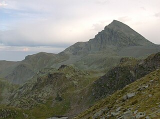
Monte Albergian is a 3,041 m a.s.l. mountain of the Cottian Alps, located in Italy. A battalion of 3rd Alpini Regiment, which during World War I earned a Silver Medal of Military Valor, was named after Monte Albergian.

<span class="mw-page-title-main">Monte Monega</span> Mountain in Italy

Monte Monega is a 1,882-metre (6,175 ft) mountain of the Ligurian Alps, in Italy.

<span class="mw-page-title-main">Punta Merciantaira</span> Mountain in Italy

The Punta Merciantaira or Grand Glaiza is a 3,293 metres high mountain of the Cottian Alps.

<span class="mw-page-title-main">Viso Mozzo</span> Mountain in Italy

The Viso Mozzo is a 3,019 metres high mountain on the Italian side of the Cottian Alps.

<span class="mw-page-title-main">Punta Leynir</span> Mountain in Italy

The Punta Leynir is a 3,238 metres high mountain belonging to the Italian side of Graian Alps.

<span class="mw-page-title-main">Punta Bes</span> Mountain in Italy

The Punta Bes is a 3,177 metres high mountain belonging to the Italian side of Graian Alps.

<span class="mw-page-title-main">Punta Nera</span> Mountain in Italy

The Punta Nera is a mountain of Savoie (France) and of the Province of Turin (Italy). It lies in the Cottian Alps range. It has an elevation of 3,047 metres above sea level.

<span class="mw-page-title-main">Pointe Rochers Charniers</span> Mountain in France

The Pointe Rochers Charniers is a mountain of the Cottian Alps at an elevation of 3,063 metres above sea level, located in France.

<span class="mw-page-title-main">Cime de Missun</span> Mountain in Italy

The Cime de Mussun (French) or Cima Missun (Italian) is a mountain of the Ligurian Alps.

<span class="mw-page-title-main">Punta Cornour</span> Mountain in Italy

The Punta Cornour is a 2,868 metres high mountain on the Italian side of the Cottian Alps.

<span class="mw-page-title-main">Cima Ciantiplagna</span> Mountain in Italy

The Cima Ciantiplagna is a mountain in the Cottian Alps belonging to the Province of Turin (Italy).

<span class="mw-page-title-main">Monte Birrone</span> Mountain in Italy

The Monte Birrone is a 2,131-metre (6,991 ft) high mountain in the Cottian Alps, belonging to the Italian province of Cuneo.

<span class="mw-page-title-main">Punta Mirauda</span> Mountain in Italy

The Punta Mirauda is a mountain of the Ligurian Alps located in Piedmont.

References

  1. 1 2 I.G.C. - Carta dei sentieri 1:50.000 n. 7 Valli Maira-Grana-Stura
  2. Key col: Colle di Esischie, 2370 m
  3. "tempesta". WordReference.com. Retrieved 2017-02-24.
  4. "Geoportale Nazionale - carta IGM 1:25.000". Istituto Geografico Militare . Retrieved 2017-02-23.
  5. Marazzi, Sergio (2005). Atlante Orografico delle Alpi. SOIUSA (in Italian). Priuli & Verlucca. ISBN   978-88-8068-273-8.
  6. utente grylluscampestris (2013-07-24). "Tempesta (Punta) dal Col d'Esischie" . Retrieved 2017-03-03.
  7. "VALLE GRANA : DAL SANTUARIO DI SAN MAGNO AL MONTE TIBERT E ALLA PUNTA TEMPESTA". 2012-01-13. Retrieved 2017-03-03.
  8. user giody54 (2015-06-22). "Piovosa (Punta la), Punta Tempesta, Monte Tibert dal Colle Intersile, anello" . Retrieved 2017-03-03.{{cite web}}: |author= has generic name (help)CS1 maint: numeric names: authors list (link)
  9. user Pieruccio (2004-04-27). "Tempesta (Punta) da Tolosano per la Comba Castellazzo" . Retrieved 2017-03-03.{{cite web}}: |author= has generic name (help)

Maps

Winter panorama from the summit looking North Punta Tempesta pan nord.png
Winter panorama from the summit looking North
Winter panorama from the summit looking South Punta Tempesta pan sud.png
Winter panorama from the summit looking South