Yavatmal districtpronunciation (help·info), [jəʋət̪maːɭ] formerly known as Yeotmal, is a district of the Indian state of Maharashtra. It is located in the region of Vidarbha, in the east-central part of the state. It is Vidarbha's third-largest district by population, after Nagpur and Amravati. Yavatmal city is the administrative headquarters of the district.
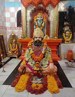
Gajanan Maharaj was an Indian Hindu guru, saint and mystic. His origins remain uncertain. But, his relatives are found in Karnataka. It believed that he hails from Devana halli, near Bangalore. His brother Narayana Maharaj is also a famous saint from Harihara in Karnataka. He first appeared at Shegaon, a village in Buldhana district, Maharashtra as a young man aged 30 probably during 23 February 1878. He attained Sanjeevana Samadhi on September 8, 1910; which is thought to be a process of voluntary withdrawal from one's physical body. This date of his Samadhi is commemorated every year as part of the Shree Punyatithi Utsav. The date of his first appearance is considered an auspicious day and is celebrated as Prakat Din Sohla.

Amravati district is a district of Maharashtra state in central India. It is the administrative headquarter of Amravati division, which is one of the two divisions in Vidarbha, out of total 6 regions in state of Maharashtra.
Murtijapur is a Municipal council and one of the taluka of district of Akola of Amravati division of Vidarbha region of Maharashtra.
Kudal is a census town in Sindhudurg district, Maharashtra, India. It is situated on River Karli in southwest Maharashtara. Kudal is the fourth largest town in Sindhudurg after Sawantwadi, Malvan and Kankavli. As of 2011, the population is 16,015. Kudal supports one MIDC area in the Konkan division. The Kudal railway station is located on the Konkan Railway route and connects the town with Mumbai (Bombay) metro situated in the Bombay, Baroda and Central India Railway of the north, and Mangalore on the south. It is a major stop for the Konkan Railway with many trains having a halt. The Deccan Odyssey train also stops in Kudal. National Highway 66 passes through Kudal. Apart from that, it also has two bus stations, a new one and old one. The old one is situated in market while the new one is just adjacent to the NH-66. Kudal is situated in centre of the Sindhudurg district and also considered one of the fastest-growing towns in the Konkan region. The Desai's were the original rulers of Kudal, who were tributaries of the Bijapur Sultanate, later the Marathas and then under the British.

Barshi is a city located in Barshi Sub district of Solapur District of Maharashtra State of Republic of India.

Chiplun is a city in Ratnagiri district in the state of Maharashtra, India. It is the financial and commercial Hub of Ratnagiri, and the headquarters of Chiplun taluka. It is about 320 km south of Mumbai in the Konkan region of Maharashtra, on the Mumbai–Goa highway (NH-66). It has a long history and a strong cultural background. Recent decades have seen much industrial development in it and its and surrounding areas.

Karad is a city in Satara district of Indian state of Maharashtra and it is 320 km (180.19 miles) from Mumbai, 72 km From Sangli and 159 km from Pune. It lies at the confluence of Koyna River and the Krishna River known as the "Priti sangam". The two rivers originate at Mahabaleshwar, which is around 100 km from Karad. They diverge at their origin, and travel for about the same distance to meet again in Karad. The rivers meet exactly head on, thus forming letter "T" which is the only head on confluence in the world. Hence Krishna and Koyna river's confluence is called Preeti Sangam, meaning Confluence of Love. Karad is well known for sugar production and is known as the sugar bowl of Maharashtra owing to the presence of many sugar factories in and around Karad. It is considered as an important educational hub in Western Maharashtra due to the presence of many prestigious educational institutes. This place is also known for resting place or (Samadhi) of the first chief minister of Maharashtra Shri. Yashwantrao Chavan situated at the confluence of Krishna and Koyana river.
Mhaswad or Mhasvad is a city in the Maan/Dahivadi taluka in the Satara district in the Indian state of Maharashtra. The NH-548C Satara-Baitul National Highway passes through the city.
Tasgaonpronunciation (help·info)Tasgaon is a city in Maharashtra and a municipal council in Sangli district in the Indian state of Maharashtra. Tasgaon city is developing city in Maharashtra. Tasgaon was given as Jahagir to Parshuram Bhau Tasgaonkar by Narayanrao Ballal Peshwa in 1774. Tasgaon Sansthan was lapsed by British during ruling of Shrimant Ganpatrao Tasgaonkar.
Koregaon is a census town and headquarters for the surrounding Koregaon Taluka in the Satara subdivision of Satara district in the Indian state of Maharashtra. It is situated on the NH-548C Satara-Baitul National Highway about 18 km east of Satara city, about 120 km from Pune and 267 km from Mumbai. The Koregaon railway station, situated on the Pune - Miraj line, is 2 kilometers outside the town. At a stone's throw from the railway station is Koregaon Bus Station.
Khatav is a town and taluka located in the Man-Khatav subdivision of the Satara district, India. Khatav has a population of about 22346.
Kavathe-Mahankalpronunciation (help·info) is a tehsil in Miraj subdivision of Sangli district in the Indian state of Maharashtra. This is famous for Mahankali Devi temple and Mallikarjun Temple. There is also a Sugar Factory, named after the same Goddess Mahankali Sugar Factory.
Arvi is a city and municipal council in Wardha district in the state of Maharashtra, India.
Shrikshetra Nagzari is a village in Shegaon tehsil of Buldhana district, Maharashtra State, India.
Yetgaon is a village situated in Kadegaon taluka in Sangli district, in the Indian state of Maharashtra.
Umarga (Omerga) Tehsil is a tehsil/ taluka/ subdistrict in Osmanabad district, Maharashtra on the Deccan Plateau of India. The town of Umarga is the administrative headquarters of the tehsil. There are 79 panchayat villages in Umarga Tehsil.
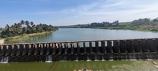
The Yerla River, alternatively Yerala River, is a tributary of Krishna River. It originates from the Mhaskoba hills in the extreme north of Khatav taluka of Satara district. It flows along a valley flanked by the Vardhangad range to its right and the Mahimangad range to its left and its total length is about 125 km. In Satara district, it passes through Mol, Lalgun, Pusegaon, Khatav, Vaduj and Nimsod. Later in Sangli district it joins Krishna River near Brahmanal. The Yerala is nonperennial river. This river is a major source of irrigation in the eastern part of Satara district and Sangli district in Maharashtra and helpful for seasonal agriculture production. The drainage network influences the economic and social development of people.

Lalgun is a village in the Satara district of the state of Maharashtra in India. It is located on Pusegaon-Phaltan State Highway and comes under Koregaon assembly constituency and Satara Parliamentary constituency. Lalgun has a population of about 2930.

Nagnathwadi is a village near to Lalgun in Satara district of Maharashtra state in India. It is known for the Lord Nagnatha Temple located on bank of Yerla river.