
Clermont-Ferrand is a city and commune of France, in the Auvergne-Rhône-Alpes region, with a population of 147,284 (2020). Its metropolitan area had 504,157 inhabitants at the 2018 census. It is the prefecture (capital) of the Puy-de-Dôme département. Olivier Bianchi is its current mayor.

Puy-de-Dôme is a department in the Auvergne-Rhône-Alpes region in the centre of France. In 2021, it had a population of 662,285. Its prefecture is Clermont-Ferrand and subprefectures are Ambert, Issoire, Riom, and Thiers.

Cantal is a rural department in the Auvergne-Rhône-Alpes region of France, with its prefecture in Aurillac. Its other principal towns are Saint-Flour and Mauriac; its residents are known as Cantalians. Cantal borders the departments of Puy-de-Dôme, Haute-Loire, Aveyron, Lot, Lozère and Corrèze, in the Massif Central natural region.
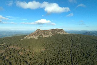
Haute-Loire is a landlocked department in the Auvergne-Rhône-Alpes region of south-central France. Named after the Loire River, it is surrounded by the departments of Loire, Ardèche, Lozère, Cantal and Puy-de-Dôme. In 2019, it had a population of 227,570; its inhabitants are called Altiligériens in French.

Puy de Dôme is a lava dome and one of the youngest volcanoes in the Chaîne des Puys region of Massif Central in central France. This chain of volcanoes including numerous cinder cones, lava domes and maars is far from the edge of any tectonic plate. Puy de Dôme was created by a Peléan eruption, some 10,700 years ago. Puy de Dôme is approximately 10 km from Clermont-Ferrand. The Puy-de-Dôme département is named after the volcano.
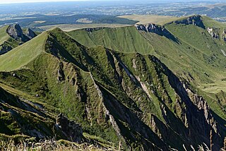
The Massif Central is a highland region in south-central France, consisting of mountains and plateaus. It covers about 15% of mainland France.

Auvergne is a cultural region in central France.
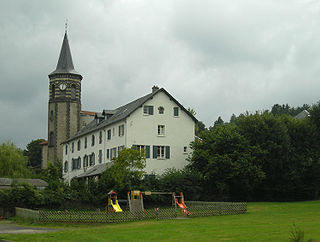
Orcines is a commune in the Puy-de-Dôme department in Auvergne in central France. Located at the foot of the Chaine des Puys, Orcines is an important village for the hikers who come visiting the natural heritage in Auvergne. The town belongs to the rural area of Clermont-Ferrand.
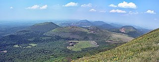
The Chaîne des Puys is a north-south oriented chain of cinder cones, lava domes, and maars in the Massif Central of France. The chain is about 40 km (25 mi) long, and the identified volcanic features, which constitute a volcanic field, include 48 cinder cones, eight lava domes, and 15 maars and explosion craters. Its highest point is the lava dome of Puy de Dôme, located near the middle of the chain, which is 1,465 m (4,806 ft) high. The name of the range comes from a French term, puy, which refers to a volcanic mountain with a rounded profile. A date of 4040 BC is usually given for the last eruption of a Chaîne des Puys volcano.

The Gergovie plateau is a plateau of the Massif Central located 10 km to the south of Clermont-Ferrand, Puy-de-Dôme, Auvergne, France and is named after the nearby village of Gergovie. It is the site of the Battle of Gergovia between Vercingetorix and Julius Caesar in 52 BC.

Lac Pavin or Lake Pavin is a meromictic crater lake, located in the Dore mountains, in Auvergne, in the territory of the commune of Besse-et-Saint-Anastaise, Puy-de-Dôme department of France, between Besse-en-Chandesse and Super-Besse. Formed by phreatomagmatism 6,900 years ago, this crater lake is the youngest volcano in mainland France

La Tour-d'Auvergne is a commune in the Puy-de-Dôme department in Auvergne in central France.

The Puy de Lassolas is a volcano in the Chaîne des Puys in France, peaking at 1187 metres. It forms, with the Puy de la Vache, a group of volcanic craters. Together, they thus form two half craters. Their lava flows created several lakes by crossing valleys, including Lake Cassière to the north and Lake Aydat to the south in the Veyre valley.
The Gour de Tazenat is a volcanic lake in the French department of Puy-de-Dôme. It was formed by a phreatomagmatic eruption about 29,000 years ago.
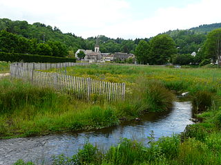
The Veyre is a left-bank tributary of the river Allier in the French region of Auvergne-Rhône-Alpes.
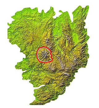
The Mounts of Cantal are a mountainous massif in the mid-west of the Massif Central, France, made up of the remnants of the largest stratovolcano of Europe, which was formed from 13 million years ago and last erupted approximately 2 million years ago. However, the main part of the volcanic activity was concentrated between 8.5 and 7 million years ago. Thereafter, the original volcano was largely eroded, massive landslides occurred, and it was further eroded by glaciers and water.

The Rava is a French sheep breed originating from the Massif Central, more specifically from the Chaîne des Puys in the Puy-de-Dôme region. It is characterized by its white fleece with long locks and coarse, garlicky wool, and its bare head marked with black spots. This breed is particularly hardy and well-suited to breeding in the sometimes harsh conditions of its birthplace. In fact, when sent to summer pastures in the Auvergne Volcanoes Regional Nature Park, it helps to maintain the landscape at a lower cost. It is bred as a purebred or crossbred to improve the conformation of lambs destined for the southeastern French market. It almost disappeared, absorbed by crossbreeding with beef breeds to improve conformation, but today seems to be preserved, with around 33,000 to 40,000 sheep in 2000.

The Puy Griou is a summit at an altitude of 1,690 meters in the Mounts of Cantal, located on the ridge line between the valleys of the Cère and the Jordanne, partially situated in the municipalities of Saint-Jacques-des-Blats and Mandailles.


