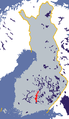
Sipoo is a municipality of Finland. It is part of the Helsinki metropolitan area. The municipality has a population of 22,840 (31 August 2024) and covers an area of 698.60 square kilometres (269.73 sq mi) of which 358.97 km2 (138.60 sq mi) is water. The population density is 67.24 inhabitants per square kilometre (174.2/sq mi). The administrative center of the municipality is Nikkilä, which is located 34 kilometres (21 mi) northeast of the center of Helsinki. Another significant urban area is Söderkulla, located in the southern part of the municipality.

The Kostroma is a river in the European part of Russia. It flows through the Kostroma and Yaroslavl Oblasts, and becomes a left tributary of the Volga, which it enters at the Gorky Reservoir, at the city of Kostroma.

The Vaal Dam in South Africa was constructed in 1938 and lies 77 km south of OR Tambo International Airport, Johannesburg. The lake behind the dam wall has a surface area of about 320 square kilometres (120 sq mi) and is 47 meters deep. The Vaal Dam lies on the Vaal River, which is one of South Africa's strongest-flowing rivers. Other rivers flowing into the dam are the Wilge River, Molspruit and Grootspruit. It has over 800 kilometres (500 mi) of shoreline and is South Africa's second biggest dam by area and the fourth largest by volume.

The Caroní River is the second most important river of Venezuela, the second in flow, and one of the longest, 952 kilometres (592 mi) from the Kukenan tepui through to its confluence with the Orinoco River. The name "Caroní" is applied starting from the confluence of the Kukenan with the Yuruaní River at 182 kilometres (113 mi) from the source of the Kukenan and 770 kilometres (480 mi) from its discharge in the Orinoco. The confluence takes place in Bolivar State. The Caroní River is the longest river located entirely within Venezuela.
Jindabyne Dam is a major ungated rockfill embankment dam across the Snowy River in the Snowy Mountains of New South Wales, Australia. The dam's main purpose is to redirect water from the Snowy River to the Murray, for the generation of hydro-power and irrigation. It is one of the sixteen major dams that comprise the Snowy Mountains Scheme, a vast hydroelectricity and irrigation complex constructed in south-east Australia between 1949 and 1974 and now run by Snowy Hydro.

Eucumbene Dam is a major gated earthfill embankment dam with an overflow ski-jump and bucket spillway with two vertical lift gates across the Eucumbene River in the Snowy Mountains of New South Wales, Australia. The dam's main purpose is for the generation of hydro-power and is one of the sixteen major dams that comprise the Snowy Mountains Scheme, a vast hydroelectricity and irrigation complex constructed in south-east Australia between 1949 and 1974 and now run by Snowy Hydro.

The Robert-Bourassa generating station, formerly known as La Grande-2 (LG-2), is a hydroelectric power station on the La Grande River that is part of Hydro-Québec's James Bay Project in Canada. The station can generate 5,616 MW and its 16 units were gradually commissioned between 1979 and 1981. Annual generation is in the vicinity of 26500 GWh.
Mangrove Creek Dam, a concrete faced rockfill embankment dam, is the primary reservoir for water supply to residents of the Central Coast in New South Wales, Australia.

Lake Qaraoun is an artificial lake or reservoir located in the southern region of the Beqaa Valley, Lebanon. It was created near Qaraoun village in 1959 by building a 61 m-high (200 ft) concrete-faced rockfill dam in the middle reaches of the Litani River. The reservoir has been used for hydropower generation, domestic water supply, and for irrigation of 27,500 ha.
The Vantaa is a 101-kilometre (63 mi) long river in Southern Finland. The river starts from the lake Erkylänjärvi in Hausjärvi and flows into the Gulf of Finland at Vanhankaupunginselkä in Helsinki. One of the tributaries of the Vantaa river is Keravanjoki that flows through the town of Kerava north of Helsinki.

The Siah Bisheh Pumped Storage Power Plant, also spelled Siyāhbisheh and Siah Bishe, is located in the Alborz Mountain range near the village of Siah Bisheh and 48 km (30 mi) south of Chalus in Mazandaran Province, Iran. The power plant uses the pumped-storage hydroelectric method to generate electricity during periods of high energy demand, making it a peaking power plant, intended to fulfill peak electricity demand in Tehran 60 km (37 mi) to the south. When complete it will have an installed generating capacity of 1,040 megawatts (1,390,000 hp) and a pumping capacity of 940 megawatts (1,260,000 hp). Planning for the project began in the 1970s and construction began in 1985. It was delayed from 1992 until 2001 and the first generator went online in May 2013. The remaining generators were commissioned by 1 September 2015. The power plant is the first pumped-storage type in Iran and will also use the country's first concrete-face rock-fill dam – two of them.

Zengwen Dam, also spelled Tsengwen Dam, is a major earthen dam in Dapu Township, Chiayi County, Taiwan on the Zengwen River. It is the third tallest dam in Taiwan, and forms Zengwen Reservoir (曾文水庫), the biggest reservoir in Taiwan by volume. The dam stores water for irrigation of the Chianan Plain, Taiwan's most productive agricultural region, and provides flood control along the Zengwen River which flows through Tainan City. The dam supports a 50 megawatt hydroelectric power station.
The Okuyoshino Pumped Storage Power Station (奥吉野発電所) is located 15 kilometres (9.3 mi) north of Totsukawa in Nara Prefecture, Japan. Using the pumped-storage hydroelectric method, the power plant has an installed capacity of 1,206 megawatts (1,617,000 hp). To accomplish power generation, the power station shifts water between two reservoirs, the lower Asahi Reservoir and the upper Seto Reservoir. Construction on both the Asahi and Seto Dams began in 1971 and was complete in 1978. The power station was commissioned in 1980. Due to heavy sediment and turbidity in the Seto Reservoir, caused by logging and landslides upstream, a sediment bypass tunnel was constructed between 1992 and 1998.
Deep Creek Dam is a major ungated concrete gravity dam across the Deep Creek in the Snowy Mountains of New South Wales, Australia. The dam's main purpose is for the diversion of water for generation of hydro-power and is the smallest of the sixteen major dams that comprise the Snowy Mountains Scheme, a vast hydroelectricity and irrigation complex constructed in south-east Australia between 1949 and 1974 and now run by Snowy Hydro.
Geehi Dam is a major ungated rockfill embankment dam across the Geehi River in the Snowy Mountains of New South Wales, Australia. The reservoir impounded by the dam is known as Geehi Reservoir.
Island Bend Dam is a major gated concrete gravity dam with a controlled spillway across the Snowy River in the Snowy Mountains region of New South Wales, Australia. The dam's main purpose is for the diversion of water for generation of hydro-power and is one of the sixteen major dams that comprise the Snowy Mountains Scheme, a vast hydroelectricity and irrigation complex constructed in south-east Australia between 1949 and 1974 and now run by Snowy Hydro.
Murray Two Dam is a major ungated concrete arch dam with a controlled spillway across Khancoban Bank, a diverted flow of the Snowy and Geehi rivers in the Snowy Mountains region of New South Wales, Australia. The impounded reservoir is called the Murray Two Pondage.

The Vorotan Cascade, or the ContourGlobal Hydro Cascade, is a cascade on the Vorotan River in Syunik Province, Armenia. It was built to produce hydroelectric power and provide irrigation water. The Vorotan Cascade consists of three hydroelectric power plants and five reservoirs with a combined installed capacity of 404.2 MW. It is one of the main power generation complexes in Armenia.

The Vingeanne is a river in France, a right tributary of the Saône, which in turn is a tributary of the Rhône. It was the scene of an important battle during the Gallic Wars. The river supplies water to the Canal entre Champagne et Bourgogne, a navigable waterway that connects the Marne and the Saône, and thus links Paris to the Mediterranean.
The Toulnustouc generating station, is a hydroelectric power generating station managed by Hydro-Québec on the Toulnustouc River in the territory of Côte-Nord, Quebec, Canada. It has an installed capacity of 526 MW. The power station is fed by water from a dam and dyke that contain the Lake-Sainte-Anne reservoir.