History
The Swedish king Gustav Vasa founded Helsinki on June 12, 1550 on the mouth of the Vantaa River on the site of the medieval village of Forsby (Finnish: Koskela). The city was to compete with Tallinn for the commerce in the Bay of Finland and to reduce the illegal trading done by peasants. The inhabitants from the city were drawn from the cities of Rauma, Ekenäs, Ulvila, and Porvoo, which were discontinued.
In 1570, a fire broke out in Helsinki in the winter, and in summer, the black plague spread into the city. The city had about 500 inhabitants at that point.
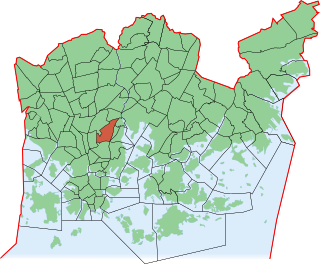
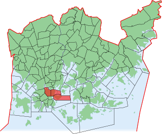
In the 1640s, Helsinki was moved to its current location on the Vironniemi peninsula because of better harbour conditions, to boost the city commerce. Vanhakaupunki was slowly deserted.
Only one map, a small-scale map drawn by Hans Hansson in 1645, remains of the first Helsinki. It depicts the city's location and the layout plan for its later years. The city blocks appear in the map, but the lots aren't marked. The only building drawn on the map is the church, which was located west of the north end of the current Vanhankaupungintie road.

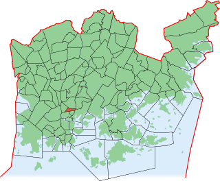
Porvoo is a city in Finland. It is located on the south coast of the country, on the Gulf of Finland. Porvoo lies in the eastern part of the Uusimaa region. The population of Porvoo is approximately 52,000, while the sub-region has a population of approximately 60,000. It is the 19th most populous municipality in Finland, and the 15th most populous urban area in the country.

Vuosaari is a neighbourhood in the City of Helsinki, Finland. It is located by the sea in East Helsinki and with its area of 15.38 km2 (5.94 sq mi) is geographically the largest district in the city. It also has two Helsinki Metro stations, Rastila and Vuosaari

Hakaniemi is an unofficial district of Helsinki, the Finnish capital. It covers most of the neighbourhood of Siltasaari in the district of Kallio. Hakaniemi is located at the sea shore and is separated from the city centre by the Siltavuorensalmi strait and from the district of Linjat by the street Hämeentie. Historically, Hakaniemi was often associated with the working class and workers' associations. However, the cost of living has risen considerably in recent years and is now on par with that of the rest of central Helsinki.

Arabianranta, sometimes simply Arabia, is a residential part of Helsinki, Finland. It is bound by Vanhankaupunginlahti bay from east, and connects to neighboring boroughs of Vanhakaupunki in north, Hermanni in south and Toukola and Kumpula in west. It is part of the greater Toukola region.
Kallio is a district and a neighbourhood in Helsinki, the capital of Finland, located on the eastern side of the Helsinki peninsula about one kilometre north from the city centre. It is one of the most densely populated areas in Finland. Kallio is separated from the city centre by the Siltasaarensalmi strait, over which is a bridge called Pitkäsilta. Traditionally, the bridge symbolizes the divide between the affluent centre and the more working class areas around Kallio.
The city of Helsinki, the capital of Finland, can be divided into various sorts of subdivisions. Helsinki is divided into three major areas: Helsinki Downtown, North Helsinki and East Helsinki. The subdivisions include boroughs, districts, major districts and postal code areas. The plethora of different official ways to divide the city is a source of some confusion to the inhabitants, as different kinds of subdivisions often share similar or identical names.
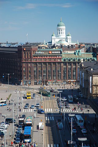
Kluuvi is the commercial centre of Helsinki, Finland, and a neighbourhood in the Vironniemi district of Helsinki. The Helsinki Central railway station, Hotel Kämp and Hotel Arthur, the Helsinki main post office, the Stockmann and Sokos department stores, the Kluuvi shopping centre and the main offices of Finnish banks are located in Kluuvi. Kluuvi includes the central campus of the University of Helsinki, the Ateneum art museum, and the movie theatres Maxim, Kinopalatsi and Bristol. The northeastern part of Kluuvi, which includes the Kaisaniemi park, is commonly called Kaisaniemi, but it is not the official name of any neighbourhood in Helsinki.
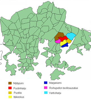
Vartiokylä is a neighbourhood in the East Helsinki area of Helsinki, the capital of Finland. Its name is derived from the ruins of an eleventh-century fortress on the Linnanvuori hill in Vartioharju, one of Vartiokylä's subdivisions. The working population of Helsinki started building their houses in the area after the completion of Uusi Porvoontie, a road to the downtown, in the 1930s. Nowadays the area has a few high density apartment areas as well as houses. Vartiokylä became a part of Helsinki in 1946. Most of the services in the district are located in the subdivision of Itäkeskus, in the area around one of the largest shopping centers in the Nordic countries.
Kumpula is a verdant neighbourhood in Helsinki, bordered by Eastern Pasila to the west, Vallila to the south, Käpylä and Koskela to the north and Toukola and Arabianranta to the east. As of January 1, 2003, Kumpula had approximately 3,600 inhabitants.

Käpylä is a neighbourhood of Helsinki with 7,600 inhabitants. Administratively speaking, Käpylä is a part of the Vanhakaupunki district.

Metsälä is a subdivision of Helsinki with about 1,000 inhabitants. It has predominantly small houses and it is situated between Maunula and Käpylä. Administratively speaking, Metsälä is a part of the Maunula district. The distance to Helsinki City Centre is about 6 kilometres from Metsälä. The primary housing type has been wooden single-family homes, and many terraced houses have been in the area in the 1970s. Nowadays Metsälä has few unbuilt lots.

Kaartinkaupunki is a neighbourhood in the southern part of Helsinki, Finland.

Jätkäsaari is a peninsula and a quarter in Helsinki, the capital city of Finland. It is part to the Kampinmalmi district and Länsisatama neighbourhood. It was the site of the main container port in Helsinki until late 2008, when the harbour moved to the new facilities in Vuosaari. The terminals for passenger ferries to Tallinn and Saint Petersburg remain in Jätkäsaari at the West Harbour.
Vironniemi is a district of Helsinki, Finland, forming the core part of the city centre, thus also the central location of the Finnish governmental and financial decision making, and the location of Helsinki's most important churches. Vironniemi is the location of the Presidential Palace, the Palace of the Finnish Council of State, the Senate Square, the Helsinki Cathedral, the Uspenski Cathedral and the main office of the Bank of Finland.
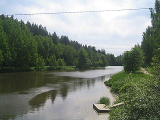
The Vantaa is a 101-kilometre (63 mi) long river in Southern Finland. The river starts from the lake Erkylänjärvi in Hausjärvi and flows into the Gulf of Finland at Vanhankaupunginselkä in Helsinki. One of the tributaries of the Vantaa river is Keravanjoki that flows through the town of Kerava north of Helsinki.

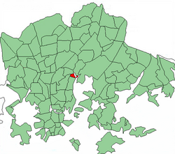
Koskela is a district in the city of Helsinki, Finland. There are about 3 300 inhabitants. The borough is surrounded by Käpylä, Kumpula, Vanhakaupunki, and Oulunkylä. Koskela is located in the subdivision of Vanhankaupungin peruspiiri, near the rapids close to the mouth of the Vantaa River. The earliest mention of the human settlement in Koskela dates back to 1417, which makes it the oldest part of Helsinki.
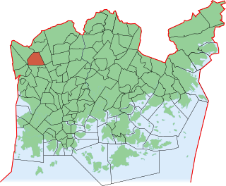
Kannelmäki is a sub-neighbourhood of the neighbourhood of Kaarela in Helsinki, Finland. Kannelmäki is located a bit more than ten kilometres from the centre of Helsinki, and is bounded by Kehä I in the south, Hämeenlinnanväylä in the east, and the Mätäjoki river in the west and north. It is a part of the Western major district. In 2018, Kannelmäki had 13,272 inhabitants.
Harju is a quarter of Helsinki, Finland. It is located northeast of the city centre, part of Alppiharju neighbourhood, between the quarters of Alppila, Torkkelinmäki, Linjat and the neighbourhoods of Sörnäinen and Vallila. Harju has a population of 7,237 and an area of 0.27 km2.
Hermanni is a neighbourhood in Central major district of Helsinki, Finland. As of 2012, Hermanni has 5,124 inhabitants living in an area of 1.05 km2. Hermanni is part of Vallila district.