Helsinki is the capital and most populous city in Finland. It is on the shore of the Gulf of Finland and is the seat of southern Finland's Uusimaa region. About 682,000 people live in the municipality, with 1.26 million in the capital region and 1.6 million in the metropolitan area. As the most populous urban area in Finland, it is the country's most significant centre for politics, education, finance, culture, and research. Helsinki is 80 kilometres (50 mi) north of Tallinn, Estonia, 360 kilometres (220 mi) north of Riga, Latvia, 400 kilometres (250 mi) east of Stockholm, Sweden, and 300 kilometres (190 mi) west of Saint Petersburg, Russia. Helsinki has significant historical connections with these four cities.

Hakaniemi is an unofficial district of Helsinki, the Finnish capital. It covers most of the neighbourhood of Siltasaari in the district of Kallio. Hakaniemi is located at the sea shore and is separated from the city centre by the Siltavuorensalmi strait and from the district of Linjat by the street Hämeentie. Historically, Hakaniemi was often associated with the working class and workers' associations. However, the cost of living has risen considerably in recent years and is now on par with that of the rest of central Helsinki.

Katajanokka is a neighbourhood of Helsinki, Finland, with around 4000 inhabitants in 2005. The district is located adjacent to the immediate downtown area, though in the first major town plan for Helsinki from the mid-18th century, the area fell outside the fortifications planned to encircle the city.

Herttoniemi is an East Helsinki neighbourhood and a suburb of Helsinki, the Finnish capital.

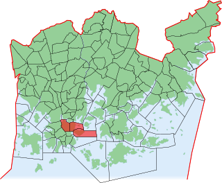
Kamppi is a neighbourhood in the centre of Helsinki, the capital of Finland. The name originally referred to a small area known as the "Kamppi field", but according to the current official designation, "Kamppi" encompasses a much larger area with a population of 10,000 in 2004.
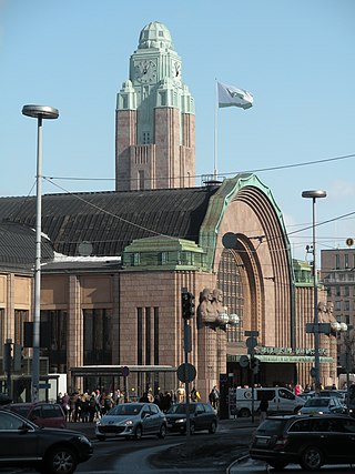
Helsinki Central Station (HEC) is the main station for commuter rail and long-distance trains departing from Helsinki, Finland. About 200,000 people "pass through the station" every day, half of whom are train passengers. The station serves as the terminus for all trains in the Helsinki commuter rail network, as well as for all Helsinki-bound long-distance trains in Finland. The Rautatientori metro station is located in the same building.

Pasila station is a railway station in Helsinki, Finland, approximately 3.5 kilometres (2.2 mi) north of Helsinki Central. It is the second busiest railway station in Finland, after Helsinki Central, and takes up a large part of the district of Pasila. The station was first opened in 1862 along the Finnish Main Line. The current station building opened in 2019.

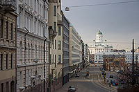
Aleksanterinkatu is a street in Kluuvi, the commercial centre of Helsinki, Finland. In the city plan by Carl Ludvig Engel, it was the Decumanus Maximus, the main east–west street in the city, crossing the Cardo, Unioninkatu (Union Street) at the corner of the Senate Square.

Esplanadi, colloquially known as Espa, is an esplanade and urban park in downtown Helsinki, Finland, situated between the Erottaja square and the Market Square. It is bordered on its northern and southern sides by the Pohjoisesplanadi and Eteläesplanadi streets, respectively. Aleksanterinkatu runs parallel to Esplanadi. Esplanadi is well known as a popular walking area, and street performances are also often held in the park.
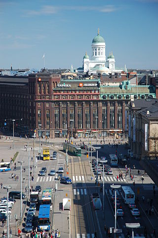
Kluuvi is the commercial centre of Helsinki, Finland, and a neighbourhood in the Vironniemi district of Helsinki. The Helsinki Central railway station, Hotel Kämp and Hotel Arthur, the Helsinki main post office, the Stockmann and Sokos department stores, the Kluuvi shopping centre and the main offices of Finnish banks are located in Kluuvi. Kluuvi includes the central campus of the University of Helsinki, the Ateneum art museum, and the movie theatres Maxim, Kinopalatsi and Bristol. The northeastern part of Kluuvi, which includes the Kaisaniemi park, is commonly called Kaisaniemi, but it is not the official name of any neighbourhood in Helsinki.
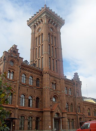
Design Museum is a museum in Helsinki devoted to the exhibition of both Finnish and foreign design, including industrial design, fashion, and graphic design. The building is situated in Kaartinkaupunki, on Korkeavuorenkatu Street, and is owned by the Republic of Finland through Senate Properties. The building was completed in 1895 and originally built as a school building for the Swedish school Läroverket för gossar och flickor.
Vironniemi is a district of Helsinki, Finland, forming the core part of the city centre, thus also the central location of the Finnish governmental and financial decision making, and the location of Helsinki's most important churches. Vironniemi is the location of the Presidential Palace, the Palace of the Finnish Council of State, the Senate Square, the Helsinki Cathedral, the Uspenski Cathedral and the main office of the Bank of Finland.
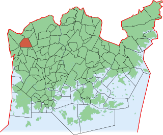
Kannelmäki is a sub-neighbourhood of the neighbourhood of Kaarela in Helsinki, Finland. Kannelmäki is located a bit more than ten kilometres from the centre of Helsinki, and is bounded by Kehä I in the south, Hämeenlinnanväylä in the east, and the Mätäjoki river in the west and north. It is a part of the Western major district. In 2018, Kannelmäki had 13,272 inhabitants.
Korkeavuorenkatu is a street in Helsinki, Finland. It runs north–south from Etelä-Esplanadi to the junction with Vuorimiehenkatu, where it becomes Kapteeninkatu. Its total length is approximately 860m (2,627 ft). The street is quite hilly, with two peaks, one at Erottaja Fire Station, and the other near the junction with Tarkk'ampujankatu. The section of the street from Etelä-Esplanadi to Yrjönkatu and Punanotkonkatu belongs to the Kaartinkaupunki district, and the rest to Ullanlinna. The houses are numbered from south to north, with odd numbers on the right and even on the left, facing north.

Bulevardi is a boulevard in Helsinki, Finland. It starts at Erottaja and ends at Hietalahdentori. The majority of the boulevard is located in the western part of the Kamppi neighborhood and a small part of Punavuori. Restaurants, cafes, and art galleries line the street. The Alexander Theatre and Sinebrychoff Museum of Art are located on Bulevardi.

Keskuskatu, literally "Central Street", is a two block-long pedestrian street in the centrally-located Kluuvi neighborhood of Helsinki, Finland. Along the street are located : the Stockmann department store, the Rautatalo building, Domus Litonii, the World Trade Center and the Citycenter Mall, nicknamed "Makkaratalo". Keskuskatu begins at Pohjoisesplanadi, across from the Swedish Theatre, and ends when it meets Kaivokatu, across from Helsinki Central Station. It is intersected just south of its midpoint by Aleksanterinkatu.

Helsinki City Library is the largest public library in Finland. Owned by the City of Helsinki, the library has 37 branches and a collection of about 1.56 million books. The City Library is part of the Helsinki Metropolitan Area Libraries network.

Mikonkatu is a street in central Helsinki, Finland, leading north from the Esplanadi Park to the Kaisaniemi Park, mostly converted into a pedestrian street in 1992.
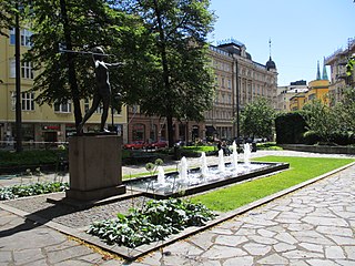
Kolmikulma, also known as the Diana Park, is a small, rectangular triangular-shaped park located in the Kaartinkaupunki district in the city center of Helsinki, Finland. It is limited by the Yrjönkatu, Uudenmaankatu and Erottajankatu streets. The park was renovated in 2006 and 2007.

Unioninkatu is one of the key streets in the historic centre of Helsinki, Finland. It stretches from the Tähtitorninvuori hill to the Pitkäsilta bridge and is about 1.5 km long. Its southern part is located in Kaartinkaupunki up to the Esplanadi park, while the northern part acts as the border between Kruununhaka to the east and Kluuvi to the west. The street functions as a local assembly street.