Villinki

Last updated

Villinki (in Finnish)
Villinge (in Swedish)
Subdistrict of Helsinki
Helsinki districts-Villinki.png
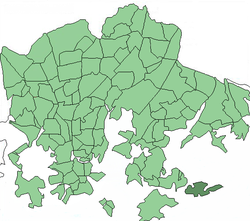
Location in Helsinki
CountryFlag of Finland.svg  Finland
Province Southern Finland
Region Uusimaa
Sub-region Helsinki
Area
  Total0.7 sq mi (1.7 km2)
Time zone UTC+2 (EET)
  Summer (DST) UTC+3 (EEST)

Villinki (Swedish : Villinge) is an island and a subdistrict of Helsinki, Finland.

Coordinates: 60°10′N25°07′E / 60.167°N 25.117°E / 60.167; 25.117

Related Research Articles

In mathematics, a primeval number is a natural number n for which the number of prime numbers which can be obtained by permuting some or all of its digits is larger than the number of primes obtainable in the same way for any smaller natural number. Primeval numbers were first described by Mike Keith.

Balearic Sea Part of the Mediterranean Sea near the Balearic Islands

The Balearic Sea is a body of water in the Mediterranean Sea near the Balearic Islands. It is not to be confused with the Alboran Sea or the Iberian shelf waters. The Ebro River flows into this small sea.

Sea of Åland The sea between the Finnish Åland islands and the Swedish mainland, part of the Baltic Sea

The Sea of Åland is a waterway in the southern Gulf of Bothnia, between the Åland islands and Sweden. It connects the Bothnian Sea with the Baltic Sea proper. The seas are often choppy here. The narrowest part is named South Kvarken. The trench running on the bottom of the Sea of Åland contains the second-deepest spot of the Baltic Sea, at a depth of 301 meters, which is second only to Landsort Deep.

Cubo de Benavente is a municipality located in the province of Zamora, Castile and León, Spain. According to the 2009 census (INE), the municipality has a population of 140 inhabitants.

Fuentelmonge is a municipality located in the province of Soria, Castile and León, Spain. According to the 2004 census (INE), the municipality has a population of 117 inhabitants.

Lapinlahti is a quarter in Helsinki, part of the Länsisatama neighbourhood.

Podenii Noi Commune in Prahova County, Romania

Podenii Noi is a commune in Prahova County, Romania. It is composed of ten villages: Ghiocel, Mehedința, Nevesteasca, Podenii Noi, Podu lui Galben, Popești, Rahova, Sălcioara, Sfăcăru and Valea Dulce.

Deurali is a village and Village Development Committee in Kaski District in the Gandaki Zone of northern-central Nepal. At the time of the 1991 Nepal census it had a population of 2,882.

Nissan NA engine

The Nissan NA family of straight-four engines is a series of engines manufactured by Nissan. It is the replacement of the Z series, on which its design is based, and is mostly used in commercial vehicles due to its use of Liquefied petroleum gas for fuel on engines with a "P" suffix code.

The Findlay Group is a group of islands in the Canadian Arctic Archipelago in Qikiqtaaluk Region, Nunavut. This Arctic Ocean group consists of Lougheed Island, Stupart Island, Edmund Walker Island, Grosvenor Island and Patterson Island.

Barłożnia Gościeszyńska Village in Greater Poland Voivodeship, Poland

Barłożnia Gościeszyńska is a village in the administrative district of Gmina Wolsztyn, within Wolsztyn County, Greater Poland Voivodeship, in west-central Poland. It lies approximately 6 kilometres (4 mi) north of Wolsztyn and 61 km (38 mi) south-west of the regional capital Poznań.

Jollas, Helsinki Neighborhood of Helsinki in Uusimaa, Southern Finland, Finland

Jollas is a southeastern neighborhood of Helsinki, Finland.

Sidi Bou Rouis is a town and commune in the Siliana Governorate, Tunisia.

Äksi, Harju County Village in Harju County, Estonia

Äksi is a village in Kose Parish, Harju County in northern Estonia.

Kuivajõe Village in Harju County, Estonia

Kuivajõe is a village in Kose Parish, Harju County in northern Estonia.

Borders of the oceans The limits of the Earths oceanic waters

The borders of the oceans are the limits of the Earth's oceanic waters. The definition and number of oceans can vary depending on the adopted criteria.

Dyamapur is a village in Dharwad district of Karnataka, India.

Colville Air Force Station

Colville Air Force Station is a closed United States Air Force General Surveillance Radar station. It is located 14.7 miles (23.7 km) east-northeast of Colville, Washington. It was closed in 1961.